The BS29 6 postcode sector is within the county of Somerset.
Did you know? According to the 2021 Census, the BS29 6 postcode sector is home to a bustling 2,909 residents!
Given that each sector allows for 400 unique postcode combinations. Letters C, I, K, M, O and V are not allowed in the last two letters of a postcode. With 107 postcodes already in use, this leaves 293 units available.
The BS29 6 postal code covers the settlement of BANWELL.
The BS29 6 Postcode shares a border with BS24 6 (Hewish, West Hewish, East Hewish), BS25 1 (WINSCOMBE, Shipham, Rowberrow), BS25 5 (Sandford, Churchill), BS26 2 (AXBRIDGE, Rooksbridge, Weare), BS24 7 (WESTON-SUPER-MARE, Locking, West Wick) and BS24 8 (WESTON-SUPER-MARE, Locking, Elborough).
The sector is within the post town of BANWELL.
BS29 6 is a postcode sector within the BS29 postcode district which is within the BS Bristol postcode area.
The Royal Mail delivery office for the BS29 6 postal sector is the Winscombe Delivery Office.
The area of the BS29 6 postcode sector is 4.51 square miles which is 11.69 square kilometres or 2,889.09 square acres.
The BS29 6 postcode sector is crossed by the M5 motorway.
Waterways within the BS29 6 postcode sector include the Towerhead Brook, Lox Yeo River.

Map of the BS29 6 Postcode Sector
Explore the BS29 6 postcode sector by using our free interactive map.
| B | S | 2 | 9 | - | 6 | X | X |
| B | S | 2 | 9 | Space | 6 | Letter | Letter |
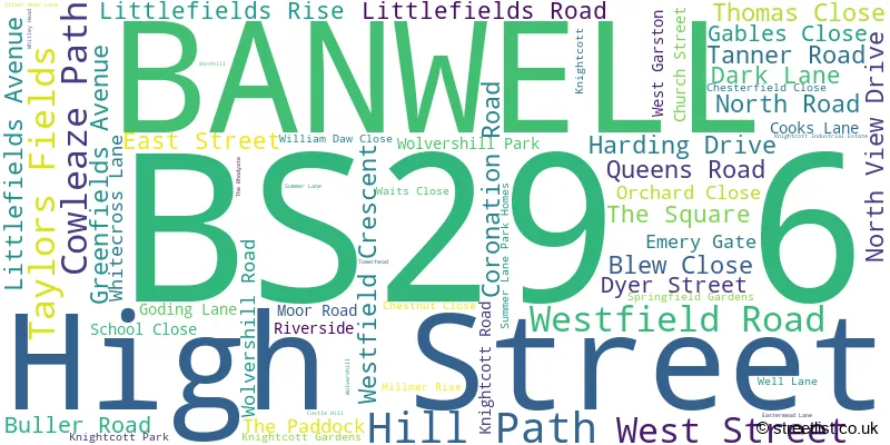
Official List of Streets
BANWELL (65 Streets)
Unofficial Streets or Alternative Spellings
Weather Forecast for BS29 6
Press Button to Show Forecast for Weston-Super-Mare No 2
| Time Period | Icon | Description | Temperature | Rain Probability | Wind |
|---|---|---|---|---|---|
| 09:00 to 12:00 | Cloudy | 10.0°C (feels like 9.0°C) | 4.00% | NNW 7 mph | |
| 12:00 to 15:00 | Cloudy | 11.0°C (feels like 10.0°C) | 4.00% | NNW 7 mph | |
| 15:00 to 18:00 | Cloudy | 12.0°C (feels like 10.0°C) | 5.00% | WNW 11 mph | |
| 18:00 to 21:00 | Cloudy | 11.0°C (feels like 9.0°C) | 4.00% | WNW 9 mph | |
| 21:00 to 00:00 | Cloudy | 9.0°C (feels like 7.0°C) | 3.00% | N 9 mph |
Press Button to Show Forecast for Weston-Super-Mare No 2
| Time Period | Icon | Description | Temperature | Rain Probability | Wind |
|---|---|---|---|---|---|
| 00:00 to 03:00 | Clear night | 7.0°C (feels like 5.0°C) | 0.00% | NE 7 mph | |
| 03:00 to 06:00 | Clear night | 6.0°C (feels like 4.0°C) | 1.00% | WNW 7 mph | |
| 06:00 to 09:00 | Sunny day | 7.0°C (feels like 5.0°C) | 2.00% | W 7 mph | |
| 09:00 to 12:00 | Cloudy | 10.0°C (feels like 8.0°C) | 5.00% | W 9 mph | |
| 12:00 to 15:00 | Cloudy | 11.0°C (feels like 9.0°C) | 9.00% | WNW 11 mph | |
| 15:00 to 18:00 | Cloudy | 11.0°C (feels like 9.0°C) | 8.00% | W 13 mph | |
| 18:00 to 21:00 | Cloudy | 11.0°C (feels like 8.0°C) | 7.00% | WNW 13 mph | |
| 21:00 to 00:00 | Cloudy | 9.0°C (feels like 7.0°C) | 6.00% | WNW 9 mph |
Press Button to Show Forecast for Weston-Super-Mare No 2
| Time Period | Icon | Description | Temperature | Rain Probability | Wind |
|---|---|---|---|---|---|
| 00:00 to 03:00 | Partly cloudy (night) | 8.0°C (feels like 6.0°C) | 6.00% | NNE 7 mph | |
| 03:00 to 06:00 | Partly cloudy (night) | 7.0°C (feels like 5.0°C) | 11.00% | ESE 7 mph | |
| 06:00 to 09:00 | Cloudy | 7.0°C (feels like 5.0°C) | 14.00% | E 7 mph | |
| 09:00 to 12:00 | Cloudy | 9.0°C (feels like 7.0°C) | 14.00% | ESE 9 mph | |
| 12:00 to 15:00 | Cloudy | 11.0°C (feels like 9.0°C) | 18.00% | SSE 9 mph | |
| 15:00 to 18:00 | Overcast | 11.0°C (feels like 9.0°C) | 23.00% | SE 9 mph | |
| 18:00 to 21:00 | Cloudy | 10.0°C (feels like 8.0°C) | 18.00% | SSE 9 mph | |
| 21:00 to 00:00 | Cloudy | 9.0°C (feels like 7.0°C) | 17.00% | E 9 mph |
Press Button to Show Forecast for Weston-Super-Mare No 2
| Time Period | Icon | Description | Temperature | Rain Probability | Wind |
|---|---|---|---|---|---|
| 00:00 to 03:00 | Overcast | 8.0°C (feels like 6.0°C) | 20.00% | E 9 mph | |
| 03:00 to 06:00 | Cloudy | 8.0°C (feels like 6.0°C) | 17.00% | ENE 9 mph | |
| 06:00 to 09:00 | Cloudy | 8.0°C (feels like 6.0°C) | 15.00% | ENE 9 mph | |
| 09:00 to 12:00 | Cloudy | 10.0°C (feels like 8.0°C) | 14.00% | ENE 11 mph | |
| 12:00 to 15:00 | Cloudy | 12.0°C (feels like 10.0°C) | 16.00% | NE 11 mph | |
| 15:00 to 18:00 | Light rain | 12.0°C (feels like 10.0°C) | 49.00% | NE 11 mph | |
| 18:00 to 21:00 | Light rain shower (day) | 11.0°C (feels like 9.0°C) | 35.00% | N 11 mph | |
| 21:00 to 00:00 | Light rain | 10.0°C (feels like 8.0°C) | 57.00% | N 9 mph |

House Prices in the BS29 6 Postcode Sector
| Type of Property | 2018 Average | 2018 Sales | 2017 Average | 2017 Sales | 2016 Average | 2016 Sales | 2015 Average | 2015 Sales |
|---|---|---|---|---|---|---|---|---|
| Detached | £349,550 | 14 | £322,164 | 20 | £313,757 | 22 | £334,404 | 26 |
| Semi-Detached | £240,548 | 21 | £197,759 | 17 | £206,798 | 23 | £217,937 | 15 |
| Terraced | £191,500 | 4 | £343,500 | 2 | £212,889 | 9 | £183,000 | 2 |
| Flats | £0 | 0 | £143,250 | 2 | £0 | 0 | £79,483 | 3 |
Important Postcodes BS29 6 in the Postcode Sector
BS29 6DB is the postcode for Banwell, Winscombe and Sandford Children's Centre, West Street, SPORTS HALL, Banwell Primary School, West Street, and Banwell Primary School, West Street
BS29 6PQ is the postcode for Tower Head Depot, Towerhead Road
| The BS29 6 Sector is within these Local Authorities |
|
|---|---|
| The BS29 6 Sector is within these Counties |
|
| The BS29 6 Sector is within these Water Company Areas |
|