The BS5 postcode district is a postal district located in the BS Bristol postcode area with a population of 57,433 residents according to the 2021 England and Wales Census.
The area of the BS5 postcode district is 3.29 square miles which is 8.53 square kilometres or 2,106.97 acres.
Currently, the BS5 district has about 1301 postcode units spread across 5 geographic postcode sectors.
Given that each sector allows for 400 unique postcode combinations, the district has a capacity of 2,000 postcodes. With 1301 postcodes already in use, this leaves 699 units available.
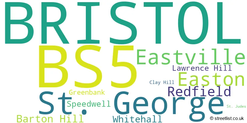
The largest settlement in the BS5 postal code is BRISTOL followed by St. George, and Eastville.
The BS5 Postcode shares a border with BS4 (BRISTOL, Brislington, Arnos Vale), BS7 (BRISTOL, Horfield, Bishopston), BS15 (BRISTOL, Kingswood, Hanham), BS16 (BRISTOL, Emersons Green, Mangotsfield) and BS2 (BRISTOL, St. Philips, St. Pauls).
The primary settlement in the BS5 postcode district is Bristol, located in the county of Bristol and in the country of England. Other significant settlements include Barton Hill, Easton, Lawrence Hill, St. Judes, Eastville, Greenbank, Clay Hill, Speedwell, St. George, Redfield, and Whitehall.
For the district BS5, we have data on 6 postcode sectors. Here's a breakdown: The sector BS5 0, covers Bristol in Bristol. The sector BS5 5 is non-geographic. It's often designated for PO Boxes, large organisations, or special services. The sector BS5 6, covers Bristol and Eastville in Bristol. The sector BS5 7, covers Bristol in Bristol. The sector BS5 8, covers Bristol and St. George in Bristol. The sector BS5 9, covers Bristol and Redfield in Bristol.

Map of the BS5 Postcode District
Explore the BS5 postcode district by using our free interactive map.

When it comes to local government, postal geography often disregards political borders. However, for a breakdown in the BS5 District: the district mostly encompasses the City of Bristol (B) area with a total of 1312 postcodes.
Weather Forecast for BS5
Press Button to Show Forecast for St George
| Time Period | Icon | Description | Temperature | Rain Probability | Wind |
|---|---|---|---|---|---|
| 18:00 to 21:00 | Cloudy | 11.0°C (feels like 9.0°C) | 6.00% | NNW 7 mph | |
| 21:00 to 00:00 | Cloudy | 9.0°C (feels like 7.0°C) | 5.00% | NE 7 mph |
Press Button to Show Forecast for St George
| Time Period | Icon | Description | Temperature | Rain Probability | Wind |
|---|---|---|---|---|---|
| 00:00 to 03:00 | Cloudy | 7.0°C (feels like 6.0°C) | 7.00% | NE 4 mph | |
| 03:00 to 06:00 | Overcast | 6.0°C (feels like 5.0°C) | 8.00% | ENE 4 mph | |
| 06:00 to 09:00 | Cloudy | 6.0°C (feels like 4.0°C) | 8.00% | ENE 7 mph | |
| 09:00 to 12:00 | Cloudy | 8.0°C (feels like 5.0°C) | 11.00% | E 9 mph | |
| 12:00 to 15:00 | Overcast | 10.0°C (feels like 8.0°C) | 15.00% | E 9 mph | |
| 15:00 to 18:00 | Overcast | 10.0°C (feels like 8.0°C) | 19.00% | E 9 mph | |
| 18:00 to 21:00 | Overcast | 10.0°C (feels like 8.0°C) | 19.00% | ENE 7 mph | |
| 21:00 to 00:00 | Cloudy | 8.0°C (feels like 6.0°C) | 16.00% | ENE 7 mph |
Press Button to Show Forecast for St George
| Time Period | Icon | Description | Temperature | Rain Probability | Wind |
|---|---|---|---|---|---|
| 00:00 to 03:00 | Cloudy | 7.0°C (feels like 4.0°C) | 14.00% | ENE 7 mph | |
| 03:00 to 06:00 | Cloudy | 6.0°C (feels like 3.0°C) | 14.00% | ENE 7 mph | |
| 06:00 to 09:00 | Cloudy | 6.0°C (feels like 3.0°C) | 18.00% | ENE 9 mph | |
| 09:00 to 12:00 | Overcast | 7.0°C (feels like 4.0°C) | 25.00% | ENE 11 mph | |
| 12:00 to 15:00 | Overcast | 10.0°C (feels like 7.0°C) | 21.00% | NE 11 mph | |
| 15:00 to 18:00 | Cloudy | 11.0°C (feels like 9.0°C) | 16.00% | ENE 11 mph | |
| 18:00 to 21:00 | Light rain | 10.0°C (feels like 8.0°C) | 48.00% | NE 9 mph | |
| 21:00 to 00:00 | Light rain | 9.0°C (feels like 6.0°C) | 48.00% | NE 11 mph |
Press Button to Show Forecast for St George
| Time Period | Icon | Description | Temperature | Rain Probability | Wind |
|---|---|---|---|---|---|
| 00:00 to 03:00 | Light rain | 8.0°C (feels like 5.0°C) | 51.00% | NE 11 mph | |
| 03:00 to 06:00 | Light rain | 7.0°C (feels like 5.0°C) | 52.00% | NE 9 mph | |
| 06:00 to 09:00 | Light rain | 7.0°C (feels like 5.0°C) | 52.00% | NE 9 mph | |
| 09:00 to 12:00 | Light rain | 9.0°C (feels like 6.0°C) | 50.00% | NNE 9 mph | |
| 12:00 to 15:00 | Heavy rain shower (day) | 11.0°C (feels like 9.0°C) | 59.00% | N 11 mph | |
| 15:00 to 18:00 | Heavy rain shower (day) | 11.0°C (feels like 9.0°C) | 58.00% | NW 11 mph | |
| 18:00 to 21:00 | Light rain shower (day) | 11.0°C (feels like 9.0°C) | 35.00% | NNW 9 mph | |
| 21:00 to 00:00 | Clear night | 9.0°C (feels like 7.0°C) | 7.00% | NW 7 mph |
Where is the BS5 Postcode District?
The postcode district BS5 is located in Bristol. The district is in close proximity to nearby towns, including Bath in the South East (9.12 miles away), Badminton in the North East (11.47 miles away), Clevedon in the West (12.48 miles away), Radstock in the South (12.75 miles away), and Caldicot in the North West (12.84 miles away). Additionally, the distance from BS5 to the center of London is approximately 104.56 miles.
The district is within the post town of BRISTOL.
The sector has postcodes within the nation of England.
The BS5 Postcode District is in the Bristol, City of region of Gloucestershire, Wiltshire and Bath/Bristol area within the South West (England).
| Postcode Sector | Delivery Office |
|---|---|
| BS5 0 | Bristol East Delivery Office |
| BS5 6 | Bristol East Delivery Office |
| BS5 7 | Bristol East Delivery Office |
| BS5 8 | Bristol East Delivery Office |
| BS5 9 | Bristol East Delivery Office |
| B | S | 5 | - | X | X | X |
| B | S | 5 | Space | Numeric | Letter | Letter |
Current Monthly Rental Prices
| # Bedrooms | Min Price | Max Price | Avg Price |
|---|---|---|---|
| 1 | £600 | £3,500 | £1,286 |
| 2 | £1,400 | £4,000 | £2,125 |
| 3 | £1,350 | £1,900 | £1,563 |
| 4 | £2,600 | £3,200 | £2,900 |
| 6 | £4,350 | £4,350 | £4,350 |
Current House Prices
| # Bedrooms | Min Price | Max Price | Avg Price |
|---|---|---|---|
| 2 | £210,000 | £450,000 | £387,000 |
| 3 | £425,000 | £600,000 | £493,145 |
| 4 | £440,000 | £750,000 | £527,206 |
| 6 | £550,000 | £550,000 | £550,000 |
Estate Agents who Operate in the BS5 District
| Logo | Name | Brand Name | Address | Contact Number | Total Properties |
|---|---|---|---|---|---|
 | Bristol | Boardwalk Property Co | Harbury Road, Westbury-On-Trym, Bristol, BS9 4PN | 0117 463 0220 | 18 |
 | Redfield | Holbrook Moran | 1st Floor 283 Church Road, Redfield, Bristol, BS5 9HT | 0117 954 0033 | 15 |
 | Redfield | CJ Hole | 163 Church Road, Bristol BS5 9LA | 0117 955 1817 | 11 |
 | Bristol | Parks Estate Agents | 199 Church Road, Redfield, Bristol, BS5 9HL | 0117 463 9765 | 10 |
 | Easton | Hunters | 72 St. Marks Road, Easton, Bristol, BS5 6JH | 0117 463 0738 | 9 |
| Type of Property | 2018 Average | 2018 Sales | 2017 Average | 2017 Sales | 2016 Average | 2016 Sales | 2015 Average | 2015 Sales |
|---|---|---|---|---|---|---|---|---|
| Detached | £279,342 | 19 | £299,398 | 28 | £293,475 | 24 | £233,228 | 26 |
| Semi-Detached | £267,228 | 109 | £251,597 | 97 | £230,104 | 92 | £197,402 | 94 |
| Terraced | £267,972 | 567 | £253,267 | 605 | £230,950 | 643 | £201,599 | 699 |
| Flats | £166,461 | 212 | £150,487 | 256 | £143,839 | 241 | £122,541 | 260 |