The CH63 5 postcode sector is within the county of Merseyside.
Did you know? According to the 2021 Census, the CH63 5 postcode sector is home to a bustling 4,342 residents!
Given that each sector allows for 400 unique postcode combinations. Letters C, I, K, M, O and V are not allowed in the last two letters of a postcode. With 106 postcodes already in use, this leaves 294 units available.
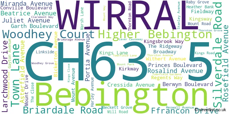
The largest settlement in the CH63 5 postal code is WIRRAL followed by Bebington, and Higher Bebington.
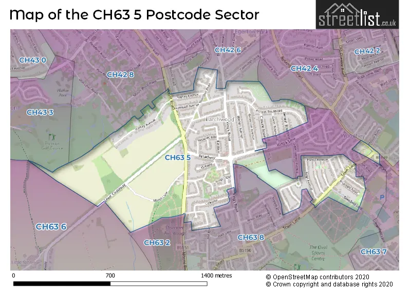
The CH63 5 Postcode shares a border with CH63 6 (WIRRAL, Higher Bebington, Brimstage), CH42 6 (BIRKENHEAD), CH42 4 (BIRKENHEAD), CH42 8 (BIRKENHEAD), CH43 3 (PRENTON, North Cheshire Trading Estate), CH63 2 (WIRRAL, Bebington, Higher Bebington), CH63 7 (WIRRAL, Bebington) and CH63 8 (WIRRAL, Bebington, Higher Bebington).
The sector is within the post town of WIRRAL.
CH63 5 is a postcode sector within the CH63 postcode district which is within the CH Chester postcode area.
The Royal Mail delivery office for the CH63 5 postal sector is the New Ferry Delivery Office.
The area of the CH63 5 postcode sector is 0.52 square miles which is 1.34 square kilometres or 332.00 square acres.

Map of the CH63 5 Postcode Sector
Explore the CH63 5 postcode sector by using our free interactive map.
| C | H | 6 | 3 | - | 5 | X | X |
| C | H | 6 | 3 | Space | 5 | Letter | Letter |
Official List of Streets
WIRRAL (41 Streets)
Bebington (11 Streets)
Unofficial Streets or Alternative Spellings
Bebington
BEECH ROAD MOUNT ROAD OAK ROAD OLD CHESTER ROADWIRRAL
QUEENSWOOD AVENUE SHERWOOD DRIVE WOODHEY ROADBIRKENHEAD
BOROUGH ROAD HURST BANK THORPE BANK MOUNTWAY ROMAN ROADWeather Forecast for CH63 5
Press Button to Show Forecast for Prenton
| Time Period | Icon | Description | Temperature | Rain Probability | Wind |
|---|---|---|---|---|---|
| 09:00 to 12:00 | Cloudy | 9.0°C (feels like 5.0°C) | 7.00% | NW 20 mph | |
| 12:00 to 15:00 | Sunny day | 10.0°C (feels like 7.0°C) | 2.00% | NW 20 mph | |
| 15:00 to 18:00 | Partly cloudy (day) | 11.0°C (feels like 7.0°C) | 1.00% | NW 20 mph | |
| 18:00 to 21:00 | Partly cloudy (day) | 10.0°C (feels like 7.0°C) | 1.00% | NW 16 mph | |
| 21:00 to 00:00 | Cloudy | 9.0°C (feels like 7.0°C) | 4.00% | NNW 9 mph |
Press Button to Show Forecast for Prenton
| Time Period | Icon | Description | Temperature | Rain Probability | Wind |
|---|---|---|---|---|---|
| 00:00 to 03:00 | Cloudy | 8.0°C (feels like 6.0°C) | 4.00% | ENE 7 mph | |
| 03:00 to 06:00 | Cloudy | 6.0°C (feels like 5.0°C) | 5.00% | ESE 4 mph | |
| 06:00 to 09:00 | Partly cloudy (day) | 6.0°C (feels like 4.0°C) | 2.00% | ENE 4 mph | |
| 09:00 to 12:00 | Partly cloudy (day) | 8.0°C (feels like 6.0°C) | 2.00% | NE 4 mph | |
| 12:00 to 15:00 | Sunny day | 10.0°C (feels like 8.0°C) | 2.00% | N 4 mph | |
| 15:00 to 18:00 | Partly cloudy (day) | 10.0°C (feels like 8.0°C) | 1.00% | NNW 7 mph | |
| 18:00 to 21:00 | Sunny day | 10.0°C (feels like 8.0°C) | 1.00% | NNW 7 mph | |
| 21:00 to 00:00 | Clear night | 8.0°C (feels like 6.0°C) | 1.00% | NW 4 mph |
Press Button to Show Forecast for Prenton
| Time Period | Icon | Description | Temperature | Rain Probability | Wind |
|---|---|---|---|---|---|
| 00:00 to 03:00 | Partly cloudy (night) | 7.0°C (feels like 6.0°C) | 1.00% | NW 4 mph | |
| 03:00 to 06:00 | Clear night | 6.0°C (feels like 5.0°C) | 1.00% | W 4 mph | |
| 06:00 to 09:00 | Cloudy | 7.0°C (feels like 6.0°C) | 4.00% | WNW 4 mph | |
| 09:00 to 12:00 | Cloudy | 10.0°C (feels like 8.0°C) | 4.00% | NNE 7 mph | |
| 12:00 to 15:00 | Cloudy | 11.0°C (feels like 10.0°C) | 4.00% | N 7 mph | |
| 15:00 to 18:00 | Partly cloudy (day) | 12.0°C (feels like 10.0°C) | 3.00% | N 9 mph | |
| 18:00 to 21:00 | Cloudy | 11.0°C (feels like 10.0°C) | 8.00% | N 7 mph | |
| 21:00 to 00:00 | Cloudy | 10.0°C (feels like 8.0°C) | 4.00% | NNE 7 mph |
Press Button to Show Forecast for Prenton
| Time Period | Icon | Description | Temperature | Rain Probability | Wind |
|---|---|---|---|---|---|
| 00:00 to 03:00 | Partly cloudy (night) | 8.0°C (feels like 6.0°C) | 2.00% | ENE 7 mph | |
| 03:00 to 06:00 | Cloudy | 7.0°C (feels like 5.0°C) | 6.00% | ENE 7 mph | |
| 06:00 to 09:00 | Cloudy | 7.0°C (feels like 5.0°C) | 7.00% | ENE 7 mph | |
| 09:00 to 12:00 | Cloudy | 9.0°C (feels like 7.0°C) | 6.00% | E 7 mph | |
| 12:00 to 15:00 | Light rain | 10.0°C (feels like 8.0°C) | 37.00% | ENE 9 mph | |
| 15:00 to 18:00 | Light rain | 11.0°C (feels like 9.0°C) | 49.00% | ENE 9 mph | |
| 18:00 to 21:00 | Cloudy | 11.0°C (feels like 9.0°C) | 7.00% | NNE 9 mph | |
| 21:00 to 00:00 | Cloudy | 9.0°C (feels like 7.0°C) | 7.00% | ENE 9 mph |
House Prices in the CH63 5 Postcode Sector
| Type of Property | 2018 Average | 2018 Sales | 2017 Average | 2017 Sales | 2016 Average | 2016 Sales | 2015 Average | 2015 Sales |
|---|---|---|---|---|---|---|---|---|
| Detached | £298,750 | 4 | £352,500 | 8 | £318,389 | 9 | £325,356 | 9 |
| Semi-Detached | £216,473 | 31 | £204,905 | 45 | £206,574 | 41 | £185,288 | 45 |
| Terraced | £119,625 | 4 | £181,400 | 6 | £138,750 | 4 | £111,100 | 5 |
| Flats | £73,640 | 5 | £78,492 | 6 | £68,500 | 10 | £49,500 | 4 |
| The CH63 5 Sector is within these Local Authorities |
|
|---|---|
| The CH63 5 Sector is within these Counties |
|
| The CH63 5 Sector is within these Water Company Areas |
|