CR0 9XS is a postal code used within the United Kingdom for delivering mail.
Postcodes are made up of two parts. The part before the space (CR0) is called the outward code. The part after the space (9XS) is called the inward code. The letters C, I, K, M, O and V are not allowed in the inward code. In addition to the inward and outward code, the postcode can be broken up into four parts:
- Postal Area. In our case CR which means Croydon.
- Postal District. In our case CR0.
- Postal Sector. In our case CR0 9.
- Postcode Unit. The last two letters. In our case XS.
The regional mail center for the post area CR is the Princess Royal Distribution Centre, which is located at Blackmore Drive, North Circular, LONDON , NW10 7RH.
The final port of call for any post addressed to the CR0 9XS postcode is the local delivery office (DO) which is . Here the post will be sorted ready for delivery.
The properties in the CR0 9XS postcode have the street address of Masons Avenue
It is situated within the post town of CROYDON within the old postal county of Surrey.
CR0 9XS is within Croydon.
According to our data CR0 9XS is a commercial postcode.
Interactive Mapping Showing UPRNs within the CR0 9XS Postcode Boundaries
Use the search box to search for other postcodes or places.
Map of the CR0 9XS Postcode

Telephone Area Code for CR0 9XS
The telephone area code for CR0 9XS is 020 London.
Map Coordinates for CR0 9XS
| Latitude | 51.3686845404 |
|---|---|
| Longitude | -0.0980030047473 |
Ordnance Survey Maps for CR0 9XS
If you purchase a map through the links below, we may earn an affiliate commission.
| Map Series | Amazon | Ordnance Survey |
| Explorer 1:25,000 161 London South, Westminster, Greenwich, Croydon, Esher & Twickenham | Check Price on Amazon | Buy Direct from the Ordnance Survey |
| Landranger 1:50,000 176 West London | Check Price on Amazon | Buy Direct from the Ordnance Survey |
| Landranger 1:50,000 177 East London | Check Price on Amazon | Buy Direct from the Ordnance Survey |

Hotel Deals for CR0 9XS
Weather Forecast for CR0 9XS
Thu 18th Apr
Press Button to Show Forecast for Croydon
| Time Period | Icon | Description | Temperature | Rain Probability | Wind |
|---|---|---|---|---|---|
| 09:00 to 12:00 | Cloudy | 8.0°C (feels like 7.0°C) | 3.00% | N 7 mph | |
| 12:00 to 15:00 | Cloudy | 11.0°C (feels like 10.0°C) | 3.00% | WNW 4 mph | |
| 15:00 to 18:00 | Cloudy | 13.0°C (feels like 11.0°C) | 4.00% | W 9 mph | |
| 18:00 to 21:00 | Cloudy | 12.0°C (feels like 10.0°C) | 6.00% | W 11 mph | |
| 21:00 to 00:00 | Overcast | 10.0°C (feels like 8.0°C) | 24.00% | WSW 11 mph |
Fri 19th Apr
Press Button to Show Forecast for Croydon
| Time Period | Icon | Description | Temperature | Rain Probability | Wind |
|---|---|---|---|---|---|
| 00:00 to 03:00 | Overcast | 9.0°C (feels like 6.0°C) | 12.00% | WSW 11 mph | |
| 03:00 to 06:00 | Overcast | 9.0°C (feels like 6.0°C) | 13.00% | W 11 mph | |
| 06:00 to 09:00 | Overcast | 9.0°C (feels like 7.0°C) | 12.00% | WNW 11 mph | |
| 09:00 to 12:00 | Overcast | 11.0°C (feels like 8.0°C) | 9.00% | NW 13 mph | |
| 12:00 to 15:00 | Cloudy | 12.0°C (feels like 9.0°C) | 10.00% | NW 16 mph | |
| 15:00 to 18:00 | Cloudy | 13.0°C (feels like 10.0°C) | 9.00% | NNW 13 mph | |
| 18:00 to 21:00 | Cloudy | 11.0°C (feels like 9.0°C) | 7.00% | N 11 mph | |
| 21:00 to 00:00 | Partly cloudy (night) | 9.0°C (feels like 7.0°C) | 3.00% | NNE 7 mph |
Sat 20th Apr
Press Button to Show Forecast for Croydon
| Time Period | Icon | Description | Temperature | Rain Probability | Wind |
|---|---|---|---|---|---|
| 00:00 to 03:00 | Partly cloudy (night) | 7.0°C (feels like 4.0°C) | 2.00% | N 9 mph | |
| 03:00 to 06:00 | Partly cloudy (night) | 6.0°C (feels like 3.0°C) | 2.00% | NNW 9 mph | |
| 06:00 to 09:00 | Overcast | 5.0°C (feels like 2.0°C) | 7.00% | NNW 9 mph | |
| 09:00 to 12:00 | Overcast | 8.0°C (feels like 5.0°C) | 7.00% | N 11 mph | |
| 12:00 to 15:00 | Overcast | 10.0°C (feels like 8.0°C) | 9.00% | N 9 mph | |
| 15:00 to 18:00 | Cloudy | 11.0°C (feels like 9.0°C) | 5.00% | N 9 mph | |
| 18:00 to 21:00 | Cloudy | 10.0°C (feels like 8.0°C) | 6.00% | NNE 9 mph | |
| 21:00 to 00:00 | Partly cloudy (night) | 8.0°C (feels like 6.0°C) | 1.00% | NNE 7 mph |
Sun 21st Apr
Press Button to Show Forecast for Croydon
| Time Period | Icon | Description | Temperature | Rain Probability | Wind |
|---|---|---|---|---|---|
| 00:00 to 03:00 | Partly cloudy (night) | 7.0°C (feels like 5.0°C) | 1.00% | NE 4 mph | |
| 03:00 to 06:00 | Partly cloudy (night) | 6.0°C (feels like 5.0°C) | 2.00% | N 4 mph | |
| 06:00 to 09:00 | Partly cloudy (day) | 6.0°C (feels like 4.0°C) | 2.00% | N 4 mph | |
| 09:00 to 12:00 | Cloudy | 8.0°C (feels like 7.0°C) | 5.00% | N 7 mph | |
| 12:00 to 15:00 | Overcast | 11.0°C (feels like 9.0°C) | 9.00% | NE 9 mph | |
| 15:00 to 18:00 | Overcast | 12.0°C (feels like 10.0°C) | 10.00% | NNE 9 mph | |
| 18:00 to 21:00 | Cloudy | 12.0°C (feels like 10.0°C) | 14.00% | NE 9 mph | |
| 21:00 to 00:00 | Cloudy | 10.0°C (feels like 8.0°C) | 5.00% | NE 7 mph |
Nearest Schools to the CR0 9XS Postcode
Primary Schools
Heathfield Academy
Address: 7 Aberdeen Road, Croydon, Surrey, CR0 1EQ
Headteacher: Miss Sarah Mackay
Ofsted Rating: Outstanding (as of 2018-05-25)
Distance: 0.23 miles
Contact: 02083534250
Howard Primary School
Address: Dering Place, Croydon, Surrey, CR0 1DT
Headteacher: Miss J De Saulles
Ofsted Rating: Good (as of 2022-05-18)
Distance: 0.38 miles
Contact: 02086884216
Krishna Avanti Primary School
Address: Southbridge Place, Croydon, , CR0 4HA
Headteacher: Mrs Bijal Pandya
Ofsted Rating: Good (as of 2019-05-01)
Distance: 0.50 miles
Contact: 02083534253
Secondary Schools
St Andrew's CofE School
Address: Warrington Road, Croydon, Surrey, CR0 4BH
Headteacher: Mr Jonathan Harris
Ofsted Rating: Serious Weaknesses (as of 2019-01-17)
Distance: 0.82 miles
Contact:
St Mary's Catholic High School
Address: Woburn Road, Croydon, Surrey, CR9 2EE
Headteacher: Mr Conal Patrick Shields
Ofsted Rating: Good (as of 2021-11-04)
Distance: 0.82 miles
Contact: 02086863837
Harris Invictus Academy Croydon
Address: 88 London Road, Croydon, , CR0 2TB
Headteacher: Ms Lisa Kattenhorn
Ofsted Rating: Outstanding (as of 2023-01-19)
Distance: 0.91 miles
Contact: 02033713002
Higher Schools
Croydon College
Address: Fairfield Campus, Croydon, Surrey, CR9 1DX
Headteacher: Caireen Mitchell
Ofsted Rating: Inadequate (as of 2023-02-09)
Distance: 0.36 miles
Contact: 02086865700
Harris Professional Skills Sixth Form
Address: 11 Oliver Grove, London, , SE25 6EJ
Headteacher: Mr Andrew Barr
Ofsted Rating: Good (as of 2022-05-05)
Distance: 2.47 miles
Contact: 02033709238
St Francis Xavier Sixth Form College
Address: Malwood Road, London, , SW12 8EN
Headteacher: Mr Graham Thompson
Ofsted Rating: Good (as of 2023-11-24)
Distance: 6.77 miles
Contact: 02087726000
Nearest Dentists
Dentists near CR0 9XS
PARK LANE DENTAL
Address: 98 PARK LANE, CROYDON, SURREY, CR0 1JB
Distance: 0.06 miles
Contact: :
FAIRFIELD DENTAL CENTRE
Address: 9 WOODSTOCK ROAD, CROYDON, CR0 1JS
Distance: 0.12 miles
Contact: :
EDRIDGE ROAD COMMUNITY HEALTH CENTRE
Address: IMPACT HOUSE, 2 EDRIDGE ROAD, CROYDON, SURREY, CR0 1FE
Distance: 0.13 miles
Contact: :
EDRIDGE ROAD COMMUNITY H.C.
Address: 2 EDRIDGE ROAD, CROYDEN, CROYDON, SURREY, CR9 1PJ
Distance: 0.13 miles
Contact: :
WHITGIFT DENTAL
Address: 70 CHATSWORTH ROAD, CROYDON, SURREY, CR0 1HB
Distance: 0.28 miles
Contact: :
TOP MEDICAL CLINIC
Address: 1B CHURCH ROAD, CROYDON, CR0 1SG
Distance: 0.31 miles
Contact: http: HTTP://TOPMEDICALCLINIC.CO.UK/CROYDON/
Nearest Chemists
Pharmacies near CR0 9XS
CROYDON PHARMACY
Address: A R DENNIS, 44 SOUTH END, CROYDON, SURREY, CR0 1DP
Distance: 0.21 miles
Contact: tel: 020 86885544
SWAN PHARMACY
Address: 119 SOUTH END, CROYDON, CR0 1BJ
Distance: 0.33 miles
Contact: tel: 02086 881714
KENT PHARMACY
Address: 66 CHURCH STREET, CROYDON, SURREY, CR0 1RB
Distance: 0.41 miles
Contact: tel: 020 86880888
ST. CLARE CHEMIST
Address: 21 NORFOLK HOUSE, GEORGE STREET, CROYDON, SURREY, CR0 1LG
Distance: 0.41 miles
Contact: :
BARKERS CHEMIST
Address: 105 CHURCH STREET, CROYDON, SURREY, CR0 1RN
Distance: 0.45 miles
Contact: tel: 020 86880835
E-MEDICINA
Address: ROOM 229, LANDSDOWNE BUILDING, LANSDOWNE ROAD, CROYDON, SURREY, CR9 2ER
Distance: 0.53 miles
Contact: tel: 02038 794043
Nearest Opticians
Opticians near CR0 9XS
OPTIMAX LASER EYE CLINIC (CROYDON)
Address: 103 HIGH STREET, CROYDON, SURREY, CR0 1QG
Distance: 0.13 miles
Contact: :
T.YOUNG OPTICIANS
Address: 12 ST. GEORGES WALK, CROYDON, SURREY, CR0 1YG
Distance: 0.29 miles
Contact: :
RAWLINGS OPTICIANS (CROYDON)
Address: 8 HIGH STREET, CROYDON, SURREY, CR0 1YA
Distance: 0.35 miles
Contact: :
SPECSAVERS (CHURCH ST, CROYDON)
Address: 19 CHURCH STREET, CROYDON, SURREY, CR0 1RH
Distance: 0.37 miles
Contact: :
FOR EYES (OPTOMISTRY LTD)
Address: 55 FRITH ROAD, CROYDON, SURREY, CR0 1TB
Distance: 0.41 miles
Contact: :
ALL IN ONE EYECARE (CROYDON)
Address: 1143 WHITGIFT CENTRE, CROYDON, SURREY, CR0 1XB
Distance: 0.48 miles
Contact: :
Nearest GP Surgeries
Doctors near CR0 9XS
IMPACT HOUSE - COVID LOCAL VACCINATION SERVICE 2
Address: IMPACT HOUSE, 2 EDRIDGE ROAD, CROYDON, SURREY, CR0 1FE
Distance: 0.13 miles
Contact: :
EDRIDGE ROAD COMMUNITY HEALTH CENTRE
Address: IMPACT HOUSE, 2 EDRIDGE ROAD, CROYDON, SURREY, CR0 1FE
Distance: 0.13 miles
Contact: tel: 020 30400800
FRIENDS ROAD MEDICAL PRACTICE
Address: 49-51 FRIENDS ROAD, CROYDON, SURREY, CR0 1ED
Distance: 0.23 miles
Contact: tel: 020 86880532
BIRDHURST MEDICAL PRACTICE
Address: 1 BIRDHURST AVENUE, SOUTH CROYDON, SURREY, CR2 7DX
Distance: 0.33 miles
Contact: tel: 020 86862070
EAST CROYDON MEDICAL CENTRE
Address: 59 ADDISCOMBE ROAD, CROYDON, CR0 6SD
Distance: 0.65 miles
Contact: tel: 020 36574170
VIOLET LANE MEDICAL PRACTICE
Address: 231 VIOLET LANE, CROYDON, SURREY, CR0 4HN
Distance: 0.72 miles
Contact: tel: 020 86880333
Transport Links near CR0 9XS
Train Stations
Nearest stations for postcode: CR0 9XS
- South Croydon
South Croydon station, Blunt Road, Croydon, Greater London, CR2 7PADistance: 0.62 milesDriving Time: 1.56 minutes - Waddon
Waddon station, Epsom Road, Croydon, London, CR0 4UPDistance: 0.99 milesDriving Time: 2.08 minutes - East Croydon
East Croydon station, Station Approach, Croydon, London, CR0 1LFDistance: 1.10 milesDriving Time: 3.72 minutes - West Croydon
West Croydon station, London Road, Croydon, Greater London, CR0 2TADistance: 1.22 milesDriving Time: 2.91 minutes - Sanderstead
Sanderstead station, Station Approach, Sanderstead Road, South Croydon, CR2 0PLDistance: 1.60 milesDriving Time: 3.65 minutes
Distances represent the quickest route by car.
Motorway Junctions near CR0 9XS
Train Stations
Motorway Junctions near CR0 9XS
Distances represent the quickest route by car.
Who are my Elected Representatives in the CR0 9XS Postcode?
| Westminster Constituency | Croydon Central Boro Const |
|---|---|
| Member or Parliament | 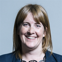 |
| Contact Details | Contact Sarah Jones |
| Political Party | Labour |
What Council is the CR0 9XS Postcode in?
The Local Council for this Postcode is Croydon London Boro Council and the County Council is Greater London Authority Council.
Greater London Authority Council is responsible for providing education, libraries and maintaining highways.
Croydon London Boro Council is responsible for duties such as council tax, rubbish collection, housing, environmental health and planning.
You can visit the website for Croydon London Boro at the following link Croydon London Boro.How much is the Council Tax?
Croydon London Boro Council is responsible for collecting council tax. This will vary depending on which council tax band the property falls within. You can check the council tax band at the gov.uk website.
Once you know the council tax band you can view how much Croydon London Boro charge for that band by visiting the The Council Tax section of their website.
Planning Applications
When moving house to a new post code it is worth checking out what will be built in the neighbourhood.
Few people want to live next door to a building site, have their garden overlooked or have the views from their property ruined.
Visit the local planning department and search for planning applications in this postcode granted within the last three years or still awaiting a decision. This will give an indication of what could still be built.
Where can I find out where the nearest Library to the CR0 9XS Postcode is?
Libraries are the responsibility of Croydon council
Visit the link for more information. Please note that some councils outsource library services to private companies and community groups ran by volunteers.
Libraries | Croydon CouncilHouse Sales in CR0 9XS
| Year | High | Low | Average | Sales |
|---|---|---|---|---|
| 2014 | £235,000 | £235,000 | £235,000 | 1 |
Contains HM Land Registry data © Crown copyright and database right 2024. This data is licensed under the Open Government Licence v3.0.
Postcodes near the CR0 9XS Postcode
Recommended Local Businesses CR0 9XS Postcode
Nobody has recommended any businesses yet.
Can you suggest any local takeaways, restaurants, pubs or businesses to our Readers?
What Popular Supermarkets are near the CR0 9XS Postcode?
| Supermarket | Distance | Directions |
|---|---|---|
| Iceland, Surrey Street, CROYDON, CR0 1RG | 0.52 miles | Directions from CR0 9XS to Iceland |
| Waitrose, George Street, CROYDON, CR0 1LG | 0.66 miles | Directions from CR0 9XS to Waitrose |
| Sainsburys, Whitgift Centre, CROYDON, CR0 1UP | 0.88 miles | Directions from CR0 9XS to Sainsburys |
| Morrisons, Wrangthorne Walk, CROYDON, CR0 4RZ | 1.42 miles | Directions from CR0 9XS to Morrisons |
| Aldi, Purley Way, CROYDON, CR0 4XJ | 1.52 miles | Directions from CR0 9XS to Aldi |
What Popular Restaurants are near the CR0 9XS Postcode?
| Burger King | Distance | Directions |
|---|---|---|
| 41 Church Street, Croydon, CR0 1RH | 0.37 miles | Directions from CR0 9XS to 41 Church Street |
| East Croydon Rail Station, Croydon, CR0 1LF | 0.48 miles | Directions from CR0 9XS to East Croydon Rail Station |
| Unit 1 Valley Park Leisure Complex, Croydon, CR0 4XP | 1.31 miles | Directions from CR0 9XS to Unit 1 Valley Park Leisure Complex |
| Priory Retail Park, London, SW19 1DN | 4.82 miles | Directions from CR0 9XS to Priory Retail Park |
| Mcdonald's | Distance | Directions |
|---|---|---|
| McDonald's, Church Street, CROYDON, CR0 1RH | 0.37 miles | Directions from CR0 9XS to McDonald's, Church Street, CROYDON, CR0 1RH |
| McDonald's, George Street, CROYDON, CR0 1LG | 0.41 miles | Directions from CR0 9XS to McDonald's, George Street, CROYDON, CR0 1LG |
| McDonald's, North End, CROYDON, CR0 1UJ | 0.53 miles | Directions from CR0 9XS to McDonald's, North End, CROYDON, CR0 1UJ |
| McDonald's, Purley Way, CROYDON, CR0 4NX | 0.86 miles | Directions from CR0 9XS to McDonald's, Purley Way, CROYDON, CR0 4NX |
| Restaurant | Distance | Directions |
|---|---|---|
| KFC, Crown Hill, Church Street, CROYDON, CR0 1RY | 0.35 miles | Directions from CR0 9XS to KFC Croydon - Church Street |
| KFC, London Road, CROYDON, CR0 2RE | 0.73 miles | Directions from CR0 9XS to KFC Croydon - London Road |
| KFC, Lower Addiscombe Road, CROYDON, CR0 6RD | 1.39 miles | Directions from CR0 9XS to KFC Croydon - Lower Addiscombe Road |
| KFC, London Road, THORNTON HEATH, CR7 6JA | 1.85 miles | Directions from CR0 9XS to KFC Thornton Heath - London Road |
| KFC, Purley Parade, High Street, PURLEY, CR8 2AB | 2.14 miles | Directions from CR0 9XS to KFC Purley - Purley Parade |