The CR7 7 postcode sector is within the county of Greater London.
Did you know? According to the 2021 Census, the CR7 7 postcode sector is home to a bustling 18,341 residents!
Given that each sector allows for 400 unique postcode combinations. Letters C, I, K, M, O and V are not allowed in the last two letters of a postcode. With 221 postcodes already in use, this leaves 179 units available.
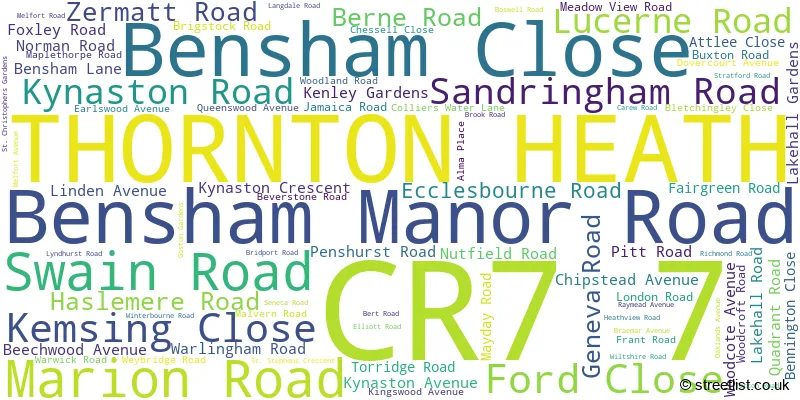
The CR7 7 postal code covers the settlement of THORNTON HEATH .
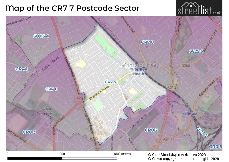
The CR7 7 Postcode shares a border with SW16 4 (NORBURY , STREATHAM ), CR0 2 (CROYDON ), CR0 3 (CROYDON , BEDDINGTON ), CR7 6 (THORNTON HEATH ) and CR7 8 (THORNTON HEATH , CROYDON ).
The sector is within the post town of THORNTON HEATH.
CR7 7 is a postcode sector within the CR7 postcode district which is within the CR Croydon postcode area.
The Royal Mail delivery office for the CR7 7 postal sector is the Thornton Heath Delivery Office.
The area of the CR7 7 postcode sector is 0.62 square miles which is 1.60 square kilometres or 396.39 square acres.

Map of the CR7 7 Postcode Sector
Explore the CR7 7 postcode sector by using our free interactive map.
| C | R | 7 | - | 7 | X | X |
| C | R | 7 | Space | 7 | Letter | Letter |
Official List of Streets
THORNTON HEATH (80 Streets)
Unofficial Streets or Alternative Spellings
CROYDON
KIMBERLEY ROAD PALMERSTON ROAD STANLEY ROADTHORNTON HEATH
COTFORD ROAD DUNHEVED ROAD NORTH DUNHEVED ROAD SOUTH FIVEACRE CLOSE GOLDWELL ROAD HEADCORN ROAD LEANDER ROAD SANDFIELD ROADCROYDON,
BENSHAM LANE PITT ROAD CHALDON PATH CROSSLAND ROAD GALPINS ROAD NUTFIELD PASSAGE NUTFIELD PLACE QUEENS ROAD RAYMEAD PASSAGE ST. CHRISTOPHERS GARDENS TREETOPS COURTCroydon
LONDON ROAD NORBURY CRESCENT STRATHYRE AVENUEWeather Forecast for CR7 7
Press Button to Show Forecast for Crystal Palace F.C.
| Time Period | Icon | Description | Temperature | Rain Probability | Wind |
|---|---|---|---|---|---|
| 06:00 to 09:00 | Overcast | 10.0°C (feels like 7.0°C) | 20.00% | WNW 11 mph | |
| 09:00 to 12:00 | Cloudy | 11.0°C (feels like 8.0°C) | 41.00% | NW 16 mph | |
| 12:00 to 15:00 | Cloudy | 12.0°C (feels like 9.0°C) | 10.00% | NW 16 mph | |
| 15:00 to 18:00 | Cloudy | 12.0°C (feels like 10.0°C) | 41.00% | NNW 11 mph | |
| 18:00 to 21:00 | Cloudy | 10.0°C (feels like 8.0°C) | 9.00% | NNE 11 mph | |
| 21:00 to 00:00 | Partly cloudy (night) | 8.0°C (feels like 5.0°C) | 4.00% | NNE 9 mph |
Press Button to Show Forecast for Crystal Palace F.C.
| Time Period | Icon | Description | Temperature | Rain Probability | Wind |
|---|---|---|---|---|---|
| 00:00 to 03:00 | Clear night | 6.0°C (feels like 3.0°C) | 2.00% | N 9 mph | |
| 03:00 to 06:00 | Clear night | 5.0°C (feels like 2.0°C) | 1.00% | NNW 9 mph | |
| 06:00 to 09:00 | Cloudy | 5.0°C (feels like 2.0°C) | 5.00% | NNW 9 mph | |
| 09:00 to 12:00 | Overcast | 7.0°C (feels like 4.0°C) | 8.00% | N 11 mph | |
| 12:00 to 15:00 | Overcast | 9.0°C (feels like 7.0°C) | 9.00% | N 11 mph | |
| 15:00 to 18:00 | Overcast | 11.0°C (feels like 8.0°C) | 10.00% | N 11 mph | |
| 18:00 to 21:00 | Overcast | 10.0°C (feels like 8.0°C) | 9.00% | NNE 9 mph | |
| 21:00 to 00:00 | Clear night | 8.0°C (feels like 6.0°C) | 2.00% | NNE 7 mph |
Press Button to Show Forecast for Crystal Palace F.C.
| Time Period | Icon | Description | Temperature | Rain Probability | Wind |
|---|---|---|---|---|---|
| 00:00 to 03:00 | Overcast | 6.0°C (feels like 5.0°C) | 8.00% | NNE 4 mph | |
| 03:00 to 06:00 | Partly cloudy (night) | 6.0°C (feels like 4.0°C) | 2.00% | N 4 mph | |
| 06:00 to 09:00 | Overcast | 6.0°C (feels like 4.0°C) | 8.00% | N 4 mph | |
| 09:00 to 12:00 | Overcast | 8.0°C (feels like 6.0°C) | 10.00% | N 7 mph | |
| 12:00 to 15:00 | Overcast | 10.0°C (feels like 7.0°C) | 11.00% | NNE 9 mph | |
| 15:00 to 18:00 | Overcast | 11.0°C (feels like 9.0°C) | 11.00% | NNE 11 mph | |
| 18:00 to 21:00 | Cloudy | 10.0°C (feels like 8.0°C) | 7.00% | NNE 11 mph | |
| 21:00 to 00:00 | Partly cloudy (night) | 8.0°C (feels like 6.0°C) | 3.00% | NE 9 mph |
Press Button to Show Forecast for Crystal Palace F.C.
| Time Period | Icon | Description | Temperature | Rain Probability | Wind |
|---|---|---|---|---|---|
| 00:00 to 03:00 | Clear night | 7.0°C (feels like 4.0°C) | 4.00% | NNE 7 mph | |
| 03:00 to 06:00 | Clear night | 6.0°C (feels like 3.0°C) | 3.00% | NNE 7 mph | |
| 06:00 to 09:00 | Partly cloudy (day) | 6.0°C (feels like 3.0°C) | 3.00% | NNE 7 mph | |
| 09:00 to 12:00 | Partly cloudy (day) | 8.0°C (feels like 6.0°C) | 3.00% | NNE 9 mph | |
| 12:00 to 15:00 | Cloudy | 11.0°C (feels like 8.0°C) | 9.00% | NE 9 mph | |
| 15:00 to 18:00 | Cloudy | 11.0°C (feels like 9.0°C) | 8.00% | NE 11 mph | |
| 18:00 to 21:00 | Cloudy | 10.0°C (feels like 8.0°C) | 9.00% | NE 9 mph | |
| 21:00 to 00:00 | Partly cloudy (night) | 8.0°C (feels like 6.0°C) | 3.00% | NE 9 mph |
Schools and Places of Education Within the CR7 7 Postcode Sector
Bensham Manor School
Community special school
Ecclesbourne Road, Thornton Heath, Surrey, CR7 7BN
Head: Mrs Fiona Robinson
Ofsted Rating: Good
Inspection: 2023-03-23 (393 days ago)
Website: Visit Bensham Manor School Website
Phone: 02086840116
Number of Pupils: 244
Ecclesbourne Primary School
Academy converter
Attlee Close, Thornton Heath, Surrey, CR7 7FA
Head: Ms Jo Waters
Ofsted Rating: Good
Inspection: 2023-05-17 (338 days ago)
Website: Visit Ecclesbourne Primary School Website
Phone: 02086843187
Number of Pupils: 448
Winterbourne Boys' Academy
Academy sponsor led
Winterbourne Road, Thornton Heath, Surrey, CR7 7QT
Head: Ms Charmaine Henny
Ofsted Rating: Good
Inspection: 2022-03-03 (778 days ago)
Website: Visit Winterbourne Boys' Academy Website
Phone: 02086897685
Number of Pupils: 220
Winterbourne Junior Girls' School
Community school
Winterbourne Road, Thornton Heath, Surrey, CR7 7QT
Head: Mrs Mary Berkeley-Agyepong
Ofsted Rating: Good
Inspection: 2023-02-03 (441 days ago)
Website: Visit Winterbourne Junior Girls' School Website
Phone: 02086843532
Number of Pupils: 263
Winterbourne Nursery and Infants' School
Community school
Winterbourne Road, Thornton Heath, Surrey, CR7 7QT
Head: Ms Petra Wigzell
Ofsted Rating: Good
Inspection: 2023-09-14 (218 days ago)
Website: Visit Winterbourne Nursery and Infants' School Website
Phone: 02086897684
Number of Pupils: 427
House Prices in the CR7 7 Postcode Sector
| Type of Property | 2018 Average | 2018 Sales | 2017 Average | 2017 Sales | 2016 Average | 2016 Sales | 2015 Average | 2015 Sales |
|---|---|---|---|---|---|---|---|---|
| Detached | £927,500 | 2 | £368,500 | 2 | £267,500 | 2 | £473,200 | 5 |
| Semi-Detached | £466,450 | 10 | £419,737 | 19 | £405,115 | 13 | £330,210 | 13 |
| Terraced | £361,876 | 87 | £376,244 | 89 | £354,586 | 130 | £311,453 | 140 |
| Flats | £245,764 | 53 | £260,963 | 47 | £230,292 | 71 | £186,000 | 83 |
Important Postcodes CR7 7 in the Postcode Sector
CR7 7BN is the postcode for Bensham Manor School, Ecclesbourne Road, and DINNING HALL, Bensham Manor School, Ecclesbourne Road
CR7 7DG is the postcode for 20, Chipstead Avenue
CR7 7FA is the postcode for ECCLESBOURNE PRIMARY PEGASUS ACADEMY TRUST, ATTLEE CLOSE, THORNTON HEATH, Ecclesbourne Primary School, Attlee Close, and Ecclesbourne Junior & Infants School, Attlee Close
CR7 7JB is the postcode for Croydon Council, Thornton Heath Library, Brigstock Road
CR7 7JN is the postcode for Brigstock Medical Centre, 141 Brigstock Road, WHITEHORSE MANOR BRIGSTOCK SITE, 129-133 BRIGSTOCK ROAD, CROYDON, Brigstock Manor Residential Home, 129-133 Brigstock Road, and Whitehorse Manor Schools - Brigstock Site, 129 Brigstock Road
CR7 7QT is the postcode for Winterbourne Youth Centre, 28 Winterbourne Road, Winterbourne School, Winterbourne Road, NURSERY AND INFANT SCHOOL, Winterbourne School, Winterbourne Road, Winterbourne Junior Girls School, Winterbourne Road, and CHILDRENS CENTRE, Winterbourne School, Winterbourne Road
CR7 7YE is the postcode for LONDON WING, Mayday Healthcare NHS Trust, Mayday University Hospital, 530 London Road, NIGHTINGALE HOUSE, Croydon University Hospital, 530 London Road, SHIRLEY HOUSE, Croydon University Hospital, 530 London Road, ENERGY CENTRE, Mayday Healthcare NHS Trust, Mayday University Hospital, 530 London Road, MATERNITY UNIT, Mayday Healthcare NHS Trust, Mayday University Hospital, 530 London Road, GENITAL URINARY MEDICINE, Mayday Healthcare NHS Trust, Mayday University Hospital, 530 London Road, WOODCROFT WING, Mayday Healthcare NHS Trust, Mayday University Hospital, 530 London Road, GENITO URINARY MEDICINE, Mayday Healthcare NHS Trust, Mayday University Hospital, 530 London Road, JUBILEE WING, Croydon University Hospital, 530 London Road, GENITAL URINARY MEDICINE, Croydon University Hospital, 530 London Road, MATERNITY UNIT, Croydon University Hospital, 530 London Road, MAYDAY HOUSE, Mayday Healthcare NHS Trust, Mayday University Hospital, 530 London Road, Mayday Healthcare NHS Trust, Mayday University Hospital, 530 London Road, MAYDAY HOUSE, Croydon University Hospital, 530 London Road, SHIRLEY HOUSE, Mayday Healthcare NHS Trust, Mayday University Hospital, 530 London Road, JUBILEE WING, Mayday Healthcare NHS Trust, Mayday University Hospital, 530 London Road, LONDON WING, Croydon University Hospital, 530 London Road, WOODCROFT WING, Croydon University Hospital, 530 London Road, NIGHTINGALE HOUSE, Mayday Healthcare NHS Trust, Mayday University Hospital, 530 London Road, and ENERGY CENTRE, Croydon University Hospital, 530 London Road
| The CR7 7 Sector is within these Local Authorities |
|
|---|---|
| The CR7 7 Sector is within these Counties |
|
| The CR7 7 Sector is within these Water Company Areas |
|