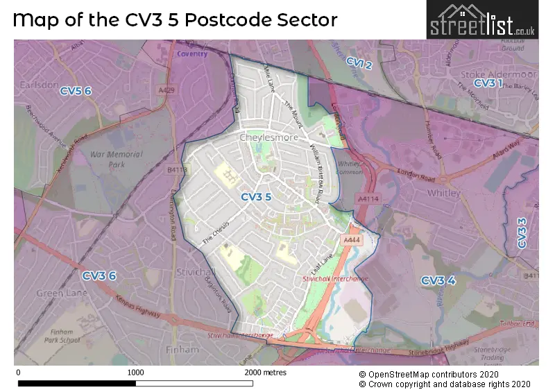
The CV3 5 postcode sector stands on the Warwickshire and West Midlands border.
Did you know? According to the 2021 Census, the CV3 5 postcode sector is home to a bustling 12,649 residents!
Given that each sector allows for 400 unique postcode combinations. Letters C, I, K, M, O and V are not allowed in the last two letters of a postcode. With 228 postcodes already in use, this leaves 172 units available.
The CV3 5 postal code covers the settlement of COVENTRY.
The CV3 5 Postcode shares a border with CV8 3 (Wolston, Ryton On Dunsmore, Baginton), CV1 2 (COVENTRY), CV3 4 (COVENTRY, Middlemarch Business Park) and CV3 6 (COVENTRY).
The sector is within the post town of COVENTRY.
CV3 5 is a postcode sector within the CV3 postcode district which is within the CV Coventry postcode area.
The Royal Mail delivery office for the CV3 5 postal sector is the Coventry South Delivery Office and Coventry City Delivery Office.
The area of the CV3 5 postcode sector is 1.08 square miles which is 2.80 square kilometres or 691.08 square acres.
The CV3 5 postcode sector is crossed by the A46 Major A road.
The CV3 5 postcode sector is crossed by the A45 Major A road.
Waterways within the CV3 5 postcode sector include the River Sowe, River Sherbourne.

Map of the CV3 5 Postcode Sector
Explore the CV3 5 postcode sector by using our free interactive map.
| C | V | 3 | - | 5 | X | X |
| C | V | 3 | Space | 5 | Letter | Letter |
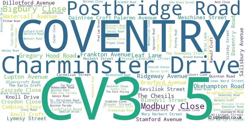
Official List of Streets
COVENTRY (108 Streets)
Unofficial Streets or Alternative Spellings
Dunchurch
LONDON ROADCOVENTRY
BENEDICTINE ROAD CARTHUSIAN ROAD FRANCISCAN ROAD HOWES LANE LEAMINGTON ROAD QUARRYFIELD LANE SCIMITAR WAY STONEBRIDGE HIGHWAY BEVAN COURT CHEYLESMORE & STIVICHALL BYPASS FESTIVAL ISLAND HELE ROAD OLD ROUTE NOW BLOCKED AT SW END RANULF STREET ROYCE COURT SEED FIELD CROFT SWIFTS CORNER THE COUNTESSS CROFTWeather Forecast for CV3 5
Press Button to Show Forecast for Stivichall
| Time Period | Icon | Description | Temperature | Rain Probability | Wind |
|---|---|---|---|---|---|
| 21:00 to 00:00 | Cloudy | 8.0°C (feels like 6.0°C) | 5.00% | NNE 7 mph |
Press Button to Show Forecast for Stivichall
| Time Period | Icon | Description | Temperature | Rain Probability | Wind |
|---|---|---|---|---|---|
| 00:00 to 03:00 | Overcast | 6.0°C (feels like 4.0°C) | 7.00% | N 7 mph | |
| 03:00 to 06:00 | Overcast | 6.0°C (feels like 4.0°C) | 7.00% | NNW 4 mph | |
| 06:00 to 09:00 | Cloudy | 6.0°C (feels like 3.0°C) | 3.00% | N 9 mph | |
| 09:00 to 12:00 | Cloudy | 7.0°C (feels like 4.0°C) | 4.00% | N 9 mph | |
| 12:00 to 15:00 | Cloudy | 9.0°C (feels like 7.0°C) | 6.00% | N 9 mph | |
| 15:00 to 18:00 | Cloudy | 10.0°C (feels like 8.0°C) | 4.00% | N 9 mph | |
| 18:00 to 21:00 | Cloudy | 10.0°C (feels like 8.0°C) | 4.00% | N 7 mph | |
| 21:00 to 00:00 | Cloudy | 7.0°C (feels like 5.0°C) | 3.00% | NNE 7 mph |
Press Button to Show Forecast for Stivichall
| Time Period | Icon | Description | Temperature | Rain Probability | Wind |
|---|---|---|---|---|---|
| 00:00 to 03:00 | Cloudy | 5.0°C (feels like 3.0°C) | 4.00% | SW 4 mph | |
| 03:00 to 06:00 | Cloudy | 4.0°C (feels like 2.0°C) | 4.00% | WSW 4 mph | |
| 06:00 to 09:00 | Cloudy | 5.0°C (feels like 2.0°C) | 6.00% | W 7 mph | |
| 09:00 to 12:00 | Cloudy | 7.0°C (feels like 5.0°C) | 8.00% | WNW 9 mph | |
| 12:00 to 15:00 | Overcast | 10.0°C (feels like 8.0°C) | 14.00% | NW 9 mph | |
| 15:00 to 18:00 | Cloudy | 10.0°C (feels like 8.0°C) | 9.00% | NW 9 mph | |
| 18:00 to 21:00 | Cloudy | 9.0°C (feels like 8.0°C) | 6.00% | N 7 mph | |
| 21:00 to 00:00 | Cloudy | 6.0°C (feels like 5.0°C) | 5.00% | NE 4 mph |
Press Button to Show Forecast for Stivichall
| Time Period | Icon | Description | Temperature | Rain Probability | Wind |
|---|---|---|---|---|---|
| 00:00 to 03:00 | Cloudy | 5.0°C (feels like 3.0°C) | 6.00% | ENE 4 mph | |
| 03:00 to 06:00 | Cloudy | 4.0°C (feels like 2.0°C) | 8.00% | ESE 4 mph | |
| 06:00 to 09:00 | Cloudy | 4.0°C (feels like 2.0°C) | 11.00% | E 7 mph | |
| 09:00 to 12:00 | Cloudy | 7.0°C (feels like 5.0°C) | 14.00% | ESE 7 mph | |
| 12:00 to 15:00 | Overcast | 9.0°C (feels like 8.0°C) | 18.00% | ESE 7 mph | |
| 15:00 to 18:00 | Overcast | 10.0°C (feels like 8.0°C) | 19.00% | ESE 9 mph | |
| 18:00 to 21:00 | Cloudy | 9.0°C (feels like 7.0°C) | 16.00% | ESE 9 mph | |
| 21:00 to 00:00 | Cloudy | 7.0°C (feels like 5.0°C) | 21.00% | E 9 mph |
Press Button to Show Forecast for Stivichall
| Time Period | Icon | Description | Temperature | Rain Probability | Wind |
|---|---|---|---|---|---|
| 00:00 to 03:00 | Overcast | 6.0°C (feels like 4.0°C) | 22.00% | E 7 mph | |
| 03:00 to 06:00 | Overcast | 6.0°C (feels like 3.0°C) | 23.00% | E 7 mph | |
| 06:00 to 09:00 | Cloudy | 6.0°C (feels like 4.0°C) | 18.00% | E 7 mph | |
| 09:00 to 12:00 | Overcast | 9.0°C (feels like 6.0°C) | 18.00% | E 9 mph | |
| 12:00 to 15:00 | Cloudy | 11.0°C (feels like 9.0°C) | 17.00% | E 9 mph | |
| 15:00 to 18:00 | Cloudy | 12.0°C (feels like 9.0°C) | 19.00% | E 9 mph | |
| 18:00 to 21:00 | Cloudy | 10.0°C (feels like 8.0°C) | 17.00% | E 9 mph | |
| 21:00 to 00:00 | Cloudy | 9.0°C (feels like 7.0°C) | 16.00% | E 9 mph |
Schools and Places of Education Within the CV3 5 Postcode Sector
Howes Community Primary School
Community school
Palermo Avenue, Coventry, West Midlands, CV3 5EH
Head: Miss Zoe Pollard
Ofsted Rating: Good
Inspection: 2018-10-17 (2015 days ago)
Website: Visit Howes Community Primary School Website
Phone: 02476411711
Number of Pupils: 152
Manor Park Primary School
Community school
Ulverscroft Road, Coventry, West Midlands, CV3 5EZ
Head: Mrs Rebekah Swindell
Ofsted Rating: Good
Inspection: 2023-03-14 (406 days ago)
Website: Visit Manor Park Primary School Website
Phone: 02476501736
Number of Pupils: 731
House Prices in the CV3 5 Postcode Sector
| Type of Property | 2018 Average | 2018 Sales | 2017 Average | 2017 Sales | 2016 Average | 2016 Sales | 2015 Average | 2015 Sales |
|---|---|---|---|---|---|---|---|---|
| Detached | £304,626 | 8 | £259,650 | 10 | £231,111 | 9 | £305,208 | 12 |
| Semi-Detached | £275,440 | 88 | £260,419 | 89 | £229,403 | 97 | £226,257 | 103 |
| Terraced | £198,426 | 66 | £191,475 | 69 | £170,800 | 73 | £157,481 | 75 |
| Flats | £108,158 | 10 | £104,431 | 19 | £82,389 | 9 | £88,688 | 21 |
Important Postcodes CV3 5 in the Postcode Sector
CV3 5AZ is the postcode for St. Thomas More RC Primary School, Watercall Avenue
CV3 5DE is the postcode for St. Thomas More Catholic Primary School, 120 Knoll Drive, and St Thomas More Catholic Primary School, 120 Knoll Drive
CV3 5EH is the postcode for Howes Community Primary School, Palermo Avenue
CV3 5EZ is the postcode for MANOR PARK PRIMARY SCHOOL, ULVERSCROFT ROAD, COVENTRY, Manor Park Primary School, Ulverscroft Road, and Manor Park School, Ulverscroft Road
CV3 5LL is the postcode for Whitley Common Pavilion, The Park Paling
| The CV3 5 Sector is within these Local Authorities |
|
|---|---|
| The CV3 5 Sector is within these Counties |
|
| The CV3 5 Sector is within these Water Company Areas |
|