The DG12 postcode district is a postal district located in the DG Dumfries and Galloway postcode area with a population of 13,137 residents according to the 2011 Scotland Census.
The area of the DG12 postcode district is 38.39 square miles which is 99.42 square kilometres or 24,566.68 acres.
Currently, the DG12 district has about 466 postcode units spread across 2 geographic postcode sectors.
Given that each sector allows for 400 unique postcode combinations, the district has a capacity of 800 postcodes. With 466 postcodes already in use, this leaves 334 units available.
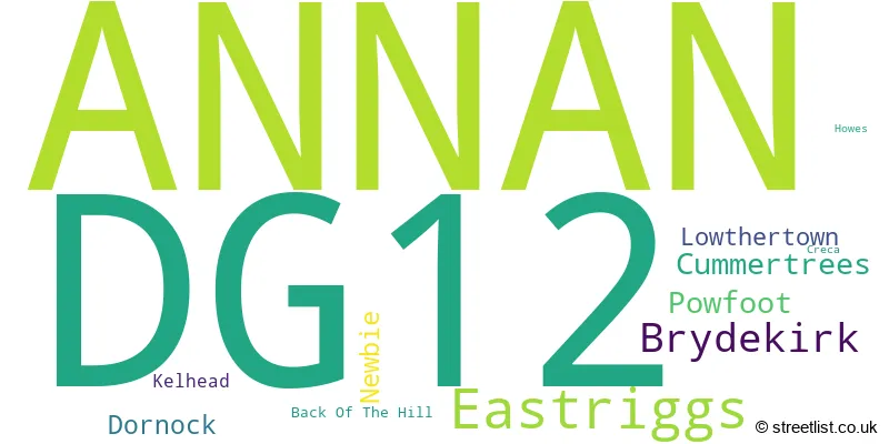
The largest settlement in the DG12 postal code is ANNAN followed by Eastriggs, and Powfoot.
The postcode area has a boundary with Solway Firth.
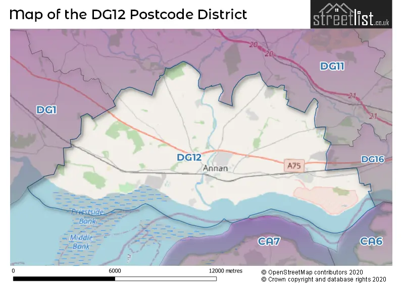
The DG12 Postcode shares a border with DG11 (LOCKERBIE, Lochmaben, Ecclefechan) and DG1 (DUMFRIES, Heathhall, Locharbriggs).
The primary settlement in the DG12 postcode district is Annan, located in Dumfries, Scotland. Other significant settlements in this district include Brydekirk, Cummertrees, Howes, Kelhead, Newbie, and Powfoot. The most significant post town in this district is Dumfries.
For the district DG12, we have data on 3 postcode sectors. Here's a breakdown: The sector DG12 5, covers Annan and Brydekirk in Dumfries. The sector DG12 6, covers Annan and Eastriggs in Dumfries. The sector DG12 9 is non-geographic. It's often designated for PO Boxes, large organisations, or special services.

Map of the DG12 Postcode District
Explore the DG12 postcode district by using our free interactive map.
When it comes to local government, postal geography often disregards political borders. However, for a breakdown in the DG12 District: the district mostly encompasses the Dumfries and Galloway area with a total of 472 postcodes.
Weather Forecast for DG12
Press Button to Show Forecast for Kinmount Gardens
| Time Period | Icon | Description | Temperature | Rain Probability | Wind |
|---|---|---|---|---|---|
| 09:00 to 12:00 | Cloudy | 8.0°C (feels like 5.0°C) | 53.00% | SW 11 mph | |
| 12:00 to 15:00 | Light rain | 8.0°C (feels like 4.0°C) | 57.00% | SW 13 mph | |
| 15:00 to 18:00 | Light rain | 9.0°C (feels like 5.0°C) | 53.00% | WSW 16 mph | |
| 18:00 to 21:00 | Cloudy | 9.0°C (feels like 6.0°C) | 46.00% | W 13 mph | |
| 21:00 to 00:00 | Cloudy | 9.0°C (feels like 6.0°C) | 12.00% | W 11 mph |
Press Button to Show Forecast for Kinmount Gardens
| Time Period | Icon | Description | Temperature | Rain Probability | Wind |
|---|---|---|---|---|---|
| 00:00 to 03:00 | Cloudy | 8.0°C (feels like 5.0°C) | 7.00% | W 11 mph | |
| 03:00 to 06:00 | Cloudy | 7.0°C (feels like 4.0°C) | 5.00% | WNW 9 mph | |
| 06:00 to 09:00 | Cloudy | 6.0°C (feels like 4.0°C) | 6.00% | WNW 9 mph | |
| 09:00 to 12:00 | Cloudy | 9.0°C (feels like 6.0°C) | 5.00% | NW 13 mph | |
| 12:00 to 15:00 | Cloudy | 11.0°C (feels like 8.0°C) | 6.00% | NNW 13 mph | |
| 15:00 to 18:00 | Cloudy | 11.0°C (feels like 9.0°C) | 5.00% | NNW 13 mph | |
| 18:00 to 21:00 | Partly cloudy (day) | 10.0°C (feels like 8.0°C) | 2.00% | NNW 9 mph | |
| 21:00 to 00:00 | Partly cloudy (night) | 6.0°C (feels like 4.0°C) | 2.00% | N 7 mph |
Press Button to Show Forecast for Kinmount Gardens
| Time Period | Icon | Description | Temperature | Rain Probability | Wind |
|---|---|---|---|---|---|
| 00:00 to 03:00 | Partly cloudy (night) | 4.0°C (feels like 2.0°C) | 2.00% | NNE 4 mph | |
| 03:00 to 06:00 | Clear night | 2.0°C (feels like 0.0°C) | 1.00% | NNE 4 mph | |
| 06:00 to 09:00 | Partly cloudy (day) | 3.0°C (feels like 1.0°C) | 1.00% | NNE 2 mph | |
| 09:00 to 12:00 | Cloudy | 7.0°C (feels like 6.0°C) | 4.00% | SSE 4 mph | |
| 12:00 to 15:00 | Cloudy | 10.0°C (feels like 9.0°C) | 5.00% | WNW 4 mph | |
| 15:00 to 18:00 | Partly cloudy (day) | 11.0°C (feels like 10.0°C) | 3.00% | WSW 7 mph | |
| 18:00 to 21:00 | Partly cloudy (day) | 10.0°C (feels like 9.0°C) | 2.00% | WSW 7 mph | |
| 21:00 to 00:00 | Partly cloudy (night) | 7.0°C (feels like 5.0°C) | 1.00% | SW 4 mph |
Press Button to Show Forecast for Kinmount Gardens
| Time Period | Icon | Description | Temperature | Rain Probability | Wind |
|---|---|---|---|---|---|
| 00:00 to 03:00 | Partly cloudy (night) | 5.0°C (feels like 4.0°C) | 2.00% | W 4 mph | |
| 03:00 to 06:00 | Cloudy | 4.0°C (feels like 3.0°C) | 4.00% | NNW 4 mph | |
| 06:00 to 09:00 | Cloudy | 6.0°C (feels like 5.0°C) | 8.00% | SE 2 mph | |
| 09:00 to 12:00 | Cloudy | 10.0°C (feels like 9.0°C) | 8.00% | ESE 4 mph | |
| 12:00 to 15:00 | Cloudy | 13.0°C (feels like 12.0°C) | 4.00% | S 7 mph | |
| 15:00 to 18:00 | Cloudy | 14.0°C (feels like 12.0°C) | 16.00% | N 7 mph | |
| 18:00 to 21:00 | Cloudy | 13.0°C (feels like 12.0°C) | 10.00% | ENE 7 mph | |
| 21:00 to 00:00 | Cloudy | 9.0°C (feels like 8.0°C) | 4.00% | ENE 7 mph |
Where is the DG12 Postcode District?
The postcode district DG12 is located in the town of Annan. Annan is situated in close proximity to several nearby towns. To the east is Gretna, which is approximately 8.15 miles away from Annan. To the north is Lockerbie, which is around 9.25 miles away. In the north-west direction, Edinburgh is located at a distance of about 10.93 miles. Canonbie is situated to the north-east of Annan, approximately 12.65 miles away. Wigton is located to the south, at a distance of around 14.16 miles. Finally, Carlisle is situated to the south-east, approximately 14.61 miles away. In addition, the postcode district has a distance of 274.24 miles from the center of London.
The district is within the post town of ANNAN.
The sector has postcodes within the nation of Scotland.
The DG12 Postcode District is in the Dumfries & Galloway region of Southern Scotland within the Scotland.
| Postcode Sector | Delivery Office |
|---|---|
| DG12 5 | Annan Delivery Office |
| DG12 6 | Annan Delivery Office |
| D | G | 1 | 2 | - | X | X | X |
| D | G | 1 | 2 | Space | Numeric | Letter | Letter |
Current Monthly Rental Prices
| # Bedrooms | Min Price | Max Price | Avg Price |
|---|---|---|---|
| 3 | £750 | £750 | £750 |
Current House Prices
| # Bedrooms | Min Price | Max Price | Avg Price |
|---|---|---|---|
| £120,000 | £120,000 | £120,000 | |
| 1 | £48,000 | £75,000 | £61,500 |
| 2 | £59,000 | £135,000 | £96,833 |
| 3 | £55,000 | £285,000 | £187,143 |
| 4 | £125,000 | £2,100,000 | £517,500 |
| 5 | £350,000 | £360,000 | £355,000 |
| 6 | £220,000 | £250,000 | £235,000 |
Estate Agents who Operate in the DG12 District
| Logo | Name | Brand Name | Address | Contact Number | Total Properties |
|---|---|---|---|---|---|
 | Annan | Harper, Robertson & Shannon | 100 High Street, Annan, DG12 6EH | 01461 387017 | 10 |
 | Carlisle | Hunters | 56 Warwick Road, Carlisle, Cumbria, CA1 1DR | 01228 582073 | 9 |
 | Scotland | Yopa | Meridian House Wheatfield Way Hinckley LE10 1YG | 0161 524 0574 | 3 |
 | Dumfries | YOUR MOVE | 2 Queensberry Street, Dumfries, DG1 1EX | 01387 213713 | 2 |
 | Hawick | Cullen Kilshaw | 55 High Street, Hawick, TD9 9BP | 01451 604180 | 2 |
Hotels within the Postcode Area
We found 4 hotels and guest houses within the DG12 postcode area