This section of the site is all about the DY Postcode area, also known as the Dudley Postal Area. Explore links to the next level to learn more about specific postcode districts such as DY1.
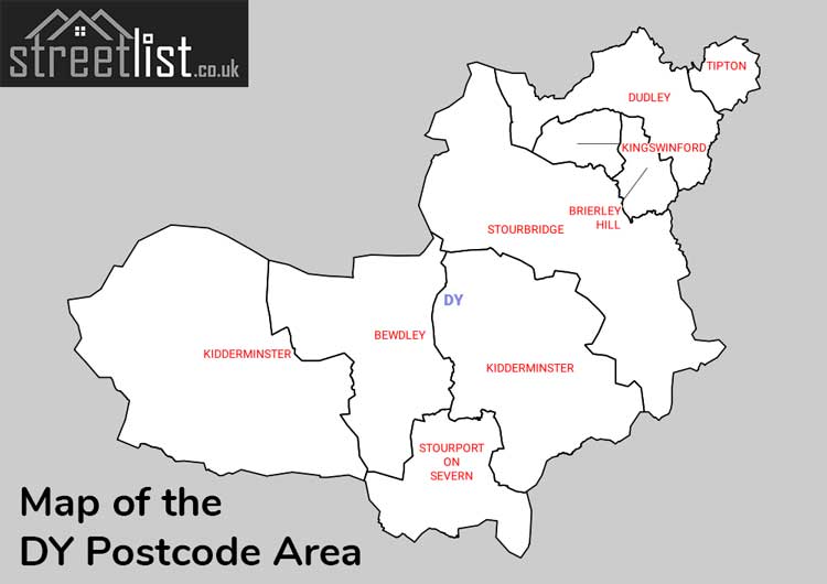
Map of the DY Postcode for Dudley
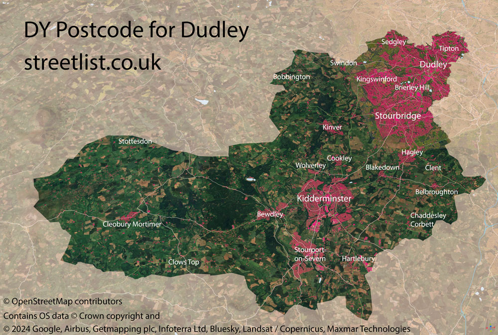
The DY postcode area represents a group of postal districts in the Dudley area of the United Kingdom. The area code DY stands for the letters d and y in DudleY. DY has a population of 410,598 and covers an area of 583,145 hectares. Fun fact: 0.63% of the population of Great Britain lives in this area.
The postcode area falls within the following counties: West Midlands (61.39%), Worcestershire (31.39%), Shropshire (3.68%), Staffordshire (3.55%).
Post Towns and Postcode Districts for the DY Postcode
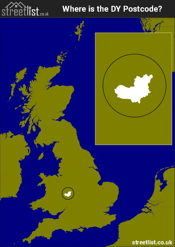
Where is the DY Postcode Area?
The Dudley DY Postcode is in the West Midlands of England. The postal area borders the following neighbouring postal areas: WV - Wolverhampton, SY - Shrewsbury, B - Birmingham, WR - Worcester and WS - Walsall, and is located inland.
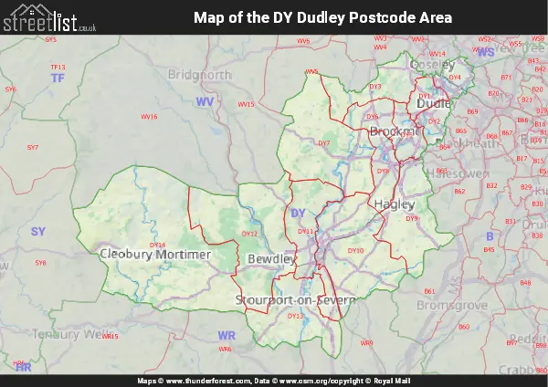
Map of the DY Dudley Postcode Area
Explore the DY Dudley postcode area by using our interactive map.
Postcode Districts within the DY Dudley Postcode Area
There are 14 postcode districts within the Dudley postcode area
A map showing the boundary of in relation to other areas
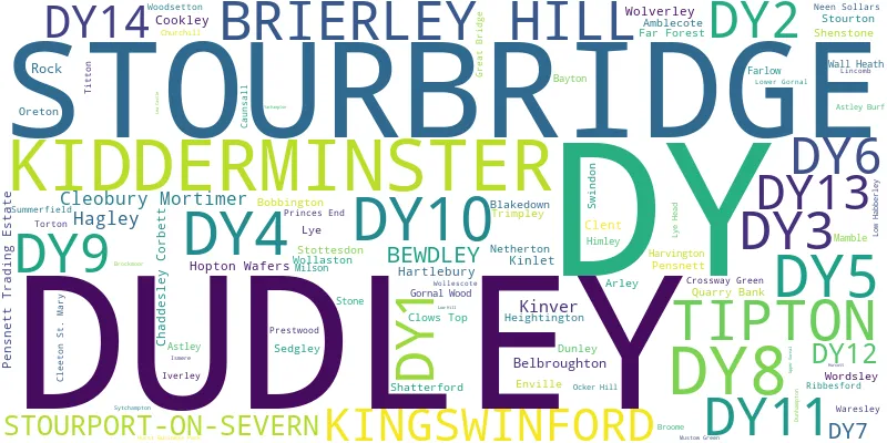
There are 16 towns within the Dudley postcode area.
| Unit | Area² |
|---|---|
| Hectares | 583,145² |
| Miles | 2,252² |
| Feet | 62,769,144,655² |
| Kilometres | 5,831² |
Postal Delivery Offices serving the DY Dudley Postcode Area
- Brierley Hill Delivery Office
- Cleobury Mortimer Scale Payment Delivery Office
- Cookley Scale Payment Delivery Office
- Delivery Office Ddington Scale Payment Delivery Office
- Dudley Delivery Office
- Farlow Scale Payment Delivery Office
- Kidderminster Delivery Office
- Kingswinford Delivery Office
- Kinver Scale Payment Delivery Office
- Oreton Scale Payment Delivery Office
- Stourbridge Delivery Office
- Stourport-on-severn Delivery Office
- Tipton Delivery Office
Councils with Postcodes in DY
Towns and Villages within the DY Dudley Postcode Area
- Astley - village
- Baveney Wood - otherSettlement
- Bayton - village
- Bayton Common - village
- Belbroughton - village
- Bell Heath - village
- Bewdley - town
- Bilston - town
- Blakedown - village
- Blakeshall - village
- Bliss Gate - village
- Bluntington - village
- Bobbington - village
- Brierley Hill - town
- Broome - village
- Buckridge - otherSettlement
- Buttonoak - village
- Callow Hill - village
- Caunsall - village
- Chaddesley Corbett - village
- Chadwick - village
- Cleeton St Mary - village
- Clent - village
- Cleobury Mortimer - town
- Clows Top - village
- Cookley - village
- Coppicegate - village
- Coseley - town
- Cradley Heath - Settlement
- Crossway Green - village
- Crumpsbrook - otherSettlement
- Doddington - village
- Drayton - village
- Dudley - town
- Dunley - village
- Dunsley - village
- Far Forest - village
- Four Ashes - otherSettlement
- Good's Green - village
- Gorst Hill - village
- Gospel End - village
- Hackman's Gate - village
- Hagley - village
- Halesowen - town
- Halfpenny Green - otherSettlement
- Hartlebury - village
- Harvington - village
- Heightington - otherSettlement
- Himley - village
- Hinksford - village
- Holy Cross - village
- Hopton Wafers - village
- Hoptonbank - village
- Iverley - village
- Kidderminster - town
- Kingsford - village
- Kingswinford - town
- Kinlet - village
- Kinver - village
- Lawns Wood - village
- Lem Hill - village
- Long Bank - village
- Lower Clent - village
- Lower Heath - village
- Lye Head - otherSettlement
- Mamble - village
- Neen Sollars - village
- New Wood - village
- Oreton - village
- Podmoor - otherSettlement
- Prestwood - village
- Rock - village
- Rowley Regis - town
- Sedgley - town
- Shatterford - village
- Shenstone - village
- Smestow - village
- Stanklyn - village
- Stone - village
- Stoneybridge - village
- Stottesdon - village
- Stourbridge - town
- Stourport-on-Severn - town
- Stourton - village
- Summerfield - village
- Swindon - village
- Sytchampton - village
- Tipton - town
- Torton - village
- Trimpley - village
- Trysull - village
- Upper Arley - village
- Waresley - village
- West Bromwich - town
- Whittington - otherSettlement
- Wilden - village
- Wolverley - village
- Wombourne - Settlement
- Wordsley - town