The EH55 postcode district is a postal district located in the EH Edinburgh postcode area with a population of 8,826 residents according to the 2011 Scotland Census.
The area of the EH55 postcode district is 35.71 square miles which is 92.49 square kilometres or 22,855.35 acres.
Currently, the EH55 district has about 271 postcode units spread across 1 geographic postcode sectors.
Given that each sector allows for 400 unique postcode combinations, the district has a capacity of 400 postcodes. With 271 postcodes already in use, this leaves 129 units available.
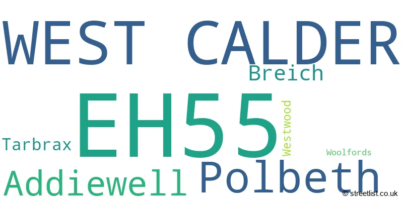
The largest settlement in the EH55 postal code is WEST CALDER followed by Polbeth, and Addiewell.
The EH55 Postcode shares a border with ML11 (LANARK, Lesmahagow, Forth), EH27 (KIRKNEWTON, Wilkieston), EH47 (Whitburn, Blackburn, Fauldhouse) and EH54 (LIVINGSTON, Deans, Livingston Village).
The primary settlement in the EH55 postcode district is West Calder, located in West Lothian, Scotland. Other significant settlements in the district include Addiewell, Breich, and Polbeth, also in West Lothian. There are also smaller settlements such as Tarbrax, Westwood, and Woolfords, located in Lanarkshire. The most significant post town in the district is West Calder.
For the district EH55, we have data on 1 postcode sectors. Here's a breakdown: The sector EH55 8, covers West Calder and Polbeth and Addiewell in West Lothian.
EH55 Postcode Sectors

Map of the EH55 Postcode District
Explore the EH55 postcode district by using our free interactive map.

When it comes to local government, postal geography often disregards political borders. However, for a breakdown in the EH55 District: the district mostly encompasses the West Lothian (269 postcodes), and finally, the South Lanarkshire area (12 postcodes).
Weather Forecast for EH55
Press Button to Show Forecast for Blackburn S Wks
| Time Period | Icon | Description | Temperature | Rain Probability | Wind |
|---|---|---|---|---|---|
| 00:00 to 03:00 | Partly cloudy (night) | 4.0°C (feels like 2.0°C) | 0.00% | N 7 mph | |
| 03:00 to 06:00 | Clear night | 2.0°C (feels like 0.0°C) | 1.00% | NNW 4 mph | |
| 06:00 to 09:00 | Sunny day | 3.0°C (feels like 1.0°C) | 2.00% | NNW 4 mph | |
| 09:00 to 12:00 | Partly cloudy (day) | 6.0°C (feels like 4.0°C) | 4.00% | NNE 7 mph | |
| 12:00 to 15:00 | Cloudy | 7.0°C (feels like 5.0°C) | 4.00% | NE 7 mph | |
| 15:00 to 18:00 | Cloudy | 7.0°C (feels like 5.0°C) | 10.00% | ESE 7 mph | |
| 18:00 to 21:00 | Cloudy | 6.0°C (feels like 4.0°C) | 8.00% | ENE 7 mph | |
| 21:00 to 00:00 | Cloudy | 4.0°C (feels like 2.0°C) | 4.00% | E 4 mph |
Press Button to Show Forecast for Blackburn S Wks
| Time Period | Icon | Description | Temperature | Rain Probability | Wind |
|---|---|---|---|---|---|
| 00:00 to 03:00 | Cloudy | 3.0°C (feels like 1.0°C) | 9.00% | NNE 2 mph | |
| 03:00 to 06:00 | Partly cloudy (night) | 2.0°C (feels like 1.0°C) | 1.00% | NNW 2 mph | |
| 06:00 to 09:00 | Cloudy | 2.0°C (feels like 1.0°C) | 5.00% | WNW 2 mph | |
| 09:00 to 12:00 | Cloudy | 6.0°C (feels like 4.0°C) | 6.00% | NNE 4 mph | |
| 12:00 to 15:00 | Cloudy | 8.0°C (feels like 7.0°C) | 7.00% | NE 4 mph | |
| 15:00 to 18:00 | Cloudy | 9.0°C (feels like 7.0°C) | 9.00% | E 4 mph | |
| 18:00 to 21:00 | Partly cloudy (day) | 8.0°C (feels like 6.0°C) | 5.00% | E 4 mph | |
| 21:00 to 00:00 | Partly cloudy (night) | 5.0°C (feels like 3.0°C) | 6.00% | ESE 4 mph |
Press Button to Show Forecast for Blackburn S Wks
| Time Period | Icon | Description | Temperature | Rain Probability | Wind |
|---|---|---|---|---|---|
| 00:00 to 03:00 | Partly cloudy (night) | 3.0°C (feels like 2.0°C) | 3.00% | ESE 2 mph | |
| 03:00 to 06:00 | Partly cloudy (night) | 2.0°C (feels like 1.0°C) | 2.00% | NE 2 mph | |
| 06:00 to 09:00 | Partly cloudy (day) | 3.0°C (feels like 1.0°C) | 2.00% | ENE 2 mph | |
| 09:00 to 12:00 | Partly cloudy (day) | 7.0°C (feels like 6.0°C) | 6.00% | ENE 2 mph | |
| 12:00 to 15:00 | Overcast | 9.0°C (feels like 8.0°C) | 14.00% | ESE 4 mph | |
| 15:00 to 18:00 | Cloudy | 9.0°C (feels like 8.0°C) | 11.00% | ESE 4 mph | |
| 18:00 to 21:00 | Cloudy | 8.0°C (feels like 7.0°C) | 14.00% | SE 4 mph | |
| 21:00 to 00:00 | Partly cloudy (night) | 6.0°C (feels like 4.0°C) | 8.00% | SE 4 mph |
Press Button to Show Forecast for Blackburn S Wks
| Time Period | Icon | Description | Temperature | Rain Probability | Wind |
|---|---|---|---|---|---|
| 00:00 to 03:00 | Clear night | 4.0°C (feels like 2.0°C) | 6.00% | SE 2 mph | |
| 03:00 to 06:00 | Clear night | 3.0°C (feels like 2.0°C) | 8.00% | ENE 2 mph | |
| 06:00 to 09:00 | Cloudy | 3.0°C (feels like 1.0°C) | 14.00% | N 4 mph | |
| 09:00 to 12:00 | Cloudy | 7.0°C (feels like 5.0°C) | 14.00% | NE 7 mph | |
| 12:00 to 15:00 | Cloudy | 10.0°C (feels like 8.0°C) | 15.00% | NNE 7 mph | |
| 15:00 to 18:00 | Cloudy | 11.0°C (feels like 9.0°C) | 15.00% | NNW 7 mph | |
| 18:00 to 21:00 | Cloudy | 10.0°C (feels like 8.0°C) | 13.00% | NNW 7 mph | |
| 21:00 to 00:00 | Cloudy | 7.0°C (feels like 5.0°C) | 12.00% | NW 7 mph |
Where is the EH55 Postcode District?
The postcode district EH55 is located in the town of West Calder. West Calder is situated near several other towns including Crieff to the northwest, Livingston to the north, Kirknewton to the northeast, and Shotts to the west. In addition, West Calder is approximately 329.75 miles away from the center of London.
The district is within the post town of WEST CALDER.
The sector has postcodes within the nation of Scotland.
The EH55 Postcode District is covers the following regions.
- West Lothian - Eastern Scotland - Scotland
- South Lanarkshire - Southern Scotland - Scotland
Postcode Sectors within the EH55 District
| Postcode Sector | Delivery Office |
|---|---|
| EH55 8 | Livingston Delivery Office |
| E | H | 5 | 5 | - | X | X | X |
| E | H | 5 | 5 | Space | Numeric | Letter | Letter |
Current Monthly Rental Prices
| # Bedrooms | Min Price | Max Price | Avg Price |
|---|
Current House Prices
| # Bedrooms | Min Price | Max Price | Avg Price |
|---|---|---|---|
| £24,000 | £249,000 | £105,750 | |
| 2 | £90,000 | £210,000 | £172,500 |
| 3 | £115,000 | £365,000 | £215,571 |
| 4 | £310,000 | £1,050,000 | £389,296 |
| 6 | £895,000 | £895,000 | £895,000 |
Estate Agents who Operate in the EH55 District
| Logo | Name | Brand Name | Address | Contact Number | Total Properties |
|---|---|---|---|---|---|
 | Livingston | Slater Hogg & Howison | Unit 102 The Centre, Livingston, EH54 6HS | 01506 379894 | 11 |
 | West Lothian | Remax Property | Fairbairn Road, West Lothian, EH54 6TS | 01506 537260 | 3 |
 | Edinburgh Country | Savills | Wemyss House 8 Wemyss Place Edinburgh EH3 6DH | 0131 381 2387 | 2 |
 | Livingston | KW Law | Torridon House Almondvale Boulevard, Livingston, EH54 6QY | 01506 379852 | 1 |
 | Livingston | Caesar & Howie | 107 Almondvale, Livingston, EH54 6QT | 01506 379849 | 1 |