This section of the site is all about the FY Postcode area, also known as the The Fylde Postal Area. Explore links to the next level to learn more about specific postcode districts such as FY0.
The FY postcode area represents a group of postal districts in the The Fylde area of the United Kingdom. The area code FY stands for the letters f and y in The FYlde. FY has a population of 276,623 and covers an area of 160,900 hectares. Fun fact: 0.43% of the population of Great Britain lives in this area.
The postcode area falls within the following counties: Lancashire (100.00%).
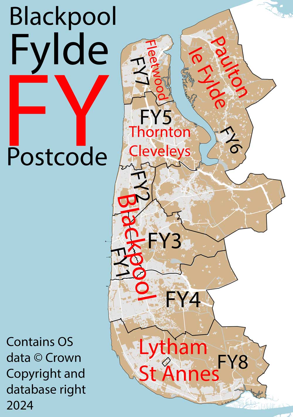
Post Towns and Postcode Districts for the FY Postcode
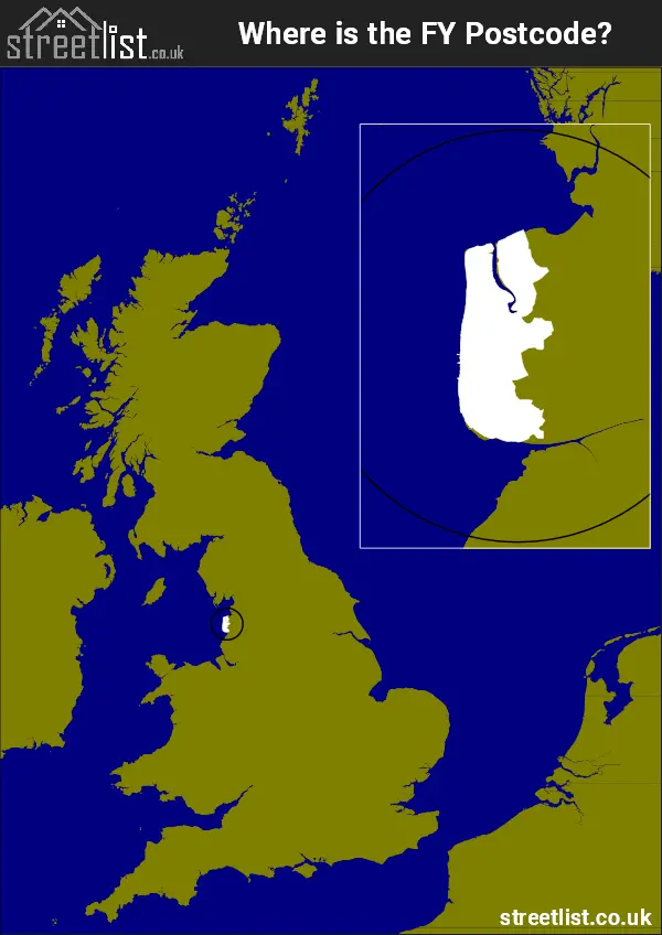
Where is the FY Postcode Area?
The Fylde, Blackpool FY Postcode is in the North West of England. The postal area borders the following neighbouring postal areas: PR - Preston, It also borders The Irish Sea and Morecambe Bay.
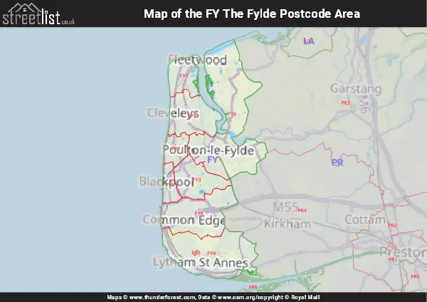
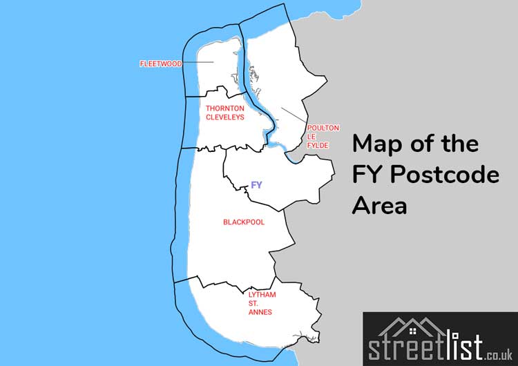
Map of the FY The Fylde Postcode Area
Explore the FY The Fylde postcode area by using our interactive map.
Postcode Districts within the FY The Fylde Postcode Area
There are 9 postcode districts within the The Fylde postcode area
A map showing the boundary of in relation to other areas
There are 6 towns within the The Fylde postcode area.
| Unit | Area² |
|---|---|
| Hectares | 160,900² |
| Miles | 621² |
| Feet | 17,319,115,100² |
| Kilometres | 1,609² |
Postal Delivery Offices serving the FY The Fylde Postcode Area
- Blackpool Delivery Office
- Cleveleys Delivery Office
- Fleetwood Delivery Office
- Lytham St Annes Delivery Office
- Poulton Le Fylde Delivery Office
- South Shore Delivery Office