The G2 postcode district is a postal district located in the G Glasgow postcode area with a population of 2,757 residents according to the 2011 Scotland Census.
The area of the G2 postcode district is 0.38 square miles which is 0.99 square kilometres or 245.01 acres.
Currently, the G2 district has about 538 postcode units spread across 21 geographic postcode sectors.
Given that each sector allows for 400 unique postcode combinations, the district has a capacity of 8,400 postcodes. With 538 postcodes already in use, this leaves 7862 units available.
The G2 postal code covers the settlement of GLASGOW.
The G2 Postcode shares a border with G1 (GLASGOW) and G3 (GLASGOW).
The primary settlement in the G2 postcode district is Glasgow, which is located in the City of Glasgow in Scotland. Other significant settlements in this district include settlements such as G2 4, G2 5, G2 6, and G2 8, all of which are also part of Glasgow.
For the district G2, we have data on 9 postcode sectors. Here's a breakdown: The sector G2 1, covers Glasgow in City of Glasgow. The sector G2 2, covers Glasgow in City of Glasgow. The sector G2 3, covers Glasgow in City of Glasgow. The sector G2 4, covers Glasgow in City of Glasgow. The sector G2 5, covers Glasgow in City of Glasgow. The sector G2 6, covers Glasgow in City of Glasgow. The sector G2 7, covers Glasgow in City of Glasgow. The sector G2 8, covers Glasgow in City of Glasgow. The sector G2 9 is non-geographic. It's often designated for PO Boxes, large organisations, or special services.


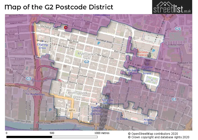
Map of the G2 Postcode District
Explore the G2 postcode district by using our free interactive map.
When it comes to local government, postal geography often disregards political borders. However, for a breakdown in the G2 District: the district mostly encompasses the Glasgow City area with a total of 532 postcodes.
Weather Forecast for G2
Press Button to Show Forecast for Glasgow
| Time Period | Icon | Description | Temperature | Rain Probability | Wind |
|---|---|---|---|---|---|
| 00:00 to 03:00 | Cloudy | 4.0°C (feels like 3.0°C) | 4.00% | ENE 4 mph | |
| 03:00 to 06:00 | Cloudy | 3.0°C (feels like 2.0°C) | 5.00% | ENE 4 mph | |
| 06:00 to 09:00 | Sunny day | 3.0°C (feels like 2.0°C) | 1.00% | ENE 2 mph | |
| 09:00 to 12:00 | Partly cloudy (day) | 7.0°C (feels like 6.0°C) | 1.00% | NE 2 mph | |
| 12:00 to 15:00 | Cloudy | 9.0°C (feels like 8.0°C) | 8.00% | NNE 4 mph | |
| 15:00 to 18:00 | Cloudy | 10.0°C (feels like 9.0°C) | 8.00% | NNE 2 mph | |
| 18:00 to 21:00 | Cloudy | 9.0°C (feels like 7.0°C) | 10.00% | NNW 4 mph | |
| 21:00 to 00:00 | Cloudy | 6.0°C (feels like 5.0°C) | 8.00% | E 4 mph |
Press Button to Show Forecast for Glasgow
| Time Period | Icon | Description | Temperature | Rain Probability | Wind |
|---|---|---|---|---|---|
| 00:00 to 03:00 | Partly cloudy (night) | 5.0°C (feels like 4.0°C) | 2.00% | ESE 2 mph | |
| 03:00 to 06:00 | Partly cloudy (night) | 4.0°C (feels like 2.0°C) | 1.00% | ESE 2 mph | |
| 06:00 to 09:00 | Partly cloudy (day) | 4.0°C (feels like 2.0°C) | 2.00% | ESE 2 mph | |
| 09:00 to 12:00 | Partly cloudy (day) | 8.0°C (feels like 7.0°C) | 4.00% | N 2 mph | |
| 12:00 to 15:00 | Overcast | 10.0°C (feels like 9.0°C) | 14.00% | SSE 4 mph | |
| 15:00 to 18:00 | Cloudy | 10.0°C (feels like 9.0°C) | 15.00% | SSE 4 mph | |
| 18:00 to 21:00 | Cloudy | 9.0°C (feels like 8.0°C) | 11.00% | SE 4 mph | |
| 21:00 to 00:00 | Clear night | 6.0°C (feels like 5.0°C) | 5.00% | ESE 4 mph |
Press Button to Show Forecast for Glasgow
| Time Period | Icon | Description | Temperature | Rain Probability | Wind |
|---|---|---|---|---|---|
| 00:00 to 03:00 | Clear night | 5.0°C (feels like 4.0°C) | 5.00% | E 4 mph | |
| 03:00 to 06:00 | Clear night | 4.0°C (feels like 2.0°C) | 5.00% | ENE 4 mph | |
| 06:00 to 09:00 | Partly cloudy (day) | 4.0°C (feels like 3.0°C) | 6.00% | NNE 4 mph | |
| 09:00 to 12:00 | Partly cloudy (day) | 7.0°C (feels like 6.0°C) | 10.00% | NNE 7 mph | |
| 12:00 to 15:00 | Cloudy | 10.0°C (feels like 9.0°C) | 15.00% | NNE 7 mph | |
| 15:00 to 18:00 | Cloudy | 11.0°C (feels like 10.0°C) | 15.00% | NNW 7 mph | |
| 18:00 to 21:00 | Partly cloudy (day) | 10.0°C (feels like 8.0°C) | 11.00% | NW 9 mph | |
| 21:00 to 00:00 | Partly cloudy (night) | 7.0°C (feels like 5.0°C) | 10.00% | W 7 mph |
Where is the G2 Postcode District?
The data provided shows that the postcode district for G2 is located in GLASGOW. GLASGOW is surrounded by several nearby towns, including AYR to the South East, DUNFERMLINE to the North West, ST. ANDREWS to the South West, ALLOA to the South, IRVINE to the East, and RENFREW to the West. Additionally, the distance from the G2 postcode district to the center of London is 345.4319925365024 miles.
The district is within the post town of GLASGOW.
The sector has postcodes within the nation of Scotland.
The G2 Postcode District is in the Glasgow City region of West Central Scotland within the Scotland.
Postcode Sectors within the G2 District
| Postcode Sector | Delivery Office |
|---|---|
| G2 1 | Glasgow G1/4 Delivery Office |
| G2 2 | Glasgow G1/4 Delivery Office |
| G2 3 | Glasgow G1/4 Delivery Office |
| G2 4 | Glasgow G1/4 Delivery Office |
| G2 5 | Glasgow G1/4 Delivery Office |
| G2 6 | Glasgow G1/4 Delivery Office |
| G2 7 | Glasgow G1/4 Delivery Office |
| G2 8 | Glasgow G1/4 Delivery Office |
| G2 9 | Glasgow G1/4 Delivery Office |
| G | 2 | - | X | X | X |
| G | 2 | Space | Numeric | Letter | Letter |
Current Monthly Rental Prices
| # Bedrooms | Min Price | Max Price | Avg Price |
|---|---|---|---|
| £995 | £1,400 | £1,198 | |
| 1 | £830 | £1,150 | £921 |
| 2 | £1,270 | £1,550 | £1,395 |
| 3 | £2,500 | £2,500 | £2,500 |
| 4 | £2,680 | £2,800 | £2,740 |
| 5 | £3,600 | £3,600 | £3,600 |
| 6 | £3,600 | £3,600 | £3,600 |
Current House Prices
| # Bedrooms | Min Price | Max Price | Avg Price |
|---|---|---|---|
| £50,000 | £2,000,000 | £539,400 | |
| 1 | £124,995 | £137,995 | £131,495 |
| 2 | £175,000 | £315,000 | £247,142 |
| 3 | £255,000 | £295,000 | £275,000 |
| 5 | £297,500 | £297,500 | £297,500 |
| 20 | £1,999,995 | £1,999,995 | £1,999,995 |
Estate Agents who Operate in the G2 District
| Logo | Name | Brand Name | Address | Contact Number | Total Properties |
|---|---|---|---|---|---|
 | London | OpenRent | 39 Great Windmill Street London W1D 7LX | 020 3322 3265 | 5 |
 | Glasgow | DJ Alexander | 303 Byres Road, Glasgow, G12 8UQ | 0141 673 3121 | 5 |
 | Glasgow | Prime Property Auctions (Scotland) Ltd | 126 West Regent Street, Glasgow, G2 2RQ | 0141 465 5880 | 2 |
 | Glasgow | 1-2-Let | 104 Bellgrove Street Glasgow G31 1AA | 0141 550 8888 | 2 |
 | Glasgow City Living | Countrywide | 71 Candleriggs, Glasgow, G1 1NP | 0141 673 9913 | 2 |