The GL12 postcode district is a postal district located in the GL Gloucester postcode area with a population of 16,184 residents according to the 2021 England and Wales Census.
The area of the GL12 postcode district is 42.70 square miles which is 110.59 square kilometres or 27,328.51 acres.
Currently, the GL12 district has about 458 postcode units spread across 2 geographic postcode sectors.
Given that each sector allows for 400 unique postcode combinations, the district has a capacity of 800 postcodes. With 458 postcodes already in use, this leaves 342 units available.
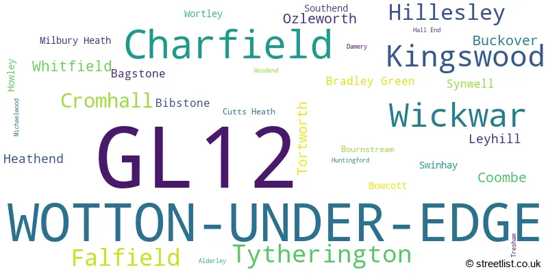
The largest settlement in the GL12 postal code is WOTTON-UNDER-EDGE followed by Charfield, and Wickwar.
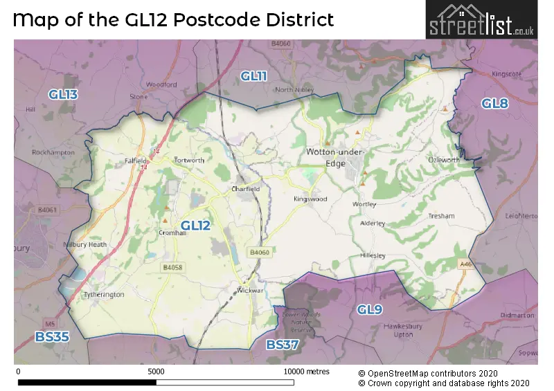
The GL12 Postcode shares a border with GL8 (TETBURY, Avening, Westonbirt), GL11 (DURSLEY, Cam, Uley), GL13 (BERKELEY, Newtown, Stone), BS37 (Yate, Chipping Sodbury, Iron Acton) and BS35 (Thornbury, Alveston, Severn Beach).
In the GL12 postcode district in Gloucestershire, the primary settlement is Wotton-under-Edge. Other significant settlements in the district include Alderley, Bournstream, Bowcott, Bradley Green, Coombe, Hillesley, Howley, Kingswood, Ozleworth, Southend, Swinhay, Synwell, Tresham, and Wortley. The most significant post town in the district is also Wotton-under-Edge.
For the district GL12, we have data on 3 postcode sectors. Here's a breakdown: The sector GL12 7, covers Wotton-Under-Edge in Gloucestershire. The sector GL12 8, covers Charfield and Wickwar and Kingswood in Gloucestershire. The sector GL12 9 is non-geographic. It's often designated for PO Boxes, large organisations, or special services.

Map of the GL12 Postcode District
Explore the GL12 postcode district by using our free interactive map.
When it comes to local government, postal geography often disregards political borders. However, for a breakdown in the GL12 District: the district mostly encompasses the Stroud District (240 postcodes), followed by the South Gloucestershire area (222 postcodes), and finally, the Cotswold District area (5 postcodes).
Recent House Sales in GL12
| Date | Price | Address |
|---|---|---|
| 26/09/2023 | £330,000 | Poskett Way, Charfield, Wotton-under-edge, GL12 8FG |
| 22/09/2023 | £480,000 | Bibstone, Wotton-under-edge, GL12 8AE |
| 21/09/2023 | £320,000 | Old Rectory Road, Kingswood, Wotton-under-edge, GL12 8RE |
| 08/09/2023 | £365,000 | Longs View, Charfield, Wotton-under-edge, GL12 8HZ |
| 06/09/2023 | £690,000 | Michaelwood, Wotton-under-edge, GL12 8HA |
| 05/09/2023 | £385,000 | Wotton Crescent, Wotton-under-edge, GL12 7JZ |
| 30/08/2023 | £264,000 | Bradley Street, Wotton-under-edge, GL12 7AR |
| 30/08/2023 | £400,000 | Boundary Close, Kingswood, Wotton-under-edge, GL12 8EN |
| 21/08/2023 | £440,000 | Talbots End, Cromhall, Wotton-under-edge, GL12 8AJ |
| 15/08/2023 | £400,000 | Somerset Close, Kingswood, Wotton-under-edge, GL12 8RQ |
Weather Forecast for GL12
Press Button to Show Forecast for Kingswood
| Time Period | Icon | Description | Temperature | Rain Probability | Wind |
|---|---|---|---|---|---|
| 12:00 to 15:00 | Cloudy | 11.0°C (feels like 9.0°C) | 14.00% | W 7 mph | |
| 15:00 to 18:00 | Cloudy | 11.0°C (feels like 9.0°C) | 7.00% | NW 9 mph | |
| 18:00 to 21:00 | Cloudy | 10.0°C (feels like 8.0°C) | 6.00% | NNE 7 mph | |
| 21:00 to 00:00 | Cloudy | 7.0°C (feels like 5.0°C) | 5.00% | NE 7 mph |
Press Button to Show Forecast for Kingswood
| Time Period | Icon | Description | Temperature | Rain Probability | Wind |
|---|---|---|---|---|---|
| 00:00 to 03:00 | Cloudy | 6.0°C (feels like 5.0°C) | 5.00% | ENE 4 mph | |
| 03:00 to 06:00 | Cloudy | 5.0°C (feels like 3.0°C) | 5.00% | ENE 4 mph | |
| 06:00 to 09:00 | Cloudy | 5.0°C (feels like 3.0°C) | 6.00% | ENE 4 mph | |
| 09:00 to 12:00 | Cloudy | 8.0°C (feels like 5.0°C) | 7.00% | E 9 mph | |
| 12:00 to 15:00 | Overcast | 10.0°C (feels like 8.0°C) | 13.00% | ENE 7 mph | |
| 15:00 to 18:00 | Cloudy | 10.0°C (feels like 9.0°C) | 13.00% | ENE 7 mph | |
| 18:00 to 21:00 | Cloudy | 9.0°C (feels like 8.0°C) | 16.00% | ENE 7 mph | |
| 21:00 to 00:00 | Cloudy | 6.0°C (feels like 4.0°C) | 14.00% | ENE 4 mph |
Press Button to Show Forecast for Kingswood
| Time Period | Icon | Description | Temperature | Rain Probability | Wind |
|---|---|---|---|---|---|
| 00:00 to 03:00 | Cloudy | 5.0°C (feels like 3.0°C) | 14.00% | E 7 mph | |
| 03:00 to 06:00 | Cloudy | 4.0°C (feels like 2.0°C) | 14.00% | ENE 7 mph | |
| 06:00 to 09:00 | Light rain | 5.0°C (feels like 2.0°C) | 48.00% | NE 7 mph | |
| 09:00 to 12:00 | Light rain | 8.0°C (feels like 5.0°C) | 51.00% | ENE 9 mph | |
| 12:00 to 15:00 | Overcast | 10.0°C (feels like 7.0°C) | 22.00% | NE 11 mph | |
| 15:00 to 18:00 | Overcast | 11.0°C (feels like 9.0°C) | 20.00% | ENE 11 mph | |
| 18:00 to 21:00 | Cloudy | 10.0°C (feels like 8.0°C) | 21.00% | NE 9 mph | |
| 21:00 to 00:00 | Light rain | 8.0°C (feels like 5.0°C) | 50.00% | NE 11 mph |
Press Button to Show Forecast for Kingswood
| Time Period | Icon | Description | Temperature | Rain Probability | Wind |
|---|---|---|---|---|---|
| 00:00 to 03:00 | Light rain | 7.0°C (feels like 4.0°C) | 52.00% | NNE 11 mph | |
| 03:00 to 06:00 | Heavy rain | 7.0°C (feels like 4.0°C) | 75.00% | NNE 11 mph | |
| 06:00 to 09:00 | Light rain | 7.0°C (feels like 4.0°C) | 55.00% | N 11 mph | |
| 09:00 to 12:00 | Heavy rain | 8.0°C (feels like 5.0°C) | 74.00% | NNE 11 mph | |
| 12:00 to 15:00 | Light rain shower (day) | 9.0°C (feels like 6.0°C) | 43.00% | NNW 13 mph | |
| 15:00 to 18:00 | Light rain | 10.0°C (feels like 7.0°C) | 52.00% | NW 11 mph | |
| 18:00 to 21:00 | Light rain shower (day) | 10.0°C (feels like 8.0°C) | 33.00% | N 9 mph | |
| 21:00 to 00:00 | Partly cloudy (night) | 8.0°C (feels like 6.0°C) | 4.00% | NNW 4 mph |
Where is the GL12 Postcode District?
The GL12 postcode district is located in Wotton-under-Edge. It is near several towns including Dursley to the North (3.88 miles away), Berkeley to the Northwest (5.92 miles away), Badminton to the Southeast (7.02 miles away), Tetbury to the East (9.50 miles away), Stonehouse to the Northeast (9.60 miles away), and Bristol to the Southwest (12.27 miles away). Additionally, the GL12 postcode district is approximately 97.65 miles away from the center of London.
The district is within the post town of WOTTON-UNDER-EDGE.
The sector has postcodes within the nation of England.
The GL12 Postcode District is covers the following regions.
- Gloucestershire - Gloucestershire, Wiltshire and Bath/Bristol area - South West (England)
- Bath and North East Somerset, North Somerset and South Gloucestershire - Gloucestershire, Wiltshire and Bath/Bristol area - South West (England)
| Postcode Sector | Delivery Office |
|---|---|
| GL12 7 | Wotton Under Edge Delivery Office |
| GL12 8 | Wotton Under Edge Delivery Office |
| G | L | 1 | 2 | - | X | X | X |
| G | L | 1 | 2 | Space | Numeric | Letter | Letter |
Current Monthly Rental Prices
| # Bedrooms | Min Price | Max Price | Avg Price |
|---|---|---|---|
| 1 | £550 | £725 | £638 |
| 2 | £700 | £700 | £700 |
| 3 | £1,450 | £1,495 | £1,480 |
| 4 | £1,500 | £1,500 | £1,500 |
Current House Prices
| # Bedrooms | Min Price | Max Price | Avg Price |
|---|---|---|---|
| £50,000 | £795,000 | £242,857 | |
| 1 | £175,000 | £240,000 | £207,500 |
| 2 | £135,000 | £340,000 | £261,869 |
| 3 | £135,000 | £995,000 | £388,897 |
| 4 | £380,000 | £1,850,000 | £641,639 |
| 5 | £499,950 | £2,525,000 | £916,061 |
| 6 | £875,000 | £5,000,000 | £2,436,875 |
| 7 | £950,000 | £950,000 | £950,000 |
| 8 | £1,250,000 | £1,250,000 | £1,250,000 |
Estate Agents who Operate in the GL12 District
| Logo | Name | Brand Name | Address | Contact Number | Total Properties |
|---|---|---|---|---|---|
 | Wotton-Under-Edge | David James | Well House The Chipping Wotton-Under-Edge GL12 7AD | 01453 702878 | 18 |
 | Wotton-Under-Edge | Milburys | 1 High Street, Wotton-Under-Edge, GL12 7DE | 01453 701904 | 16 |
 | Wotton-under-Edge | David James | Well House, The Chipping, Wotton-Under-Edge, GL12 7AD | 01453 702692 | 8 |
 | Dursley | Bennett Jones | 31 Parsonage Street, Dursley, Gloucestershire, GL11 4BW | 01453 702682 | 6 |
 | Stroud | Hamptons Sales | 52-53 London Road, Stroud, GL5 2AD | 01453 702660 | 5 |
| Type of Property | 2018 Average | 2018 Sales | 2017 Average | 2017 Sales | 2016 Average | 2016 Sales | 2015 Average | 2015 Sales |
|---|---|---|---|---|---|---|---|---|
| Detached | £441,255 | 96 | £459,024 | 101 | £425,978 | 78 | £372,015 | 83 |
| Semi-Detached | £304,349 | 60 | £290,270 | 70 | £290,165 | 75 | £265,112 | 65 |
| Terraced | £241,386 | 40 | £225,106 | 60 | £235,649 | 51 | £227,361 | 71 |
| Flats | £130,200 | 10 | £138,494 | 9 | £149,778 | 18 | £142,313 | 16 |