The GL14 postcode district is a postal district located in the GL Gloucester postcode area with a population of 15,946 residents according to the 2021 England and Wales Census.
The area of the GL14 postcode district is 29.92 square miles which is 77.49 square kilometres or 19,147.60 acres.
Currently, the GL14 district has about 627 postcode units spread across 3 geographic postcode sectors.
Given that each sector allows for 400 unique postcode combinations, the district has a capacity of 1,200 postcodes. With 627 postcodes already in use, this leaves 573 units available.
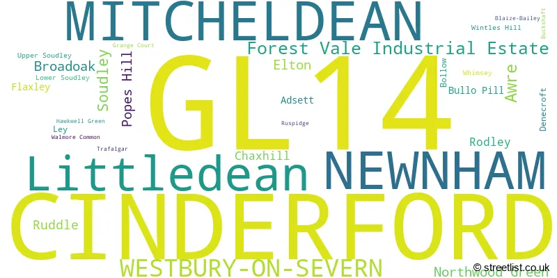
The largest settlement in the GL14 postal code is CINDERFORD followed by NEWNHAM, and Littledean.
The postcode area has a boundary with The Bristol Channel.
The GL14 Postcode shares a border with GL17 (MITCHELDEAN, DRYBROOK, LONGHOPE), GL19 (Redmarley, Staunton, Hartpury), GL2 (Quedgeley, GLOUCESTER, Hardwicke) and GL15 (LYDNEY, Bream, St. Briavels).
The primary settlement in the GL14 postcode district is Newnham, located in Gloucestershire, England. The most significant post town in the GL14 postcode district is also Newnham, within Gloucestershire. Other significant settlements in the GL14 postcode district include Westbury-on-Severn, Westbury-on-Severn, Cinderford, and Littledean, all within Gloucestershire, England.
For the district GL14, we have data on 4 postcode sectors. Here's a breakdown: The sector GL14 1, covers Newnham and Westbury-On-Severn in Gloucestershire. The sector GL14 2, covers Cinderford in Gloucestershire. The sector GL14 3, covers Cinderford and Littledean in Gloucestershire. The sector GL14 9 is non-geographic. It's often designated for PO Boxes, large organisations, or special services.

Map of the GL14 Postcode District
Explore the GL14 postcode district by using our free interactive map.

When it comes to local government, postal geography often disregards political borders. However, for a breakdown in the GL14 District: the district mostly encompasses the Forest of Dean District area with a total of 672 postcodes.
Recent House Sales in GL14
| Date | Price | Address |
|---|---|---|
| 20/10/2023 | £140,000 | Beaconsview Road, Cinderford, GL14 2PY |
| 28/09/2023 | £189,000 | Church Road, Newnham, GL14 1AP |
| 08/09/2023 | £385,000 | Buckshaft Road, Cinderford, GL14 3DN |
| 07/09/2023 | £384,000 | St Whites Road, Cinderford, GL14 3ER |
| 01/09/2023 | £270,000 | Railway Road, Cinderford, GL14 3HL |
| 25/08/2023 | £85,000 | Allsopp Close, Newnham, GL14 1DP |
| 21/08/2023 | £297,500 | Springfield Drive, Cinderford, GL14 2TE |
| 18/08/2023 | £280,000 | Steam Mills Road, Cinderford, GL14 3JB |
| 18/08/2023 | £150,000 | Ruspidge Road, Cinderford, GL14 3AE |
| 11/08/2023 | £242,000 | Parragate Road, Cinderford, GL14 2LY |
Weather Forecast for GL14
Press Button to Show Forecast for Littledean Hall
| Time Period | Icon | Description | Temperature | Rain Probability | Wind |
|---|---|---|---|---|---|
| 09:00 to 12:00 | Cloudy | 8.0°C (feels like 6.0°C) | 48.00% | W 7 mph | |
| 12:00 to 15:00 | Cloudy | 10.0°C (feels like 8.0°C) | 48.00% | NW 7 mph | |
| 15:00 to 18:00 | Cloudy | 11.0°C (feels like 9.0°C) | 46.00% | NNW 7 mph | |
| 18:00 to 21:00 | Cloudy | 9.0°C (feels like 7.0°C) | 4.00% | N 7 mph | |
| 21:00 to 00:00 | Cloudy | 6.0°C (feels like 5.0°C) | 5.00% | NE 4 mph |
Press Button to Show Forecast for Littledean Hall
| Time Period | Icon | Description | Temperature | Rain Probability | Wind |
|---|---|---|---|---|---|
| 00:00 to 03:00 | Cloudy | 6.0°C (feels like 4.0°C) | 8.00% | NE 4 mph | |
| 03:00 to 06:00 | Cloudy | 4.0°C (feels like 3.0°C) | 5.00% | NE 4 mph | |
| 06:00 to 09:00 | Overcast | 5.0°C (feels like 2.0°C) | 9.00% | NE 7 mph | |
| 09:00 to 12:00 | Cloudy | 7.0°C (feels like 4.0°C) | 8.00% | E 9 mph | |
| 12:00 to 15:00 | Overcast | 9.0°C (feels like 7.0°C) | 17.00% | E 7 mph | |
| 15:00 to 18:00 | Overcast | 9.0°C (feels like 8.0°C) | 15.00% | ENE 7 mph | |
| 18:00 to 21:00 | Cloudy | 9.0°C (feels like 7.0°C) | 14.00% | ENE 7 mph | |
| 21:00 to 00:00 | Cloudy | 6.0°C (feels like 3.0°C) | 15.00% | NE 7 mph |
Press Button to Show Forecast for Littledean Hall
| Time Period | Icon | Description | Temperature | Rain Probability | Wind |
|---|---|---|---|---|---|
| 00:00 to 03:00 | Cloudy | 4.0°C (feels like 2.0°C) | 14.00% | ENE 7 mph | |
| 03:00 to 06:00 | Cloudy | 3.0°C (feels like 1.0°C) | 13.00% | NNE 7 mph | |
| 06:00 to 09:00 | Cloudy | 4.0°C (feels like 1.0°C) | 15.00% | NNE 9 mph | |
| 09:00 to 12:00 | Overcast | 7.0°C (feels like 4.0°C) | 26.00% | NE 9 mph | |
| 12:00 to 15:00 | Overcast | 9.0°C (feels like 7.0°C) | 23.00% | ENE 11 mph | |
| 15:00 to 18:00 | Cloudy | 10.0°C (feels like 8.0°C) | 19.00% | ENE 11 mph | |
| 18:00 to 21:00 | Cloudy | 10.0°C (feels like 7.0°C) | 19.00% | NE 11 mph | |
| 21:00 to 00:00 | Light rain | 8.0°C (feels like 5.0°C) | 50.00% | NE 11 mph |
Press Button to Show Forecast for Littledean Hall
| Time Period | Icon | Description | Temperature | Rain Probability | Wind |
|---|---|---|---|---|---|
| 00:00 to 03:00 | Light rain | 7.0°C (feels like 3.0°C) | 49.00% | NNE 13 mph | |
| 03:00 to 06:00 | Heavy rain | 6.0°C (feels like 2.0°C) | 75.00% | NNE 13 mph | |
| 06:00 to 09:00 | Heavy rain | 6.0°C (feels like 2.0°C) | 74.00% | N 13 mph | |
| 09:00 to 12:00 | Heavy rain | 7.0°C (feels like 3.0°C) | 77.00% | N 13 mph | |
| 12:00 to 15:00 | Light rain | 9.0°C (feels like 5.0°C) | 55.00% | W 13 mph | |
| 15:00 to 18:00 | Light rain shower (day) | 10.0°C (feels like 7.0°C) | 42.00% | NNW 11 mph | |
| 18:00 to 21:00 | Partly cloudy (day) | 10.0°C (feels like 8.0°C) | 12.00% | NW 7 mph | |
| 21:00 to 00:00 | Partly cloudy (night) | 7.0°C (feels like 5.0°C) | 5.00% | WNW 7 mph |
Where is the GL14 Postcode District?
The postcode district GL14 is located in Cinderford. Nearby towns to Cinderford include Newnham to the South, Westbury-on-Severn to the North East, Mitcheldean to the North West, Longhope to the North, and Coleford to the West. Cinderford is approximately 102.17 miles away from the centre of London.
The district covers the post towns of CINDERFORD, MITCHELDEAN, WESTBURY-ON-SEVERN.
The sector has postcodes within the nation of England.
The GL14 Postcode District is in the Gloucestershire region of Gloucestershire, Wiltshire and Bath/Bristol area within the South West (England).
| Postcode Sector | Delivery Office |
|---|---|
| GL14 1 | Cinderford Delivery Office |
| GL14 2 | Cinderford Delivery Office |
| GL14 3 | Cinderford Delivery Office |
| G | L | 1 | 4 | - | X | X | X |
| G | L | 1 | 4 | Space | Numeric | Letter | Letter |
Tourist Attractions within the Postcode Area
We found 1 visitor attractions within the GL14 postcode area
| Westbury Court Garden |
|---|
| Gardens |
| Garden |
| View Westbury Court Garden on Google Maps |
Current Monthly Rental Prices
| # Bedrooms | Min Price | Max Price | Avg Price |
|---|---|---|---|
| 1 | £495 | £495 | £495 |
| 2 | £625 | £795 | £690 |
| 3 | £895 | £1,500 | £1,198 |
Current House Prices
| # Bedrooms | Min Price | Max Price | Avg Price |
|---|---|---|---|
| £80,000 | £245,000 | £149,165 | |
| 1 | £112,500 | £199,000 | £166,300 |
| 2 | £100,000 | £490,000 | £224,897 |
| 3 | £65,000 | £800,000 | £310,746 |
| 4 | £245,000 | £750,000 | £422,403 |
| 5 | £125,000 | £1,800,000 | £632,800 |
| 6 | £799,999 | £825,000 | £812,500 |
| 8 | £649,950 | £649,950 | £649,950 |
| 10 | £500,000 | £500,000 | £500,000 |
Estate Agents who Operate in the GL14 District
| Logo | Name | Brand Name | Address | Contact Number | Total Properties |
|---|---|---|---|---|---|
 | Cinderford | KJT Residential | 15 High Street, Cinderford, GL14 2SE | 01594 808750 | 52 |
 | Mitcheldean | Steve Gooch Estate Agents | The Cross Mill End st Mitcheldean, GL17 0BP | 01594 808783 | 35 |
 | Cinderford | Dean Estate Agents | 4A Dockham Road, Cinderford, GL14 2AQ | 01594 808805 | 29 |
 | Newnham | Hills Property Consultants | Unit 1 Central House Dean Road Newnham Gloucestershire GL14 1AB | 01594 808815 | 22 |
 | Cheltenham | PARTNERS IN PROPERTY | Carrick House Lypiatt Road, Cheltenham, GL50 2QJ | 01432 805185 | 14 |
| Type of Property | 2018 Average | 2018 Sales | 2017 Average | 2017 Sales | 2016 Average | 2016 Sales | 2015 Average | 2015 Sales |
|---|---|---|---|---|---|---|---|---|
| Detached | £301,400 | 75 | £259,177 | 83 | £260,505 | 91 | £236,102 | 93 |
| Semi-Detached | £195,016 | 82 | £177,490 | 83 | £166,441 | 91 | £156,069 | 91 |
| Terraced | £166,536 | 72 | £141,909 | 86 | £145,141 | 99 | £135,704 | 68 |
| Flats | £92,833 | 12 | £122,975 | 16 | £122,409 | 11 | £89,705 | 11 |