The GL14 1 postcode sector is within the county of Gloucestershire.
Did you know? According to the 2021 Census, the GL14 1 postcode sector is home to a bustling 3,308 residents!
Given that each sector allows for 400 unique postcode combinations. Letters C, I, K, M, O and V are not allowed in the last two letters of a postcode. With 167 postcodes already in use, this leaves 233 units available.
The largest settlement in the GL14 1 postal code is NEWNHAM followed by WESTBURY-ON-SEVERN, and Elton.
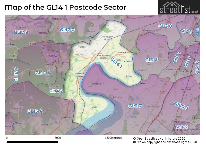
The GL14 1 Postcode shares a border with GL14 3 (CINDERFORD, Littledean, Whimsey), GL15 4 (BLAKENEY, Yorkley, LYDNEY), GL19 3 (Redmarley, Staunton, Hartpury), GL2 3 (Longney, Elmore, Quedgeley), GL2 8 (Highnam, Minsterworth, Churcham), GL14 2 (CINDERFORD, Forest Vale Industrial Estate, Soudley) and GL17 0 (MITCHELDEAN, LONGHOPE, May Hill).
The sector is within the post town of NEWNHAM.
GL14 1 is a postcode sector within the GL14 postcode district which is within the GL Gloucester postcode area.
The Royal Mail delivery office for the GL14 1 postal sector is the Cinderford Delivery Office.
The area of the GL14 1 postcode sector is 18.81 square miles which is 48.71 square kilometres or 12,036.72 square acres.

Map of the GL14 1 Postcode Sector
Explore the GL14 1 postcode sector by using our free interactive map.
| G | L | 1 | 4 | - | 1 | X | X |
| G | L | 1 | 4 | Space | 1 | Letter | Letter |
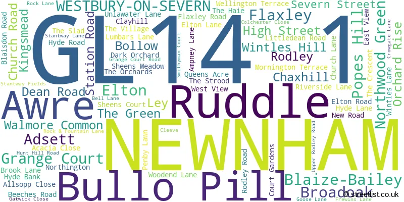
Official List of Streets
NEWNHAM (29 Streets)
WESTBURY-ON-SEVERN (16 Streets)
Adsett (2 Streets)
Northwood Green (3 Streets)
Elton (4 Streets)
Ley (1 Streets)
Bollow (2 Streets)
Popes Hill (2 Streets)
Awre (2 Streets)
Broadoak (2 Streets)
Ruddle (1 Streets)
Unofficial Streets or Alternative Spellings
Churcham
CHAPEL LANEBLAKENEY
AWRE ROADLittledean
PLEASANT STILEBirdwood
WHITLOW LANEMITCHELDEAN
FLAXLEY ROADSchools and Places of Education Within the GL14 1 Postcode Sector
Westbury-on-Severn Church of England Primary School
Voluntary aided school
The Village, Westbury-on-Severn, Gloucestershire, GL14 1PA
Head: Mrs Anna-Mai Armstrong
Ofsted Rating: Good
Inspection: 2018-06-19 (2131 days ago)
Website: Visit Westbury-on-Severn Church of England Primary School Website
Phone: 01452760303
Number of Pupils: 73
House Prices in the GL14 1 Postcode Sector
| Type of Property | 2018 Average | 2018 Sales | 2017 Average | 2017 Sales | 2016 Average | 2016 Sales | 2015 Average | 2015 Sales |
|---|---|---|---|---|---|---|---|---|
| Detached | £411,479 | 24 | £400,247 | 15 | £421,024 | 21 | £313,550 | 20 |
| Semi-Detached | £271,250 | 8 | £257,577 | 13 | £197,265 | 13 | £305,238 | 8 |
| Terraced | £245,970 | 11 | £176,600 | 15 | £197,468 | 16 | £231,765 | 13 |
| Flats | £125,000 | 1 | £160,833 | 6 | £177,167 | 3 | £154,000 | 3 |
Important Postcodes GL14 1 in the Postcode Sector
GL14 1AT is the postcode for Newnham St. Peters C of E Primary School, Station Road
GL14 1PA is the postcode for Westbury on Severn C of E Primary School, The Village
| The GL14 1 Sector is within these Local Authorities |
|
|---|---|
| The GL14 1 Sector is within these Counties |
|
| The GL14 1 Sector is within these Water Company Areas |
|
Tourist Attractions within the GL14 1 Postcode Area
We found 1 visitor attractions within the GL14 postcode area
| Westbury Court Garden |
|---|
| Gardens |
| Garden |
| View Westbury Court Garden on Google Maps |