GL9 1HZ is a postal code used within the United Kingdom for delivering mail.
Postcodes are made up of two parts. The part before the space (GL9) is called the outward code. The part after the space (1HZ) is called the inward code. The letters C, I, K, M, O and V are not allowed in the inward code. In addition to the inward and outward code, the postcode can be broken up into four parts:
- Postal Area. In our case GL which means Gloucester.
- Postal District. In our case GL9.
- Postal Sector. In our case GL9 1.
- Postcode Unit. The last two letters. In our case HZ.
The regional mail center for the post area GL is the South West Distribution Centre, which is located at Western Approach, Distribution Park, Severn Beach, BRISTOL, BS35 4GG.
The final port of call for any post addressed to the GL9 1HZ postcode is the local delivery office (DO) which is TETBURY DO. Here the post will be sorted ready for delivery.
The properties in the GL9 1HZ postcode have the street address of High Street
Did you know? According to the 2021 Census, the GL9 1HZ postcode is home to a bustling 34 residents!
It is situated within the post town of BADMINTON within the old postal county of Gloucestershire.
GL9 1HZ is within the village of Tormarton.
The GL9 1HZ postcode area is composed of 93.33% residential properties, 6.67% commercial properties, and 0% public properties.
According to our data. Most dwellings in GL9 1HZ are houses. The remainder of residential properties consist of bungalows. Of these houses, most are detached. The remainder are semi-detached. Of these bungalows, most are detached. The remainder are semi-detached.
Most properties in GL9 1HZ are owned by the occupiers with the rest being privately rented.

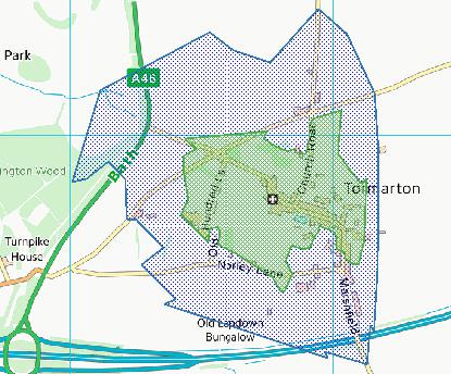
Interactive Mapping Showing UPRNs within the GL9 1HZ Postcode Boundaries
Use the search box to search for other postcodes or places.
| Property Type | Percentage |
|---|---|
| Residential | 93.33% |
| Commercial | 6.67% |
| Public | 0% |
Map Coordinates for GL9 1HZ
| Latitude | 51.5072342007 |
|---|---|
| Longitude | -2.33612948963 |
Ordnance Survey Maps for GL9 1HZ
| Map Series | Amazon | Ordnance Survey |
| Explorer 1:25,000 155 Bristol and Bath | Check Price on Amazon | Buy Direct from the Ordnance Survey |
| Landranger 1:50,000 172 Bristol & Bath | Check Price on Amazon | Buy Direct from the Ordnance Survey |
Weather Forecast for GL9 1HZ
Wed 24th Apr
Press Button to Show Forecast for Dyrham Park
| Time Period | Icon | Description | Temperature | Rain Probability | Wind |
|---|---|---|---|---|---|
| 21:00 to 00:00 | Cloudy | 8.0°C (feels like 7.0°C) | 4.00% | SSE 4 mph |
Thu 25th Apr
Press Button to Show Forecast for Dyrham Park
| Time Period | Icon | Description | Temperature | Rain Probability | Wind |
|---|---|---|---|---|---|
| 00:00 to 03:00 | Partly cloudy (night) | 6.0°C (feels like 4.0°C) | 1.00% | S 4 mph | |
| 03:00 to 06:00 | Clear night | 4.0°C (feels like 2.0°C) | 0.00% | W 4 mph | |
| 06:00 to 09:00 | Cloudy | 4.0°C (feels like 2.0°C) | 4.00% | WSW 4 mph | |
| 09:00 to 12:00 | Cloudy | 7.0°C (feels like 5.0°C) | 52.00% | WSW 9 mph | |
| 12:00 to 15:00 | Light rain | 9.0°C (feels like 7.0°C) | 44.00% | WNW 9 mph | |
| 15:00 to 18:00 | Light rain | 10.0°C (feels like 8.0°C) | 50.00% | WNW 9 mph | |
| 18:00 to 21:00 | Light rain | 9.0°C (feels like 8.0°C) | 50.00% | NNE 2 mph | |
| 21:00 to 00:00 | Cloudy | 7.0°C (feels like 5.0°C) | 6.00% | NE 7 mph |
Fri 26th Apr
Press Button to Show Forecast for Dyrham Park
| Time Period | Icon | Description | Temperature | Rain Probability | Wind |
|---|---|---|---|---|---|
| 00:00 to 03:00 | Cloudy | 5.0°C (feels like 3.0°C) | 4.00% | ENE 7 mph | |
| 03:00 to 06:00 | Cloudy | 5.0°C (feels like 2.0°C) | 5.00% | ENE 7 mph | |
| 06:00 to 09:00 | Cloudy | 4.0°C (feels like 1.0°C) | 6.00% | ENE 9 mph | |
| 09:00 to 12:00 | Cloudy | 6.0°C (feels like 3.0°C) | 7.00% | E 11 mph | |
| 12:00 to 15:00 | Overcast | 9.0°C (feels like 7.0°C) | 14.00% | E 9 mph | |
| 15:00 to 18:00 | Overcast | 9.0°C (feels like 8.0°C) | 17.00% | E 7 mph | |
| 18:00 to 21:00 | Cloudy | 9.0°C (feels like 7.0°C) | 15.00% | ENE 7 mph | |
| 21:00 to 00:00 | Cloudy | 6.0°C (feels like 3.0°C) | 14.00% | ENE 7 mph |
Sat 27th Apr
Press Button to Show Forecast for Dyrham Park
| Time Period | Icon | Description | Temperature | Rain Probability | Wind |
|---|---|---|---|---|---|
| 00:00 to 03:00 | Cloudy | 5.0°C (feels like 2.0°C) | 12.00% | ENE 9 mph | |
| 03:00 to 06:00 | Cloudy | 4.0°C (feels like 1.0°C) | 16.00% | ENE 9 mph | |
| 06:00 to 09:00 | Light rain | 4.0°C (feels like 1.0°C) | 51.00% | ENE 9 mph | |
| 09:00 to 12:00 | Overcast | 6.0°C (feels like 3.0°C) | 25.00% | ENE 11 mph | |
| 12:00 to 15:00 | Overcast | 9.0°C (feels like 7.0°C) | 20.00% | ENE 11 mph | |
| 15:00 to 18:00 | Overcast | 11.0°C (feels like 8.0°C) | 20.00% | ENE 11 mph | |
| 18:00 to 21:00 | Overcast | 9.0°C (feels like 7.0°C) | 24.00% | NE 11 mph | |
| 21:00 to 00:00 | Light rain | 8.0°C (feels like 4.0°C) | 53.00% | NE 13 mph |
Sun 28th Apr
Press Button to Show Forecast for Dyrham Park
| Time Period | Icon | Description | Temperature | Rain Probability | Wind |
|---|---|---|---|---|---|
| 00:00 to 03:00 | Light rain | 7.0°C (feels like 3.0°C) | 51.00% | NE 13 mph | |
| 03:00 to 06:00 | Heavy rain | 6.0°C (feels like 3.0°C) | 75.00% | NE 11 mph | |
| 06:00 to 09:00 | Heavy rain | 6.0°C (feels like 3.0°C) | 75.00% | NNE 11 mph | |
| 09:00 to 12:00 | Heavy rain | 7.0°C (feels like 4.0°C) | 73.00% | NE 13 mph | |
| 12:00 to 15:00 | Light rain shower (day) | 9.0°C (feels like 6.0°C) | 42.00% | W 13 mph | |
| 15:00 to 18:00 | Light rain shower (day) | 10.0°C (feels like 7.0°C) | 40.00% | W 13 mph | |
| 18:00 to 21:00 | Light rain shower (day) | 10.0°C (feels like 7.0°C) | 34.00% | WNW 9 mph | |
| 21:00 to 00:00 | Partly cloudy (night) | 7.0°C (feels like 5.0°C) | 5.00% | S 4 mph |
What are the Broadband Speeds like in the GL9 1HZ Postcode?
Download Speeds For GL9 1HZ

| Average Mbps | 56.100 |
|---|---|
| Median Mbps | 54.800 |
| Maximum Mbps | 72.200 |
GL9 1HZ has an average download speed of 56.1 Megabits per second (Mbps).
1,472 other postcode units have the same broadband speed.
34% of postcodes (402,796) have slower broadband speeds.
66% of postcodes (780,373) have faster broadband speeds.
Upload Speeds For GL9 1HZ

| Average Mbps | 15.400 |
|---|---|
| Median Mbps | 16.700 |
| Maximum Mbps | 20.000 |
GL9 1HZ has an average upload speed of 15.4 Megabits per second (Mbps).
10,994 other postcode units have the same upload speed.
69% of postcodes (815,646) have slower upload speeds.
30% of postcodes (358,001) have faster upload speeds.
Schools within a five minute drive of GL9 1HZ Postcode
England Primary Schools
Trinity Church of England Primary School
Address: Trinity Church of England Primary School, Littleton Drew Lane, Acton Turville, Badminton, South Gloucestershire, GL9 1HJ
Distance: 3.10 miles
Contact: 01454218462
Old Sodbury Church of England Primary School
Address: Old Sodbury Church of England Primary School, Church Lane, Old Sodbury, Bristol, BS37 6NB
Distance: 1.90 miles
Contact: 01454313682
Nearest Dentists
Dentists near GL9 1HZ
DENTAL SURGERY
Address: 8 HOUNDS ROAD, CHIPPING SODBURY, BRISTOL, AVON, BS37 6EE
Distance: 3.23 miles
Contact: :
THE RIDGE DENTAL SURGERY
Address: 86 FIRGROVE CRESCENT, YATE, BRISTOL, AVON, BS37 7AG
Distance: 3.86 miles
Contact: :
YATE CENTRE DENTAL SURGERY
Address: 2A NORTH WALK, YATE, BRISTOL, AVON, BS37 4AP
Distance: 4.05 miles
Contact: :
DENTAL DEPARTMENT
Address: YATE HEALTH CENTRE, 21 WEST WALK, BRISTOL, NORTH SOMERSET, BS37 4AX
Distance: 4.07 miles
Contact: :
APPLE DENTAL PRACTICE
Address: 43 ABBOTSWOOD, YATE, BRISTOL, AVON, BS37 4NG
Distance: 4.08 miles
Contact: :
APPLE DENTAL PRACTICE
Address: WELLINGTON ROAD, YATE, BRISTOL, AVON, BS37 5UY
Distance: 4.54 miles
Contact: :
Nearest Chemists
Pharmacies near GL9 1HZ
CHIPPING SODBURY PHARMACY
Address: 33 HIGH STREET, CHIPPING SODBURY, BRISTOL, BS37 6BA
Distance: 3.33 miles
Contact: tel: 01454 313354
TESCO INSTORE PHARMACY
Address: 12 EAST WALK, YATE, BRISTOL, AVON, BS37 4AS
Distance: 3.99 miles
Contact: tel: 01172 919019
BOOTS
Address: 15-17 NORTH WALK, YATE, BRISTOL, AVON, BS37 4AP
Distance: 4.05 miles
Contact: tel: 01454 312589
YATE FAMILY PHARMACY
Address: KENNEDY WAY SURGERY, KENNEDY WAY, YATE, BRISTOL, BS37 4AA
Distance: 4.07 miles
Contact: tel: 01454 323496
ABBOTSWOOD PHARMACY
Address: 38 ABBOTSWOOD, YATE, BRISTOL, AVON, BS37 4NG
Distance: 4.08 miles
Contact: tel: 01454 313193
SHAUNAK'S PHARMACY
Address: COURTSIDE SURGERY, KENNEDY WAY, YATE, BRISTOL, BS37 4DQ
Distance: 4.14 miles
Contact: tel: 01454 322452
Nearest Opticians
Opticians near GL9 1HZ
ARMSTRONG & NORTH OPTICIANS
Address: 23 HIGH STREET, CHIPPING SODBURY, BRISTOL, AVON, BS37 6BA
Distance: 3.33 miles
Contact: :
ARMSTRONG & NORTH OPTICIANS
Address: 27 EAST WALK, YATE, BRISTOL, BS37 4AS
Distance: 3.99 miles
Contact: :
SPECSAVERS (YATE, BRISTOL)
Address: 2-4 NORTH WALK, YATE, BRISTOL, BS37 4AR
Distance: 4.04 miles
Contact: :
BOOTS OPTICIANS (YATE)
Address: 11 WEST WALK, YATE, BRISTOL, BS37 4AX
Distance: 4.07 miles
Contact: :
BOOTS OPTICIANS (EMERSONS GREEN, BRISTOL)
Address: 1A THE VILLAGE, EMERSON WAY, EMERSONS GREEN, BRISTOL, AVON, BS16 7AE
Distance: 6.04 miles
Contact: :
EMERSONS GREEN SPECSAVERS LIMITED (EMERSON WAY)
Address: THE VILLAGE, EMERSON WAY, EMERSONS GREEN, BRISTOL, BS16 7AE
Distance: 6.04 miles
Contact: :
Nearest GP Surgeries
Doctors near GL9 1HZ
MARSHFIELD SURGERY
Address: 2 BACK LANE, MARSHFIELD, CHIPPENHAM, WILTSHIRE, SN14 8NQ
Distance: 3.14 miles
Contact: :
KENNEDY WAY SURGERY
Address: KENNEDY WAY, YATE, BRISTOL, BS37 4AA
Distance: 4.07 miles
Contact: tel: 01454 313849
WEST WALK SURGERY - COVID LOCAL VACCINATION SERVICE 2
Address: YATE WEST GATE CENTRE, 21 WEST WALK, YATE, BRISTOL, BS37 4AX
Distance: 4.07 miles
Contact: :
WEST WALK SURGERY
Address: YATE WEST GATE CENTRE, 21 WEST WALK, YATE, BRISTOL, BS37 4AX
Distance: 4.07 miles
Contact: tel: 01454 272200
WEST WALK SURGERY - COVID LOCAL VACCINATION SERVICE
Address: YATE WEST GATE CENTRE, 21 WEST WALK, YATE, BRISTOL, BS37 4AX
Distance: 4.07 miles
Contact: :
THE SURGERY ABBOTSWOOD
Address: 42 ABBOTSWOOD, YATE, BRISTOL, AVON, BS37 4NG
Distance: 4.08 miles
Contact: tel: 01454 313577
Transport Links near GL9 1HZ
Train Stations
Nearest stations for postcode: GL9 1HZ
- Yate
Yate station, Badminton Road, Yate, South Gloucestershire, BS37 5JFDistance: 6.16 milesDriving Time: 10.83 minutes - Bristol Parkway
Bristol Parkway station, Station Approach Road, off Hatchet Road, Stoke Gifford, BS34 8PUDistance: 10.66 milesDriving Time: 12.73 minutes - Oldfield Park
Oldfield Park station, Brook Road, Bath Spa, Somerset, BA2 3RSDistance: 10.84 milesDriving Time: 17.96 minutes - Bath Spa
Bath Spa station, Dorchester Street, Bath Spa, Somerset, BA1 1SUDistance: 11.09 milesDriving Time: 18.01 minutes - Keynsham
Keynsham station, Station Road, Keynsham, Somerset, BS31 2BNDistance: 11.43 milesDriving Time: 18.94 minutes
Distances represent the quickest route by car.
Motorway Junctions near GL9 1HZ
Train Stations
Motorway Junctions near GL9 1HZ
Distances represent the quickest route by car.
Who are my Elected Representatives in the GL9 1HZ Postcode?
| Westminster Constituency | Thornbury and Yate Co Const |
|---|---|
| Member or Parliament |  |
| Contact Details | Contact Luke Hall |
| Political Party | Conservative |
What Council is the GL9 1HZ Postcode in?
The Council for this Postcode is South Gloucestershire Council, who are a Unitary authority. This means that they are responsible for providing education, libraries and maintaining highways as well as normal council duties such as council tax, rubbish collection, housing, environmental health and planning.
You can visit the website for South Gloucestershire at the following link South Gloucestershire.How much is the Council Tax?
South Gloucestershire Council is responsible for collecting council tax. This will vary depending on which council tax band the property falls within. You can check the council tax band at the gov.uk website.
Once you know the council tax band you can view how much South Gloucestershire charge for that band by visiting the The Council Tax section of their website.
Where can I find out where the nearest Library to the GL9 1HZ Postcode is?
Libraries are the responsibility of South Gloucestershire council
Visit the link for more information. Please note that some councils outsource library services to private companies and community groups ran by volunteers.
Libraries | South Gloucestershire CouncilHouse Sales in GL9 1HZ
| Year | High | Low | Average | Sales |
|---|---|---|---|---|
| 2012 | £1,100,000 | £1,100,000 | £1,100,000 | 1 |
| 2015 | £720,000 | £720,000 | £720,000 | 1 |
| 2020 | £600,000 | £600,000 | £600,000 | 1 |
| 2022 | £490,000 | £760,000 | £916,750 | 3 |
Contains HM Land Registry data © Crown copyright and database right 2024. This data is licensed under the Open Government Licence v3.0.
Postcodes near the GL9 1HZ Postcode
What Popular Supermarkets are near the GL9 1HZ Postcode?
| Supermarket | Distance | Directions |
|---|---|---|
| Waitrose, Wickwar Road, Chipping Sodbury, BRISTOL, BS37 6AU | 5.56 miles | Directions from GL9 1HZ to Waitrose |
| Lidl, Kennedy Way, Yate, BRISTOL, BS37 4BA | 6.44 miles | Directions from GL9 1HZ to Lidl |
| Iceland, North Walk, Yate, BRISTOL, BS37 4AP | 6.51 miles | Directions from GL9 1HZ to Iceland |
| Morrisons, Station Road, Yate, BRISTOL, BS37 5PW | 6.82 miles | Directions from GL9 1HZ to Morrisons |
| Morrisons, Lower East Hayes, BATH, BA1 6AN | 12.82 miles | Directions from GL9 1HZ to Morrisons |
What Popular Restaurants are near the GL9 1HZ Postcode?
| Burger King | Distance | Directions |
|---|---|---|
| M4 Service Area, Westbound, Chippenham, SN14 6LB | 7.65 miles | Directions from GL9 1HZ to M4 Service Area, Westbound |
| Leigh Delamare, Chippenham, SN14 6LB | 7.65 miles | Directions from GL9 1HZ to Leigh Delamare |
| A350 Par Drive, Chippenham, SN14 6UY | 9.07 miles | Directions from GL9 1HZ to A350 Par Drive |
| Unit 6, Eastgate Retail Park, Bristol, BS5 6XX | 10.10 miles | Directions from GL9 1HZ to Unit 6, Eastgate Retail Park |
| Mcdonald's | Distance | Directions |
|---|---|---|
| McDonald's, West Walk, Yate, BRISTOL, BS37 4AX | 4.06 miles | Directions from GL9 1HZ to McDonald's, West Walk, Yate, BRISTOL, BS37 4AX |
| McDonald's, Kingswood Aspects Leisure Park, Kingswood, BRISTOL, BS15 9LA | 8.05 miles | Directions from GL9 1HZ to McDonald's, Kingswood Aspects Leisure Park, Kingswood, BRISTOL, BS15 9LA |
| McDonald's, Southgate Street, BATH, BA1 1TG | 8.89 miles | Directions from GL9 1HZ to McDonald's, Southgate Street, BATH, BA1 1TG |
| McDonald's, Fishponds Road, Fishponds, BRISTOL, BS16 3AF | 8.97 miles | Directions from GL9 1HZ to McDonald's, Fishponds Road, Fishponds, BRISTOL, BS16 3AF |
| Restaurant | Distance | Directions |
|---|---|---|
| KFC, Straits Parade, BRISTOL, BS16 2LA | 8.36 miles | Directions from GL9 1HZ to KFC Bristol - Fishponds |
| KFC, Broadmead Lane, Keynsham, BRISTOL, BS31 1ST | 8.69 miles | Directions from GL9 1HZ to KFC Bristol - Keynsham |
| KFC, Lower Borough Walls, BATH, BA1 1QU | 8.85 miles | Directions from GL9 1HZ to KFC Bath - Lower Borough Walls |
| KFC, Bradley Stoke District Centre, Bradley Stoke, BRISTOL, BS32 8EF | 9.30 miles | Directions from GL9 1HZ to KFC Bristol Bradley Stoke |
| KFC, Eastgate Road, BRISTOL, BS5 6XX | 10.21 miles | Directions from GL9 1HZ to KFC Bristol - Eastgate Retail Park |