The HR5 postcode district is a postal district located in the HR Hereford postcode area with a population of 4,788 residents according to the 2021 England and Wales Census.
The area of the HR5 postcode district is 55.24 square miles which is 143.07 square kilometres or 35,354.40 acres.
Currently, the HR5 district has about 242 postcode units spread across 1 geographic postcode sectors.
Given that each sector allows for 400 unique postcode combinations, the district has a capacity of 400 postcodes. With 242 postcodes already in use, this leaves 158 units available.
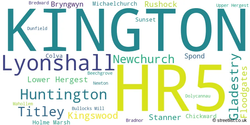
The largest settlement in the HR5 postal code is KINGTON followed by Lyonshall, and Titley.
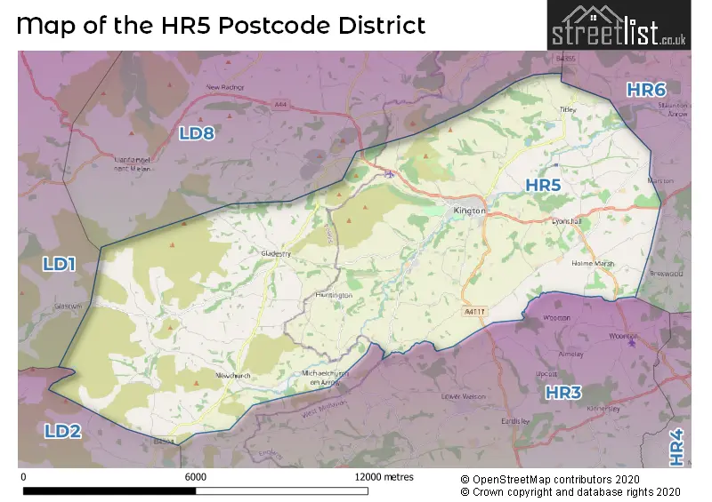
The HR5 Postcode shares a border with HR3 (HAY-ON-WYE, Eardisley, GLASBURY) and LD8 (PRESTEIGNE, NEW RADNOR, NORTON).
In the HR5 postcode district, the primary settlement is Kington, located in Herefordshire, a county in England. The most significant postal town in this district is also Kington. Other notable settlements include Lyonshall, Gladestry, Huntington, and Titley. These settlements are located in Herefordshire and Powys, a county in Wales.
For the district HR5, we have data on 1 postcode sectors. Here's a breakdown: The sector HR5 3, covers Kington and Lyonshall in Herefordshire.
HR5 Postcode Sectors

Map of the HR5 Postcode District
Explore the HR5 postcode district by using our free interactive map.
When it comes to local government, postal geography often disregards political borders. However, for a breakdown in the HR5 District: the district mostly encompasses the County of Herefordshire (205 postcodes), and finally, the Powys - Powys area (39 postcodes).
Recent House Sales in HR5
| Date | Price | Address |
|---|---|---|
| 09/10/2023 | £280,000 | Banley Drive, Kington, HR5 3FD |
| 06/10/2023 | £207,000 | Orchard Rise, Kington, HR5 3FH |
| 20/09/2023 | £210,000 | Meadow Vale, Gladestry, Kington, HR5 3PR |
| 17/08/2023 | £360,000 | Gladestry, Kington, HR5 3NR |
| 28/07/2023 | £320,000 | Rushock, Kington, HR5 3SB |
| 28/07/2023 | £220,000 | Wall Hills Close, Kington, HR5 3GA |
| 19/07/2023 | £235,000 | Park Avenue, Kington, HR5 3AN |
| 04/07/2023 | £200,000 | Garden Close, Kington, HR5 3FJ |
| 08/06/2023 | £429,000 | Hergest Road, Kington, HR5 3EQ |
| 26/05/2023 | £280,000 | Meadow Vale, Gladestry, Kington, HR5 3PR |
Weather Forecast for HR5
Press Button to Show Forecast for Hergest Croft Gardens
| Time Period | Icon | Description | Temperature | Rain Probability | Wind |
|---|---|---|---|---|---|
| 15:00 to 18:00 | Cloudy | 9.0°C (feels like 7.0°C) | 6.00% | NNW 9 mph | |
| 18:00 to 21:00 | Cloudy | 8.0°C (feels like 6.0°C) | 8.00% | NNW 7 mph | |
| 21:00 to 00:00 | Cloudy | 5.0°C (feels like 4.0°C) | 5.00% | NNE 4 mph |
Press Button to Show Forecast for Hergest Croft Gardens
| Time Period | Icon | Description | Temperature | Rain Probability | Wind |
|---|---|---|---|---|---|
| 00:00 to 03:00 | Cloudy | 4.0°C (feels like 2.0°C) | 4.00% | NNE 2 mph | |
| 03:00 to 06:00 | Cloudy | 3.0°C (feels like 1.0°C) | 5.00% | NE 4 mph | |
| 06:00 to 09:00 | Cloudy | 3.0°C (feels like 1.0°C) | 12.00% | ENE 4 mph | |
| 09:00 to 12:00 | Cloudy | 5.0°C (feels like 3.0°C) | 7.00% | E 7 mph | |
| 12:00 to 15:00 | Cloudy | 8.0°C (feels like 6.0°C) | 12.00% | E 7 mph | |
| 15:00 to 18:00 | Overcast | 8.0°C (feels like 7.0°C) | 14.00% | E 7 mph | |
| 18:00 to 21:00 | Cloudy | 7.0°C (feels like 6.0°C) | 12.00% | ENE 4 mph | |
| 21:00 to 00:00 | Partly cloudy (night) | 4.0°C (feels like 2.0°C) | 9.00% | NNE 4 mph |
Press Button to Show Forecast for Hergest Croft Gardens
| Time Period | Icon | Description | Temperature | Rain Probability | Wind |
|---|---|---|---|---|---|
| 00:00 to 03:00 | Cloudy | 3.0°C (feels like 1.0°C) | 12.00% | NE 4 mph | |
| 03:00 to 06:00 | Cloudy | 2.0°C (feels like 0.0°C) | 11.00% | NNE 4 mph | |
| 06:00 to 09:00 | Cloudy | 3.0°C (feels like 0.0°C) | 12.00% | NNE 7 mph | |
| 09:00 to 12:00 | Overcast | 6.0°C (feels like 3.0°C) | 18.00% | ENE 9 mph | |
| 12:00 to 15:00 | Overcast | 8.0°C (feels like 6.0°C) | 25.00% | ENE 9 mph | |
| 15:00 to 18:00 | Overcast | 9.0°C (feels like 7.0°C) | 20.00% | ENE 9 mph | |
| 18:00 to 21:00 | Light rain | 8.0°C (feels like 6.0°C) | 45.00% | NE 9 mph | |
| 21:00 to 00:00 | Cloudy | 7.0°C (feels like 4.0°C) | 22.00% | NE 9 mph |
Press Button to Show Forecast for Hergest Croft Gardens
| Time Period | Icon | Description | Temperature | Rain Probability | Wind |
|---|---|---|---|---|---|
| 00:00 to 03:00 | Light rain | 5.0°C (feels like 2.0°C) | 49.00% | NNE 11 mph | |
| 03:00 to 06:00 | Heavy rain | 5.0°C (feels like 2.0°C) | 71.00% | NNE 11 mph | |
| 06:00 to 09:00 | Heavy rain | 5.0°C (feels like 1.0°C) | 72.00% | N 11 mph | |
| 09:00 to 12:00 | Light rain | 6.0°C (feels like 2.0°C) | 53.00% | N 13 mph | |
| 12:00 to 15:00 | Light rain | 8.0°C (feels like 5.0°C) | 51.00% | N 13 mph | |
| 15:00 to 18:00 | Light rain shower (day) | 9.0°C (feels like 6.0°C) | 39.00% | NW 13 mph | |
| 18:00 to 21:00 | Partly cloudy (day) | 9.0°C (feels like 7.0°C) | 12.00% | NW 9 mph | |
| 21:00 to 00:00 | Clear night | 5.0°C (feels like 3.0°C) | 4.00% | W 4 mph |
Where is the HR5 Postcode District?
The postcode district HR5 is located in the town of Kington in Herefordshire. Kington is surrounded by several nearby towns, including Presteigne to the northeast (6.62 miles away), Knighton to the north (10.99 miles away), Builth Wells to the west (13.45 miles away), Llandrindod Wells to the northwest (14.02 miles away), Leominster to the east (14.86 miles away), and Hereford to the southeast (19.64 miles away). Furthermore, the distance between Kington and the center of London is approximately 134.83 miles.
The district is within the post town of KINGTON.
The sector has postcodes within the nations of England, Wales.
The HR5 Postcode District is covers the following regions.
- Herefordshire, County of - Herefordshire, Worcestershire and Warwickshire - West Midlands (England)
- Powys - East Wales - Wales
Postcode Sectors within the HR5 District
| Postcode Sector | Delivery Office |
|---|---|
| HR5 3 | Kington Scale Payment Delivery Office |
| H | R | 5 | - | X | X | X |
| H | R | 5 | Space | Numeric | Letter | Letter |
Tourist Attractions within the Postcode Area
We found 2 visitor attractions within the HR5 postcode area
| Hergest Croft Gardens |
|---|
| Gardens |
| Garden |
| View Hergest Croft Gardens on Google Maps |
| Hergest Gardens. |
| View Hergest Gardens. on Google Maps |
Current Monthly Rental Prices
| # Bedrooms | Min Price | Max Price | Avg Price |
|---|---|---|---|
| 1 | £455 | £455 | £455 |
| 2 | £650 | £650 | £650 |
| 3 | £850 | £1,200 | £982 |
Current House Prices
| # Bedrooms | Min Price | Max Price | Avg Price |
|---|---|---|---|
| £225,000 | £225,000 | £225,000 | |
| 1 | £87,500 | £125,000 | £100,000 |
| 2 | £124,500 | £375,000 | £239,542 |
| 3 | £160,000 | £815,000 | £328,070 |
| 4 | £265,000 | £675,000 | £500,000 |
| 5 | £360,000 | £450,000 | £391,250 |
Estate Agents who Operate in the HR5 District
| Logo | Name | Brand Name | Address | Contact Number | Total Properties |
|---|---|---|---|---|---|
 | Kington | Chancellors | 5 High Street, Kington, HR5 3AX | 01544 300865 | 21 |
 | Hay-On-Wye | McCartneys LLP | 11 High Town, Hay-On-Wye, HR3 5AE | 01497 701050 | 10 |
 | Leominster | Jackson Property | 3 Broad Street, Leominster, HR6 8BT | 01568 605229 | 5 |
 | Leominster | Cobb Amos | 2 Broad Street, Leominster, HR6 8BS | 01568 605225 | 4 |
 | Hereford | Flint & Cook | 22 Broad Street Hereford HR4 9AP | 01432 355455 | 4 |
| Type of Property | 2018 Average | 2018 Sales | 2017 Average | 2017 Sales | 2016 Average | 2016 Sales | 2015 Average | 2015 Sales |
|---|---|---|---|---|---|---|---|---|
| Detached | £304,546 | 34 | £295,070 | 30 | £261,438 | 40 | £264,136 | 33 |
| Semi-Detached | £177,353 | 17 | £202,344 | 16 | £176,222 | 9 | £155,973 | 20 |
| Terraced | £193,714 | 7 | £147,912 | 17 | £142,433 | 15 | £156,263 | 15 |
| Flats | £86,742 | 6 | £96,167 | 3 | £102,333 | 6 | £65,000 | 3 |