The HR7 4 postcode sector stands on the Herefordshire and Worcestershire border.
Did you know? According to the 2021 Census, the HR7 4 postcode sector is home to a bustling 7,357 residents!
Given that each sector allows for 400 unique postcode combinations. Letters C, I, K, M, O and V are not allowed in the last two letters of a postcode. With 278 postcodes already in use, this leaves 122 units available.
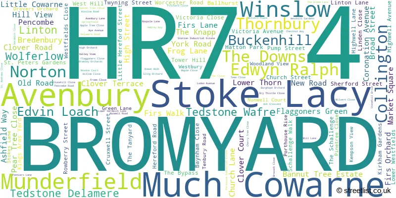
The largest settlement in the HR7 4 postal code is BROMYARD followed by Tedstone Wafre, and Stoke Lacy.
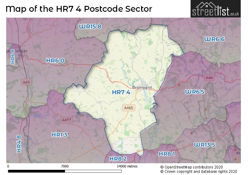
The HR7 4 Postcode shares a border with HR1 3 (Bodenham, Sutton St. Nicholas, Marden), HR6 0 (LEOMINSTER, Kimbolton, Stoke Prior), WR6 5 (Whitbourne, Bishops Frome, Suckley), WR6 6 (Martley, Clifton-on-Teme, Holt Heath), WR15 8 (TENBURY WELLS, Burford, Newnham Bridge), HR8 1 (LEDBURY, Bosbury, Wellington Heath) and HR8 2 (LEDBURY, Much Marcle, Putley).
The sector is within the post town of BROMYARD.
HR7 4 is a postcode sector within the HR7 postcode district which is within the HR Hereford postcode area.
The Royal Mail delivery office for the HR7 4 postal sector is the Bromyard Postal Delivery Office.
The area of the HR7 4 postcode sector is 47.99 square miles which is 124.29 square kilometres or 30,712.01 square acres.

Map of the HR7 4 Postcode Sector
Explore the HR7 4 postcode sector by using our free interactive map.
| H | R | 7 | - | 4 | X | X |
| H | R | 7 | Space | 4 | Letter | Letter |
Official List of Streets
BROMYARD (85 Streets)
Avenbury (1 Streets)
Pencombe (3 Streets)
Tedstone Delamere (1 Streets)
Winslow (2 Streets)
Flaggoners Green (1 Streets)
Tedstone Wafre (1 Streets)
Thornbury (1 Streets)
Bredenbury (2 Streets)
Stoke Lacy (3 Streets)
Unofficial Streets or Alternative Spellings
LEOMINSTER
WORCESTER ROADWeather Forecast for HR7 4
Press Button to Show Forecast for Bromyard
| Time Period | Icon | Description | Temperature | Rain Probability | Wind |
|---|---|---|---|---|---|
| 03:00 to 06:00 | Overcast | 6.0°C (feels like 5.0°C) | 7.00% | NW 4 mph | |
| 06:00 to 09:00 | Cloudy | 6.0°C (feels like 4.0°C) | 29.00% | N 4 mph | |
| 09:00 to 12:00 | Cloudy | 8.0°C (feels like 6.0°C) | 4.00% | NNE 7 mph | |
| 12:00 to 15:00 | Cloudy | 10.0°C (feels like 8.0°C) | 4.00% | N 9 mph | |
| 15:00 to 18:00 | Partly cloudy (day) | 11.0°C (feels like 9.0°C) | 1.00% | N 9 mph | |
| 18:00 to 21:00 | Partly cloudy (day) | 10.0°C (feels like 8.0°C) | 1.00% | N 7 mph | |
| 21:00 to 00:00 | Partly cloudy (night) | 5.0°C (feels like 3.0°C) | 1.00% | N 4 mph |
Press Button to Show Forecast for Bromyard
| Time Period | Icon | Description | Temperature | Rain Probability | Wind |
|---|---|---|---|---|---|
| 00:00 to 03:00 | Clear night | 3.0°C (feels like 1.0°C) | 1.00% | NW 4 mph | |
| 03:00 to 06:00 | Clear night | 2.0°C (feels like 0.0°C) | 1.00% | WNW 4 mph | |
| 06:00 to 09:00 | Cloudy | 4.0°C (feels like 1.0°C) | 5.00% | W 7 mph | |
| 09:00 to 12:00 | Cloudy | 8.0°C (feels like 6.0°C) | 6.00% | WNW 9 mph | |
| 12:00 to 15:00 | Overcast | 10.0°C (feels like 8.0°C) | 11.00% | NW 9 mph | |
| 15:00 to 18:00 | Overcast | 11.0°C (feels like 9.0°C) | 12.00% | NNW 9 mph | |
| 18:00 to 21:00 | Cloudy | 9.0°C (feels like 8.0°C) | 7.00% | NNW 7 mph | |
| 21:00 to 00:00 | Cloudy | 6.0°C (feels like 4.0°C) | 5.00% | NNW 4 mph |
Press Button to Show Forecast for Bromyard
| Time Period | Icon | Description | Temperature | Rain Probability | Wind |
|---|---|---|---|---|---|
| 00:00 to 03:00 | Cloudy | 5.0°C (feels like 3.0°C) | 8.00% | NNE 4 mph | |
| 03:00 to 06:00 | Cloudy | 4.0°C (feels like 2.0°C) | 9.00% | NE 4 mph | |
| 06:00 to 09:00 | Cloudy | 4.0°C (feels like 2.0°C) | 14.00% | ESE 7 mph | |
| 09:00 to 12:00 | Cloudy | 7.0°C (feels like 5.0°C) | 14.00% | ESE 9 mph | |
| 12:00 to 15:00 | Overcast | 9.0°C (feels like 7.0°C) | 17.00% | SE 9 mph | |
| 15:00 to 18:00 | Overcast | 10.0°C (feels like 8.0°C) | 21.00% | ESE 9 mph | |
| 18:00 to 21:00 | Cloudy | 8.0°C (feels like 6.0°C) | 19.00% | E 7 mph | |
| 21:00 to 00:00 | Light rain | 7.0°C (feels like 4.0°C) | 48.00% | E 7 mph |
Press Button to Show Forecast for Bromyard
| Time Period | Icon | Description | Temperature | Rain Probability | Wind |
|---|---|---|---|---|---|
| 00:00 to 03:00 | Overcast | 6.0°C (feels like 4.0°C) | 23.00% | E 7 mph | |
| 03:00 to 06:00 | Light rain | 5.0°C (feels like 3.0°C) | 49.00% | NE 7 mph | |
| 06:00 to 09:00 | Overcast | 6.0°C (feels like 3.0°C) | 20.00% | NE 7 mph | |
| 09:00 to 12:00 | Overcast | 8.0°C (feels like 5.0°C) | 21.00% | ENE 9 mph | |
| 12:00 to 15:00 | Light rain shower (day) | 10.0°C (feels like 8.0°C) | 39.00% | E 11 mph | |
| 15:00 to 18:00 | Light rain shower (day) | 11.0°C (feels like 9.0°C) | 51.00% | E 9 mph | |
| 18:00 to 21:00 | Light rain | 10.0°C (feels like 8.0°C) | 45.00% | ENE 9 mph | |
| 21:00 to 00:00 | Cloudy | 8.0°C (feels like 6.0°C) | 17.00% | ENE 9 mph |
Schools and Places of Education Within the HR7 4 Postcode Sector
Pencombe CofE Primary School
Voluntary aided school
Pencombe, Bromyard, Herefordshire, HR7 4SH
Head: Mrs Elizabeth Orton
Ofsted Rating: Good
Inspection: 2018-10-02 (2031 days ago)
Website: Visit Pencombe CofE Primary School Website
Phone: 01885400255
Number of Pupils: 61
Queen Elizabeth High School
Academy converter
Ashfields, Bromyard, Herefordshire, HR7 4QS
Head: Mr Martin Farmer
Ofsted Rating: Good
Inspection: 2023-01-11 (469 days ago)
Website: Visit Queen Elizabeth High School Website
Phone: 01885482230
Number of Pupils: 378
Rowden House School
Other independent special school
Rowden House, Bromyard, , HR7 4LS
Head: Mr Martin Carter
Ofsted Rating: Good
Inspection: 2022-06-30 (664 days ago)
Website: Visit Rowden House School Website
Phone: 01885488096
Number of Pupils: 20
House Prices in the HR7 4 Postcode Sector
| Type of Property | 2018 Average | 2018 Sales | 2017 Average | 2017 Sales | 2016 Average | 2016 Sales | 2015 Average | 2015 Sales |
|---|---|---|---|---|---|---|---|---|
| Detached | £322,203 | 37 | £305,937 | 51 | £275,451 | 62 | £307,083 | 47 |
| Semi-Detached | £206,800 | 25 | £190,532 | 30 | £192,677 | 28 | £187,659 | 22 |
| Terraced | £169,161 | 28 | £152,242 | 30 | £176,662 | 26 | £154,700 | 27 |
| Flats | £86,107 | 7 | £99,242 | 6 | £74,439 | 9 | £80,983 | 9 |
Important Postcodes HR7 4 in the Postcode Sector
HR7 4BZ is the postcode for Nunwell Surgery, 10 Pump Street
HR7 4EB is the postcode for County of Herefordshire District Council, Bromyard Leisure Centre, Cruxwell Street
HR7 4QN is the postcode for Bromyard Community Hospital, Hillside Road, and BROMYARD COMMUNITY HOSPITAL, HIGHWELL LANE
HR7 4QS is the postcode for MAIN BUILDING, Queen Elizabeth High School, MUSIC BLOCK, Queen Elizabeth High School, and NORTH BUILDING, Queen Elizabeth High School
HR7 4QU is the postcode for Hope Family Centre, Top Garage, Hereford Road, Panniers Lane
HR7 4SH is the postcode for Pencombe V A School, Pencombe
HR7 4TF is the postcode for Bredenbury Primary School, Bredenbury
HR7 4UY is the postcode for St. Peters Primary School, Cherry Tree Close
| The HR7 4 Sector is within these Local Authorities |
|
|---|---|
| The HR7 4 Sector is within these Counties |
|
| The HR7 4 Sector is within these Water Company Areas |
|