The IP10 postcode district is a postal district located in the IP Ipswich postcode area with a population of 3,416 residents according to the 2021 England and Wales Census.
The area of the IP10 postcode district is 19.13 square miles which is 49.56 square kilometres or 12,245.42 acres.
Currently, the IP10 district has about 191 postcode units spread across 1 geographic postcode sectors.
Given that each sector allows for 400 unique postcode combinations, the district has a capacity of 400 postcodes. With 191 postcodes already in use, this leaves 209 units available.
The largest settlement in the IP10 postal code is Nacton followed by Kirton, and Bucklesham.
The postcode area has a boundary with Harwich Harbour and The North Sea.
The IP10 Postcode shares a border with IP3 (IPSWICH, Purdis Farm), IP5 (Kesgrave, Martlesham Heath, Rushmere St. Andrew), IP12 (WOODBRIDGE, Melton, Rendlesham) and IP11 (FELIXSTOWE, Trimley St. Mary, Trimley St. Martin).
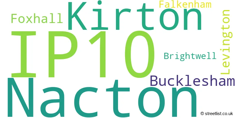
In the IP10 postcode district in Suffolk, there is a primary settlement called Kirton. Other significant settlements in the district include Nacton, Bucklesham, Foxhall, Levington, Brightwell, and Falkenham. The post town for this district is Ipswich, located in Suffolk.
For the district IP10, we have data on 1 postcode sectors. Here's a breakdown: The sector IP10 0, covers Nacton and Kirton and Bucklesham and Foxhall in Suffolk.
IP10 Postcode Sectors

Map of the IP10 Postcode District
Explore the IP10 postcode district by using our free interactive map.

When it comes to local government, postal geography often disregards political borders. However, for a breakdown in the IP10 District: the district mostly encompasses the East Suffolk District (186 postcodes), and finally, the Ipswich District (B) area (4 postcodes).
Recent House Sales in IP10
| Date | Price | Address |
|---|---|---|
| 04/10/2023 | £820,000 | Nacton, Ipswich, IP10 0ET |
| 29/09/2023 | £425,000 | The Street, Nacton, Ipswich, IP10 0HR |
| 08/09/2023 | £415,000 | Finneys Drift, Nacton, Ipswich, IP10 0HF |
| 01/09/2023 | £360,000 | Meadowlands, Kirton, Ipswich, IP10 0PP |
| 22/08/2023 | £340,000 | Mill Piece, Nacton, Ipswich, IP10 0HQ |
| 18/08/2023 | £562,500 | Elmham Drive, Nacton, Ipswich, IP10 0DG |
| 07/08/2023 | £625,000 | Amberfield Mews, Nacton, Ipswich, IP10 0FH |
| 21/07/2023 | £510,000 | Church Lane, Kirton, Ipswich, IP10 0PS |
| 11/07/2023 | £305,000 | Green Crescent, Bucklesham, Ipswich, IP10 0EA |
| 23/06/2023 | £120,000 | Durilda Green, Kirton, Ipswich, IP10 0NQ |
Weather Forecast for IP10
Press Button to Show Forecast for Levington
| Time Period | Icon | Description | Temperature | Rain Probability | Wind |
|---|---|---|---|---|---|
| 15:00 to 18:00 | Cloudy | 11.0°C (feels like 7.0°C) | 5.00% | N 20 mph | |
| 18:00 to 21:00 | Partly cloudy (day) | 7.0°C (feels like 4.0°C) | 4.00% | NNW 16 mph | |
| 21:00 to 00:00 | Partly cloudy (night) | 5.0°C (feels like 1.0°C) | 1.00% | NNW 13 mph |
Press Button to Show Forecast for Levington
| Time Period | Icon | Description | Temperature | Rain Probability | Wind |
|---|---|---|---|---|---|
| 00:00 to 03:00 | Cloudy | 5.0°C (feels like 1.0°C) | 4.00% | NNW 11 mph | |
| 03:00 to 06:00 | Cloudy | 4.0°C (feels like 0.0°C) | 4.00% | NNW 11 mph | |
| 06:00 to 09:00 | Cloudy | 5.0°C (feels like 1.0°C) | 4.00% | NNW 11 mph | |
| 09:00 to 12:00 | Cloudy | 8.0°C (feels like 4.0°C) | 8.00% | NNW 16 mph | |
| 12:00 to 15:00 | Cloudy | 10.0°C (feels like 6.0°C) | 4.00% | N 16 mph | |
| 15:00 to 18:00 | Cloudy | 9.0°C (feels like 6.0°C) | 7.00% | N 16 mph | |
| 18:00 to 21:00 | Cloudy | 7.0°C (feels like 4.0°C) | 4.00% | N 13 mph | |
| 21:00 to 00:00 | Cloudy | 5.0°C (feels like 2.0°C) | 4.00% | NNW 9 mph |
Press Button to Show Forecast for Levington
| Time Period | Icon | Description | Temperature | Rain Probability | Wind |
|---|---|---|---|---|---|
| 00:00 to 03:00 | Cloudy | 5.0°C (feels like 2.0°C) | 5.00% | NNW 9 mph | |
| 03:00 to 06:00 | Overcast | 4.0°C (feels like 1.0°C) | 8.00% | NNW 9 mph | |
| 06:00 to 09:00 | Overcast | 5.0°C (feels like 2.0°C) | 8.00% | NNW 9 mph | |
| 09:00 to 12:00 | Overcast | 8.0°C (feels like 5.0°C) | 9.00% | N 13 mph | |
| 12:00 to 15:00 | Overcast | 9.0°C (feels like 7.0°C) | 9.00% | NNE 13 mph | |
| 15:00 to 18:00 | Cloudy | 10.0°C (feels like 7.0°C) | 6.00% | NNE 13 mph | |
| 18:00 to 21:00 | Cloudy | 8.0°C (feels like 5.0°C) | 5.00% | NNE 11 mph | |
| 21:00 to 00:00 | Partly cloudy (night) | 6.0°C (feels like 3.0°C) | 2.00% | N 9 mph |
Press Button to Show Forecast for Levington
| Time Period | Icon | Description | Temperature | Rain Probability | Wind |
|---|---|---|---|---|---|
| 00:00 to 03:00 | Clear night | 5.0°C (feels like 2.0°C) | 1.00% | N 9 mph | |
| 03:00 to 06:00 | Clear night | 4.0°C (feels like 1.0°C) | 1.00% | N 9 mph | |
| 06:00 to 09:00 | Cloudy | 5.0°C (feels like 2.0°C) | 5.00% | N 9 mph | |
| 09:00 to 12:00 | Cloudy | 9.0°C (feels like 6.0°C) | 6.00% | NNE 9 mph | |
| 12:00 to 15:00 | Cloudy | 9.0°C (feels like 7.0°C) | 9.00% | NNE 9 mph | |
| 15:00 to 18:00 | Overcast | 9.0°C (feels like 7.0°C) | 13.00% | NE 9 mph | |
| 18:00 to 21:00 | Overcast | 8.0°C (feels like 6.0°C) | 15.00% | N 7 mph | |
| 21:00 to 00:00 | Cloudy | 6.0°C (feels like 4.0°C) | 11.00% | NE 7 mph |
Press Button to Show Forecast for Levington
| Time Period | Icon | Description | Temperature | Rain Probability | Wind |
|---|---|---|---|---|---|
| 00:00 to 03:00 | Cloudy | 5.0°C (feels like 3.0°C) | 10.00% | NW 7 mph | |
| 03:00 to 06:00 | Cloudy | 5.0°C (feels like 2.0°C) | 12.00% | NNW 7 mph | |
| 06:00 to 09:00 | Cloudy | 5.0°C (feels like 2.0°C) | 11.00% | NNW 7 mph | |
| 09:00 to 12:00 | Cloudy | 8.0°C (feels like 6.0°C) | 10.00% | NNE 7 mph | |
| 12:00 to 15:00 | Overcast | 10.0°C (feels like 7.0°C) | 11.00% | NNE 11 mph | |
| 15:00 to 18:00 | Overcast | 10.0°C (feels like 7.0°C) | 15.00% | NNE 9 mph | |
| 18:00 to 21:00 | Cloudy | 9.0°C (feels like 6.0°C) | 8.00% | NNE 11 mph | |
| 21:00 to 00:00 | Cloudy | 6.0°C (feels like 4.0°C) | 5.00% | N 9 mph |
Where is the IP10 Postcode District?
The postcode district IP10 is located in Ipswich, which is a town in the East of England. Ipswich is situated near several nearby towns, including Felixstowe to the South East (approx. 4.7 miles away), Woodbridge to the North (approx. 5.1 miles away), Harwich to the South (approx. 7.3 miles away), Manningtree to the South West (approx. 9.9 miles away), and Saxmundham to the North East (approx. 16.1 miles away). Furthermore, Ipswich is approximately 70 miles away from the centre of London.
The district is within the post town of IPSWICH.
The sector has postcodes within the nation of England.
The IP10 Postcode District is in the Suffolk region of East Anglia within the East of England.
Postcode Sectors within the IP10 District
| Postcode Sector | Delivery Office |
|---|---|
| IP10 0 | Ipswich Delivery Office |
| IP10 0 | Nacton Scale Payment Delivery Office |
| I | P | 1 | 0 | - | X | X | X |
| I | P | 1 | 0 | Space | Numeric | Letter | Letter |
Current Monthly Rental Prices
| # Bedrooms | Min Price | Max Price | Avg Price |
|---|---|---|---|
| 3 | £950 | £1,500 | £1,233 |
| 4 | £1,600 | £2,500 | £2,050 |
Current House Prices
| # Bedrooms | Min Price | Max Price | Avg Price |
|---|---|---|---|
| £30,000 | £30,000 | £30,000 | |
| 2 | £129,500 | £407,950 | £286,233 |
| 3 | £280,000 | £750,000 | £522,494 |
| 4 | £474,950 | £1,250,000 | £768,738 |
| 5 | £1,000,000 | £1,399,500 | £1,249,875 |
Estate Agents who Operate in the IP10 District
| Logo | Name | Brand Name | Address | Contact Number | Total Properties |
|---|---|---|---|---|---|
 | Cambridge New Homes | Carter Jonas | The Marque, 141 Hills Road, Cambridge, CB2 8RJ | 01223 972839 | 4 |
 | Felixstowe | ScottBeckett | 19 Hamilton Road, Felixstowe, IP11 7AX | 01394 331688 | 3 |
 | Ipswich | Jackson-Stops | 15 Tower Street, Ipswich, IP1 3BE | 01473 943579 | 3 |
 | Framlingham | Clarke & Simpson | Well Close Square, Framlingham, IP13 9DU | 01728 448659 | 3 |
 | Martlesham | Marks & Mann Estate Agents Ltd | 7 The Square, Martlesham Heath, IP5 3SL | 01473 943013 | 2 |
| Type of Property | 2018 Average | 2018 Sales | 2017 Average | 2017 Sales | 2016 Average | 2016 Sales | 2015 Average | 2015 Sales |
|---|---|---|---|---|---|---|---|---|
| Detached | £433,809 | 21 | £469,292 | 45 | £481,316 | 30 | £475,214 | 35 |
| Semi-Detached | £288,000 | 4 | £273,337 | 29 | £249,726 | 22 | £263,381 | 13 |
| Terraced | £0 | 0 | £241,000 | 1 | £232,500 | 2 | £335,622 | 9 |
| Flats | £0 | 0 | £0 | 0 | £308,750 | 4 | £396,667 | 3 |