This section of the site is all about the KA Postcode area, also known as the Kilmarnock Postal Area. Explore links to the next level to learn more about specific postcode districts such as KA1.
The KA postcode area represents a group of postal districts in the Kilmarnock area of the United Kingdom. The area code KA stands for the letters k and a in KilmArnock. KA has a population of 371,478 and covers an area of 3,302,663 hectares. Fun fact: 0.57% of the population of Great Britain lives in this area.
The postcode area falls within the following counties: Ayrshire and Arran (100.00%).
Post Towns and Postcode Districts for the KA Postcode
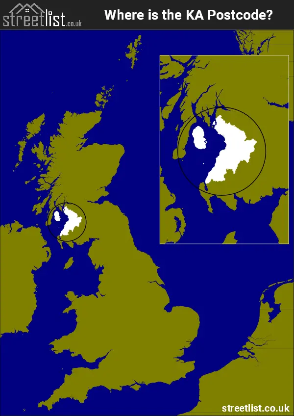
Where is the KA Postcode Area?
The KM Kilmarnock Postcode is in Scotland. The postal area borders the following neighbouring postal areas: PA - Paisley, ML - Motherwell, G - Glasgow and DG - Dumfries and Galloway, It also borders The Irish Sea,
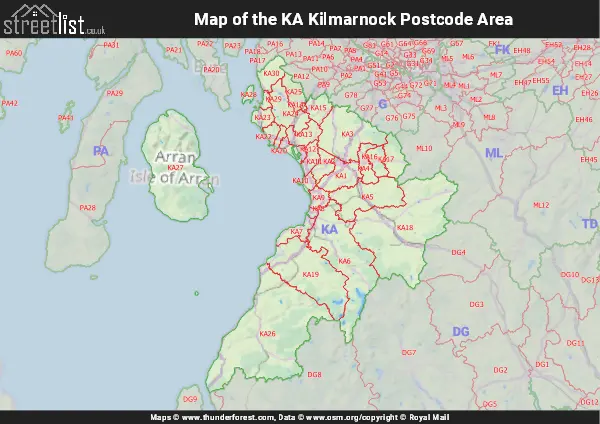
Map of the KA Kilmarnock Postcode Area
Explore the KA Kilmarnock postcode area by using our interactive map.
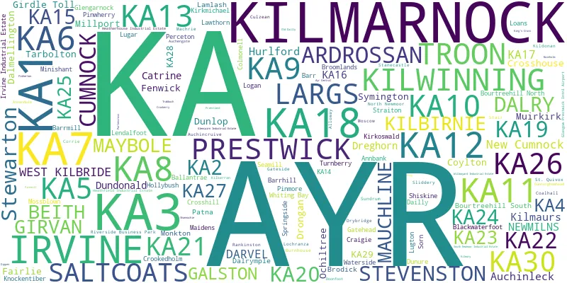
Postcode Districts within the KA Kilmarnock Postcode Area
There are 30 postcode districts within the Kilmarnock postcode area
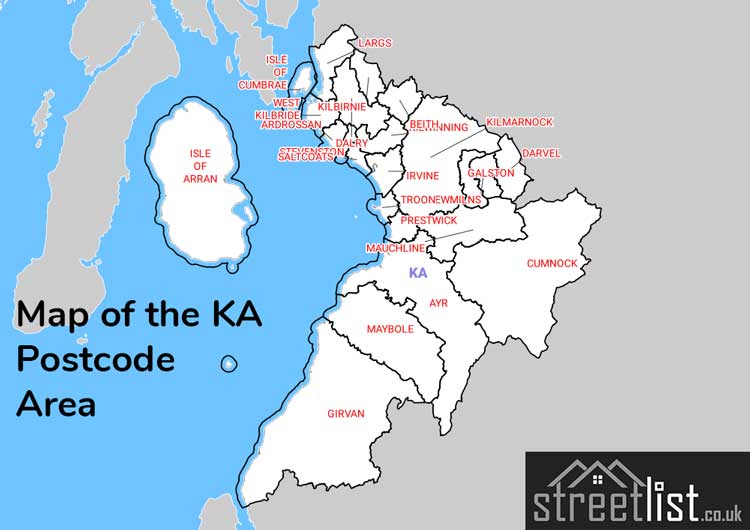
A map showing the boundary of in relation to other areas
There are 17 towns within the Kilmarnock postcode area.
| Unit | Area² |
|---|---|
| Hectares | 3,302,663² |
| Miles | 12,752² |
| Feet | 355,495,342,657² |
| Kilometres | 33,027² |
Postal Delivery Offices serving the KA Kilmarnock Postcode Area
- Ayr Delivery Office
- Beith Delivery Office
- Brodick Delivery Office
- Cumnock Delivery Office
- Dalmellington Scale Payment Delivery Office
- Dalry (ka) Delivery Office
- Girvan Delivery Office
- Irvine Delivery Office
- Kilmarnock Delivery Office
- Kilwinning Delivery Office
- Largs Delivery Office
- Maybole Delivery Office
- Prestwick Delivery Office
- Saltcoats Delivery Office
- Troon Delivery Office
Councils with Postcodes in KA
Towns and Villages within the KA Kilmarnock Postcode Area
- Annbank - village
- Ardrossan - town
- Auchinleck - village
- Ayr - town
- Ballantrae - village
- Bankglen - village
- Barr - village
- Barrhill - village
- Barrmill - village
- Beith - village
- Bellsbank - village
- Blackwaterfoot - village
- Brodick - village
- Burnton - village
- Catrine - village
- Colmonell - village
- Corrie - village
- Coylton - village
- Crosshill -
- Crosshouse - village
- Cumnock - town
- Dailly - village
- Dalmellington - village
- Dalry - village
- Dalrymple - village
- Darvel - town
- Dreghorn -
- Drongan - village
- Dundonald -
- Dunlop - village
- Dunure - village
- Fairlie - village
- Fenwick -
- Fisherton - village
- Galston - town
- Gateside - village
- Girvan - town
- Hillhead -
- Hollybush - village
- Hurlford and Crookedholm -
- Irvine - town
- Kilbirnie - village
- Kilmarnock - town
- Kilmaurs - village
- Kilmory - village
- Kilwinning - town
- Kirkmichael - village
- Kirkoswald - village
- Lamlash - village
- Largs - town
- Lendalfoot - village
- Loans - village
- Lochranza - village
- Logan - village
- Maidens - village
- Mauchline - village
- Maybole - town
- Millport - town
- Minishant - village
- Monkton -
- Moscow - village
- Mossblown - village
- Muirkirk - village
- New Cumnock - village
- Newmilns - town
- Ochiltree - village
- Patna - village
- Pinwherry - village
- Port-nah-Abhainne / Gatehead - village
- Prestwick -
- Rankinston - village
- Saltcoats - town
- Shiskine - village
- Sorn - village
- Springside - village
- Stevenston - town
- Stewarton - town
- Straiton - village
- Sundrum - village
- Symington (South Ayrshire) -
- Tarbolton - village
- Troon - town
- Turnberry - village
- Waterside - village
- Waterside - village
- West Kilbride - village
- Whiting Bay - village