The KY1 postcode district is a postal district located in the KY Kirkcaldy postcode area with a population of 25,235 residents according to the 2011 Scotland Census.
The area of the KY1 postcode district is 15.89 square miles which is 41.15 square kilometres or 10,168.14 acres.
Currently, the KY1 district has about 787 postcode units spread across 28 geographic postcode sectors.
Given that each sector allows for 400 unique postcode combinations, the district has a capacity of 11,200 postcodes. With 787 postcodes already in use, this leaves 10413 units available.
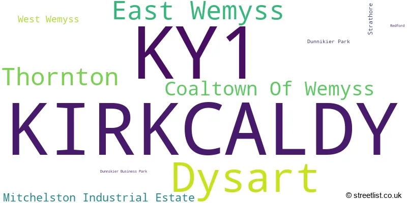
The largest settlement in the KY1 postal code is KIRKCALDY followed by Thornton, and Dysart.
The postcode area has a boundary with Firth of Forth.
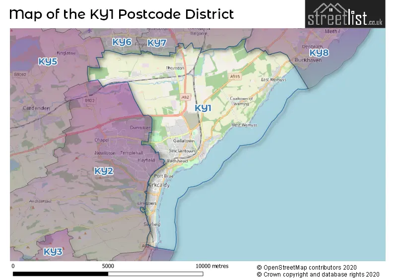
The KY1 Postcode shares a border with KY2 (KIRKCALDY, Auchtertool), KY5 (LOCHGELLY, Cardenden, Ballingry), KY6 (GLENROTHES, Leslie) and KY7 (GLENROTHES, Markinch, Coaltown).
The primary settlement in the KY1 postcode district is Kirkcaldy, located in the county of Fife in Scotland. Other significant settlements within this postcode district include Dysart, Coaltown of Wemyss, East Wemyss, Strathore, Thornton, and West Wemyss. The most significant post town in this district is Kirkcaldy.
For the district KY1, we have data on 4 postcode sectors. Here's a breakdown: The sector KY1 1, covers Kirkcaldy in Fife. The sector KY1 2, covers Kirkcaldy and Dysart in Fife. The sector KY1 3, covers Kirkcaldy and Mitchelston Industrial Estate in Fife. The sector KY1 4, covers East Wemyss and Thornton and Coaltown Of Wemyss in Fife.

Map of the KY1 Postcode District
Explore the KY1 postcode district by using our free interactive map.
When it comes to local government, postal geography often disregards political borders. However, for a breakdown in the KY1 District: the district mostly encompasses the Fife area with a total of 808 postcodes.
Weather Forecast for KY1
Press Button to Show Forecast for Kirkcaldy
| Time Period | Icon | Description | Temperature | Rain Probability | Wind |
|---|---|---|---|---|---|
| 06:00 to 09:00 | Sunny day | 4.0°C (feels like 1.0°C) | 1.00% | NW 7 mph | |
| 09:00 to 12:00 | Partly cloudy (day) | 7.0°C (feels like 5.0°C) | 5.00% | N 9 mph | |
| 12:00 to 15:00 | Light rain | 7.0°C (feels like 5.0°C) | 49.00% | ENE 7 mph | |
| 15:00 to 18:00 | Cloudy | 6.0°C (feels like 4.0°C) | 51.00% | E 7 mph | |
| 18:00 to 21:00 | Cloudy | 6.0°C (feels like 3.0°C) | 10.00% | ENE 9 mph | |
| 21:00 to 00:00 | Cloudy | 5.0°C (feels like 3.0°C) | 4.00% | NNE 4 mph |
Press Button to Show Forecast for Kirkcaldy
| Time Period | Icon | Description | Temperature | Rain Probability | Wind |
|---|---|---|---|---|---|
| 00:00 to 03:00 | Partly cloudy (night) | 3.0°C (feels like 2.0°C) | 1.00% | N 4 mph | |
| 03:00 to 06:00 | Partly cloudy (night) | 2.0°C (feels like 0.0°C) | 1.00% | NW 4 mph | |
| 06:00 to 09:00 | Partly cloudy (day) | 3.0°C (feels like 1.0°C) | 2.00% | NW 4 mph | |
| 09:00 to 12:00 | Cloudy | 6.0°C (feels like 5.0°C) | 5.00% | NNE 4 mph | |
| 12:00 to 15:00 | Cloudy | 8.0°C (feels like 6.0°C) | 10.00% | ESE 4 mph | |
| 15:00 to 18:00 | Cloudy | 8.0°C (feels like 7.0°C) | 10.00% | SE 4 mph | |
| 18:00 to 21:00 | Cloudy | 7.0°C (feels like 6.0°C) | 8.00% | E 4 mph | |
| 21:00 to 00:00 | Cloudy | 5.0°C (feels like 3.0°C) | 7.00% | E 4 mph |
Press Button to Show Forecast for Kirkcaldy
| Time Period | Icon | Description | Temperature | Rain Probability | Wind |
|---|---|---|---|---|---|
| 00:00 to 03:00 | Partly cloudy (night) | 4.0°C (feels like 2.0°C) | 2.00% | ENE 4 mph | |
| 03:00 to 06:00 | Cloudy | 2.0°C (feels like 0.0°C) | 6.00% | NE 2 mph | |
| 06:00 to 09:00 | Mist | 3.0°C (feels like 2.0°C) | 14.00% | NE 2 mph | |
| 09:00 to 12:00 | Partly cloudy (day) | 7.0°C (feels like 6.0°C) | 6.00% | SE 4 mph | |
| 12:00 to 15:00 | Cloudy | 9.0°C (feels like 8.0°C) | 13.00% | SE 7 mph | |
| 15:00 to 18:00 | Cloudy | 9.0°C (feels like 7.0°C) | 12.00% | SE 9 mph | |
| 18:00 to 21:00 | Sunny day | 8.0°C (feels like 6.0°C) | 7.00% | SE 7 mph | |
| 21:00 to 00:00 | Clear night | 5.0°C (feels like 3.0°C) | 6.00% | SE 7 mph |
Press Button to Show Forecast for Kirkcaldy
| Time Period | Icon | Description | Temperature | Rain Probability | Wind |
|---|---|---|---|---|---|
| 00:00 to 03:00 | Partly cloudy (night) | 4.0°C (feels like 2.0°C) | 7.00% | E 7 mph | |
| 03:00 to 06:00 | Cloudy | 4.0°C (feels like 1.0°C) | 11.00% | E 7 mph | |
| 06:00 to 09:00 | Cloudy | 4.0°C (feels like 2.0°C) | 13.00% | N 7 mph | |
| 09:00 to 12:00 | Partly cloudy (day) | 8.0°C (feels like 6.0°C) | 11.00% | NE 9 mph | |
| 12:00 to 15:00 | Cloudy | 10.0°C (feels like 8.0°C) | 15.00% | ENE 9 mph | |
| 15:00 to 18:00 | Cloudy | 10.0°C (feels like 9.0°C) | 17.00% | ESE 9 mph | |
| 18:00 to 21:00 | Cloudy | 9.0°C (feels like 8.0°C) | 12.00% | ESE 9 mph | |
| 21:00 to 00:00 | Partly cloudy (night) | 8.0°C (feels like 5.0°C) | 9.00% | N 9 mph |
Where is the KY1 Postcode District?
The postcode district KY1 is located in Kirkcaldy. Kirkcaldy is situated in the South West direction of Linlithgow, with a distance of approximately 3.24 miles. It is also located in the North direction of Glenrothes, around 3.83 miles away. In the North East direction, Edinburgh is approximately 5.31 miles from Kirkcaldy. Additionally, it is in the West direction of Lochgelly, around 6.99 miles away. Kirkcaldy is approximately 343.70 miles away from the center of London.
The district is within the post town of KIRKCALDY.
The sector has postcodes within the nation of Scotland.
The KY1 Postcode District is in the region of within the .
Postcode Sectors within the KY1 District
| Postcode Sector | Delivery Office |
|---|---|
| KY1 1 | Kirkcaldy Delivery Office |
| KY1 2 | Kirkcaldy Delivery Office |
| KY1 3 | Kirkcaldy Delivery Office |
| KY1 4 | Kirkcaldy Delivery Office |
| K | Y | 1 | - | X | X | X |
| K | Y | 1 | Space | Numeric | Letter | Letter |
Current Monthly Rental Prices
| # Bedrooms | Min Price | Max Price | Avg Price |
|---|---|---|---|
| 1 | £485 | £485 | £485 |
| 2 | £600 | £760 | £680 |
| 4 | £1,600 | £1,600 | £1,600 |
Current House Prices
| # Bedrooms | Min Price | Max Price | Avg Price |
|---|---|---|---|
| £110,000 | £300,000 | £190,000 | |
| 1 | £39,999 | £85,000 | £63,987 |
| 2 | £60,000 | £255,000 | £129,841 |
| 3 | £65,000 | £339,995 | £181,465 |
| 4 | £137,000 | £450,000 | £302,884 |
| 5 | £285,000 | £460,000 | £372,463 |
| 6 | £675,000 | £675,000 | £675,000 |
| 7 | £599,950 | £599,950 | £599,950 |
Estate Agents who Operate in the KY1 District
| Logo | Name | Brand Name | Address | Contact Number | Total Properties |
|---|---|---|---|---|---|
 | Kirkcaldy | Morton Napier | 1A Whytescauseway, Kirkcaldy, KY1 1XF | 01592 809971 | 20 |
 | Kirkcaldy | Delmor Estate & Lettings Agents | 17, Whytescauseway, Kirkcaldy, KY1 1XF | 01592 802081 | 19 |
 | Glenrothes | First for Homes | 32 North Street, Glenrothes, KY7 5NA | 01592 809929 | 9 |
 | Kirkcaldy | Fords Daly Legal | Office 1, Evans Business Centre, 1 Begg Road Kirkcaldy KY2 6HD | 01592 802095 | 8 |
 | Kirkcaldy | Slater Hogg & Howison | 27 Whytescauseway Whytescauseway Kirkcaldy KY1 1XF | 01592 802232 | 8 |