The KY12 postcode district is a postal district located in the KY Kirkcaldy postcode area with a population of 39,157 residents according to the 2011 Scotland Census.
The area of the KY12 postcode district is 55.08 square miles which is 142.65 square kilometres or 35,249.52 acres.
Currently, the KY12 district has about 1120 postcode units spread across 4 geographic postcode sectors.
Given that each sector allows for 400 unique postcode combinations, the district has a capacity of 1,600 postcodes. With 1120 postcodes already in use, this leaves 480 units available.
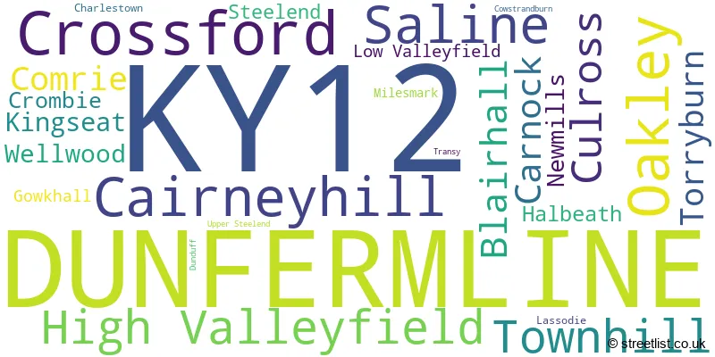
The largest settlement in the KY12 postal code is DUNFERMLINE followed by Cairneyhill, and Oakley.
The postcode area has a boundary with Firth of Forth.
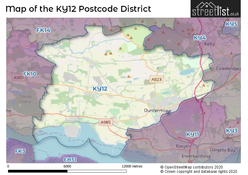
The KY12 Postcode shares a border with KY13 (KINROSS, Milnathort, Crook Of Devon), KY4 (COWDENBEATH, KELTY, Crossgates), KY11 (DUNFERMLINE, Rosyth, Dalgety Bay), FK14 (DOLLAR, Muckhart, Glendevon) and FK10 (ALLOA, Tullibody, Sauchie).
In the KY12 postcode district in Fife, the primary settlement is Dunfermline. Other significant settlements in the district include Halbeath, Kingseat, Lassodie, Townhill, and Wellwood. The county in which this district is located is Fife. The most significant post town in the district is Dunfermline.
For the district KY12, we have data on 5 postcode sectors. Here's a breakdown: The sector KY12 0, covers Dunfermline and Townhill in Fife. The sector KY12 2 is non-geographic. It's often designated for PO Boxes, large organisations, or special services. The sector KY12 7, covers Dunfermline in Fife. The sector KY12 8, covers Crossford and Dunfermline and Cairneyhill and High Valleyfield and Culross in Fife. The sector KY12 9, covers Dunfermline and Oakley and Saline in Fife.

Map of the KY12 Postcode District
Explore the KY12 postcode district by using our free interactive map.
When it comes to local government, postal geography often disregards political borders. However, for a breakdown in the KY12 District: the district mostly encompasses the Fife area with a total of 1128 postcodes.
Weather Forecast for KY12
Press Button to Show Forecast for Knockhill Motor Racing Circuit
| Time Period | Icon | Description | Temperature | Rain Probability | Wind |
|---|---|---|---|---|---|
| 15:00 to 18:00 | Overcast | 8.0°C (feels like 4.0°C) | 48.00% | W 18 mph | |
| 18:00 to 21:00 | Cloudy | 8.0°C (feels like 5.0°C) | 41.00% | W 16 mph | |
| 21:00 to 00:00 | Cloudy | 7.0°C (feels like 3.0°C) | 6.00% | WSW 13 mph |
Press Button to Show Forecast for Knockhill Motor Racing Circuit
| Time Period | Icon | Description | Temperature | Rain Probability | Wind |
|---|---|---|---|---|---|
| 00:00 to 03:00 | Overcast | 6.0°C (feels like 2.0°C) | 8.00% | WSW 13 mph | |
| 03:00 to 06:00 | Cloudy | 5.0°C (feels like 2.0°C) | 5.00% | W 9 mph | |
| 06:00 to 09:00 | Overcast | 5.0°C (feels like 2.0°C) | 8.00% | W 7 mph | |
| 09:00 to 12:00 | Cloudy | 6.0°C (feels like 3.0°C) | 8.00% | NNW 11 mph | |
| 12:00 to 15:00 | Cloudy | 8.0°C (feels like 5.0°C) | 6.00% | NNW 13 mph | |
| 15:00 to 18:00 | Overcast | 9.0°C (feels like 6.0°C) | 7.00% | NNW 13 mph | |
| 18:00 to 21:00 | Cloudy | 7.0°C (feels like 4.0°C) | 4.00% | N 11 mph | |
| 21:00 to 00:00 | Cloudy | 4.0°C (feels like 2.0°C) | 5.00% | N 7 mph |
Press Button to Show Forecast for Knockhill Motor Racing Circuit
| Time Period | Icon | Description | Temperature | Rain Probability | Wind |
|---|---|---|---|---|---|
| 00:00 to 03:00 | Partly cloudy (night) | 3.0°C (feels like 0.0°C) | 1.00% | NNW 4 mph | |
| 03:00 to 06:00 | Cloudy | 2.0°C (feels like 0.0°C) | 5.00% | NNW 4 mph | |
| 06:00 to 09:00 | Cloudy | 3.0°C (feels like 2.0°C) | 5.00% | W 2 mph | |
| 09:00 to 12:00 | Cloudy | 7.0°C (feels like 6.0°C) | 5.00% | WNW 2 mph | |
| 12:00 to 15:00 | Cloudy | 9.0°C (feels like 8.0°C) | 7.00% | NW 4 mph | |
| 15:00 to 18:00 | Overcast | 11.0°C (feels like 10.0°C) | 10.00% | WNW 4 mph | |
| 18:00 to 21:00 | Overcast | 10.0°C (feels like 9.0°C) | 10.00% | WSW 4 mph | |
| 21:00 to 00:00 | Cloudy | 7.0°C (feels like 5.0°C) | 5.00% | WNW 4 mph |
Press Button to Show Forecast for Knockhill Motor Racing Circuit
| Time Period | Icon | Description | Temperature | Rain Probability | Wind |
|---|---|---|---|---|---|
| 00:00 to 03:00 | Cloudy | 6.0°C (feels like 5.0°C) | 5.00% | NNE 2 mph | |
| 03:00 to 06:00 | Cloudy | 5.0°C (feels like 4.0°C) | 5.00% | N 2 mph | |
| 06:00 to 09:00 | Cloudy | 6.0°C (feels like 5.0°C) | 5.00% | NW 2 mph | |
| 09:00 to 12:00 | Cloudy | 10.0°C (feels like 9.0°C) | 4.00% | NNW 2 mph | |
| 12:00 to 15:00 | Overcast | 12.0°C (feels like 11.0°C) | 7.00% | E 4 mph | |
| 15:00 to 18:00 | Overcast | 12.0°C (feels like 11.0°C) | 10.00% | SSW 4 mph | |
| 18:00 to 21:00 | Overcast | 11.0°C (feels like 9.0°C) | 8.00% | ESE 4 mph | |
| 21:00 to 00:00 | Overcast | 7.0°C (feels like 6.0°C) | 7.00% | ENE 4 mph |
Press Button to Show Forecast for Knockhill Motor Racing Circuit
| Time Period | Icon | Description | Temperature | Rain Probability | Wind |
|---|---|---|---|---|---|
| 00:00 to 03:00 | Cloudy | 6.0°C (feels like 5.0°C) | 5.00% | NE 2 mph | |
| 03:00 to 06:00 | Overcast | 5.0°C (feels like 4.0°C) | 9.00% | NNE 2 mph | |
| 06:00 to 09:00 | Cloudy | 6.0°C (feels like 5.0°C) | 7.00% | NNE 2 mph | |
| 09:00 to 12:00 | Cloudy | 9.0°C (feels like 8.0°C) | 7.00% | NE 2 mph | |
| 12:00 to 15:00 | Cloudy | 11.0°C (feels like 10.0°C) | 9.00% | ENE 4 mph | |
| 15:00 to 18:00 | Overcast | 12.0°C (feels like 11.0°C) | 18.00% | ESE 4 mph | |
| 18:00 to 21:00 | Cloudy | 11.0°C (feels like 10.0°C) | 15.00% | E 4 mph | |
| 21:00 to 00:00 | Overcast | 8.0°C (feels like 7.0°C) | 10.00% | E 4 mph |
Where is the KY12 Postcode District?
The postcode district KY12 is located in the town of Dunfermline. It is situated in close proximity to several nearby towns, including Kelty to the North East (5.92 miles), Bo'ness to the South West (6.75 miles), Cowdenbeath to the East (7.11 miles), Grantown-on-Spey to the South (7.52 miles), Dollar to the North West (7.54 miles), and Alloa to the West (7.97 miles). Additionally, it is approximately 346.34 miles away from the centre of London.
The district is within the post town of DUNFERMLINE.
The sector has postcodes within the nation of Scotland.
The KY12 Postcode District is in the region of within the .
| Postcode Sector | Delivery Office |
|---|---|
| KY12 0 | Dunfermline Delivery Office |
| KY12 7 | Dunfermline Delivery Office |
| KY12 8 | Dunfermline Delivery Office |
| KY12 8 | Newmills Scale Payment Delivery Office |
| KY12 9 | Dunfermline Delivery Office |
| KY12 9 | Saline Scale Payment Delivery Office |
| K | Y | 1 | 2 | - | X | X | X |
| K | Y | 1 | 2 | Space | Numeric | Letter | Letter |
Current Monthly Rental Prices
| # Bedrooms | Min Price | Max Price | Avg Price |
|---|---|---|---|
| 11 | £12,000 | £12,000 | £12,000 |
Current House Prices
| # Bedrooms | Min Price | Max Price | Avg Price |
|---|---|---|---|
| £59,000 | £192,500 | £114,125 | |
| 1 | £65,000 | £155,000 | £90,083 |
| 2 | £84,000 | £315,000 | £168,321 |
| 3 | £98,000 | £500,000 | £239,971 |
| 4 | £249,950 | £1,000,000 | £372,386 |
| 5 | £178,000 | £550,000 | £365,414 |
| 6 | £820,000 | £820,000 | £820,000 |
Estate Agents who Operate in the KY12 District
| Logo | Name | Brand Name | Address | Contact Number | Total Properties |
|---|---|---|---|---|---|
 | Dunfermline | Morgans | 33 East Port, Dunfermline, KY12 7JE | 01383 663801 | 25 |
 | Dunfermline | YOUR MOVE | 11 New Row, Dunfermline, KY12 7EA | 020 3835 2544 | 16 |
 | Dunfermline | remax property marketing | 1 New Row, Dunfermline, Fife, KY12 7EA | 020 3872 2993 | 13 |
 | Dunfermline | Maloco Mowat Parker | 6/8 Bonnar Street, Dunfermline, KY12 7JR | 01383 663834 | 8 |
 | Dunfermline | Stevenson & Marshall | 41 East Port, Dunfermline, KY12 7LG | 01383 663847 | 4 |
Hotels within the Postcode Area
We found 16 hotels and guest houses within the KY12 postcode area
Best Western Plus Keavil House Hotel
Main Street, Dunfermline, Dunfermline, dunfermline, KY12 8NN.
View detailsForrester Park Resort
Forrester Park Resort, Pitdinnie Road, Cairneyhill, Dunfermline, dunfermline, KY12 8RF.
View detailsCarnegie Holiday Cottage
97 Grieve Street, Dunfermline, Dunfermline, dunfermline, KY12 8DW.
View detailsThe Guildhall and Linen Exchange
79-83 High Street, Dunfermline, dunfermline, KY12 7DR.
View details