The L31 0 postcode sector is within the county of Merseyside.
Did you know? According to the 2021 Census, the L31 0 postcode sector is home to a bustling 1,983 residents!
Given that each sector allows for 400 unique postcode combinations. Letters C, I, K, M, O and V are not allowed in the last two letters of a postcode. With 47 postcodes already in use, this leaves 353 units available.
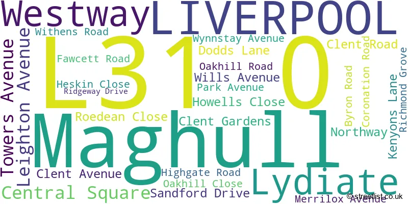
The largest settlement in the L31 0 postal code is LIVERPOOL followed by Maghull, and Lydiate.
The L31 0 Postcode shares a border with L31 2 (LIVERPOOL, Lydiate, Maghull), L31 6 (LIVERPOOL, Maghull) and L31 9 (LIVERPOOL, Maghull).
The sector is within the post town of LIVERPOOL.
L31 0 is a postcode sector within the L31 postcode district which is within the L Liverpool postcode area.
The Royal Mail delivery office for the L31 0 postal sector is the Maghull Delivery Office.
The area of the L31 0 postcode sector is 0.17 square miles which is 0.44 square kilometres or 109.96 square acres.

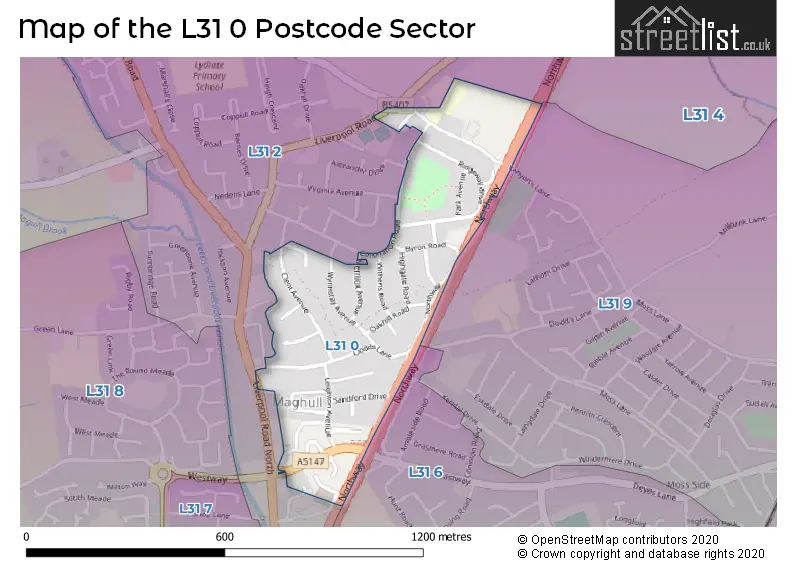
Map of the L31 0 Postcode Sector
Explore the L31 0 postcode sector by using our free interactive map.
| L | 3 | 1 | - | 0 | X | X |
| L | 3 | 1 | Space | 0 | Letter | Letter |
Official List of Streets
Lydiate (5 Streets)
LIVERPOOL (17 Streets)
Unofficial Streets or Alternative Spellings
Lydiate
LIVERPOOL ROADLIVERPOOL
GRANVILLE AVENUE LIVERPOOL ROAD NORTH STAFFORD MORETON WAY VIRGINIA AVENUE HALTON ROAD PEDESTRIAN SUBWAYAughton
NORTHWAYWeather Forecast for L31 0
Press Button to Show Forecast for Maghull
| Time Period | Icon | Description | Temperature | Rain Probability | Wind |
|---|---|---|---|---|---|
| 21:00 to 00:00 | Cloudy | 7.0°C (feels like 5.0°C) | 5.00% | ENE 7 mph |
Press Button to Show Forecast for Maghull
| Time Period | Icon | Description | Temperature | Rain Probability | Wind |
|---|---|---|---|---|---|
| 00:00 to 03:00 | Cloudy | 6.0°C (feels like 3.0°C) | 5.00% | E 7 mph | |
| 03:00 to 06:00 | Clear night | 4.0°C (feels like 2.0°C) | 2.00% | E 7 mph | |
| 06:00 to 09:00 | Partly cloudy (day) | 4.0°C (feels like 2.0°C) | 2.00% | E 4 mph | |
| 09:00 to 12:00 | Cloudy | 7.0°C (feels like 6.0°C) | 6.00% | E 4 mph | |
| 12:00 to 15:00 | Cloudy | 9.0°C (feels like 8.0°C) | 6.00% | N 4 mph | |
| 15:00 to 18:00 | Cloudy | 9.0°C (feels like 8.0°C) | 6.00% | N 7 mph | |
| 18:00 to 21:00 | Partly cloudy (day) | 9.0°C (feels like 7.0°C) | 3.00% | NNE 7 mph | |
| 21:00 to 00:00 | Cloudy | 7.0°C (feels like 5.0°C) | 7.00% | NE 9 mph |
Press Button to Show Forecast for Maghull
| Time Period | Icon | Description | Temperature | Rain Probability | Wind |
|---|---|---|---|---|---|
| 00:00 to 03:00 | Partly cloudy (night) | 5.0°C (feels like 3.0°C) | 4.00% | ESE 9 mph | |
| 03:00 to 06:00 | Partly cloudy (night) | 4.0°C (feels like 2.0°C) | 5.00% | ESE 7 mph | |
| 06:00 to 09:00 | Partly cloudy (day) | 5.0°C (feels like 2.0°C) | 4.00% | E 7 mph | |
| 09:00 to 12:00 | Cloudy | 8.0°C (feels like 6.0°C) | 8.00% | ESE 7 mph | |
| 12:00 to 15:00 | Overcast | 10.0°C (feels like 9.0°C) | 12.00% | E 7 mph | |
| 15:00 to 18:00 | Overcast | 10.0°C (feels like 9.0°C) | 18.00% | NE 7 mph | |
| 18:00 to 21:00 | Cloudy | 10.0°C (feels like 8.0°C) | 14.00% | ENE 9 mph | |
| 21:00 to 00:00 | Cloudy | 8.0°C (feels like 6.0°C) | 13.00% | ENE 9 mph |
Press Button to Show Forecast for Maghull
| Time Period | Icon | Description | Temperature | Rain Probability | Wind |
|---|---|---|---|---|---|
| 00:00 to 03:00 | Light rain | 6.0°C (feels like 4.0°C) | 45.00% | NE 9 mph | |
| 03:00 to 06:00 | Cloudy | 6.0°C (feels like 3.0°C) | 15.00% | NNE 11 mph | |
| 06:00 to 09:00 | Light rain | 7.0°C (feels like 4.0°C) | 48.00% | NNE 11 mph | |
| 09:00 to 12:00 | Cloudy | 8.0°C (feels like 5.0°C) | 20.00% | NNE 11 mph | |
| 12:00 to 15:00 | Light rain | 9.0°C (feels like 6.0°C) | 52.00% | N 11 mph | |
| 15:00 to 18:00 | Heavy rain | 10.0°C (feels like 7.0°C) | 70.00% | NNW 11 mph | |
| 18:00 to 21:00 | Partly cloudy (day) | 10.0°C (feels like 8.0°C) | 15.00% | WNW 11 mph | |
| 21:00 to 00:00 | Partly cloudy (night) | 9.0°C (feels like 7.0°C) | 9.00% | WNW 9 mph |
House Prices in the L31 0 Postcode Sector
| Type of Property | 2018 Average | 2018 Sales | 2017 Average | 2017 Sales | 2016 Average | 2016 Sales | 2015 Average | 2015 Sales |
|---|---|---|---|---|---|---|---|---|
| Detached | £0 | 0 | £226,500 | 2 | £0 | 0 | £200,000 | 1 |
| Semi-Detached | £194,764 | 28 | £197,602 | 25 | £186,435 | 24 | £168,873 | 22 |
| Terraced | £173,375 | 4 | £170,000 | 1 | £207,000 | 2 | £202,000 | 1 |
| Flats | £113,214 | 7 | £105,000 | 4 | £92,000 | 3 | £72,000 | 2 |
Important Postcodes L31 0 in the Postcode Sector
L31 0BP is the postcode for St. Thomas C of E Primary School, Kenyons Lane
L31 0DJ is the postcode for MAGHULL HEALTH CENTRE, WESTWAY, MAGHULL, and Maghull Health Centre, Westway
| The L31 0 Sector is within these Local Authorities |
|
|---|---|
| The L31 0 Sector is within these Counties |
|
| The L31 0 Sector is within these Water Company Areas |
|