The L33 6 postcode sector is within the county of Merseyside.
Did you know? According to the 2021 Census, the L33 6 postcode sector is home to a bustling 1,839 residents!
Given that each sector allows for 400 unique postcode combinations. Letters C, I, K, M, O and V are not allowed in the last two letters of a postcode. With 48 postcodes already in use, this leaves 352 units available.
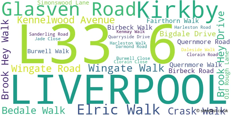
The largest settlements in the L33 6 postal code are LIVERPOOL and Kirkby.
The L33 6 Postcode shares a border with L33 7 (Knowsley Industrial Park, LIVERPOOL, Kirkby), L33 9 (LIVERPOOL, Kirkby), L33 8 (LIVERPOOL, Kirkby) and L33 5 (LIVERPOOL).
The sector is within the post town of LIVERPOOL.
L33 6 is a postcode sector within the L33 postcode district which is within the L Liverpool postcode area.
The Royal Mail delivery office for the L33 6 postal sector is the Kirkby Delivery Office.
The area of the L33 6 postcode sector is 0.13 square miles which is 0.35 square kilometres or 85.58 square acres.

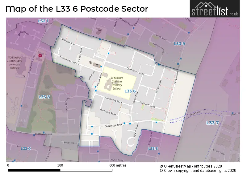
Map of the L33 6 Postcode Sector
Explore the L33 6 postcode sector by using our free interactive map.
| L | 3 | 3 | - | 6 | X | X |
| L | 3 | 3 | Space | 6 | Letter | Letter |
Official List of Streets
LIVERPOOL (28 Streets)
Kirkby (1 Streets)
Unofficial Streets or Alternative Spellings
Weather Forecast for L33 6
Press Button to Show Forecast for Kirkby
| Time Period | Icon | Description | Temperature | Rain Probability | Wind |
|---|---|---|---|---|---|
| 09:00 to 12:00 | Cloudy | 8.0°C (feels like 5.0°C) | 13.00% | NW 13 mph | |
| 12:00 to 15:00 | Cloudy | 9.0°C (feels like 7.0°C) | 7.00% | NNW 9 mph | |
| 15:00 to 18:00 | Light rain | 9.0°C (feels like 7.0°C) | 46.00% | N 7 mph | |
| 18:00 to 21:00 | Cloudy | 8.0°C (feels like 6.0°C) | 42.00% | NW 7 mph | |
| 21:00 to 00:00 | Cloudy | 7.0°C (feels like 5.0°C) | 5.00% | E 7 mph |
Press Button to Show Forecast for Kirkby
| Time Period | Icon | Description | Temperature | Rain Probability | Wind |
|---|---|---|---|---|---|
| 00:00 to 03:00 | Partly cloudy (night) | 6.0°C (feels like 3.0°C) | 2.00% | E 7 mph | |
| 03:00 to 06:00 | Clear night | 4.0°C (feels like 2.0°C) | 2.00% | E 7 mph | |
| 06:00 to 09:00 | Partly cloudy (day) | 4.0°C (feels like 2.0°C) | 2.00% | E 4 mph | |
| 09:00 to 12:00 | Cloudy | 7.0°C (feels like 5.0°C) | 6.00% | ESE 4 mph | |
| 12:00 to 15:00 | Cloudy | 9.0°C (feels like 8.0°C) | 6.00% | NNE 4 mph | |
| 15:00 to 18:00 | Cloudy | 9.0°C (feels like 8.0°C) | 6.00% | N 4 mph | |
| 18:00 to 21:00 | Partly cloudy (day) | 9.0°C (feels like 7.0°C) | 3.00% | NNE 7 mph | |
| 21:00 to 00:00 | Cloudy | 7.0°C (feels like 5.0°C) | 7.00% | NE 9 mph |
Press Button to Show Forecast for Kirkby
| Time Period | Icon | Description | Temperature | Rain Probability | Wind |
|---|---|---|---|---|---|
| 00:00 to 03:00 | Partly cloudy (night) | 5.0°C (feels like 3.0°C) | 4.00% | ESE 9 mph | |
| 03:00 to 06:00 | Partly cloudy (night) | 4.0°C (feels like 2.0°C) | 6.00% | ESE 7 mph | |
| 06:00 to 09:00 | Partly cloudy (day) | 5.0°C (feels like 2.0°C) | 4.00% | E 7 mph | |
| 09:00 to 12:00 | Cloudy | 8.0°C (feels like 6.0°C) | 8.00% | ESE 7 mph | |
| 12:00 to 15:00 | Overcast | 10.0°C (feels like 9.0°C) | 12.00% | E 7 mph | |
| 15:00 to 18:00 | Overcast | 10.0°C (feels like 9.0°C) | 18.00% | NE 7 mph | |
| 18:00 to 21:00 | Cloudy | 10.0°C (feels like 8.0°C) | 13.00% | ENE 9 mph | |
| 21:00 to 00:00 | Cloudy | 8.0°C (feels like 6.0°C) | 13.00% | NE 9 mph |
Press Button to Show Forecast for Kirkby
| Time Period | Icon | Description | Temperature | Rain Probability | Wind |
|---|---|---|---|---|---|
| 00:00 to 03:00 | Light rain | 6.0°C (feels like 4.0°C) | 45.00% | NE 9 mph | |
| 03:00 to 06:00 | Cloudy | 6.0°C (feels like 3.0°C) | 15.00% | NNE 11 mph | |
| 06:00 to 09:00 | Light rain | 7.0°C (feels like 4.0°C) | 49.00% | NNE 11 mph | |
| 09:00 to 12:00 | Cloudy | 8.0°C (feels like 5.0°C) | 20.00% | NNE 11 mph | |
| 12:00 to 15:00 | Light rain | 9.0°C (feels like 6.0°C) | 53.00% | N 11 mph | |
| 15:00 to 18:00 | Heavy rain | 10.0°C (feels like 7.0°C) | 70.00% | N 11 mph | |
| 18:00 to 21:00 | Partly cloudy (day) | 10.0°C (feels like 8.0°C) | 15.00% | NNW 11 mph | |
| 21:00 to 00:00 | Partly cloudy (night) | 9.0°C (feels like 7.0°C) | 9.00% | NW 9 mph |
Schools and Places of Education Within the L33 6 Postcode Sector
St Marie's Catholic Primary School
Voluntary aided school
Bigdale Drive, Liverpool, Merseyside, L33 6XL
Head: Mr M White
Ofsted Rating: Good
Inspection: 2021-06-10 (1050 days ago)
Website: Visit St Marie's Catholic Primary School Website
Phone: 01514778480
Number of Pupils: 228
House Prices in the L33 6 Postcode Sector
| Type of Property | 2018 Average | 2018 Sales | 2017 Average | 2017 Sales | 2016 Average | 2016 Sales | 2015 Average | 2015 Sales |
|---|---|---|---|---|---|---|---|---|
| Detached | £0 | 0 | £0 | 0 | £0 | 0 | £0 | 0 |
| Semi-Detached | £82,000 | 5 | £67,107 | 5 | £84,000 | 3 | £70,000 | 1 |
| Terraced | £61,897 | 12 | £58,300 | 10 | £62,421 | 7 | £63,650 | 10 |
| Flats | £58,000 | 1 | £0 | 0 | £65,000 | 1 | £59,464 | 14 |
Important Postcodes L33 6 in the Postcode Sector
L33 6XL is the postcode for St. Maries Primary School, Bigdale Drive, and SPORTS AND ARTS BUILDING, St. Maries Primary School, Bigdale Drive
| The L33 6 Sector is within these Local Authorities |
|
|---|---|
| The L33 6 Sector is within these Counties |
|
| The L33 6 Sector is within these Water Company Areas |
|