The L35 2 postcode sector is within the county of Merseyside.
Did you know? According to the 2021 Census, the L35 2 postcode sector is home to a bustling 2,569 residents!
Given that each sector allows for 400 unique postcode combinations. Letters C, I, K, M, O and V are not allowed in the last two letters of a postcode. With 55 postcodes already in use, this leaves 345 units available.
The L35 2 postal code covers the settlement of Whiston.
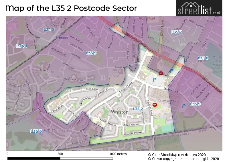
The L35 2 Postcode shares a border with L35 3 (Whiston, Halsnead Park), L35 5 (PRESCOT, Whiston), L35 7 (PRESCOT, Whiston, Eccleston Park), L35 8 (Rainhill) and L35 9 (Rainhill).
The sector is within the post town of PRESCOT.
L35 2 is a postcode sector within the L35 postcode district which is within the L Liverpool postcode area.
The Royal Mail delivery office for the L35 2 postal sector is the Prescot Delivery Office.
The area of the L35 2 postcode sector is 0.23 square miles which is 0.61 square kilometres or 150.05 square acres.

Map of the L35 2 Postcode Sector
Explore the L35 2 postcode sector by using our free interactive map.
| L | 3 | 5 | - | 2 | X | X |
| L | 3 | 5 | Space | 2 | Letter | Letter |
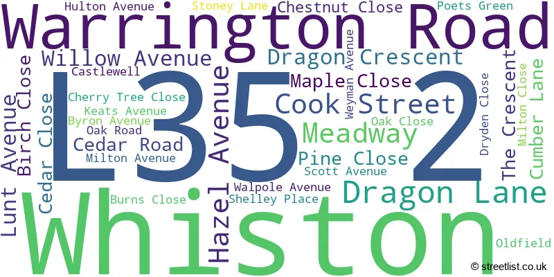
Official List of Streets
Whiston (34 Streets)
Unofficial Streets or Alternative Spellings
Rainhill
LONGVIEW ROAD STONEY LANEBold Heath
WARRINGTON ROADWhiston
BROOK STREET CABLE ROAD DRAGON DRIVE EDWARD ROAD WHITESTONE COURTPRESCOT
SHAW LANE SINCLAIR AVENUEWeather Forecast for L35 2
Press Button to Show Forecast for Whiston Cross
| Time Period | Icon | Description | Temperature | Rain Probability | Wind |
|---|---|---|---|---|---|
| 06:00 to 09:00 | Partly cloudy (day) | 6.0°C (feels like 4.0°C) | 0.00% | NNE 4 mph | |
| 09:00 to 12:00 | Sunny day | 7.0°C (feels like 6.0°C) | 0.00% | NNE 4 mph | |
| 12:00 to 15:00 | Partly cloudy (day) | 10.0°C (feels like 8.0°C) | 1.00% | N 7 mph | |
| 15:00 to 18:00 | Partly cloudy (day) | 11.0°C (feels like 8.0°C) | 1.00% | NW 9 mph | |
| 18:00 to 21:00 | Sunny day | 9.0°C (feels like 7.0°C) | 0.00% | NW 9 mph | |
| 21:00 to 00:00 | Clear night | 7.0°C (feels like 5.0°C) | 1.00% | NW 7 mph |
Press Button to Show Forecast for Whiston Cross
| Time Period | Icon | Description | Temperature | Rain Probability | Wind |
|---|---|---|---|---|---|
| 00:00 to 03:00 | Cloudy | 6.0°C (feels like 4.0°C) | 4.00% | WNW 7 mph | |
| 03:00 to 06:00 | Cloudy | 6.0°C (feels like 4.0°C) | 4.00% | WNW 9 mph | |
| 06:00 to 09:00 | Cloudy | 7.0°C (feels like 4.0°C) | 7.00% | WNW 9 mph | |
| 09:00 to 12:00 | Cloudy | 8.0°C (feels like 5.0°C) | 9.00% | NW 9 mph | |
| 12:00 to 15:00 | Cloudy | 10.0°C (feels like 7.0°C) | 10.00% | NW 11 mph | |
| 15:00 to 18:00 | Cloudy | 10.0°C (feels like 8.0°C) | 6.00% | NW 9 mph | |
| 18:00 to 21:00 | Cloudy | 9.0°C (feels like 8.0°C) | 6.00% | NNW 7 mph | |
| 21:00 to 00:00 | Cloudy | 7.0°C (feels like 6.0°C) | 6.00% | NNE 4 mph |
Press Button to Show Forecast for Whiston Cross
| Time Period | Icon | Description | Temperature | Rain Probability | Wind |
|---|---|---|---|---|---|
| 00:00 to 03:00 | Cloudy | 6.0°C (feels like 4.0°C) | 8.00% | E 7 mph | |
| 03:00 to 06:00 | Cloudy | 5.0°C (feels like 3.0°C) | 10.00% | ESE 7 mph | |
| 06:00 to 09:00 | Cloudy | 5.0°C (feels like 2.0°C) | 11.00% | ESE 7 mph | |
| 09:00 to 12:00 | Cloudy | 7.0°C (feels like 5.0°C) | 12.00% | ESE 7 mph | |
| 12:00 to 15:00 | Overcast | 9.0°C (feels like 7.0°C) | 16.00% | ESE 7 mph | |
| 15:00 to 18:00 | Cloudy | 10.0°C (feels like 8.0°C) | 16.00% | E 7 mph | |
| 18:00 to 21:00 | Cloudy | 9.0°C (feels like 8.0°C) | 11.00% | E 7 mph | |
| 21:00 to 00:00 | Cloudy | 7.0°C (feels like 5.0°C) | 12.00% | E 9 mph |
Press Button to Show Forecast for Whiston Cross
| Time Period | Icon | Description | Temperature | Rain Probability | Wind |
|---|---|---|---|---|---|
| 00:00 to 03:00 | Cloudy | 6.0°C (feels like 4.0°C) | 13.00% | E 7 mph | |
| 03:00 to 06:00 | Cloudy | 6.0°C (feels like 3.0°C) | 18.00% | E 7 mph | |
| 06:00 to 09:00 | Cloudy | 6.0°C (feels like 3.0°C) | 17.00% | ENE 7 mph | |
| 09:00 to 12:00 | Cloudy | 8.0°C (feels like 6.0°C) | 18.00% | E 9 mph | |
| 12:00 to 15:00 | Overcast | 11.0°C (feels like 8.0°C) | 20.00% | ENE 9 mph | |
| 15:00 to 18:00 | Cloudy | 11.0°C (feels like 9.0°C) | 43.00% | ENE 9 mph | |
| 18:00 to 21:00 | Cloudy | 10.0°C (feels like 8.0°C) | 14.00% | NE 9 mph | |
| 21:00 to 00:00 | Cloudy | 9.0°C (feels like 7.0°C) | 15.00% | NE 9 mph |
Schools and Places of Education Within the L35 2 Postcode Sector
Whiston Willis Primary Academy
Academy converter
Milton Avenue, Prescot, Merseyside, L35 2XY
Head: Mr IAN COOPER
Ofsted Rating: Good
Inspection: 2022-10-12 (560 days ago)
Website: Visit Whiston Willis Primary Academy Website
Phone: 01514778270
Number of Pupils: 346
House Prices in the L35 2 Postcode Sector
| Type of Property | 2018 Average | 2018 Sales | 2017 Average | 2017 Sales | 2016 Average | 2016 Sales | 2015 Average | 2015 Sales |
|---|---|---|---|---|---|---|---|---|
| Detached | £197,000 | 1 | £188,000 | 2 | £0 | 0 | £0 | 0 |
| Semi-Detached | £128,667 | 12 | £116,833 | 15 | £86,889 | 9 | £95,682 | 11 |
| Terraced | £105,643 | 7 | £97,722 | 9 | £81,750 | 4 | £79,125 | 8 |
| Flats | £0 | 0 | £0 | 0 | £0 | 0 | £70,000 | 1 |
Important Postcodes L35 2 in the Postcode Sector
L35 2XG is the postcode for ST EDMUND ARROWSMITH, St. Edmund Arrowsmith Catholic Centre for Learning, Cumber Lane, St. Edmund Arrowsmith Catholic Centre for Learning, Cumber Lane, ST EDMUND ARROWSMITH CATHOLIC CENTRE FOR LEARNING, CUMBER LANE, St Edmind Arrowsmith RC High, Science Hub, Cumber Lane, Higher Side Community Comprehensive School, Cumber Lane, and ST EDMUND ARROWSMITH CATHOLIC CENTRE FOR LEARNING, CUMBER LANE, WHISTON
L35 2XY is the postcode for Whiston Willis Junior School, Milton Avenue, Whiston, Whiston Willis Community Primary School, Milton Avenue, Whiston Willis Community Primary School, Milton Avenue, Whiston, and Whiston Willis Junior School, Milton Avenue
L35 2YW is the postcode for The Acorn Centre, Weyman Avenue
L35 2YZ is the postcode for North West Boroughs Healthcare NHS Foundation Trust, Willis House, 23 Cumber Lane
| The L35 2 Sector is within these Local Authorities |
|
|---|---|
| The L35 2 Sector is within these Counties |
|
| The L35 2 Sector is within these Water Company Areas |
|