The L35 9 postcode sector is within the county of Merseyside.
Did you know? According to the 2021 Census, the L35 9 postcode sector is home to a bustling 1,547 residents!
Given that each sector allows for 400 unique postcode combinations. Letters C, I, K, M, O and V are not allowed in the last two letters of a postcode. With 38 postcodes already in use, this leaves 362 units available.
The L35 9 postal code covers the settlement of Rainhill.
The L35 9 Postcode shares a border with L35 3 (Whiston, Halsnead Park), L35 0 (Rainhill), L35 2 (Whiston), L35 4 (Rainhill), L35 6 (Rainhill) and L35 8 (Rainhill).
The sector is within the post town of PRESCOT.
L35 9 is a postcode sector within the L35 postcode district which is within the L Liverpool postcode area.
The Royal Mail delivery office for the L35 9 postal sector is the Prescot Delivery Office.
The area of the L35 9 postcode sector is 0.26 square miles which is 0.68 square kilometres or 166.81 square acres.

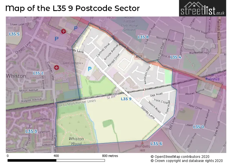
Map of the L35 9 Postcode Sector
Explore the L35 9 postcode sector by using our free interactive map.
| L | 3 | 5 | - | 9 | X | X |
| L | 3 | 5 | Space | 9 | Letter | Letter |
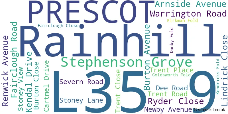
Official List of Streets
Rainhill (23 Streets)
PRESCOT (1 Streets)
Unofficial Streets or Alternative Spellings
Rainhill
CHATSWORTH ROAD HOLT LANE THE CRESCENTSBold Heath
WARRINGTON ROADWeather Forecast for L35 9
Press Button to Show Forecast for Whiston Cross
| Time Period | Icon | Description | Temperature | Rain Probability | Wind |
|---|---|---|---|---|---|
| 06:00 to 09:00 | Cloudy | 6.0°C (feels like 4.0°C) | 11.00% | NW 9 mph | |
| 09:00 to 12:00 | Cloudy | 7.0°C (feels like 4.0°C) | 8.00% | NNW 11 mph | |
| 12:00 to 15:00 | Light rain | 9.0°C (feels like 7.0°C) | 48.00% | N 9 mph | |
| 15:00 to 18:00 | Cloudy | 9.0°C (feels like 8.0°C) | 12.00% | NNW 7 mph | |
| 18:00 to 21:00 | Cloudy | 8.0°C (feels like 6.0°C) | 7.00% | NW 7 mph | |
| 21:00 to 00:00 | Cloudy | 6.0°C (feels like 5.0°C) | 13.00% | NE 4 mph |
Press Button to Show Forecast for Whiston Cross
| Time Period | Icon | Description | Temperature | Rain Probability | Wind |
|---|---|---|---|---|---|
| 00:00 to 03:00 | Partly cloudy (night) | 5.0°C (feels like 3.0°C) | 2.00% | E 7 mph | |
| 03:00 to 06:00 | Partly cloudy (night) | 3.0°C (feels like 1.0°C) | 1.00% | E 4 mph | |
| 06:00 to 09:00 | Sunny day | 3.0°C (feels like 1.0°C) | 1.00% | ENE 4 mph | |
| 09:00 to 12:00 | Cloudy | 7.0°C (feels like 5.0°C) | 4.00% | E 4 mph | |
| 12:00 to 15:00 | Cloudy | 9.0°C (feels like 8.0°C) | 9.00% | E 4 mph | |
| 15:00 to 18:00 | Cloudy | 10.0°C (feels like 9.0°C) | 9.00% | E 4 mph | |
| 18:00 to 21:00 | Cloudy | 9.0°C (feels like 8.0°C) | 7.00% | NE 4 mph | |
| 21:00 to 00:00 | Cloudy | 6.0°C (feels like 3.0°C) | 7.00% | NE 7 mph |
Press Button to Show Forecast for Whiston Cross
| Time Period | Icon | Description | Temperature | Rain Probability | Wind |
|---|---|---|---|---|---|
| 00:00 to 03:00 | Partly cloudy (night) | 4.0°C (feels like 2.0°C) | 6.00% | E 7 mph | |
| 03:00 to 06:00 | Partly cloudy (night) | 3.0°C (feels like 0.0°C) | 7.00% | E 4 mph | |
| 06:00 to 09:00 | Partly cloudy (day) | 4.0°C (feels like 1.0°C) | 6.00% | E 7 mph | |
| 09:00 to 12:00 | Cloudy | 8.0°C (feels like 6.0°C) | 8.00% | ESE 7 mph | |
| 12:00 to 15:00 | Overcast | 10.0°C (feels like 8.0°C) | 16.00% | E 7 mph | |
| 15:00 to 18:00 | Cloudy | 11.0°C (feels like 9.0°C) | 18.00% | ENE 9 mph | |
| 18:00 to 21:00 | Cloudy | 10.0°C (feels like 8.0°C) | 15.00% | ENE 9 mph | |
| 21:00 to 00:00 | Partly cloudy (night) | 7.0°C (feels like 5.0°C) | 14.00% | NE 9 mph |
Press Button to Show Forecast for Whiston Cross
| Time Period | Icon | Description | Temperature | Rain Probability | Wind |
|---|---|---|---|---|---|
| 00:00 to 03:00 | Cloudy | 6.0°C (feels like 3.0°C) | 16.00% | NE 7 mph | |
| 03:00 to 06:00 | Cloudy | 5.0°C (feels like 2.0°C) | 19.00% | NNE 9 mph | |
| 06:00 to 09:00 | Cloudy | 6.0°C (feels like 3.0°C) | 21.00% | N 9 mph | |
| 09:00 to 12:00 | Light rain | 8.0°C (feels like 5.0°C) | 52.00% | NNE 9 mph | |
| 12:00 to 15:00 | Light rain | 9.0°C (feels like 6.0°C) | 56.00% | N 11 mph | |
| 15:00 to 18:00 | Light rain | 10.0°C (feels like 7.0°C) | 53.00% | N 9 mph | |
| 18:00 to 21:00 | Cloudy | 10.0°C (feels like 8.0°C) | 18.00% | N 9 mph | |
| 21:00 to 00:00 | Clear night | 7.0°C (feels like 5.0°C) | 10.00% | NW 7 mph |
House Prices in the L35 9 Postcode Sector
| Type of Property | 2018 Average | 2018 Sales | 2017 Average | 2017 Sales | 2016 Average | 2016 Sales | 2015 Average | 2015 Sales |
|---|---|---|---|---|---|---|---|---|
| Detached | £262,059 | 2 | £302,833 | 3 | £244,676 | 25 | £251,274 | 19 |
| Semi-Detached | £147,813 | 15 | £135,083 | 12 | £187,675 | 26 | £179,139 | 18 |
| Terraced | £117,500 | 2 | £136,875 | 4 | £133,750 | 4 | £147,321 | 7 |
| Flats | £0 | 0 | £0 | 0 | £0 | 0 | £0 | 0 |
| The L35 9 Sector is within these Local Authorities |
|
|---|---|
| The L35 9 Sector is within these Counties |
|
| The L35 9 Sector is within these Water Company Areas |
|