The L39 6 postcode sector stands on the Lancashire and Merseyside border.
Did you know? According to the 2021 Census, the L39 6 postcode sector is home to a bustling 2,219 residents!
Given that each sector allows for 400 unique postcode combinations. Letters C, I, K, M, O and V are not allowed in the last two letters of a postcode. With 53 postcodes already in use, this leaves 347 units available.
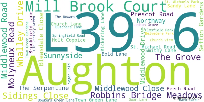
The L39 6 postal code covers the settlement of Aughton.
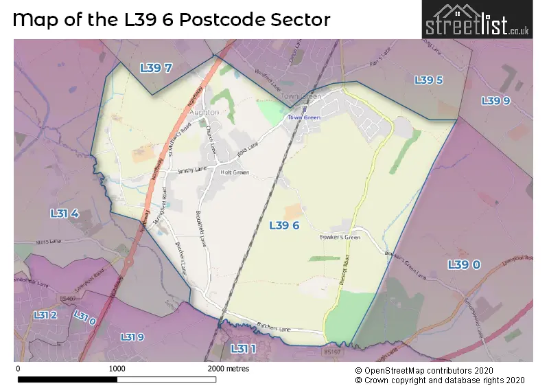
The L39 6 Postcode shares a border with L31 1 (Melling, Maghull, LIVERPOOL), L31 4 (LIVERPOOL, Lydiate, Maghull), L39 7 (Downholland, Aughton, Haskayne), L31 9 (LIVERPOOL, Maghull), L39 0 (Bickerstaffe), L39 3 (ORMSKIRK, Aughton) and L39 5 (Aughton).
The sector is within the post town of ORMSKIRK.
L39 6 is a postcode sector within the L39 postcode district which is within the L Liverpool postcode area.
The Royal Mail delivery office for the L39 6 postal sector is the Ormskirk Delivery Office.
The area of the L39 6 postcode sector is 2.67 square miles which is 6.92 square kilometres or 1,711.09 square acres.

Map of the L39 6 Postcode Sector
Explore the L39 6 postcode sector by using our free interactive map.
| L | 3 | 9 | - | 6 | X | X |
| L | 3 | 9 | Space | 6 | Letter | Letter |
Official List of Streets
Aughton (39 Streets)
Unofficial Streets or Alternative Spellings
Weather Forecast for L39 6
Press Button to Show Forecast for Maghull
| Time Period | Icon | Description | Temperature | Rain Probability | Wind |
|---|---|---|---|---|---|
| 21:00 to 00:00 | Overcast | 9.0°C (feels like 8.0°C) | 7.00% | NNW 7 mph |
Press Button to Show Forecast for Maghull
| Time Period | Icon | Description | Temperature | Rain Probability | Wind |
|---|---|---|---|---|---|
| 00:00 to 03:00 | Cloudy | 9.0°C (feels like 8.0°C) | 7.00% | NE 4 mph | |
| 03:00 to 06:00 | Cloudy | 7.0°C (feels like 6.0°C) | 3.00% | ENE 4 mph | |
| 06:00 to 09:00 | Sunny day | 6.0°C (feels like 4.0°C) | 0.00% | NNE 7 mph | |
| 09:00 to 12:00 | Sunny day | 7.0°C (feels like 6.0°C) | 0.00% | NNE 7 mph | |
| 12:00 to 15:00 | Partly cloudy (day) | 9.0°C (feels like 8.0°C) | 0.00% | NNW 7 mph | |
| 15:00 to 18:00 | Sunny day | 10.0°C (feels like 7.0°C) | 1.00% | NW 11 mph | |
| 18:00 to 21:00 | Sunny day | 9.0°C (feels like 6.0°C) | 1.00% | NW 9 mph | |
| 21:00 to 00:00 | Clear night | 7.0°C (feels like 5.0°C) | 1.00% | NW 7 mph |
Press Button to Show Forecast for Maghull
| Time Period | Icon | Description | Temperature | Rain Probability | Wind |
|---|---|---|---|---|---|
| 00:00 to 03:00 | Cloudy | 7.0°C (feels like 5.0°C) | 4.00% | WNW 9 mph | |
| 03:00 to 06:00 | Cloudy | 7.0°C (feels like 4.0°C) | 4.00% | WNW 11 mph | |
| 06:00 to 09:00 | Cloudy | 7.0°C (feels like 5.0°C) | 7.00% | NW 11 mph | |
| 09:00 to 12:00 | Partly cloudy (day) | 8.0°C (feels like 5.0°C) | 5.00% | NW 11 mph | |
| 12:00 to 15:00 | Partly cloudy (day) | 9.0°C (feels like 7.0°C) | 4.00% | NW 11 mph | |
| 15:00 to 18:00 | Cloudy | 10.0°C (feels like 7.0°C) | 5.00% | NW 11 mph | |
| 18:00 to 21:00 | Partly cloudy (day) | 9.0°C (feels like 7.0°C) | 2.00% | NW 9 mph | |
| 21:00 to 00:00 | Cloudy | 8.0°C (feels like 6.0°C) | 6.00% | NNE 7 mph |
Press Button to Show Forecast for Maghull
| Time Period | Icon | Description | Temperature | Rain Probability | Wind |
|---|---|---|---|---|---|
| 00:00 to 03:00 | Cloudy | 7.0°C (feels like 4.0°C) | 8.00% | ESE 7 mph | |
| 03:00 to 06:00 | Cloudy | 6.0°C (feels like 3.0°C) | 9.00% | ESE 7 mph | |
| 06:00 to 09:00 | Cloudy | 5.0°C (feels like 3.0°C) | 12.00% | ESE 9 mph | |
| 09:00 to 12:00 | Cloudy | 7.0°C (feels like 5.0°C) | 12.00% | E 9 mph | |
| 12:00 to 15:00 | Overcast | 9.0°C (feels like 7.0°C) | 15.00% | E 9 mph | |
| 15:00 to 18:00 | Overcast | 10.0°C (feels like 8.0°C) | 16.00% | E 7 mph | |
| 18:00 to 21:00 | Overcast | 10.0°C (feels like 8.0°C) | 16.00% | E 7 mph | |
| 21:00 to 00:00 | Overcast | 8.0°C (feels like 6.0°C) | 15.00% | ENE 9 mph |
Press Button to Show Forecast for Maghull
| Time Period | Icon | Description | Temperature | Rain Probability | Wind |
|---|---|---|---|---|---|
| 00:00 to 03:00 | Cloudy | 7.0°C (feels like 4.0°C) | 12.00% | ENE 9 mph | |
| 03:00 to 06:00 | Overcast | 6.0°C (feels like 4.0°C) | 18.00% | E 9 mph | |
| 06:00 to 09:00 | Cloudy | 6.0°C (feels like 4.0°C) | 18.00% | E 9 mph | |
| 09:00 to 12:00 | Cloudy | 8.0°C (feels like 6.0°C) | 15.00% | E 9 mph | |
| 12:00 to 15:00 | Overcast | 11.0°C (feels like 8.0°C) | 19.00% | E 11 mph | |
| 15:00 to 18:00 | Cloudy | 11.0°C (feels like 9.0°C) | 41.00% | ENE 11 mph | |
| 18:00 to 21:00 | Cloudy | 10.0°C (feels like 8.0°C) | 13.00% | NE 11 mph | |
| 21:00 to 00:00 | Cloudy | 9.0°C (feels like 7.0°C) | 14.00% | ENE 11 mph |
Schools and Places of Education Within the L39 6 Postcode Sector
Aughton Town Green Primary School
Community school
Town Green Lane, Ormskirk, Lancashire, L39 6SF
Head: Mr Nick Huxley
Ofsted Rating: Good
Inspection: 2019-03-06 (1875 days ago)
Website: Visit Aughton Town Green Primary School Website
Phone: 01695423688
Number of Pupils: 326
House Prices in the L39 6 Postcode Sector
| Type of Property | 2018 Average | 2018 Sales | 2017 Average | 2017 Sales | 2016 Average | 2016 Sales | 2015 Average | 2015 Sales |
|---|---|---|---|---|---|---|---|---|
| Detached | £437,737 | 19 | £437,500 | 15 | £462,500 | 11 | £406,944 | 18 |
| Semi-Detached | £198,125 | 8 | £238,804 | 13 | £228,250 | 12 | £258,931 | 8 |
| Terraced | £198,983 | 3 | £150,750 | 4 | £216,667 | 3 | £186,780 | 5 |
| Flats | £80,000 | 2 | £127,000 | 1 | £130,000 | 1 | £113,000 | 3 |
Important Postcodes L39 6 in the Postcode Sector
L39 6SF is the postcode for Aughton Town Green Primary School, Town Green Lane, Aughton, and Aughton Town Green Primary School, Town Green Lane
| The L39 6 Sector is within these Local Authorities |
|
|---|---|
| The L39 6 Sector is within these Counties |
|
| The L39 6 Sector is within these Water Company Areas |
|