The L7 3 postcode sector is within the county of Merseyside.
Did you know? According to the 2021 Census, the L7 3 postcode sector is home to a bustling 2,932 residents!
Given that each sector allows for 400 unique postcode combinations. Letters C, I, K, M, O and V are not allowed in the last two letters of a postcode. With 63 postcodes already in use, this leaves 337 units available.
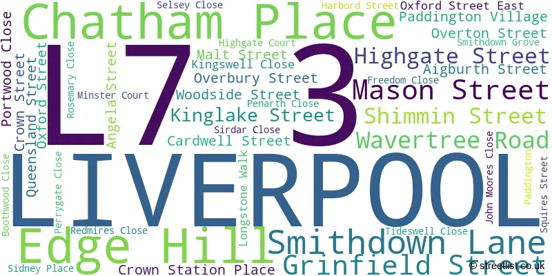
The largest settlements in the L7 3 postal code are LIVERPOOL and Edge Hill.
The L7 3 Postcode shares a border with L7 6 (LIVERPOOL), L7 1 (LIVERPOOL, Edge Hill), L8 7 (LIVERPOOL, Toxteth), L7 7 (LIVERPOOL, Edge Hill) and L7 8 (LIVERPOOL, Kensington, Edge Hill).
The sector is within the post town of LIVERPOOL.
L7 3 is a postcode sector within the L7 postcode district which is within the L Liverpool postcode area.
The Royal Mail delivery office for the L7 3 postal sector is the Liverpool 6-7.
The area of the L7 3 postcode sector is 0.20 square miles which is 0.51 square kilometres or 126.11 square acres.

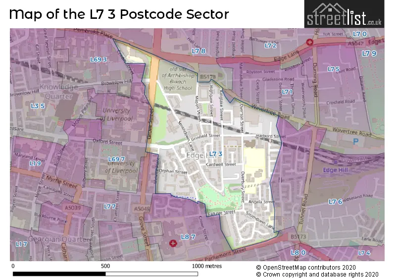
Map of the L7 3 Postcode Sector
Explore the L7 3 postcode sector by using our free interactive map.
| L | 7 | - | 3 | X | X |
| L | 7 | Space | 3 | Letter | Letter |
Official List of Streets
LIVERPOOL (39 Streets)
Edge Hill (1 Streets)
Unofficial Streets or Alternative Spellings
LIVERPOOL
BROWNLOW HILL CROWN STATION PLACE FALKNER STREET IRVINE STREET LOW HILL MARMADUKE STREET MYRTLE STREET TOWERLANDS STREET WEST DERBY STREET WINIFRED STREET ALBERT STREET BACK CHATHAM PLACE BRYDGES STREET ELM GROVE HELENA STREET HELSBY STREET MELVILLE PLACE MOUNT VERNON ROAD NELSON ROAD NEVISON STREET ORPHAN STREET SHENSTONE STREETEdge Hill
GROVE STREETWeather Forecast for L7 3
Press Button to Show Forecast for Edge Hill
| Time Period | Icon | Description | Temperature | Rain Probability | Wind |
|---|---|---|---|---|---|
| 06:00 to 09:00 | Cloudy | 7.0°C (feels like 4.0°C) | 8.00% | NW 11 mph | |
| 09:00 to 12:00 | Cloudy | 8.0°C (feels like 5.0°C) | 11.00% | NW 11 mph | |
| 12:00 to 15:00 | Cloudy | 9.0°C (feels like 7.0°C) | 7.00% | NW 11 mph | |
| 15:00 to 18:00 | Cloudy | 9.0°C (feels like 7.0°C) | 12.00% | NNW 9 mph | |
| 18:00 to 21:00 | Cloudy | 8.0°C (feels like 6.0°C) | 43.00% | NNE 7 mph | |
| 21:00 to 00:00 | Cloudy | 7.0°C (feels like 5.0°C) | 4.00% | ENE 7 mph |
Press Button to Show Forecast for Edge Hill
| Time Period | Icon | Description | Temperature | Rain Probability | Wind |
|---|---|---|---|---|---|
| 00:00 to 03:00 | Cloudy | 6.0°C (feels like 3.0°C) | 5.00% | E 7 mph | |
| 03:00 to 06:00 | Clear night | 4.0°C (feels like 2.0°C) | 2.00% | E 7 mph | |
| 06:00 to 09:00 | Sunny day | 4.0°C (feels like 1.0°C) | 1.00% | E 7 mph | |
| 09:00 to 12:00 | Partly cloudy (day) | 7.0°C (feels like 5.0°C) | 1.00% | E 4 mph | |
| 12:00 to 15:00 | Cloudy | 9.0°C (feels like 8.0°C) | 6.00% | NNE 4 mph | |
| 15:00 to 18:00 | Cloudy | 9.0°C (feels like 8.0°C) | 6.00% | N 4 mph | |
| 18:00 to 21:00 | Cloudy | 9.0°C (feels like 7.0°C) | 6.00% | NNE 7 mph | |
| 21:00 to 00:00 | Cloudy | 7.0°C (feels like 5.0°C) | 8.00% | NE 7 mph |
Press Button to Show Forecast for Edge Hill
| Time Period | Icon | Description | Temperature | Rain Probability | Wind |
|---|---|---|---|---|---|
| 00:00 to 03:00 | Partly cloudy (night) | 5.0°C (feels like 3.0°C) | 7.00% | ESE 7 mph | |
| 03:00 to 06:00 | Partly cloudy (night) | 4.0°C (feels like 2.0°C) | 7.00% | ESE 7 mph | |
| 06:00 to 09:00 | Partly cloudy (day) | 4.0°C (feels like 2.0°C) | 5.00% | E 7 mph | |
| 09:00 to 12:00 | Partly cloudy (day) | 8.0°C (feels like 6.0°C) | 5.00% | ESE 7 mph | |
| 12:00 to 15:00 | Overcast | 10.0°C (feels like 8.0°C) | 14.00% | E 7 mph | |
| 15:00 to 18:00 | Light rain | 10.0°C (feels like 9.0°C) | 46.00% | NE 7 mph | |
| 18:00 to 21:00 | Cloudy | 10.0°C (feels like 8.0°C) | 15.00% | ENE 9 mph | |
| 21:00 to 00:00 | Partly cloudy (night) | 8.0°C (feels like 6.0°C) | 13.00% | ENE 9 mph |
Press Button to Show Forecast for Edge Hill
| Time Period | Icon | Description | Temperature | Rain Probability | Wind |
|---|---|---|---|---|---|
| 00:00 to 03:00 | Cloudy | 6.0°C (feels like 4.0°C) | 17.00% | NE 9 mph | |
| 03:00 to 06:00 | Cloudy | 6.0°C (feels like 3.0°C) | 16.00% | NNE 9 mph | |
| 06:00 to 09:00 | Light rain | 6.0°C (feels like 3.0°C) | 48.00% | NNE 11 mph | |
| 09:00 to 12:00 | Light rain | 8.0°C (feels like 5.0°C) | 49.00% | NNE 11 mph | |
| 12:00 to 15:00 | Light rain | 9.0°C (feels like 6.0°C) | 54.00% | N 11 mph | |
| 15:00 to 18:00 | Heavy rain | 10.0°C (feels like 7.0°C) | 73.00% | N 11 mph | |
| 18:00 to 21:00 | Partly cloudy (day) | 10.0°C (feels like 7.0°C) | 13.00% | NW 11 mph | |
| 21:00 to 00:00 | Clear night | 9.0°C (feels like 7.0°C) | 11.00% | WNW 9 mph |
Schools and Places of Education Within the L7 3 Postcode Sector
St Anne's Catholic Primary School
Voluntary aided school
Overbury Street, Liverpool, Merseyside, L7 3HJ
Head: Mrs Gillian Murphy
Ofsted Rating: Good
Inspection: 2021-11-10 (897 days ago)
Website: Visit St Anne's Catholic Primary School Website
Phone: 01517091698
Number of Pupils: 259
House Prices in the L7 3 Postcode Sector
| Type of Property | 2018 Average | 2018 Sales | 2017 Average | 2017 Sales | 2016 Average | 2016 Sales | 2015 Average | 2015 Sales |
|---|---|---|---|---|---|---|---|---|
| Detached | £0 | 0 | £0 | 0 | £0 | 0 | £0 | 0 |
| Semi-Detached | £0 | 0 | £111,333 | 3 | £0 | 0 | £0 | 0 |
| Terraced | £90,000 | 1 | £104,975 | 2 | £102,478 | 2 | £97,750 | 4 |
| Flats | £117,043 | 27 | £75,016 | 45 | £82,635 | 44 | £79,553 | 16 |
Important Postcodes L7 3 in the Postcode Sector
L7 3EA is the postcode for Archbishop Blanch School, Mount Vernon Road
L7 3HJ is the postcode for St. Annes RC Primary School, Overbury Street, St. Annes RC Junior School, Overbury Street, and St. Annes RC Infant's School, Overbury Street
L7 3NY is the postcode for Materials Innovation Factory, University of Liverpool, 51 Oxford Street, and Materials Innovation Factory, University of Liverpool
L7 3PF is the postcode for D W P, Edgehill Office, Kinglake House, Shenstone Street
L7 3PR is the postcode for Merseyside Police, Traffic Division Headquarters, Smithdown Lane
L7 3RH is the postcode for Crown Street Day Centre, Crown Street
| The L7 3 Sector is within these Local Authorities |
|
|---|---|
| The L7 3 Sector is within these Counties |
|
| The L7 3 Sector is within these Water Company Areas |
|