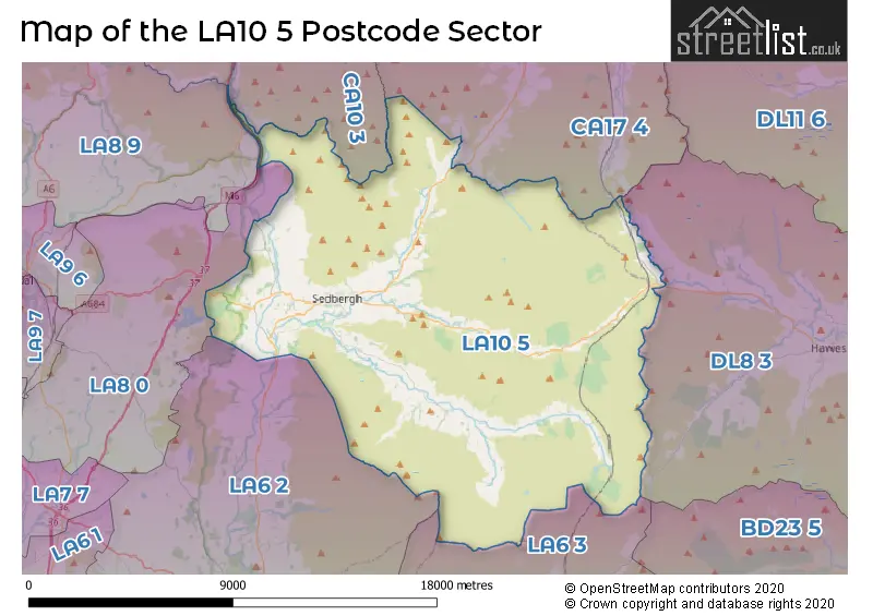
The LA10 5 postcode sector lies where the three counties of Cumbria, North Yorkshire, and Lancashire meet.
Did you know? According to the 2021 Census, the LA10 5 postcode sector is home to a bustling 3,825 residents!
Given that each sector allows for 400 unique postcode combinations. Letters C, I, K, M, O and V are not allowed in the last two letters of a postcode. With 221 postcodes already in use, this leaves 179 units available.
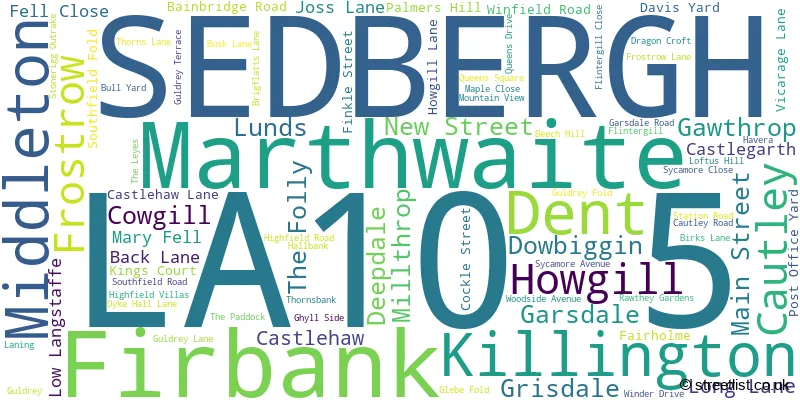
The largest settlement in the LA10 5 postal code is SEDBERGH followed by Dent, and Garsdale.
The LA10 5 Postcode shares a border with CA17 4 (KIRKBY STEPHEN, Brough, Ravenstonedale), CA10 3 (Shap, Tebay, Orton), DL8 3 (Askrigg, HAWES, Bainbridge), LA6 3 (Ingleton, Burton In Lonsdale, Chapel Le Dale), LA8 0 (Endmoor, Old Hutton, New Hutton), LA8 9 (Staveley, Selside, Burneside) and LA6 2 (Kirkby Lonsdale, Casterton, Whittington).
The sector is within the post town of SEDBERGH.
LA10 5 is a postcode sector within the LA10 postcode district which is within the LA Lancaster postcode area.
The Royal Mail delivery office for the LA10 5 postal sector is the Sedbergh Scale Payment Delivery Office.
The area of the LA10 5 postcode sector is 93.24 square miles which is 241.48 square kilometres or 59,671.52 square acres.
The LA10 5 postcode sector is crossed by the M6 motorway.
Waterways within the LA10 5 postcode sector include the River Dee, River Rawthey, River Lune, Barkin Beck, River Ure, Needlehouse Gill, Whin Stone Gill, Mouse Sike, Long Gill, Geaseat Beck, Grisedale Beck, Rawthey Gill, Thrush Gill, Rawthey, Taythes Gill, Calf Beck, Long Rigg Beck, Cowgill, Deepdale Beck.

Map of the LA10 5 Postcode Sector
Explore the LA10 5 postcode sector by using our free interactive map.
| L | A | 1 | 0 | - | 5 | X | X |
| L | A | 1 | 0 | Space | 5 | Letter | Letter |
Official List of Streets
SEDBERGH (49 Streets)
Dent (10 Streets)
Gawthrop (1 Streets)
Unofficial Streets or Alternative Spellings
SEDBERGH
THE PADDOCKWeather Forecast for LA10 5
Press Button to Show Forecast for Knoutberry Haw
| Time Period | Icon | Description | Temperature | Rain Probability | Wind |
|---|---|---|---|---|---|
| 06:00 to 09:00 | Light snow | 0.0°C (feels like -4.0°C) | 48.00% | NW 9 mph | |
| 09:00 to 12:00 | Cloudy | 1.0°C (feels like -3.0°C) | 4.00% | N 11 mph | |
| 12:00 to 15:00 | Cloudy | 3.0°C (feels like -1.0°C) | 5.00% | NNE 13 mph | |
| 15:00 to 18:00 | Sleet | 3.0°C (feels like -1.0°C) | 52.00% | NNE 11 mph | |
| 18:00 to 21:00 | Partly cloudy (day) | 2.0°C (feels like -2.0°C) | 3.00% | NE 11 mph | |
| 21:00 to 00:00 | Clear night | -1.0°C (feels like -5.0°C) | 1.00% | E 11 mph |
Press Button to Show Forecast for Knoutberry Haw
| Time Period | Icon | Description | Temperature | Rain Probability | Wind |
|---|---|---|---|---|---|
| 00:00 to 03:00 | Clear night | -2.0°C (feels like -6.0°C) | 0.00% | ENE 9 mph | |
| 03:00 to 06:00 | Clear night | -3.0°C (feels like -7.0°C) | 1.00% | NE 7 mph | |
| 06:00 to 09:00 | Partly cloudy (day) | -2.0°C (feels like -5.0°C) | 2.00% | NE 7 mph | |
| 09:00 to 12:00 | Cloudy | 1.0°C (feels like -2.0°C) | 6.00% | ENE 7 mph | |
| 12:00 to 15:00 | Cloudy | 3.0°C (feels like 0.0°C) | 11.00% | NE 7 mph | |
| 15:00 to 18:00 | Light rain shower (day) | 4.0°C (feels like 1.0°C) | 29.00% | ENE 4 mph | |
| 18:00 to 21:00 | Cloudy | 2.0°C (feels like -1.0°C) | 10.00% | E 7 mph | |
| 21:00 to 00:00 | Cloudy | 0.0°C (feels like -3.0°C) | 7.00% | ESE 7 mph |
Press Button to Show Forecast for Knoutberry Haw
| Time Period | Icon | Description | Temperature | Rain Probability | Wind |
|---|---|---|---|---|---|
| 00:00 to 03:00 | Clear night | -2.0°C (feels like -5.0°C) | 3.00% | E 7 mph | |
| 03:00 to 06:00 | Partly cloudy (night) | -3.0°C (feels like -6.0°C) | 4.00% | E 7 mph | |
| 06:00 to 09:00 | Partly cloudy (day) | -1.0°C (feels like -5.0°C) | 5.00% | E 7 mph | |
| 09:00 to 12:00 | Partly cloudy (day) | 3.0°C (feels like -1.0°C) | 6.00% | ESE 9 mph | |
| 12:00 to 15:00 | Cloudy | 5.0°C (feels like 2.0°C) | 11.00% | ESE 9 mph | |
| 15:00 to 18:00 | Overcast | 5.0°C (feels like 2.0°C) | 14.00% | ESE 9 mph | |
| 18:00 to 21:00 | Cloudy | 4.0°C (feels like 0.0°C) | 12.00% | E 11 mph | |
| 21:00 to 00:00 | Partly cloudy (night) | 1.0°C (feels like -3.0°C) | 10.00% | ENE 11 mph |
Press Button to Show Forecast for Knoutberry Haw
| Time Period | Icon | Description | Temperature | Rain Probability | Wind |
|---|---|---|---|---|---|
| 00:00 to 03:00 | Overcast | 0.0°C (feels like -5.0°C) | 17.00% | ENE 11 mph | |
| 03:00 to 06:00 | Overcast | 0.0°C (feels like -5.0°C) | 18.00% | NE 11 mph | |
| 06:00 to 09:00 | Overcast | 1.0°C (feels like -4.0°C) | 20.00% | NE 13 mph | |
| 09:00 to 12:00 | Overcast | 3.0°C (feels like -2.0°C) | 25.00% | NE 13 mph | |
| 12:00 to 15:00 | Overcast | 4.0°C (feels like 0.0°C) | 26.00% | NNE 11 mph | |
| 15:00 to 18:00 | Light rain | 4.0°C (feels like 1.0°C) | 56.00% | N 9 mph | |
| 18:00 to 21:00 | Light rain shower (day) | 5.0°C (feels like 2.0°C) | 38.00% | WSW 9 mph | |
| 21:00 to 00:00 | Partly cloudy (night) | 2.0°C (feels like -1.0°C) | 10.00% | NNW 9 mph |
Schools and Places of Education Within the LA10 5 Postcode Sector
Dent CofE Voluntary Aided Primary School
Voluntary aided school
Laning, Sedbergh, Cumbria, LA10 5QJ
Head: Mr David Prescott
Ofsted Rating: Good
Inspection: 2018-11-14 (1989 days ago)
Website: Visit Dent CofE Voluntary Aided Primary School Website
Phone: 01539625259
Number of Pupils: 41
Sedbergh Primary School
Community school
Long Lane, Sedbergh, Cumbria, LA10 5AL
Head: Mrs Victoria Hudson
Ofsted Rating: Good
Inspection: 2023-07-04 (296 days ago)
Website: Visit Sedbergh Primary School Website
Phone: 01539620510
Number of Pupils: 152
Settlebeck School
Academy converter
Long Lane, Sedbergh, Cumbria, LA10 5AL
Head: Mrs Sarah Campbell
Ofsted Rating: Requires improvement
Inspection: 2023-03-29 (393 days ago)
Website: Visit Settlebeck School Website
Phone: 01539620383
Number of Pupils: 211
House Prices in the LA10 5 Postcode Sector
| Type of Property | 2018 Average | 2018 Sales | 2017 Average | 2017 Sales | 2016 Average | 2016 Sales | 2015 Average | 2015 Sales |
|---|---|---|---|---|---|---|---|---|
| Detached | £345,906 | 18 | £373,704 | 27 | £380,722 | 23 | £355,382 | 17 |
| Semi-Detached | £276,068 | 22 | £211,896 | 25 | £238,944 | 18 | £208,762 | 21 |
| Terraced | £178,755 | 27 | £189,354 | 26 | £187,656 | 16 | £185,279 | 17 |
| Flats | £134,333 | 3 | £129,625 | 8 | £108,875 | 4 | £142,500 | 2 |
Important Postcodes LA10 5 in the Postcode Sector
LA10 5AL is the postcode for Sedbergh Primary School, Long Lane, and Settlebeck High School, Long Lane
LA10 5DL is the postcode for Sedbergh Health Centre, Station Road
LA10 5LQ is the postcode for Baliol School, and RESIDENTIAL BLOCK, Baliol School
| The LA10 5 Sector is within these Local Authorities |
|
|---|---|
| The LA10 5 Sector is within these Counties |
|
| The LA10 5 Sector is within these Water Company Areas |
|