This section of the site is all about the ML Postcode area, also known as the Motherwell Postal Area. Explore links to the next level to learn more about specific postcode districts such as ML1.
The ML postcode area represents a group of postal districts in the Motherwell area of the United Kingdom. The area code ML stands for the letters m and l in MotherwelL. ML has a population of 383,317 and covers an area of 2,218,647 hectares. Fun fact: 0.59% of the population of Great Britain lives in this area.
The postcode area falls within the following counties: Lanarkshire (99.31%), Tweeddale (0.28%), Dumfries (0.22%), West Lothian (0.19%).
Post Towns and Postcode Districts for the ML Postcode
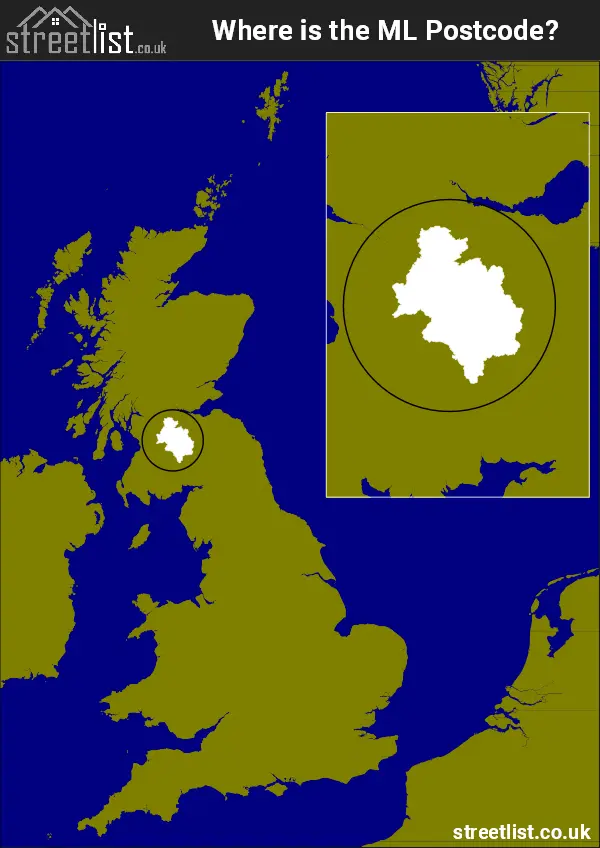
Where is the ML Postcode Area?
The ML Motherwell Postcode is in Scotland. The postal area borders the following neighbouring postal areas: TD - Teviotdale, KA - Kilmarnock, FK - Falkirk, EH - Edinburgh, G - Glasgow and DG - Dumfries and Galloway, and is located inland.
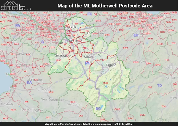
Map of the ML Motherwell Postcode Area
Explore the ML Motherwell postcode area by using our interactive map.
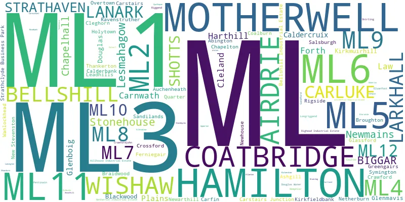
Postcode Districts within the ML Motherwell Postcode Area
There are 12 postcode districts within the Motherwell postcode area
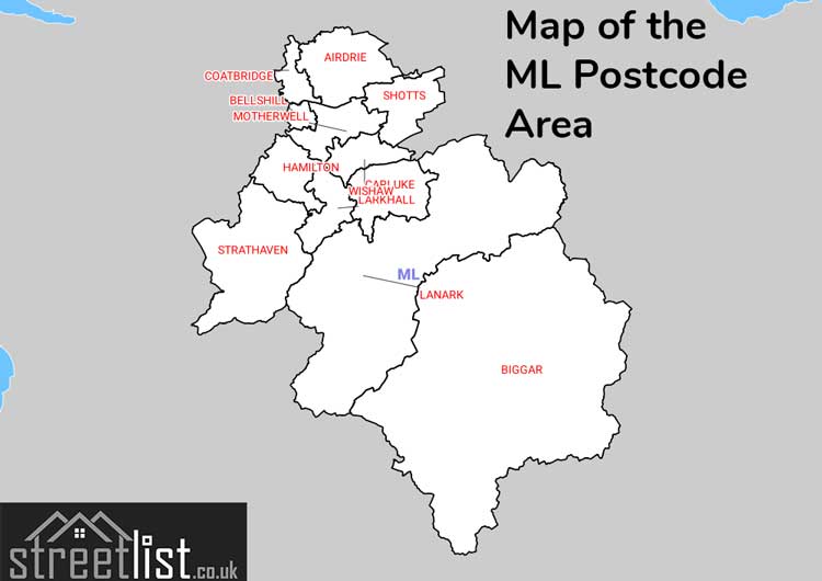
A map showing the boundary of in relation to other areas
There are 11 towns within the Motherwell postcode area.
| Unit | Area² |
|---|---|
| Hectares | 2,218,647² |
| Miles | 8,566² |
| Feet | 238,812,944,433² |
| Kilometres | 22,186² |
Postal Delivery Offices serving the ML Motherwell Postcode Area
- Airdrie Delivery Office
- Bellshill Delivery Office
- Biggar Delivery Office
- Coatbridge Delivery Office
- Hamilton Delivery Office
- Lanark Delivery Office
- Larkhall Delivery Office
- Motherwell Delivery Office
- Shotts Delivery Office
- Wishaw Delivery Office
Councils with Postcodes in ML
Towns and Villages within the ML Motherwell Postcode Area
- Abington - village
- Airdrie - town
- Allanton - village
- Annathill - village
- Ashgill - village
- Auchenheath - village
- Auchlochan - village
- Bargeddie - village
- Bellshill - town
- Biggar - town
- Blackridge - village
- Blantyre - Settlement
- Boghead - village
- Bothwell - Settlement
- Braehead - village
- Braidwood - village
- Broughton - village
- Calderbank - village
- Caldercruix - village
- Carfin -
- Carluke - town
- Carnwath - village
- Carstairs - village
- Carstairs Junction - village
- Chapelhall - village
- Chapelton -
- Cleghorn - village
- Cleland - village
- Coalburn - village
- Coatbridge - town
- Coulter - village
- Crawford - village
- Crawfordjohn - village
- Crossford (South Lanarkshire) -
- Cumbernauld - town
- Douglas - village
- Douglas Water - village
- Eastfield - village
- Elvanfoot - otherSettlement
- Forth - village
- Gartness - village
- Glassford - village
- Glenboig - village
- Glenmavis - village
- Gowkthrapple -
- Greengairs - village
- Hamilton - town
- Hareshaw - village
- Harthill -
- Hartwood - village
- Holytown - village
- Kilncadzow - village
- Kirkfieldbank - village
- Kirkmuirhill and Blackwood -
- Lanark - town
- Larkhall - town
- Law - village
- Leadhills - village
- Lesmahagow - village
- Morningside - village
- Motherwell - town
- Nemphlar - village
- Netherburn - village
- New Stevenston -
- Newarthill - village
- Newbigging - village
- Newmains - village
- Overtown - village
- Pettinain - village
- Plains - village
- Quarter - village
- Quothquan - village
- Ravenstruther - village
- Rigside - village
- Rosebank - village
- Salsburgh - village
- Sandford - village
- Shotts - village
- Skirling - village
- Stonehouse -
- Strathaven - village
- Symington (South Lanarkshire) -
- Thankerton - village
- Upperton - village
- Viewpark - urban area
- Wanlockhead - village
- Wattston - village
- West End - village
- Wildmanbridge - village
- Wilsontown - village
- Wishaw - town
- Wiston - village