The NE10 9 postcode sector is within the county of Tyne & Wear.
Did you know? According to the 2021 Census, the NE10 9 postcode sector is home to a bustling 9,091 residents!
Given that each sector allows for 400 unique postcode combinations. Letters C, I, K, M, O and V are not allowed in the last two letters of a postcode. With 217 postcodes already in use, this leaves 183 units available.
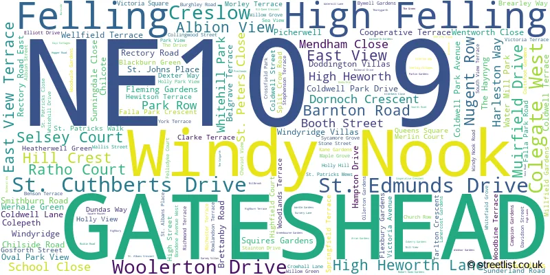
The largest settlement in the NE10 9 postal code is GATESHEAD followed by Felling, and Windy Nook.
The NE10 9 Postcode shares a border with NE8 3 (GATESHEAD), NE10 8 (GATESHEAD, Wardley), NE9 5 (GATESHEAD, Low Fell, Sheriff Hill), NE9 6 (GATESHEAD, Low Fell) and NE10 0 (GATESHEAD, Pelaw, Bill Quay).
The sector is within the post town of GATESHEAD.
NE10 9 is a postcode sector within the NE10 postcode district which is within the NE Newcastle upon Tyne postcode area.
The Royal Mail delivery office for the NE10 9 postal sector is the Gateshead Delivery Office.
The area of the NE10 9 postcode sector is 0.93 square miles which is 2.42 square kilometres or 597.89 square acres.

Map of the NE10 9 Postcode Sector
Explore the NE10 9 postcode sector by using our free interactive map.
| N | E | 1 | 0 | - | 9 | X | X |
| N | E | 1 | 0 | Space | 9 | Letter | Letter |
Official List of Streets
GATESHEAD (140 Streets)
Windy Nook (6 Streets)
Felling (15 Streets)
High Felling (2 Streets)
Unofficial Streets or Alternative Spellings
GATESHEAD
CARLISLE STREET CARR HILL ROAD ELL-DENE CRESCENT ESK STREET FELLING GATE GOWER WALK HEPBURN GARDENS HEWORTH BURN CRESCENT HODKIN GARDENS MEADOW RISE MULBERRY STREET SIR GODFREY THOMSON COURT STRATHMORE ROAD CHURCH STREET CROUDACE ROW HOLLYBUSH ROAD HOWARD STREET PROVIDENCE PLACE QUARRY ROW ROWLANDSON CRESCENT SAINT ALBANS PLACE SAINT CUTHBERTS DRIVE SAINT EDMUNDS DRIVE SAINT JOHNS PLACE THOMPSON PLACEFelling
WELLINGTON STREETWeather Forecast for NE10 9
Press Button to Show Forecast for Felling
| Time Period | Icon | Description | Temperature | Rain Probability | Wind |
|---|---|---|---|---|---|
| 12:00 to 15:00 | Overcast | 6.0°C (feels like 3.0°C) | 11.00% | N 11 mph | |
| 15:00 to 18:00 | Cloudy | 7.0°C (feels like 4.0°C) | 9.00% | NNE 11 mph | |
| 18:00 to 21:00 | Partly cloudy (day) | 6.0°C (feels like 3.0°C) | 0.00% | NNE 9 mph | |
| 21:00 to 00:00 | Cloudy | 5.0°C (feels like 3.0°C) | 12.00% | N 4 mph |
Press Button to Show Forecast for Felling
| Time Period | Icon | Description | Temperature | Rain Probability | Wind |
|---|---|---|---|---|---|
| 00:00 to 03:00 | Cloudy | 3.0°C (feels like 2.0°C) | 4.00% | NNW 4 mph | |
| 03:00 to 06:00 | Partly cloudy (night) | 3.0°C (feels like 1.0°C) | 2.00% | NW 4 mph | |
| 06:00 to 09:00 | Cloudy | 3.0°C (feels like 1.0°C) | 4.00% | NW 7 mph | |
| 09:00 to 12:00 | Cloudy | 6.0°C (feels like 4.0°C) | 49.00% | ENE 4 mph | |
| 12:00 to 15:00 | Cloudy | 7.0°C (feels like 5.0°C) | 9.00% | NE 4 mph | |
| 15:00 to 18:00 | Cloudy | 8.0°C (feels like 6.0°C) | 9.00% | E 7 mph | |
| 18:00 to 21:00 | Sunny day | 7.0°C (feels like 5.0°C) | 5.00% | E 7 mph | |
| 21:00 to 00:00 | Partly cloudy (night) | 4.0°C (feels like 2.0°C) | 2.00% | SE 4 mph |
Press Button to Show Forecast for Felling
| Time Period | Icon | Description | Temperature | Rain Probability | Wind |
|---|---|---|---|---|---|
| 00:00 to 03:00 | Partly cloudy (night) | 3.0°C (feels like 1.0°C) | 2.00% | S 4 mph | |
| 03:00 to 06:00 | Partly cloudy (night) | 1.0°C (feels like 0.0°C) | 4.00% | SSW 4 mph | |
| 06:00 to 09:00 | Partly cloudy (day) | 3.0°C (feels like 1.0°C) | 6.00% | SSE 4 mph | |
| 09:00 to 12:00 | Cloudy | 7.0°C (feels like 5.0°C) | 11.00% | ESE 7 mph | |
| 12:00 to 15:00 | Cloudy | 9.0°C (feels like 6.0°C) | 10.00% | ESE 9 mph | |
| 15:00 to 18:00 | Partly cloudy (day) | 9.0°C (feels like 6.0°C) | 8.00% | E 11 mph | |
| 18:00 to 21:00 | Partly cloudy (day) | 8.0°C (feels like 5.0°C) | 9.00% | E 9 mph | |
| 21:00 to 00:00 | Cloudy | 6.0°C (feels like 3.0°C) | 13.00% | E 7 mph |
Press Button to Show Forecast for Felling
| Time Period | Icon | Description | Temperature | Rain Probability | Wind |
|---|---|---|---|---|---|
| 00:00 to 03:00 | Cloudy | 5.0°C (feels like 3.0°C) | 14.00% | ENE 7 mph | |
| 03:00 to 06:00 | Cloudy | 5.0°C (feels like 2.0°C) | 19.00% | NE 9 mph | |
| 06:00 to 09:00 | Overcast | 7.0°C (feels like 3.0°C) | 22.00% | NE 11 mph | |
| 09:00 to 12:00 | Light rain | 7.0°C (feels like 4.0°C) | 51.00% | NE 13 mph | |
| 12:00 to 15:00 | Light rain | 8.0°C (feels like 5.0°C) | 54.00% | NNE 13 mph | |
| 15:00 to 18:00 | Light rain | 9.0°C (feels like 6.0°C) | 57.00% | NNE 11 mph | |
| 18:00 to 21:00 | Light rain shower (day) | 9.0°C (feels like 7.0°C) | 39.00% | N 7 mph | |
| 21:00 to 00:00 | Partly cloudy (night) | 6.0°C (feels like 4.0°C) | 10.00% | ESE 7 mph |
Schools and Places of Education Within the NE10 9 Postcode Sector
Ateres Girls High School
Other independent school
Willow Grove, Gateshead, , NE10 9PQ
Head: Rabbi Y M Katz
Ofsted Rating: Requires improvement
Inspection: 2022-07-14 (651 days ago)
Website: Visit Ateres Girls High School Website
Phone: 01914692969
Number of Pupils: 287
Colegate Community Primary School
Community school
Colegate West, Gateshead, Tyne and Wear, NE10 9AH
Head: Mrs H Gladstone
Ofsted Rating: Requires improvement
Inspection: 2022-03-17 (770 days ago)
Website: Visit Colegate Community Primary School Website
Phone: 01914206626
Number of Pupils: 152
Falla Park Community Primary School
Community school
Falla Park Road, Gateshead, Tyne and Wear, NE10 9HP
Head: Miss Vanessa Carr
Ofsted Rating: Good
Inspection: 2019-04-25 (1827 days ago)
Website: Visit Falla Park Community Primary School Website
Phone: 01914334011
Number of Pupils: 204
Furrowfield School
Community special school
Whitehill Drive, Gateshead, Tyne and Wear, NE10 9RZ
Head: Miss Heather Scott
Ofsted Rating: Good
Inspection: 2022-11-17 (525 days ago)
Website: Visit Furrowfield School Website
Phone: 01914954700
Number of Pupils: 71
Windy Nook Primary School
Community school
Albion Street, Gateshead, Tyne and Wear, NE10 9BD
Head: Mrs Lucie Forrest
Ofsted Rating: Good
Inspection: 2023-06-28 (302 days ago)
Website: Visit Windy Nook Primary School Website
Phone: 01914694954
Number of Pupils: 323

House Prices in the NE10 9 Postcode Sector
| Type of Property | 2018 Average | 2018 Sales | 2017 Average | 2017 Sales | 2016 Average | 2016 Sales | 2015 Average | 2015 Sales |
|---|---|---|---|---|---|---|---|---|
| Detached | £205,343 | 7 | £223,713 | 4 | £216,083 | 6 | £197,000 | 3 |
| Semi-Detached | £128,828 | 39 | £124,277 | 31 | £118,728 | 54 | £121,872 | 52 |
| Terraced | £105,016 | 32 | £101,137 | 27 | £107,528 | 32 | £106,345 | 28 |
| Flats | £60,879 | 17 | £57,841 | 11 | £66,874 | 17 | £69,927 | 22 |
Important Postcodes NE10 9 in the Postcode Sector
NE10 9AH is the postcode for Colegate Community Primary School, Colegate West, KEY STAGE 1, Colegate Community Primary School, Colegate West, and KEY STAGE 2, Colegate Community Primary School, Colegate West
NE10 9BD is the postcode for Windy Nook Primary School, Windy Nook
NE10 9DT is the postcode for Heworth Hall Centre, Smithburn Road
NE10 9HP is the postcode for Falla Park Community Primary School, Falla Park Road
NE10 9LT is the postcode for Felling Children's Centre, 58 High Street
NE10 9NJ is the postcode for Youth Offending Team, Sunderland Road
NE10 9PQ is the postcode for St. John the Baptist RC Primary School, Willow Grove
NE10 9QG is the postcode for Felling Health Centre, Stephenson Terrace
NE10 9RZ is the postcode for Furrowfield School, Whitehill Drive
NE10 9UZ is the postcode for BLOCK B, Thomas Hepburn Community Academy, Swards Road, and MAIN BLOCK, Thomas Hepburn Community Academy, Swards Road
| The NE10 9 Sector is within these Local Authorities |
|
|---|---|
| The NE10 9 Sector is within these Counties |
|
| The NE10 9 Sector is within these Water Company Areas |
|