The NE23 3 postcode sector is within the county of Northumberland.
Did you know? According to the 2021 Census, the NE23 3 postcode sector is home to a bustling 5,452 residents!
Given that each sector allows for 400 unique postcode combinations. Letters C, I, K, M, O and V are not allowed in the last two letters of a postcode. With 119 postcodes already in use, this leaves 281 units available.
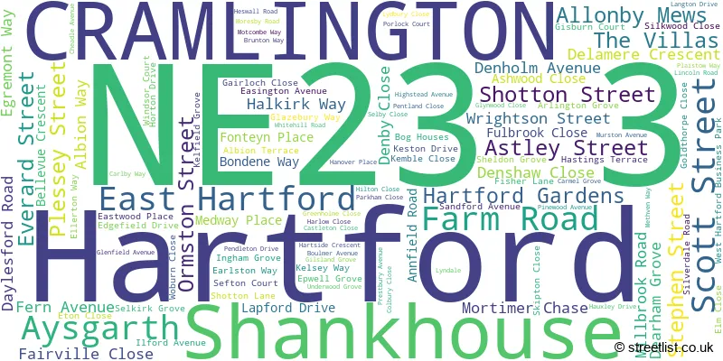
The largest settlement in the NE23 3 postal code is CRAMLINGTON followed by Hartford, and Shankhouse.
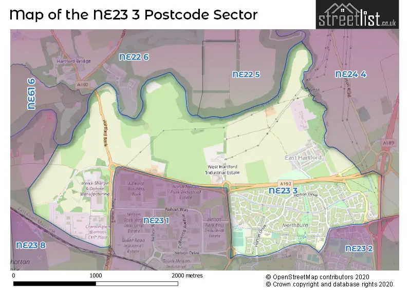
The NE23 3 Postcode shares a border with NE22 5 (BEDLINGTON), NE22 6 (BEDLINGTON, Fenwick Park, Nedderton Village), NE23 1 (CRAMLINGTON, St. Nicholas Manor, Nelson Village), NE23 2 (CRAMLINGTON), NE61 6 (Pegswood, Stannington, St. Mary Park) and NE24 4 (BLYTH, Long Grange, Blyth Riverside Business Park).
The sector is within the post town of CRAMLINGTON.
NE23 3 is a postcode sector within the NE23 postcode district which is within the NE Newcastle upon Tyne postcode area.
The Royal Mail delivery office for the NE23 3 postal sector is the Cramlington Delivery Office.
The area of the NE23 3 postcode sector is 2.09 square miles which is 5.40 square kilometres or 1,334.96 square acres.
Waterways within the NE23 3 postcode sector include the Blyth.

Map of the NE23 3 Postcode Sector
Explore the NE23 3 postcode sector by using our free interactive map.
| N | E | 2 | 3 | - | 3 | X | X |
| N | E | 2 | 3 | Space | 3 | Letter | Letter |
Official List of Streets
Shankhouse (4 Streets)
CRAMLINGTON (88 Streets)
Hartford (11 Streets)
East Hartford (2 Streets)
Unofficial Streets or Alternative Spellings
CRAMLINGTON
NELSON WAY NORTHUMBRIAN ROAD BROCKWELL ROUNDABOUT DURHAM ROAD FOOT BRIDGE HARTFORD BANKSeaton Burn
FISHER LANEWeather Forecast for NE23 3
Press Button to Show Forecast for Bedlington
| Time Period | Icon | Description | Temperature | Rain Probability | Wind |
|---|---|---|---|---|---|
| 00:00 to 03:00 | Partly cloudy (night) | 4.0°C (feels like 0.0°C) | 1.00% | NW 9 mph | |
| 03:00 to 06:00 | Cloudy | 3.0°C (feels like 0.0°C) | 4.00% | NW 9 mph | |
| 06:00 to 09:00 | Cloudy | 4.0°C (feels like 1.0°C) | 4.00% | NW 7 mph | |
| 09:00 to 12:00 | Overcast | 7.0°C (feels like 4.0°C) | 8.00% | N 11 mph | |
| 12:00 to 15:00 | Cloudy | 8.0°C (feels like 5.0°C) | 7.00% | NNE 9 mph | |
| 15:00 to 18:00 | Cloudy | 8.0°C (feels like 5.0°C) | 4.00% | NNE 9 mph | |
| 18:00 to 21:00 | Cloudy | 7.0°C (feels like 5.0°C) | 6.00% | NE 7 mph | |
| 21:00 to 00:00 | Overcast | 6.0°C (feels like 5.0°C) | 9.00% | NE 2 mph |
Press Button to Show Forecast for Bedlington
| Time Period | Icon | Description | Temperature | Rain Probability | Wind |
|---|---|---|---|---|---|
| 00:00 to 03:00 | Overcast | 6.0°C (feels like 5.0°C) | 10.00% | SE 2 mph | |
| 03:00 to 06:00 | Light rain | 5.0°C (feels like 4.0°C) | 50.00% | WNW 2 mph | |
| 06:00 to 09:00 | Light rain | 5.0°C (feels like 4.0°C) | 52.00% | ENE 4 mph | |
| 09:00 to 12:00 | Overcast | 6.0°C (feels like 5.0°C) | 49.00% | E 7 mph | |
| 12:00 to 15:00 | Light rain | 7.0°C (feels like 5.0°C) | 48.00% | E 7 mph | |
| 15:00 to 18:00 | Light rain | 7.0°C (feels like 5.0°C) | 45.00% | E 7 mph | |
| 18:00 to 21:00 | Cloudy | 6.0°C (feels like 5.0°C) | 17.00% | ESE 7 mph | |
| 21:00 to 00:00 | Overcast | 6.0°C (feels like 4.0°C) | 12.00% | ESE 4 mph |
Press Button to Show Forecast for Bedlington
| Time Period | Icon | Description | Temperature | Rain Probability | Wind |
|---|---|---|---|---|---|
| 00:00 to 03:00 | Overcast | 6.0°C (feels like 4.0°C) | 11.00% | S 4 mph | |
| 03:00 to 06:00 | Overcast | 6.0°C (feels like 4.0°C) | 14.00% | SSW 4 mph | |
| 06:00 to 09:00 | Light rain | 6.0°C (feels like 4.0°C) | 52.00% | SSW 4 mph | |
| 09:00 to 12:00 | Overcast | 8.0°C (feels like 7.0°C) | 14.00% | SW 4 mph | |
| 12:00 to 15:00 | Overcast | 9.0°C (feels like 7.0°C) | 16.00% | ENE 7 mph | |
| 15:00 to 18:00 | Cloudy | 9.0°C (feels like 8.0°C) | 17.00% | ENE 7 mph | |
| 18:00 to 21:00 | Cloudy | 9.0°C (feels like 7.0°C) | 15.00% | NE 7 mph | |
| 21:00 to 00:00 | Overcast | 8.0°C (feels like 6.0°C) | 11.00% | NNE 7 mph |
Press Button to Show Forecast for Bedlington
| Time Period | Icon | Description | Temperature | Rain Probability | Wind |
|---|---|---|---|---|---|
| 00:00 to 03:00 | Overcast | 7.0°C (feels like 5.0°C) | 11.00% | NNW 9 mph | |
| 03:00 to 06:00 | Overcast | 7.0°C (feels like 4.0°C) | 10.00% | NNW 11 mph | |
| 06:00 to 09:00 | Overcast | 7.0°C (feels like 3.0°C) | 19.00% | NNW 11 mph | |
| 09:00 to 12:00 | Overcast | 8.0°C (feels like 4.0°C) | 18.00% | N 13 mph | |
| 12:00 to 15:00 | Cloudy | 8.0°C (feels like 5.0°C) | 8.00% | N 13 mph | |
| 15:00 to 18:00 | Cloudy | 9.0°C (feels like 5.0°C) | 12.00% | NNE 13 mph | |
| 18:00 to 21:00 | Partly cloudy (day) | 8.0°C (feels like 5.0°C) | 2.00% | NNE 11 mph | |
| 21:00 to 00:00 | Clear night | 6.0°C (feels like 4.0°C) | 2.00% | N 9 mph |
Schools and Places of Education Within the NE23 3 Postcode Sector
Cramlington Northburn Primary School
Community school
Horton Drive, Cramlington, Northumberland, NE23 3QS
Head: Mrs Clare Scott
Ofsted Rating: Good
Inspection: 2022-10-05 (563 days ago)
Website: Visit Cramlington Northburn Primary School Website
Phone: 07970728774
Number of Pupils: 328
Eastlea Primary School
Community school
Skipton Close, Cramlington, Northumberland, NE23 3ST
Head: Miss Emma Beeston
Ofsted Rating: Good
Inspection: 2019-07-03 (1753 days ago)
Website: Visit Eastlea Primary School Website
Phone: 01670732261
Number of Pupils: 215
House Prices in the NE23 3 Postcode Sector
| Type of Property | 2018 Average | 2018 Sales | 2017 Average | 2017 Sales | 2016 Average | 2016 Sales | 2015 Average | 2015 Sales |
|---|---|---|---|---|---|---|---|---|
| Detached | £258,311 | 33 | £243,948 | 29 | £256,037 | 35 | £226,753 | 31 |
| Semi-Detached | £162,790 | 20 | £153,571 | 41 | £154,978 | 30 | £147,578 | 36 |
| Terraced | £117,992 | 6 | £102,954 | 12 | £86,875 | 8 | £108,029 | 7 |
| Flats | £60,000 | 1 | £216,213 | 4 | £0 | 0 | £93,990 | 5 |
Important Postcodes NE23 3 in the Postcode Sector
NE23 3JP is the postcode for Northumberland Fire & Rescue Service, Headquarters, West Hartford Business Park, and West Hartford Community Fire Station, West Hartford Business Park, West Hartford
NE23 3QS is the postcode for Northburn Primary School, Horton Drive, and NORTHBURN PRIMARY SCHOOL, HORTON DRIVE, CRAMLINGTON
NE23 3ST is the postcode for Eastlea Primary School, Skipton Close, Cramlington Eastlea First School, Durham Road, Burnside County First School, Durham Road, and Burnside First School, Durham Road
NE23 3YP is the postcode for Northburn Sports & Community Centre
| The NE23 3 Sector is within these Local Authorities |
|
|---|---|
| The NE23 3 Sector is within these Counties |
|
| The NE23 3 Sector is within these Water Company Areas |
|