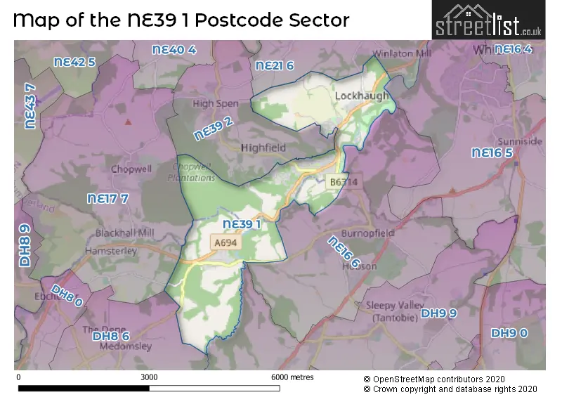
The NE39 1 postcode sector stands on the Durham and Tyne & Wear border.
Did you know? According to the 2021 Census, the NE39 1 postcode sector is home to a bustling 3,811 residents!
Given that each sector allows for 400 unique postcode combinations. Letters C, I, K, M, O and V are not allowed in the last two letters of a postcode. With 156 postcodes already in use, this leaves 244 units available.
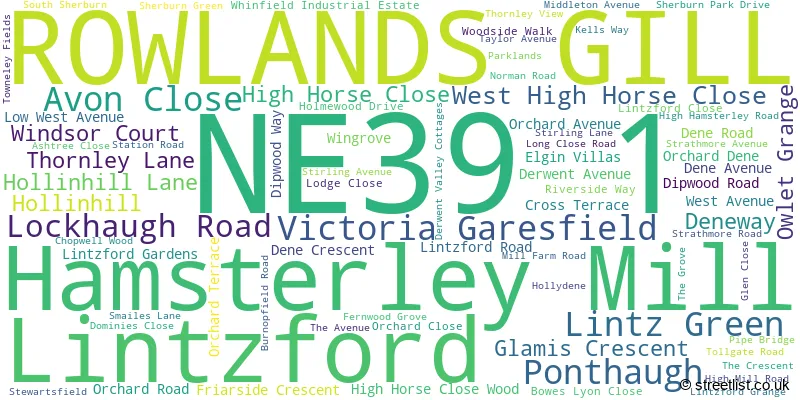
The largest settlement in the NE39 1 postal code is ROWLANDS GILL followed by Hamsterley Mill, and Lintzford.
The NE39 1 Postcode shares a border with NE21 6 (BLAYDON-ON-TYNE, Winlaton Mill, Winlaton), NE39 2 (ROWLANDS GILL, High Spen, Highfield), DH8 6 (CONSETT, Medomsley, Villa Real), DH9 9 (Dipton, Tanfield Lea, Tantobie), NE16 5 (Whickham, Sunniside, Marley Hill), NE16 6 (Burnopfield, Hobson) and NE17 7 (Chopwell, Hamsterley Colliery, Blackhall Mill).
The sector is within the post town of ROWLANDS GILL.
NE39 1 is a postcode sector within the NE39 postcode district which is within the NE Newcastle upon Tyne postcode area.
The Royal Mail delivery office for the NE39 1 postal sector is the Blaydon-on-tyne Delivery Office.
The area of the NE39 1 postcode sector is 4.93 square miles which is 12.78 square kilometres or 3,156.88 square acres.
Waterways within the NE39 1 postcode sector include the River Derwent.

Map of the NE39 1 Postcode Sector
Explore the NE39 1 postcode sector by using our free interactive map.
| N | E | 3 | 9 | - | 1 | X | X |
| N | E | 3 | 9 | Space | 1 | Letter | Letter |
Official List of Streets
ROWLANDS GILL (65 Streets)
Hamsterley Mill (10 Streets)
Lintzford (1 Streets)
Unofficial Streets or Alternative Spellings
ROWLANDS GILL
BURNSIDE ROAD HIGHFIELD ROADBLAYDON-ON-TYNE
BARLOW FELL ROADBurnopfield
BUSTY BANK LINTZ LANEHighfield
SMAILES LANEHigh Spen
ASHTREE LANEMedomsley
LONGCLOSE BANKWeather Forecast for NE39 1
Press Button to Show Forecast for Powerline Mountain Bike Trail
| Time Period | Icon | Description | Temperature | Rain Probability | Wind |
|---|---|---|---|---|---|
| 06:00 to 09:00 | Cloudy | 3.0°C (feels like 0.0°C) | 7.00% | NNW 9 mph | |
| 09:00 to 12:00 | Cloudy | 6.0°C (feels like 2.0°C) | 5.00% | N 11 mph | |
| 12:00 to 15:00 | Cloudy | 7.0°C (feels like 5.0°C) | 4.00% | N 11 mph | |
| 15:00 to 18:00 | Cloudy | 8.0°C (feels like 6.0°C) | 4.00% | N 9 mph | |
| 18:00 to 21:00 | Cloudy | 7.0°C (feels like 5.0°C) | 4.00% | ENE 7 mph | |
| 21:00 to 00:00 | Cloudy | 4.0°C (feels like 3.0°C) | 8.00% | SW 4 mph |
Press Button to Show Forecast for Powerline Mountain Bike Trail
| Time Period | Icon | Description | Temperature | Rain Probability | Wind |
|---|---|---|---|---|---|
| 00:00 to 03:00 | Cloudy | 4.0°C (feels like 2.0°C) | 6.00% | W 7 mph | |
| 03:00 to 06:00 | Cloudy | 4.0°C (feels like 1.0°C) | 11.00% | WNW 9 mph | |
| 06:00 to 09:00 | Cloudy | 4.0°C (feels like 1.0°C) | 15.00% | NW 9 mph | |
| 09:00 to 12:00 | Overcast | 6.0°C (feels like 3.0°C) | 11.00% | NNW 9 mph | |
| 12:00 to 15:00 | Cloudy | 7.0°C (feels like 5.0°C) | 11.00% | N 9 mph | |
| 15:00 to 18:00 | Overcast | 7.0°C (feels like 5.0°C) | 11.00% | NNE 9 mph | |
| 18:00 to 21:00 | Partly cloudy (day) | 6.0°C (feels like 4.0°C) | 3.00% | NE 7 mph | |
| 21:00 to 00:00 | Clear night | 2.0°C (feels like 1.0°C) | 1.00% | NE 4 mph |
Press Button to Show Forecast for Powerline Mountain Bike Trail
| Time Period | Icon | Description | Temperature | Rain Probability | Wind |
|---|---|---|---|---|---|
| 00:00 to 03:00 | Partly cloudy (night) | 1.0°C (feels like -1.0°C) | 2.00% | WNW 4 mph | |
| 03:00 to 06:00 | Cloudy | 1.0°C (feels like -1.0°C) | 5.00% | WNW 4 mph | |
| 06:00 to 09:00 | Cloudy | 3.0°C (feels like 1.0°C) | 6.00% | W 2 mph | |
| 09:00 to 12:00 | Overcast | 6.0°C (feels like 4.0°C) | 11.00% | ENE 7 mph | |
| 12:00 to 15:00 | Overcast | 7.0°C (feels like 5.0°C) | 11.00% | E 7 mph | |
| 15:00 to 18:00 | Overcast | 8.0°C (feels like 5.0°C) | 11.00% | E 7 mph | |
| 18:00 to 21:00 | Cloudy | 7.0°C (feels like 4.0°C) | 8.00% | E 7 mph | |
| 21:00 to 00:00 | Partly cloudy (night) | 4.0°C (feels like 2.0°C) | 12.00% | ESE 4 mph |
Press Button to Show Forecast for Powerline Mountain Bike Trail
| Time Period | Icon | Description | Temperature | Rain Probability | Wind |
|---|---|---|---|---|---|
| 00:00 to 03:00 | Cloudy | 3.0°C (feels like 1.0°C) | 22.00% | E 4 mph | |
| 03:00 to 06:00 | Cloudy | 2.0°C (feels like 0.0°C) | 9.00% | E 4 mph | |
| 06:00 to 09:00 | Cloudy | 4.0°C (feels like 2.0°C) | 10.00% | E 4 mph | |
| 09:00 to 12:00 | Overcast | 7.0°C (feels like 4.0°C) | 18.00% | E 9 mph | |
| 12:00 to 15:00 | Overcast | 8.0°C (feels like 6.0°C) | 19.00% | E 11 mph | |
| 15:00 to 18:00 | Cloudy | 8.0°C (feels like 6.0°C) | 15.00% | ENE 11 mph | |
| 18:00 to 21:00 | Light rain shower (day) | 7.0°C (feels like 5.0°C) | 30.00% | ENE 9 mph | |
| 21:00 to 00:00 | Partly cloudy (night) | 6.0°C (feels like 3.0°C) | 10.00% | ENE 7 mph |
House Prices in the NE39 1 Postcode Sector
| Type of Property | 2018 Average | 2018 Sales | 2017 Average | 2017 Sales | 2016 Average | 2016 Sales | 2015 Average | 2015 Sales |
|---|---|---|---|---|---|---|---|---|
| Detached | £349,679 | 28 | £380,245 | 21 | £297,035 | 26 | £302,842 | 19 |
| Semi-Detached | £194,212 | 20 | £189,250 | 31 | £172,834 | 26 | £189,802 | 27 |
| Terraced | £149,500 | 10 | £162,200 | 5 | £134,344 | 8 | £123,100 | 5 |
| Flats | £87,988 | 4 | £105,738 | 4 | £0 | 0 | £0 | 0 |
| The NE39 1 Sector is within these Local Authorities |
|
|---|---|
| The NE39 1 Sector is within these Counties |
|
| The NE39 1 Sector is within these Water Company Areas |
|