The NE44 postcode district is a postal district located in the NE Newcastle upon Tyne postcode area with a population of 1,066 residents according to the 2021 England and Wales Census.
The area of the NE44 postcode district is 9.59 square miles which is 24.85 square kilometres or 6,140.62 acres.
Currently, the NE44 district has about 86 postcode units spread across 1 geographic postcode sectors.
Given that each sector allows for 400 unique postcode combinations, the district has a capacity of 400 postcodes. With 86 postcodes already in use, this leaves 314 units available.
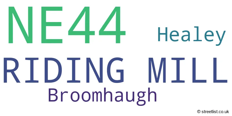
The largest settlement in the NE44 postal code is RIDING MILL followed by Broomhaugh, and Healey.
The NE44 Postcode shares a border with NE43 (STOCKSFIELD, Mickley, Newton), NE45 (CORBRIDGE, Roman Heights), NE46 (HEXHAM, Acomb, Humshaugh) and NE47 (Haydon Bridge, Allendale, Bardon Mill).
The primary settlement in the NE44 postcode district is Riding Mill, located in the county of Northumberland in England. Other significant settlements in the district include Broomhaugh and Healey. The post town associated with the NE44 postcode district is Riding Mill.
For the district NE44, we have data on 1 postcode sectors. Here's a breakdown: The sector NE44 6, covers Riding Mill in Northumberland.
NE44 Postcode Sectors

Map of the NE44 Postcode District
Explore the NE44 postcode district by using our free interactive map.

When it comes to local government, postal geography often disregards political borders. However, for a breakdown in the NE44 District: the district mostly encompasses the Northumberland area with a total of 87 postcodes.
Recent House Sales in NE44
| Date | Price | Address |
|---|---|---|
| 08/09/2023 | £237,000 | Station Close, Riding Mill, NE44 6HF |
| 14/08/2023 | £365,000 | Station Close, Riding Mill, NE44 6HE |
| 30/06/2023 | £423,800 | St James Terrace, Riding Mill, NE44 6ED |
| 16/06/2023 | £306,000 | Riding Mill, NE44 6HL |
| 15/06/2023 | £312,500 | Station Close, Riding Mill, NE44 6HE |
| 28/04/2023 | £111,000 | Broomhaugh, Riding Mill, NE44 6EQ |
| 28/04/2023 | £550,000 | Long Rigg, Riding Mill, NE44 6AL |
| 25/04/2023 | £670,000 | Oaklands Rise, Riding Mill, NE44 6EX |
| 31/03/2023 | £180,000 | Station Close, Riding Mill, NE44 6HF |
| 10/02/2023 | £280,000 | Riding Mill, NE44 6HL |
Weather Forecast for NE44
Press Button to Show Forecast for Corbridge
| Time Period | Icon | Description | Temperature | Rain Probability | Wind |
|---|---|---|---|---|---|
| 00:00 to 03:00 | Cloudy | 5.0°C (feels like 3.0°C) | 5.00% | NW 4 mph | |
| 03:00 to 06:00 | Cloudy | 3.0°C (feels like 0.0°C) | 7.00% | NW 4 mph | |
| 06:00 to 09:00 | Cloudy | 4.0°C (feels like 2.0°C) | 4.00% | NW 4 mph | |
| 09:00 to 12:00 | Cloudy | 7.0°C (feels like 4.0°C) | 4.00% | N 9 mph | |
| 12:00 to 15:00 | Cloudy | 9.0°C (feels like 6.0°C) | 5.00% | N 9 mph | |
| 15:00 to 18:00 | Partly cloudy (day) | 10.0°C (feels like 8.0°C) | 1.00% | N 7 mph | |
| 18:00 to 21:00 | Cloudy | 8.0°C (feels like 7.0°C) | 4.00% | E 4 mph | |
| 21:00 to 00:00 | Cloudy | 6.0°C (feels like 4.0°C) | 5.00% | SW 4 mph |
Press Button to Show Forecast for Corbridge
| Time Period | Icon | Description | Temperature | Rain Probability | Wind |
|---|---|---|---|---|---|
| 00:00 to 03:00 | Cloudy | 5.0°C (feels like 2.0°C) | 5.00% | WNW 7 mph | |
| 03:00 to 06:00 | Cloudy | 5.0°C (feels like 2.0°C) | 11.00% | WNW 9 mph | |
| 06:00 to 09:00 | Cloudy | 5.0°C (feels like 2.0°C) | 15.00% | NW 7 mph | |
| 09:00 to 12:00 | Overcast | 7.0°C (feels like 5.0°C) | 12.00% | NNW 9 mph | |
| 12:00 to 15:00 | Cloudy | 8.0°C (feels like 6.0°C) | 9.00% | N 9 mph | |
| 15:00 to 18:00 | Overcast | 9.0°C (feels like 6.0°C) | 10.00% | NNE 9 mph | |
| 18:00 to 21:00 | Cloudy | 7.0°C (feels like 5.0°C) | 4.00% | NE 7 mph | |
| 21:00 to 00:00 | Partly cloudy (night) | 3.0°C (feels like 1.0°C) | 1.00% | NE 4 mph |
Press Button to Show Forecast for Corbridge
| Time Period | Icon | Description | Temperature | Rain Probability | Wind |
|---|---|---|---|---|---|
| 00:00 to 03:00 | Cloudy | 2.0°C (feels like 0.0°C) | 4.00% | NNE 2 mph | |
| 03:00 to 06:00 | Cloudy | 1.0°C (feels like 0.0°C) | 5.00% | NNE 2 mph | |
| 06:00 to 09:00 | Cloudy | 3.0°C (feels like 2.0°C) | 6.00% | N 4 mph | |
| 09:00 to 12:00 | Cloudy | 7.0°C (feels like 5.0°C) | 8.00% | ENE 7 mph | |
| 12:00 to 15:00 | Cloudy | 8.0°C (feels like 6.0°C) | 9.00% | E 7 mph | |
| 15:00 to 18:00 | Overcast | 8.0°C (feels like 6.0°C) | 13.00% | E 9 mph | |
| 18:00 to 21:00 | Cloudy | 7.0°C (feels like 5.0°C) | 9.00% | E 7 mph | |
| 21:00 to 00:00 | Cloudy | 4.0°C (feels like 2.0°C) | 14.00% | ESE 4 mph |
Press Button to Show Forecast for Corbridge
| Time Period | Icon | Description | Temperature | Rain Probability | Wind |
|---|---|---|---|---|---|
| 00:00 to 03:00 | Overcast | 4.0°C (feels like 2.0°C) | 24.00% | E 4 mph | |
| 03:00 to 06:00 | Cloudy | 3.0°C (feels like 1.0°C) | 22.00% | E 4 mph | |
| 06:00 to 09:00 | Cloudy | 5.0°C (feels like 3.0°C) | 8.00% | E 4 mph | |
| 09:00 to 12:00 | Cloudy | 8.0°C (feels like 5.0°C) | 13.00% | E 9 mph | |
| 12:00 to 15:00 | Overcast | 9.0°C (feels like 7.0°C) | 17.00% | E 11 mph | |
| 15:00 to 18:00 | Light rain shower (day) | 9.0°C (feels like 7.0°C) | 33.00% | E 11 mph | |
| 18:00 to 21:00 | Light rain | 8.0°C (feels like 5.0°C) | 40.00% | ENE 9 mph | |
| 21:00 to 00:00 | Cloudy | 6.0°C (feels like 4.0°C) | 11.00% | ENE 9 mph |
Where is the NE44 Postcode District?
The NE44 postcode district is located in Riding Mill. Riding Mill is a district town that is situated near several other towns. To the North East, Riding Mill is close to Stocksfield, which is approximately 2.74 miles away. To the North, there is Corbridge, which is about 4.14 miles away. To the East, there is Prudhoe, which is approximately 5.87 miles away. To the North West, there is Hexham, which is about 5.89 miles away. Additionally, Riding Mill is about 6.86 miles away from Consett, which is located in the South East. Moreover, Riding Mill is approximately 248.49 miles away from the center of London.
The district is within the post town of RIDING MILL.
The sector has postcodes within the nation of England.
The NE44 Postcode District is in the Northumberland region of Northumberland and Tyne and Wear within the North East (England).
Postcode Sectors within the NE44 District
| Postcode Sector | Delivery Office |
|---|---|
| NE44 6 | Hexham Delivery Office |
| N | E | 4 | 4 | - | X | X | X |
| N | E | 4 | 4 | Space | Numeric | Letter | Letter |
Current Monthly Rental Prices
| # Bedrooms | Min Price | Max Price | Avg Price |
|---|
Current House Prices
| # Bedrooms | Min Price | Max Price | Avg Price |
|---|---|---|---|
| 2 | £125,000 | £125,000 | £125,000 |
| 3 | £260,000 | £450,000 | £355,000 |
| 4 | £248,500 | £730,000 | £489,250 |
| 5 | £450,000 | £1,100,000 | £775,000 |
| 6 | £650,000 | £1,550,000 | £1,100,000 |
| 7 | £1,650,000 | £1,650,000 | £1,650,000 |
Estate Agents who Operate in the NE44 District
| Logo | Name | Brand Name | Address | Contact Number | Total Properties |
|---|---|---|---|---|---|
 | Hexham | Andrew Coulson Property Sales & Lettings | 39 Fore Street, Hexham, NE46 1LN | 01434 405385 | 3 |
 | Prudhoe | Red Hot Property | 68 Front Street, Prudhoe, NE42 5AA | 01666 337146 | 2 |
 | Corbridge | Finest Properties | Crossways, Market Place, Corbridge NE45 5AW | 01434 409033 | 2 |
 | Hexham | Galbraith | Hexham Business Park, Burn Lane, Hexham, NE46 3RU | 01434 405346 | 1 |
 | Newcastle Upon Tyne | A & G Land & Property Agents | Anderson House, Crispin Court, Newcastle Upon Tyne, NE5 1BF | 0191 625 0199 | 1 |
| Type of Property | 2018 Average | 2018 Sales | 2017 Average | 2017 Sales | 2016 Average | 2016 Sales | 2015 Average | 2015 Sales |
|---|---|---|---|---|---|---|---|---|
| Detached | £505,179 | 14 | £379,159 | 11 | £452,450 | 11 | £446,250 | 8 |
| Semi-Detached | £258,613 | 4 | £262,625 | 6 | £328,875 | 4 | £212,375 | 4 |
| Terraced | £300,931 | 8 | £245,375 | 2 | £245,000 | 2 | £344,000 | 2 |
| Flats | £0 | 0 | £75,000 | 1 | £102,500 | 2 | £0 | 0 |