The NE63 9 postcode sector is within the county of Northumberland.
Did you know? According to the 2021 Census, the NE63 9 postcode sector is home to a bustling 12,084 residents!
Given that each sector allows for 400 unique postcode combinations. Letters C, I, K, M, O and V are not allowed in the last two letters of a postcode. With 316 postcodes already in use, this leaves 84 units available.
The largest settlement in the NE63 9 postal code is ASHINGTON followed by North Seaton, and Meadow Vale.
The NE63 9 Postcode shares a border with NE61 5 (Widdrington, Ellington, Lynemouth), NE62 5 (CHOPPINGTON, Scotland Gate, West Sleekburn), NE63 0 (ASHINGTON, North Seaton, North Seaton Industrial Estate), NE63 8 (ASHINGTON, Jubilee Industrial Estate), NE64 6 (NEWBIGGIN-BY-THE-SEA) and NE24 1 (BLYTH, Cambois).
The sector is within the post town of ASHINGTON.
NE63 9 is a postcode sector within the NE63 postcode district which is within the NE Newcastle upon Tyne postcode area.
The Royal Mail delivery office for the NE63 9 postal sector is the Ashington Delivery Office.
The area of the NE63 9 postcode sector is 4.57 square miles which is 11.84 square kilometres or 2,926.08 square acres.

Map of the NE63 9 Postcode Sector
Explore the NE63 9 postcode sector by using our free interactive map.
| N | E | 6 | 3 | - | 9 | X | X |
| N | E | 6 | 3 | Space | 9 | Letter | Letter |
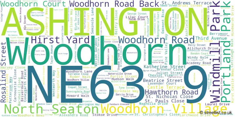
Official List of Streets
ASHINGTON (165 Streets)
Woodhorn (1 Streets)
Windmill Park (3 Streets)
Portland Park (2 Streets)
Meadow Vale (6 Streets)
Woodhorn Village (2 Streets)
North Seaton (1 Streets)
Unofficial Streets or Alternative Spellings
NEWBIGGIN-BY-THE-SEA
WOODHORN ROADASHINGTON
CEDAR TERRACE CHESTNUT STREET ELDER SQUARE FALSTONE CRESCENT GROUSEMOOR DRIVE JOHN STREET MAPLE STREET MYRTLE STREET NORTH SEATON ROAD REIVERDALE ROAD ROTARY PARKWAY SECOND AVENUE SEVENTH AVENUE ST. ANDREWS TERRACENorth Seaton
HARRISON CRESCENT NEWBIGGIN ROADLynemouth
PARK ROADWeather Forecast for NE63 9
Press Button to Show Forecast for Ashington
| Time Period | Icon | Description | Temperature | Rain Probability | Wind |
|---|---|---|---|---|---|
| 00:00 to 03:00 | Cloudy | 4.0°C (feels like 1.0°C) | 14.00% | NNW 4 mph | |
| 03:00 to 06:00 | Cloudy | 3.0°C (feels like 1.0°C) | 6.00% | NW 4 mph | |
| 06:00 to 09:00 | Cloudy | 3.0°C (feels like 1.0°C) | 6.00% | NNW 7 mph | |
| 09:00 to 12:00 | Cloudy | 6.0°C (feels like 3.0°C) | 7.00% | NNE 9 mph | |
| 12:00 to 15:00 | Cloudy | 7.0°C (feels like 5.0°C) | 28.00% | ENE 7 mph | |
| 15:00 to 18:00 | Cloudy | 8.0°C (feels like 6.0°C) | 10.00% | E 7 mph | |
| 18:00 to 21:00 | Sunny day | 7.0°C (feels like 5.0°C) | 4.00% | E 7 mph | |
| 21:00 to 00:00 | Clear night | 4.0°C (feels like 2.0°C) | 2.00% | SE 4 mph |
Press Button to Show Forecast for Ashington
| Time Period | Icon | Description | Temperature | Rain Probability | Wind |
|---|---|---|---|---|---|
| 00:00 to 03:00 | Partly cloudy (night) | 3.0°C (feels like 1.0°C) | 2.00% | SSE 4 mph | |
| 03:00 to 06:00 | Partly cloudy (night) | 2.0°C (feels like 0.0°C) | 3.00% | S 4 mph | |
| 06:00 to 09:00 | Partly cloudy (day) | 3.0°C (feels like 1.0°C) | 6.00% | SSE 4 mph | |
| 09:00 to 12:00 | Cloudy | 8.0°C (feels like 6.0°C) | 9.00% | ESE 7 mph | |
| 12:00 to 15:00 | Partly cloudy (day) | 9.0°C (feels like 6.0°C) | 8.00% | ESE 9 mph | |
| 15:00 to 18:00 | Partly cloudy (day) | 9.0°C (feels like 6.0°C) | 6.00% | E 11 mph | |
| 18:00 to 21:00 | Partly cloudy (day) | 8.0°C (feels like 5.0°C) | 6.00% | E 11 mph | |
| 21:00 to 00:00 | Cloudy | 6.0°C (feels like 3.0°C) | 10.00% | E 9 mph |
Press Button to Show Forecast for Ashington
| Time Period | Icon | Description | Temperature | Rain Probability | Wind |
|---|---|---|---|---|---|
| 00:00 to 03:00 | Cloudy | 5.0°C (feels like 3.0°C) | 14.00% | ENE 9 mph | |
| 03:00 to 06:00 | Cloudy | 6.0°C (feels like 3.0°C) | 14.00% | NE 9 mph | |
| 06:00 to 09:00 | Overcast | 7.0°C (feels like 4.0°C) | 17.00% | NE 13 mph | |
| 09:00 to 12:00 | Light rain | 8.0°C (feels like 4.0°C) | 49.00% | NE 16 mph | |
| 12:00 to 15:00 | Light rain | 8.0°C (feels like 4.0°C) | 50.00% | NNE 16 mph | |
| 15:00 to 18:00 | Light rain | 8.0°C (feels like 5.0°C) | 49.00% | NNE 13 mph | |
| 18:00 to 21:00 | Partly cloudy (day) | 8.0°C (feels like 7.0°C) | 14.00% | NNE 9 mph | |
| 21:00 to 00:00 | Partly cloudy (night) | 6.0°C (feels like 3.0°C) | 10.00% | SE 9 mph |
Schools and Places of Education Within the NE63 9 Postcode Sector
NCEA Bishop's Primary School
Academy converter
Academy Road, Ashington, , NE63 9FZ
Head: Mrs Clare Marriott
Ofsted Rating: Good
Inspection: 2022-10-19 (555 days ago)
Website: Visit NCEA Bishop's Primary School Website
Phone: 01670844323
Number of Pupils: 471
NCEA Castle School
Academy special converter
Academy Road, Ashington, Northumberland, NE63 9FZ
Head: Mr Patrick Ford-Hutchinson
Ofsted Rating: Good
Inspection: 2022-11-09 (534 days ago)
Website: Visit NCEA Castle School Website
Phone: 01670844322
Number of Pupils: 118
NCEA Duke's Secondary School
Academy sponsor led
Academy Road, Ashington, Northumberland, NE63 9FZ
Head: Mr Ruston Atkinson
Ofsted Rating: Requires improvement
Inspection: 2023-06-07 (324 days ago)
Website: Visit NCEA Duke's Secondary School Website
Phone: 01670816111
Number of Pupils: 1018

House Prices in the NE63 9 Postcode Sector
| Type of Property | 2018 Average | 2018 Sales | 2017 Average | 2017 Sales | 2016 Average | 2016 Sales | 2015 Average | 2015 Sales |
|---|---|---|---|---|---|---|---|---|
| Detached | £200,880 | 58 | £195,946 | 58 | £186,156 | 60 | £188,482 | 47 |
| Semi-Detached | £116,180 | 40 | £123,078 | 30 | £118,097 | 32 | £112,417 | 35 |
| Terraced | £66,142 | 95 | £70,731 | 107 | £69,005 | 92 | £71,333 | 101 |
| Flats | £54,133 | 6 | £56,363 | 8 | £27,989 | 9 | £49,405 | 11 |
Important Postcodes NE63 9 in the Postcode Sector
NE63 9BA is the postcode for Growing Zone, Hirst Park, Rosalind Street
NE63 9BE is the postcode for Central Primary School Upper, Third Avenue, and Central Primary School Upper Site, Third Avenue
NE63 9FZ is the postcode for Josephine Butler Church of England Academy, Academy Road, and James Knott Campus, Norham Road
NE63 9HN is the postcode for HIRST WELFARE CENTRE, ALEXANDRA ROAD, ASHINGTON, and Hirst Welfare Centre, Alexandra Road
NE63 9JJ is the postcode for Wansbeck General Hospital, Woodhorn Lane, and Northumbria Healthcare NHS Foundation Trust, Wansbeck General Hospital
NE63 9JX is the postcode for Northumbria Police, Ashington Police Station, Lintonville Terrace, and Northumbria Police, Police Station, Lintonville Terrace
NE63 9JY is the postcode for Ashington Leisure Centre, Portland Park, ASHINGTON LEISURE CENTRE, PORTLAND PARK, NORTHERN RELIEF ROAD, and Ashington Leisure Centre, Portland Park, Lintonville Terrace
NE63 9LP is the postcode for Thomas Berwick Campus, Moorhouse Lane, Ncea Thomas Bewick C Of E Primary, Moorhouse Lane, and Ashington Alexandra County First School, Moorhouse Lane
NE63 9LR is the postcode for St Aidans RC VA Primary School, Moorhouse Lane, St. Aidans Primary School House, Moorhouse Lane, and MAIN BUILDING, St. Aidans RC VA Primary School, Moorhouse Lane
NE63 9RG is the postcode for THE STEM BUILDING, Northumberland College, College Road, JOINERY, TILING AND PAINTING, Northumberland College, College Road, NEW ENGINEERING, HIGHWAYS AND TRADES WORKSHOP, Northumberland College, College Road, HIGHWAYS WORKSHOP, Northumberland College, College Road, BUSINESS SOLUTIONS, Northumberland College, College Road, PRACTICAL INSTRUCTION, Northumberland College, College Road, THE MAIN BUILDING, Northumberland College, College Road, BRICKLAYING AND PLASTERING, Northumberland College, College Road, and Northumberland College, College Road
NE63 9RL is the postcode for Richard Grainger Campus, Alexandra Road, and Ashington Coulson Park County First School, Alexandra Road
NE63 9RX is the postcode for MAIN SCHOOL, Hirst High School, Lichfield Close, Hirst High School, Lichfield Close, SCIENCE BLOCK, Hirst High School, Lichfield Close, and SPORTS BLOCK, Hirst High School, Lichfield Close
NE63 9SA is the postcode for Josephine Butler Campus, Norwich Close, and Seaton Hirst C of E Middle School, Norwich Close
NE63 9TA is the postcode for Robert Stephenson Campus, Northumberland C Of E Academy, Thorntree Gardens, Welbeck Community First School, Thorntree Gardens, and Robert Stephenson Campus, Thorntree Gardens
NE63 9UT is the postcode for Lintonville Medical Group, Lintonville Terrace
NE63 9XL is the postcode for Northumberland County Council, Wansbeck Square, and Council Offices, Wansbeck Square, Station Road
NE63 9YF is the postcode for CUTTER BUILDING, Woodhorn Museum Archives & Country Park, Queen Elizabeth II Country Park,, The Cutter Building, Woodhorn, Access Road From A189 To Woodhorn Colliery Museum, and CUTTER BUILDING, Woodhorn Museum Archives & Country Park, Queen Elizabeth II Country Park
NE63 9YY is the postcode for Jobcentre Plus, Government Buildings, Reiverdale Road
| The NE63 9 Sector is within these Local Authorities |
|
|---|---|
| The NE63 9 Sector is within these Counties |
|
| The NE63 9 Sector is within these Water Company Areas |
|