The NE70 7 postcode sector is within the county of Northumberland.
Did you know? According to the 2021 Census, the NE70 7 postcode sector is home to a bustling 1,779 residents!
Given that each sector allows for 400 unique postcode combinations. Letters C, I, K, M, O and V are not allowed in the last two letters of a postcode. With 128 postcodes already in use, this leaves 272 units available.
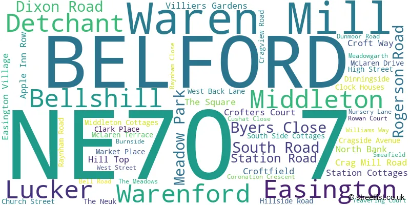
The largest settlement in the NE70 7 postal code is BELFORD followed by Waren Mill, and Lucker.
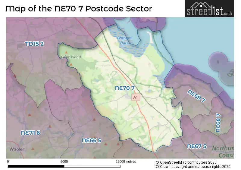
The NE70 7 Postcode shares a border with NE66 5 (Chatton, Chillingham), NE67 5 (Beadnell, CHATHILL, Ellingham), NE69 7 (BAMBURGH) and TD15 2 (Tweedmouth, BERWICK-UPON-TWEED, Spittal).
The sector is within the post town of BELFORD.
NE70 7 is a postcode sector within the NE70 postcode district which is within the NE Newcastle upon Tyne postcode area.
The Royal Mail delivery office for the NE70 7 postal sector is the Alnwick Delivery Office.
The area of the NE70 7 postcode sector is 35.21 square miles which is 91.20 square kilometres or 22,536.31 square acres.
The NE70 7 postcode sector is crossed by the A1 Major A road.
Waterways within the NE70 7 postcode sector include the Fenham Burn.

Map of the NE70 7 Postcode Sector
Explore the NE70 7 postcode sector by using our free interactive map.
| N | E | 7 | 0 | - | 7 | X | X |
| N | E | 7 | 0 | Space | 7 | Letter | Letter |
Official List of Streets
Lucker (5 Streets)
BELFORD (39 Streets)
Middleton (2 Streets)
Easington (1 Streets)
Bellshill (1 Streets)
Unofficial Streets or Alternative Spellings
Weather Forecast for NE70 7
Press Button to Show Forecast for Middleton (Northumberland)
| Time Period | Icon | Description | Temperature | Rain Probability | Wind |
|---|---|---|---|---|---|
| 06:00 to 09:00 | Cloudy | 4.0°C (feels like 0.0°C) | 9.00% | NW 11 mph | |
| 09:00 to 12:00 | Cloudy | 6.0°C (feels like 2.0°C) | 10.00% | N 13 mph | |
| 12:00 to 15:00 | Cloudy | 7.0°C (feels like 3.0°C) | 37.00% | N 13 mph | |
| 15:00 to 18:00 | Cloudy | 7.0°C (feels like 4.0°C) | 7.00% | NNE 9 mph | |
| 18:00 to 21:00 | Cloudy | 6.0°C (feels like 3.0°C) | 3.00% | NNE 9 mph | |
| 21:00 to 00:00 | Cloudy | 3.0°C (feels like 1.0°C) | 4.00% | N 4 mph |
Press Button to Show Forecast for Middleton (Northumberland)
| Time Period | Icon | Description | Temperature | Rain Probability | Wind |
|---|---|---|---|---|---|
| 00:00 to 03:00 | Cloudy | 2.0°C (feels like 0.0°C) | 4.00% | NW 4 mph | |
| 03:00 to 06:00 | Cloudy | 2.0°C (feels like 0.0°C) | 9.00% | NW 4 mph | |
| 06:00 to 09:00 | Light rain | 4.0°C (feels like 1.0°C) | 47.00% | NW 4 mph | |
| 09:00 to 12:00 | Cloudy | 6.0°C (feels like 4.0°C) | 36.00% | N 7 mph | |
| 12:00 to 15:00 | Cloudy | 7.0°C (feels like 5.0°C) | 12.00% | NE 7 mph | |
| 15:00 to 18:00 | Cloudy | 7.0°C (feels like 5.0°C) | 8.00% | ENE 7 mph | |
| 18:00 to 21:00 | Partly cloudy (day) | 6.0°C (feels like 5.0°C) | 4.00% | E 7 mph | |
| 21:00 to 00:00 | Clear night | 3.0°C (feels like 1.0°C) | 1.00% | ESE 4 mph |
Press Button to Show Forecast for Middleton (Northumberland)
| Time Period | Icon | Description | Temperature | Rain Probability | Wind |
|---|---|---|---|---|---|
| 00:00 to 03:00 | Clear night | 1.0°C (feels like -1.0°C) | 1.00% | SSW 4 mph | |
| 03:00 to 06:00 | Partly cloudy (night) | 0.0°C (feels like -2.0°C) | 3.00% | S 4 mph | |
| 06:00 to 09:00 | Partly cloudy (day) | 2.0°C (feels like 0.0°C) | 3.00% | S 4 mph | |
| 09:00 to 12:00 | Partly cloudy (day) | 7.0°C (feels like 6.0°C) | 7.00% | ESE 4 mph | |
| 12:00 to 15:00 | Partly cloudy (day) | 9.0°C (feels like 7.0°C) | 8.00% | ESE 9 mph | |
| 15:00 to 18:00 | Cloudy | 9.0°C (feels like 6.0°C) | 12.00% | ESE 11 mph | |
| 18:00 to 21:00 | Partly cloudy (day) | 8.0°C (feels like 5.0°C) | 8.00% | ESE 11 mph | |
| 21:00 to 00:00 | Partly cloudy (night) | 5.0°C (feels like 2.0°C) | 6.00% | ESE 9 mph |
Press Button to Show Forecast for Middleton (Northumberland)
| Time Period | Icon | Description | Temperature | Rain Probability | Wind |
|---|---|---|---|---|---|
| 00:00 to 03:00 | Cloudy | 4.0°C (feels like 1.0°C) | 11.00% | ESE 7 mph | |
| 03:00 to 06:00 | Cloudy | 5.0°C (feels like 2.0°C) | 14.00% | NNE 7 mph | |
| 06:00 to 09:00 | Cloudy | 6.0°C (feels like 3.0°C) | 14.00% | ENE 11 mph | |
| 09:00 to 12:00 | Overcast | 8.0°C (feels like 5.0°C) | 19.00% | NE 13 mph | |
| 12:00 to 15:00 | Cloudy | 8.0°C (feels like 5.0°C) | 17.00% | NNE 13 mph | |
| 15:00 to 18:00 | Cloudy | 9.0°C (feels like 6.0°C) | 16.00% | NNE 11 mph | |
| 18:00 to 21:00 | Partly cloudy (day) | 8.0°C (feels like 6.0°C) | 12.00% | NE 9 mph | |
| 21:00 to 00:00 | Partly cloudy (night) | 6.0°C (feels like 4.0°C) | 11.00% | ESE 7 mph |
Schools and Places of Education Within the NE70 7 Postcode Sector
Belford Primary School
Community school
West Street, Belford, Northumberland, NE70 7QD
Head: Mrs Lorna Rainey
Ofsted Rating: Good
Inspection: 2023-01-25 (456 days ago)
Website: Visit Belford Primary School Website
Phone: 01668213372
Number of Pupils: 84
House Prices in the NE70 7 Postcode Sector
| Type of Property | 2018 Average | 2018 Sales | 2017 Average | 2017 Sales | 2016 Average | 2016 Sales | 2015 Average | 2015 Sales |
|---|---|---|---|---|---|---|---|---|
| Detached | £241,838 | 13 | £251,227 | 15 | £222,179 | 14 | £196,626 | 8 |
| Semi-Detached | £158,889 | 9 | £144,550 | 10 | £122,656 | 9 | £126,925 | 4 |
| Terraced | £135,900 | 10 | £160,056 | 18 | £206,998 | 21 | £103,500 | 13 |
| Flats | £162,500 | 4 | £130,000 | 2 | £250,000 | 1 | £141,667 | 3 |
Important Postcodes NE70 7 in the Postcode Sector
NE70 7ER is the postcode for Belford Medical Practice, Croftfield
NE70 7NX is the postcode for St. Mary's C of E Middle School, Williams Way
NE70 7QF is the postcode for Belford First School, West Street, and BELFORD FIRST SCHOOL, WEST STREET, BELFORD
| The NE70 7 Sector is within these Local Authorities |
|
|---|---|
| The NE70 7 Sector is within these Counties |
|
| The NE70 7 Sector is within these Water Company Areas |
|