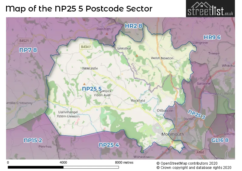
The NP25 5 postcode sector stands on the Gwent and Herefordshire border.
Did you know? According to the 2021 Census, the NP25 5 postcode sector is home to a bustling 7,162 residents!
Given that each sector allows for 400 unique postcode combinations. Letters C, I, K, M, O and V are not allowed in the last two letters of a postcode. With 202 postcodes already in use, this leaves 198 units available.
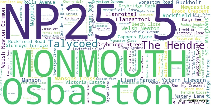
The largest settlement in the NP25 5 postal code is MONMOUTH followed by ROCKFIELD, and THE HENDRE.
The NP25 5 Postcode shares a border with HR2 8 (St. Weonards, Much Birch, Much Dewchurch), HR9 6 (Whitchurch, Symonds Yat, Goodrich), NP25 4 (DINGESTOW, LLANDOGO, TRELLECH), NP15 2 (Raglan, PENRHOS, LLANARTH), NP7 8 (GROSMONT, LLANVIHANGEL CRUCORNEY, PANDY) and NP25 3 (MONMOUTH, WYESHAM, Osbaston).
The sector is within the post town of MONMOUTH.
NP25 5 is a postcode sector within the NP25 postcode district which is within the NP Newport postcode area.
The Royal Mail delivery office for the NP25 5 postal sector is the Monmouth Delivery Office.
The area of the NP25 5 postcode sector is 26.22 square miles which is 67.92 square kilometres or 16,782.48 square acres.

Map of the NP25 5 Postcode Sector
Explore the NP25 5 postcode sector by using our free interactive map.
| N | P | 2 | 5 | - | 5 | X | X |
| N | P | 2 | 5 | Space | 5 | Letter | Letter |
Official List of Streets
MONMOUTH (98 Streets)
Newcastle (1 Streets)
Manson (1 Streets)
Mansons Cross (1 Streets)
Unofficial Streets or Alternative Spellings
MONMOUTH
CRAIG-Y-DORTH VIEW OSBASTON ROAD PRIORY STREET "LONDON ROAD" ANCREHILL LANE CARBONNE CLOSE TO ELSTOB WAY CLOS BRIALLEN COURT FIELD CLOSE DUKE OF BEAUFORT BRIDGE GIBRALTAR TUNNEL HARFLEUR CLOSE HEOL KEMBLE INGLES BRIDGE JORDANS GARDENS LINK ROAD LON LEASBROOK MAERDY BRIDGE MANSONS LANE PWLL-Y-PWCA RECTORY LANE RHODFA ROCKFIELD ROCKFIELD BRIDGE ST THOMASS SQUARE TRODDI BRIDGE WHEAT FIELD CLOSE WHITEHILL LANEDixton
LEASBROOK LANEWeather Forecast for NP25 5
Press Button to Show Forecast for Monmouth Youth Hostel
| Time Period | Icon | Description | Temperature | Rain Probability | Wind |
|---|---|---|---|---|---|
| 12:00 to 15:00 | Partly cloudy (day) | 12.0°C (feels like 10.0°C) | 1.00% | N 9 mph | |
| 15:00 to 18:00 | Sunny day | 13.0°C (feels like 11.0°C) | 0.00% | N 9 mph | |
| 18:00 to 21:00 | Sunny day | 11.0°C (feels like 10.0°C) | 0.00% | NNE 7 mph | |
| 21:00 to 00:00 | Clear night | 5.0°C (feels like 4.0°C) | 0.00% | NNW 2 mph |
Press Button to Show Forecast for Monmouth Youth Hostel
| Time Period | Icon | Description | Temperature | Rain Probability | Wind |
|---|---|---|---|---|---|
| 00:00 to 03:00 | Clear night | 3.0°C (feels like 2.0°C) | 0.00% | NW 2 mph | |
| 03:00 to 06:00 | Clear night | 1.0°C (feels like 0.0°C) | 1.00% | WNW 2 mph | |
| 06:00 to 09:00 | Cloudy | 4.0°C (feels like 3.0°C) | 3.00% | WSW 2 mph | |
| 09:00 to 12:00 | Cloudy | 9.0°C (feels like 8.0°C) | 4.00% | W 7 mph | |
| 12:00 to 15:00 | Cloudy | 12.0°C (feels like 10.0°C) | 6.00% | WNW 9 mph | |
| 15:00 to 18:00 | Cloudy | 12.0°C (feels like 11.0°C) | 7.00% | NW 7 mph | |
| 18:00 to 21:00 | Cloudy | 11.0°C (feels like 10.0°C) | 8.00% | NW 7 mph | |
| 21:00 to 00:00 | Cloudy | 8.0°C (feels like 7.0°C) | 4.00% | NNW 4 mph |
Press Button to Show Forecast for Monmouth Youth Hostel
| Time Period | Icon | Description | Temperature | Rain Probability | Wind |
|---|---|---|---|---|---|
| 00:00 to 03:00 | Cloudy | 6.0°C (feels like 5.0°C) | 6.00% | N 4 mph | |
| 03:00 to 06:00 | Cloudy | 5.0°C (feels like 3.0°C) | 9.00% | ENE 4 mph | |
| 06:00 to 09:00 | Cloudy | 6.0°C (feels like 4.0°C) | 10.00% | NE 4 mph | |
| 09:00 to 12:00 | Cloudy | 9.0°C (feels like 7.0°C) | 10.00% | ESE 7 mph | |
| 12:00 to 15:00 | Overcast | 11.0°C (feels like 9.0°C) | 14.00% | SE 7 mph | |
| 15:00 to 18:00 | Overcast | 11.0°C (feels like 10.0°C) | 18.00% | ESE 7 mph | |
| 18:00 to 21:00 | Cloudy | 10.0°C (feels like 9.0°C) | 14.00% | SE 7 mph | |
| 21:00 to 00:00 | Cloudy | 8.0°C (feels like 6.0°C) | 14.00% | E 7 mph |
Press Button to Show Forecast for Monmouth Youth Hostel
| Time Period | Icon | Description | Temperature | Rain Probability | Wind |
|---|---|---|---|---|---|
| 00:00 to 03:00 | Cloudy | 7.0°C (feels like 5.0°C) | 15.00% | ENE 7 mph | |
| 03:00 to 06:00 | Light rain shower (night) | 6.0°C (feels like 5.0°C) | 32.00% | NE 7 mph | |
| 06:00 to 09:00 | Overcast | 7.0°C (feels like 5.0°C) | 16.00% | NNE 7 mph | |
| 09:00 to 12:00 | Cloudy | 10.0°C (feels like 8.0°C) | 12.00% | NE 9 mph | |
| 12:00 to 15:00 | Light rain shower (day) | 12.0°C (feels like 10.0°C) | 44.00% | ENE 9 mph | |
| 15:00 to 18:00 | Light rain | 12.0°C (feels like 10.0°C) | 55.00% | E 9 mph | |
| 18:00 to 21:00 | Light rain shower (day) | 11.0°C (feels like 9.0°C) | 35.00% | ENE 7 mph | |
| 21:00 to 00:00 | Light rain | 9.0°C (feels like 7.0°C) | 45.00% | ENE 7 mph |
House Prices in the NP25 5 Postcode Sector
| Type of Property | 2018 Average | 2018 Sales | 2017 Average | 2017 Sales | 2016 Average | 2016 Sales | 2015 Average | 2015 Sales |
|---|---|---|---|---|---|---|---|---|
| Detached | £371,365 | 92 | £334,337 | 90 | £322,423 | 56 | £314,222 | 47 |
| Semi-Detached | £215,861 | 41 | £204,014 | 46 | £183,516 | 29 | £202,526 | 34 |
| Terraced | £179,639 | 35 | £176,540 | 36 | £174,643 | 14 | £158,046 | 35 |
| Flats | £3,870,860 | 8 | £83,000 | 6 | £79,286 | 7 | £67,813 | 8 |
Important Postcodes NP25 5 in the Postcode Sector
NP25 5BA is the postcode for Overmonnow Primary School, Rockfield Road
NP25 5BL is the postcode for Monnow Vale Health & Social Care Facility, Drybridge Park
NP25 5NY is the postcode for Hilston Park Centre, Newcastle
| The NP25 5 Sector is within these Local Authorities |
|
|---|---|
| The NP25 5 Sector is within these Counties |
|
| The NP25 5 Sector is within these Water Company Areas |
|