The NR27 0 postcode sector is within the county of Norfolk.
Did you know? According to the 2021 Census, the NR27 0 postcode sector is home to a bustling 5,856 residents!
Given that each sector allows for 400 unique postcode combinations. Letters C, I, K, M, O and V are not allowed in the last two letters of a postcode. With 180 postcodes already in use, this leaves 220 units available.
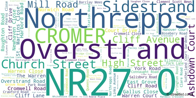
The largest settlement in the NR27 0 postal code is CROMER followed by Overstrand, and Northrepps.
The NR27 0 Postcode shares a border with NR11 8 (Mundesley, Southrepps, Roughton) and NR27 9 (CROMER, West Runton, East Runton).
The sector is within the post town of CROMER.
NR27 0 is a postcode sector within the NR27 postcode district which is within the NR Norwich postcode area.
The Royal Mail delivery office for the NR27 0 postal sector is the Cromer Delivery Office.
The area of the NR27 0 postcode sector is 4.85 square miles which is 12.57 square kilometres or 3,105.94 square acres.

Map of the NR27 0 Postcode Sector
Explore the NR27 0 postcode sector by using our free interactive map.
| N | R | 2 | 7 | - | 0 | X | X |
| N | R | 2 | 7 | Space | 0 | Letter | Letter |
Official List of Streets
CROMER (71 Streets)
Overstrand (24 Streets)
Northrepps (20 Streets)
Unofficial Streets or Alternative Spellings
Hanworth
NORWICH ROADSouthrepps
SANDY LANE TOP ROAD ARCADIA DRIVE ASH GROVE BEECH VIEW BLOSSOM WAY BLUEBELL WOODS CONIFER VIEW COPSE VIEW ESPLANADE FIVE ACRE GREEN LANE GREEN WALK HIGHVIEW PARK KINGS CHALET PARK LIME TREE CLOSE LOVE LANE MAPLE LEAF CLOSE NEW ROAD NUT LANE OLIVER COURT PINE VIEW PROMENADE RIDGE WAY ROADSIDE SAINT MARGARETS LANE SAINT MARGARETS ROAD SCHOOL CLOSE SILVER BIRCH CLOSE SOUTHREPPS ROAD SPINNEY DRIVE ST MARGARETS LANE ST MARGARETS ROAD THE AVENUE THE DOCTORS STEPS THE GLADES THORPE MARKET ROAD WHITE HOUSE ESTATE WOODLAND RISECROMER
CHURCH STREET HANOVER COURT VICARAGE ROADRoughton
NORWICH ROADWeather Forecast for NR27 0
Press Button to Show Forecast for Cromer
| Time Period | Icon | Description | Temperature | Rain Probability | Wind |
|---|---|---|---|---|---|
| 18:00 to 21:00 | Partly cloudy (day) | 6.0°C (feels like 3.0°C) | 2.00% | NNW 11 mph | |
| 21:00 to 00:00 | Clear night | 4.0°C (feels like 1.0°C) | 1.00% | NNW 9 mph |
Press Button to Show Forecast for Cromer
| Time Period | Icon | Description | Temperature | Rain Probability | Wind |
|---|---|---|---|---|---|
| 00:00 to 03:00 | Cloudy | 3.0°C (feels like 0.0°C) | 3.00% | NNW 7 mph | |
| 03:00 to 06:00 | Cloudy | 4.0°C (feels like 1.0°C) | 8.00% | NW 7 mph | |
| 06:00 to 09:00 | Cloudy | 5.0°C (feels like 3.0°C) | 5.00% | NNW 7 mph | |
| 09:00 to 12:00 | Cloudy | 8.0°C (feels like 6.0°C) | 6.00% | NNE 7 mph | |
| 12:00 to 15:00 | Cloudy | 8.0°C (feels like 6.0°C) | 6.00% | NE 9 mph | |
| 15:00 to 18:00 | Cloudy | 9.0°C (feels like 7.0°C) | 6.00% | ENE 9 mph | |
| 18:00 to 21:00 | Cloudy | 8.0°C (feels like 6.0°C) | 5.00% | ENE 7 mph | |
| 21:00 to 00:00 | Partly cloudy (night) | 5.0°C (feels like 3.0°C) | 2.00% | ENE 7 mph |
Press Button to Show Forecast for Cromer
| Time Period | Icon | Description | Temperature | Rain Probability | Wind |
|---|---|---|---|---|---|
| 00:00 to 03:00 | Partly cloudy (night) | 6.0°C (feels like 4.0°C) | 5.00% | ENE 7 mph | |
| 03:00 to 06:00 | Cloudy | 5.0°C (feels like 2.0°C) | 10.00% | NE 9 mph | |
| 06:00 to 09:00 | Cloudy | 7.0°C (feels like 5.0°C) | 11.00% | ENE 9 mph | |
| 09:00 to 12:00 | Overcast | 9.0°C (feels like 6.0°C) | 20.00% | ENE 11 mph | |
| 12:00 to 15:00 | Cloudy | 10.0°C (feels like 8.0°C) | 13.00% | ENE 11 mph | |
| 15:00 to 18:00 | Cloudy | 10.0°C (feels like 8.0°C) | 12.00% | ENE 11 mph | |
| 18:00 to 21:00 | Cloudy | 9.0°C (feels like 7.0°C) | 11.00% | ENE 13 mph | |
| 21:00 to 00:00 | Cloudy | 9.0°C (feels like 6.0°C) | 21.00% | ENE 13 mph |
Press Button to Show Forecast for Cromer
| Time Period | Icon | Description | Temperature | Rain Probability | Wind |
|---|---|---|---|---|---|
| 00:00 to 03:00 | Light rain | 10.0°C (feels like 7.0°C) | 50.00% | E 13 mph | |
| 03:00 to 06:00 | Light rain | 10.0°C (feels like 7.0°C) | 49.00% | ESE 13 mph | |
| 06:00 to 09:00 | Light rain shower (day) | 10.0°C (feels like 8.0°C) | 40.00% | SE 13 mph | |
| 09:00 to 12:00 | Light rain shower (day) | 12.0°C (feels like 10.0°C) | 35.00% | SSE 13 mph | |
| 12:00 to 15:00 | Heavy rain shower (day) | 13.0°C (feels like 10.0°C) | 59.00% | SSE 16 mph | |
| 15:00 to 18:00 | Heavy rain shower (day) | 13.0°C (feels like 10.0°C) | 56.00% | S 16 mph | |
| 18:00 to 21:00 | Partly cloudy (day) | 12.0°C (feels like 9.0°C) | 11.00% | SSW 11 mph | |
| 21:00 to 00:00 | Partly cloudy (night) | 9.0°C (feels like 7.0°C) | 4.00% | SW 11 mph |
Schools and Places of Education Within the NR27 0 Postcode Sector
Cromer Academy
Academy converter
Norwich Road, Cromer, Norfolk, NR27 0EX
Head: Mr John Vincent
Ofsted Rating: Good
Inspection: 2023-05-24 (337 days ago)
Website: Visit Cromer Academy Website
Phone: 01263511433
Number of Pupils: 692
Cromer Junior School
Academy converter
Norwich Road, Cromer, Norfolk, NR27 0EX
Head: Mr Whilhelm De Neve
Ofsted Rating: Good
Inspection: 2023-10-19 (189 days ago)
Website: Visit Cromer Junior School Website
Phone: 01263512155
Number of Pupils: 252
Northrepps Primary School
Community school
Church Street, Cromer, Norfolk, NR27 0LG
Head: Mr John Neenan
Ofsted Rating: Good
Inspection: 2019-05-23 (1799 days ago)
Website: Visit Northrepps Primary School Website
Phone: 01263579396
Number of Pupils: 40
Overstrand, the Belfry, Church of England Voluntary Aided Primary School
Voluntary aided school
23 Cromer Road, Cromer, Norfolk, NR27 0NT
Head: Mr Nicholas Read
Ofsted Rating: Good
Inspection: 2021-11-11 (896 days ago)
Website: Visit Overstrand, the Belfry, Church of England Voluntary Aided Primary School Website
Phone: 01263576040
Number of Pupils: 145
Sidestrand Hall School
Foundation special school
Cromer Road, Cromer, Norfolk, NR27 0NH
Head: Ms Shelley Taylor
Ofsted Rating: Good
Inspection: 2023-11-07 (170 days ago)
Website: Visit Sidestrand Hall School Website
Phone: 01263578144
Number of Pupils: 194
Suffield Park Infant and Nursery School, Cromer
Community school
Mill Road, Cromer, Norfolk, NR27 0AD
Head: Mrs Nichola Stewart
Ofsted Rating: Good
Inspection: 2018-11-14 (1989 days ago)
Website: Visit Suffield Park Infant and Nursery School, Cromer Website
Phone: 01263513296
Number of Pupils: 168

House Prices in the NR27 0 Postcode Sector
| Type of Property | 2018 Average | 2018 Sales | 2017 Average | 2017 Sales | 2016 Average | 2016 Sales | 2015 Average | 2015 Sales |
|---|---|---|---|---|---|---|---|---|
| Detached | £364,006 | 61 | £335,626 | 63 | £296,736 | 67 | £277,683 | 60 |
| Semi-Detached | £235,077 | 26 | £259,239 | 24 | £225,402 | 33 | £196,813 | 22 |
| Terraced | £234,734 | 47 | £212,318 | 46 | £189,934 | 50 | £167,232 | 30 |
| Flats | £198,056 | 26 | £148,957 | 29 | £164,077 | 47 | £159,662 | 34 |
Important Postcodes NR27 0 in the Postcode Sector
NR27 0AJ is the postcode for The Surgery, 48 Overstrand Road
NR27 0BQ is the postcode for Norfolk and Norwich University Hospital NHS Trust, Cromer Hospital, and Cromer & District Hospital, Mill Road
NR27 0EU is the postcode for Benjamin Court, Roughton Road
NR27 0EX is the postcode for Cromer Junior School, Norwich Road, Cromer Academy, Norwich Road, and Cromer County Junior School, Norwich Road
NR27 0HH is the postcode for Norfolk Community Health and Care NHS Trust, Benjamin Court
NR27 0NH is the postcode for CLASSROOM BLOCK, Sidestrand Hall School, Cromer Road, MAIN BUILDING, Sidestrand Hall School, Cromer Road, NEW SIXTH FORM BLOCK, Sidestrand Hall School, Cromer Road, and Sidestrand Hall School, Cromer Road
NR27 0NT is the postcode for Overstrand The Belfry CE VA Primary School, 23 Cromer Road
| The NR27 0 Sector is within these Local Authorities |
|
|---|---|
| The NR27 0 Sector is within these Counties |
|
| The NR27 0 Sector is within these Water Company Areas |
|