The OX13 6 postcode sector is within the county of Oxfordshire.
Did you know? According to the 2021 Census, the OX13 6 postcode sector is home to a bustling 9,705 residents!
Given that each sector allows for 400 unique postcode combinations. Letters C, I, K, M, O and V are not allowed in the last two letters of a postcode. With 244 postcodes already in use, this leaves 156 units available.
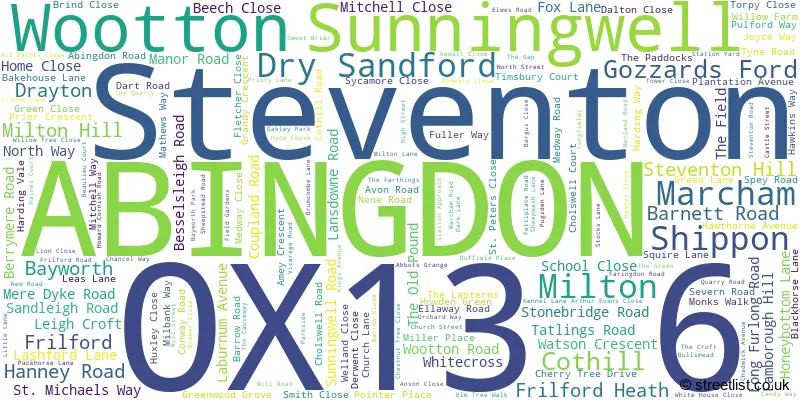
The largest settlement in the OX13 6 postal code is Steventon followed by Marcham, and Wootton.
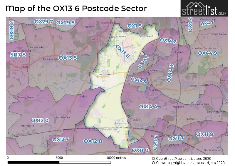
The OX13 6 Postcode shares a border with OX11 0 (Harwell, Chilton, DIDCOT), OX12 8 (WANTAGE, East Hendred, Ardington), OX13 5 (Southmoor, Kingston Bagpuize, Longworth), OX1 5 (Kennington, Boars Hill, OXFORD), OX12 0 (Grove, East Hanney, West Hanney), OX14 1 (ABINGDON), OX14 2 (ABINGDON, Radley), OX14 4 (Sutton Courtenay, Drayton, Milton) and OX14 5 (ABINGDON).
The sector is within the post town of ABINGDON.
OX13 6 is a postcode sector within the OX13 postcode district which is within the OX Oxford postcode area.
The Royal Mail delivery office for the OX13 6 postal sector is the Abingdon Delivery Office.
The area of the OX13 6 postcode sector is 15.11 square miles which is 39.14 square kilometres or 9,672.70 square acres.
The OX13 6 postcode sector is crossed by the A34 Major A road.
Waterways within the OX13 6 postcode sector include the Ock, Childrey Brook, Mill Brook, Wilts & Berks Canal.

Map of the OX13 6 Postcode Sector
Explore the OX13 6 postcode sector by using our free interactive map.
| O | X | 1 | 3 | - | 6 | X | X |
| O | X | 1 | 3 | Space | 6 | Letter | Letter |
Official List of Streets
Marcham (41 Streets)
Steventon (44 Streets)
Wootton (20 Streets)
ABINGDON (18 Streets)
Shippon (7 Streets)
Bayworth (4 Streets)
Sunningwell (6 Streets)
Milton (10 Streets)
Cothill (2 Streets)
Dry Sandford (7 Streets)
Frilford Heath (2 Streets)
Gozzards Ford (1 Streets)
Drayton (1 Streets)
Unofficial Streets or Alternative Spellings
ABINGDON
BENSON ROAD DUNMORE ROAD FARM ROAD MARCHAM ROAD OXFORD ROAD PARSONS MEAD AIRD ROW BLACK HORSE PATH COW LANE CUMBERS OF THIELE DENMAN COLLEGE FEATHERBED LANE HOBBY GREEN HUNGERFORD ROAD HYDE FARM PATH LONG TOW MARCHAM COMMON PATH MARCHAM PRIMARY SCHOOL MARCHAM ROAD INTERCHANGE MEADOW FARM PATH MERLIN ROAD MILLBANK WAY MORGAN VALE PACK HORSE LANE PARK SIDE PEAT MOOR LANE PEN LANE PROSSER WAY SHEEPSTED ROAD STRING LANE TRENDLE LANE TRENDLES PATH VERNON PLACE WALKER GROVE WHITE CROSS WHITEHOUSE CLOSE WIVELL DRIVEBoars Hill
BAYWORTH LANE CUMNOR ROAD FOX LANEMarcham
THE GREENHarwell
ABINGDON ROADFrilford
WANTAGE ROADWeather Forecast for OX13 6
Press Button to Show Forecast for Abingdon
| Time Period | Icon | Description | Temperature | Rain Probability | Wind |
|---|---|---|---|---|---|
| 09:00 to 12:00 | Cloudy | 8.0°C (feels like 6.0°C) | 8.00% | W 7 mph | |
| 12:00 to 15:00 | Light rain | 11.0°C (feels like 8.0°C) | 47.00% | WNW 9 mph | |
| 15:00 to 18:00 | Cloudy | 11.0°C (feels like 9.0°C) | 8.00% | NW 9 mph | |
| 18:00 to 21:00 | Cloudy | 9.0°C (feels like 7.0°C) | 43.00% | NE 7 mph | |
| 21:00 to 00:00 | Cloudy | 7.0°C (feels like 5.0°C) | 7.00% | ENE 7 mph |
Press Button to Show Forecast for Abingdon
| Time Period | Icon | Description | Temperature | Rain Probability | Wind |
|---|---|---|---|---|---|
| 00:00 to 03:00 | Cloudy | 6.0°C (feels like 3.0°C) | 5.00% | ENE 7 mph | |
| 03:00 to 06:00 | Cloudy | 4.0°C (feels like 2.0°C) | 4.00% | ENE 7 mph | |
| 06:00 to 09:00 | Cloudy | 4.0°C (feels like 1.0°C) | 5.00% | NE 7 mph | |
| 09:00 to 12:00 | Cloudy | 8.0°C (feels like 5.0°C) | 6.00% | ENE 9 mph | |
| 12:00 to 15:00 | Overcast | 10.0°C (feels like 9.0°C) | 12.00% | ENE 7 mph | |
| 15:00 to 18:00 | Overcast | 10.0°C (feels like 9.0°C) | 16.00% | ENE 4 mph | |
| 18:00 to 21:00 | Cloudy | 10.0°C (feels like 9.0°C) | 13.00% | NE 4 mph | |
| 21:00 to 00:00 | Cloudy | 7.0°C (feels like 5.0°C) | 14.00% | ENE 7 mph |
Press Button to Show Forecast for Abingdon
| Time Period | Icon | Description | Temperature | Rain Probability | Wind |
|---|---|---|---|---|---|
| 00:00 to 03:00 | Cloudy | 5.0°C (feels like 3.0°C) | 11.00% | ENE 7 mph | |
| 03:00 to 06:00 | Cloudy | 4.0°C (feels like 2.0°C) | 17.00% | ENE 7 mph | |
| 06:00 to 09:00 | Cloudy | 5.0°C (feels like 2.0°C) | 22.00% | NE 7 mph | |
| 09:00 to 12:00 | Cloudy | 8.0°C (feels like 5.0°C) | 21.00% | ENE 9 mph | |
| 12:00 to 15:00 | Cloudy | 11.0°C (feels like 9.0°C) | 19.00% | ENE 11 mph | |
| 15:00 to 18:00 | Overcast | 12.0°C (feels like 10.0°C) | 21.00% | ENE 11 mph | |
| 18:00 to 21:00 | Cloudy | 10.0°C (feels like 8.0°C) | 21.00% | ENE 9 mph | |
| 21:00 to 00:00 | Light rain | 8.0°C (feels like 6.0°C) | 52.00% | NE 11 mph |
Press Button to Show Forecast for Abingdon
| Time Period | Icon | Description | Temperature | Rain Probability | Wind |
|---|---|---|---|---|---|
| 00:00 to 03:00 | Heavy rain | 8.0°C (feels like 5.0°C) | 72.00% | NE 11 mph | |
| 03:00 to 06:00 | Heavy rain | 8.0°C (feels like 5.0°C) | 75.00% | NE 9 mph | |
| 06:00 to 09:00 | Heavy rain | 8.0°C (feels like 6.0°C) | 76.00% | NE 9 mph | |
| 09:00 to 12:00 | Light rain | 10.0°C (feels like 8.0°C) | 50.00% | SE 9 mph | |
| 12:00 to 15:00 | Heavy rain shower (day) | 12.0°C (feels like 10.0°C) | 61.00% | WSW 9 mph | |
| 15:00 to 18:00 | Light rain shower (day) | 11.0°C (feels like 9.0°C) | 43.00% | W 11 mph | |
| 18:00 to 21:00 | Light rain shower (day) | 10.0°C (feels like 8.0°C) | 33.00% | W 9 mph | |
| 21:00 to 00:00 | Cloudy | 8.0°C (feels like 7.0°C) | 7.00% | WSW 7 mph |
Schools and Places of Education Within the OX13 6 Postcode Sector
Dry Sandford Primary School
Community school
Lashford Lane, Abingdon, Oxfordshire, OX13 6EE
Head: Mrs Katie Friday
Ofsted Rating: Good
Inspection: 2023-01-17 (464 days ago)
Website: Visit Dry Sandford Primary School Website
Phone: 01865730432
Number of Pupils: 101
Marcham Church of England (Voluntary Controlled) Primary School
Voluntary controlled school
Morland Road, Abingdon, Oxfordshire, OX13 6PY
Head: Mrs Viv Hutchinson
Ofsted Rating: Good
Inspection: 2023-06-21 (309 days ago)
Website: Visit Marcham Church of England (Voluntary Controlled) Primary School Website
Phone: 01865391448
Number of Pupils: 182
St Michaels CofE Primary School, Steventon Village
Voluntary controlled school
The Causeway, Abingdon, Oxfordshire, OX13 6SQ
Head: Ms Hayley Leyshon
Ofsted Rating: Good
Inspection: 2019-06-12 (1779 days ago)
Website: Visit St Michaels CofE Primary School, Steventon Village Website
Phone: 01235831298
Number of Pupils: 210
Sunningwell Church of England Primary School
Voluntary controlled school
Dark Lane, Oxon, Oxfordshire, OX13 6RE
Head: Mrs Anita Leech
Ofsted Rating: Good
Inspection: 2019-01-16 (1926 days ago)
Website: Visit Sunningwell Church of England Primary School Website
Phone: 01865739378
Number of Pupils: 68
House Prices in the OX13 6 Postcode Sector
| Type of Property | 2018 Average | 2018 Sales | 2017 Average | 2017 Sales | 2016 Average | 2016 Sales | 2015 Average | 2015 Sales |
|---|---|---|---|---|---|---|---|---|
| Detached | £528,034 | 94 | £511,403 | 111 | £546,744 | 95 | £552,955 | 74 |
| Semi-Detached | £342,188 | 32 | £330,991 | 44 | £350,344 | 24 | £320,781 | 32 |
| Terraced | £298,497 | 19 | £333,900 | 15 | £312,446 | 24 | £284,544 | 16 |
| Flats | £152,750 | 4 | £185,000 | 3 | £181,064 | 7 | £164,833 | 3 |
Important Postcodes OX13 6 in the Postcode Sector
OX13 6EE is the postcode for Dry Sandford Cp School, Lashford Lane
OX13 6RE is the postcode for Sunningwell C of E School, Dark Lane
OX13 6SQ is the postcode for St. Michaels C of E Primary School, The Causeway
| The OX13 6 Sector is within these Local Authorities |
|
|---|---|
| The OX13 6 Sector is within these Counties |
|
| The OX13 6 Sector is within these Water Company Areas |
|