The OX5 2 postcode sector stands on the Buckinghamshire and Oxfordshire border.
Did you know? According to the 2021 Census, the OX5 2 postcode sector is home to a bustling 9,140 residents!
Given that each sector allows for 400 unique postcode combinations. Letters C, I, K, M, O and V are not allowed in the last two letters of a postcode. With 269 postcodes already in use, this leaves 131 units available.
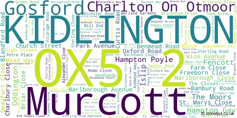
The largest settlement in the OX5 2 postal code is KIDLINGTON followed by Charlton On Otmoor, and Islip.
The OX5 2 Postcode shares a border with OX2 8 (OXFORD, Wolvercote, Wytham), OX3 9 (Headington, Beckley, Noke), OX5 3 (Kirtlington, Bletchingdon, Tackley), OX25 1 (Upper Arncott, Piddington, Blackthorn), OX25 2 (Ambrosden, Wendlebury, Merton), OX25 3 (Weston-on-the-Green, Little Chesterton), HP18 9 (Long Crendon, Brill, Oakley), OX5 1 (KIDLINGTON, Yarnton, Begbroke) and OX33 1 (Wheatley, Horspath, Horton-cum-Studley).
The sector is within the post town of KIDLINGTON.
OX5 2 is a postcode sector within the OX5 postcode district which is within the OX Oxford postcode area.
The Royal Mail delivery office for the OX5 2 postal sector is the Kidlington Delivery Office.
The area of the OX5 2 postcode sector is 16.02 square miles which is 41.49 square kilometres or 10,253.30 square acres.
The OX5 2 postcode sector is crossed by the M40 motorway.
The OX5 2 postcode sector is crossed by the A34 Major A road.
Waterways within the OX5 2 postcode sector include the River Cherwell, River Ray, Cherwell, Oxford Canal, New River Ray.

Map of the OX5 2 Postcode Sector
Explore the OX5 2 postcode sector by using our free interactive map.
| O | X | 5 | - | 2 | X | X |
| O | X | 5 | Space | 2 | Letter | Letter |
Official List of Streets
KIDLINGTON (86 Streets)
Gosford (3 Streets)
Charlton On Otmoor (14 Streets)
Hampton Poyle (4 Streets)
Islip (19 Streets)
Oddington (2 Streets)
Unofficial Streets or Alternative Spellings
Upper Arncott
MURCOTT ROAD BLACKBULL LANE BLETCHINGDON SPORTS AND SOCIAL BULLS LANE CHERRY TREES CHERWELL COURT CYDEL COURT EATON GATE FIELD ROAD FRANK COOK COURT GOSFORD BRIDGE GOSFORD HILL COURT KIDLINGTON ROUNDABOUT MANSMOOR ROAD NEW POND LANE NEWGATE ROAD PIGEONHOUSE LANE RAGNALLS LANE THE CHURE THE TOWN GREEN WATTS WAYKIDLINGTON
CHURCHILL ROAD LANGFORD LANE ROWLES WAYBletchingdon
OXFORD ROADShipton-on-Cherwell
BANBURY ROADWeather Forecast for OX5 2
Press Button to Show Forecast for Bicester
| Time Period | Icon | Description | Temperature | Rain Probability | Wind |
|---|---|---|---|---|---|
| 15:00 to 18:00 | Cloudy | 11.0°C (feels like 8.0°C) | 33.00% | N 13 mph | |
| 18:00 to 21:00 | Overcast | 10.0°C (feels like 8.0°C) | 9.00% | N 9 mph | |
| 21:00 to 00:00 | Cloudy | 7.0°C (feels like 5.0°C) | 4.00% | NNE 9 mph |
Press Button to Show Forecast for Bicester
| Time Period | Icon | Description | Temperature | Rain Probability | Wind |
|---|---|---|---|---|---|
| 00:00 to 03:00 | Clear night | 4.0°C (feels like 2.0°C) | 0.00% | N 7 mph | |
| 03:00 to 06:00 | Partly cloudy (night) | 3.0°C (feels like 1.0°C) | 1.00% | NNW 7 mph | |
| 06:00 to 09:00 | Sunny day | 4.0°C (feels like 1.0°C) | 0.00% | NNW 7 mph | |
| 09:00 to 12:00 | Sunny day | 8.0°C (feels like 5.0°C) | 1.00% | N 9 mph | |
| 12:00 to 15:00 | Cloudy | 10.0°C (feels like 8.0°C) | 4.00% | N 11 mph | |
| 15:00 to 18:00 | Cloudy | 11.0°C (feels like 9.0°C) | 5.00% | N 9 mph | |
| 18:00 to 21:00 | Cloudy | 10.0°C (feels like 8.0°C) | 5.00% | NNE 7 mph | |
| 21:00 to 00:00 | Cloudy | 7.0°C (feels like 5.0°C) | 5.00% | NE 4 mph |
Press Button to Show Forecast for Bicester
| Time Period | Icon | Description | Temperature | Rain Probability | Wind |
|---|---|---|---|---|---|
| 00:00 to 03:00 | Cloudy | 5.0°C (feels like 4.0°C) | 6.00% | NE 4 mph | |
| 03:00 to 06:00 | Overcast | 5.0°C (feels like 3.0°C) | 8.00% | N 4 mph | |
| 06:00 to 09:00 | Overcast | 5.0°C (feels like 3.0°C) | 9.00% | N 7 mph | |
| 09:00 to 12:00 | Overcast | 7.0°C (feels like 5.0°C) | 10.00% | NNE 9 mph | |
| 12:00 to 15:00 | Overcast | 9.0°C (feels like 6.0°C) | 10.00% | NNE 9 mph | |
| 15:00 to 18:00 | Overcast | 10.0°C (feels like 8.0°C) | 10.00% | NNE 9 mph | |
| 18:00 to 21:00 | Cloudy | 9.0°C (feels like 7.0°C) | 7.00% | NNE 9 mph | |
| 21:00 to 00:00 | Partly cloudy (night) | 6.0°C (feels like 4.0°C) | 3.00% | NE 7 mph |
Press Button to Show Forecast for Bicester
| Time Period | Icon | Description | Temperature | Rain Probability | Wind |
|---|---|---|---|---|---|
| 00:00 to 03:00 | Clear night | 4.0°C (feels like 1.0°C) | 2.00% | NNE 7 mph | |
| 03:00 to 06:00 | Partly cloudy (night) | 3.0°C (feels like 0.0°C) | 2.00% | N 4 mph | |
| 06:00 to 09:00 | Cloudy | 4.0°C (feels like 2.0°C) | 8.00% | N 4 mph | |
| 09:00 to 12:00 | Cloudy | 7.0°C (feels like 6.0°C) | 9.00% | NNE 4 mph | |
| 12:00 to 15:00 | Overcast | 8.0°C (feels like 6.0°C) | 24.00% | N 7 mph | |
| 15:00 to 18:00 | Light rain | 8.0°C (feels like 6.0°C) | 48.00% | NNW 7 mph | |
| 18:00 to 21:00 | Light rain | 8.0°C (feels like 6.0°C) | 54.00% | NNW 7 mph | |
| 21:00 to 00:00 | Light rain | 7.0°C (feels like 5.0°C) | 48.00% | NNW 4 mph |
Press Button to Show Forecast for Bicester
| Time Period | Icon | Description | Temperature | Rain Probability | Wind |
|---|---|---|---|---|---|
| 00:00 to 03:00 | Cloudy | 6.0°C (feels like 4.0°C) | 8.00% | NNE 4 mph | |
| 03:00 to 06:00 | Overcast | 5.0°C (feels like 3.0°C) | 17.00% | NNE 7 mph | |
| 06:00 to 09:00 | Cloudy | 6.0°C (feels like 3.0°C) | 5.00% | N 7 mph | |
| 09:00 to 12:00 | Cloudy | 8.0°C (feels like 6.0°C) | 7.00% | N 9 mph | |
| 12:00 to 15:00 | Overcast | 10.0°C (feels like 8.0°C) | 12.00% | N 9 mph | |
| 15:00 to 18:00 | Cloudy | 11.0°C (feels like 9.0°C) | 19.00% | N 9 mph | |
| 18:00 to 21:00 | Light rain shower (day) | 10.0°C (feels like 9.0°C) | 35.00% | NNE 9 mph | |
| 21:00 to 00:00 | Cloudy | 7.0°C (feels like 5.0°C) | 6.00% | NNE 7 mph |
Schools and Places of Education Within the OX5 2 Postcode Sector
Charlton-on-Otmoor Church of England Primary School
Voluntary controlled school
Fencott Road, Kidlington, Oxfordshire, OX5 2UT
Head: Mrs Nadia Gosling
Ofsted Rating: Good
Inspection: 2022-10-18 (549 days ago)
Website: Visit Charlton-on-Otmoor Church of England Primary School Website
Phone: 01865331239
Number of Pupils: 90
Dr South's Church of England Primary School
Academy converter
Bletchingdon Road, Kidlington, Oxfordshire, OX5 2TQ
Head: Huw Morgan/Helen Watson
Ofsted Rating: Good
Inspection: 2019-03-12 (1865 days ago)
Website: Visit Dr South's Church of England Primary School Website
Phone: 01865372323
Number of Pupils: 96
Edward Feild Primary School
Community school
Bicester Road, Kidlington, Oxfordshire, OX5 2LG
Head: Mr Scott Lewis
Ofsted Rating: Good
Inspection: 2022-07-06 (653 days ago)
Website: Visit Edward Feild Primary School Website
Phone: 01865372268
Number of Pupils: 280
Gosford Hill School
Academy converter
Oxford Road, Kidlington, Oxfordshire, OX5 2NT
Head: Mr Nigel Sellars
Ofsted Rating: Good
Inspection: 2022-02-16 (793 days ago)
Website: Visit Gosford Hill School Website
Phone: 01865374971
Number of Pupils: 838
North Kidlington Primary School
Community school
Benmead Road, Kidlington, Oxfordshire, OX5 2DA
Head: Ms Emilie Fidler
Ofsted Rating: Good
Inspection: 2018-11-20 (1977 days ago)
Website: Visit North Kidlington Primary School Website
Phone: 01865372607
Number of Pupils: 306

House Prices in the OX5 2 Postcode Sector
| Type of Property | 2018 Average | 2018 Sales | 2017 Average | 2017 Sales | 2016 Average | 2016 Sales | 2015 Average | 2015 Sales |
|---|---|---|---|---|---|---|---|---|
| Detached | £598,947 | 47 | £537,269 | 54 | £556,750 | 46 | £559,451 | 56 |
| Semi-Detached | £382,069 | 57 | £375,145 | 40 | £391,309 | 68 | £368,222 | 51 |
| Terraced | £312,663 | 16 | £349,787 | 19 | £320,000 | 19 | £323,747 | 18 |
| Flats | £217,500 | 20 | £221,482 | 31 | £207,765 | 17 | £187,961 | 29 |
Important Postcodes OX5 2 in the Postcode Sector
OX5 2AL is the postcode for Thornbury House, 40 The Moors
OX5 2BP is the postcode for Kidlington Library, 23 Oxford Road
OX5 2DA is the postcode for A BLOCK, North Kidlington School, Benmead Road, and B BLOCK, North Kidlington School, Benmead Road
OX5 2DU is the postcode for Oxfordshire Fire & Rescue Service, Headquarters, Sterling Road
OX5 2LG is the postcode for BLOCK A, Edward Field Primary School, Bicester Road, and Edward Field Primary School, Bicester Road
OX5 2NS is the postcode for Gosford Hill Medical Centre, 167 Oxford Road
OX5 2NT is the postcode for E BLOCK, Gosford Hill School, Oxford Road, B BLOCK, Gosford Hill School, Oxford Road, Gosford Hill School, Oxford Road, C & D BLOCK, Gosford Hill School, Oxford Road, A BLOCK, Gosford Hill School, Oxford Road, and D BLOCK, Gosford Hill School, Oxford Road
OX5 2NU is the postcode for Kidlington & Gosford Leisure Centre, Oxford Road
OX5 2NX is the postcode for Thames Valley Police, 169 Oxford Road, B BLOCK, Thames Valley Police, 169 Oxford Road, E BLOCK, Thames Valley Police, 169 Oxford Road, A/D BLOCKS, Thames Valley Police, 169 Oxford Road, and G BLOCK, Thames Valley Police, 169 Oxford Road
OX5 2TQ is the postcode for Islip Surgery, Bletchingdon Road
OX5 2UT is the postcode for Charlton on Otmoor Parochial School, Fencott Road
| The OX5 2 Sector is within these Local Authorities |
|
|---|---|
| The OX5 2 Sector is within these Counties |
|
| The OX5 2 Sector is within these Water Company Areas |
|