The PA3 postcode district is a postal district located in the PA Paisley postcode area with a population of 23,589 residents according to the 2011 Scotland Census.
The area of the PA3 postcode district is 6.79 square miles which is 17.59 square kilometres or 4,346.55 acres.
Currently, the PA3 district has about 696 postcode units spread across 14 geographic postcode sectors.
Given that each sector allows for 400 unique postcode combinations, the district has a capacity of 5,600 postcodes. With 696 postcodes already in use, this leaves 4904 units available.
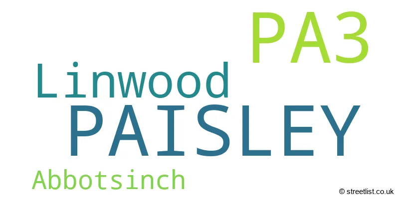
The largest settlement in the PA3 postal code is PAISLEY followed by Linwood, and Abbotsinch.
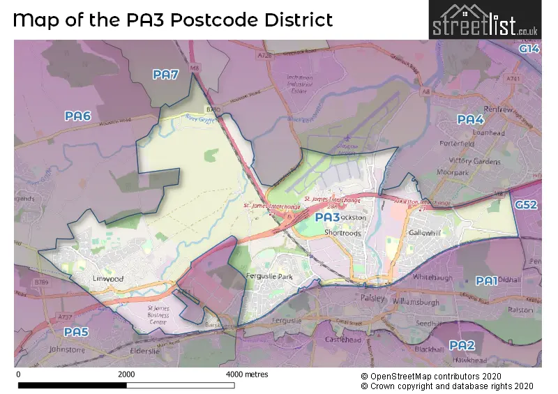
The PA3 Postcode shares a border with PA7 (BISHOPTON, Erskine Hospital), PA1 (PAISLEY), PA4 (RENFREW, Inchinnan), G52 (GLASGOW, Hillington Park), PA6 (Houston, Crosslee) and PA5 (JOHNSTONE, Elderslie, Brookfield).
The primary settlement in the PA3 postcode district is Paisley, located in the county of Renfrewshire in Scotland, with a count of 107. Other significant settlements include Abbotsinch, also in Renfrewshire, with a count of 15, and Linwood, also in Renfrewshire, with a count of 173. The main post town for the PA3 postcode district is Paisley, with the highest number of postcodes.
For the district PA3, we have data on 5 postcode sectors. Here's a breakdown: The sector PA3 1, covers Paisley in Renfrewshire. The sector PA3 2, covers Paisley and Abbotsinch in Renfrewshire. The sector PA3 3, covers Linwood in Renfrewshire. The sector PA3 4, covers Paisley in Renfrewshire. The sector PA3 9 is non-geographic. It's often designated for PO Boxes, large organisations, or special services.

Map of the PA3 Postcode District
Explore the PA3 postcode district by using our free interactive map.
When it comes to local government, postal geography often disregards political borders. However, for a breakdown in the PA3 District: the district mostly encompasses the Renfrewshire area with a total of 704 postcodes.
Weather Forecast for PA3
Press Button to Show Forecast for St Mirren Fc
| Time Period | Icon | Description | Temperature | Rain Probability | Wind |
|---|---|---|---|---|---|
| 00:00 to 03:00 | Clear night | 7.0°C (feels like 6.0°C) | 0.00% | E 4 mph | |
| 03:00 to 06:00 | Clear night | 5.0°C (feels like 4.0°C) | 0.00% | NE 4 mph | |
| 06:00 to 09:00 | Sunny day | 5.0°C (feels like 3.0°C) | 0.00% | NE 4 mph | |
| 09:00 to 12:00 | Sunny day | 7.0°C (feels like 6.0°C) | 0.00% | S 2 mph | |
| 12:00 to 15:00 | Sunny day | 10.0°C (feels like 9.0°C) | 0.00% | N 2 mph | |
| 15:00 to 18:00 | Sunny day | 12.0°C (feels like 11.0°C) | 0.00% | WNW 7 mph | |
| 18:00 to 21:00 | Sunny day | 11.0°C (feels like 9.0°C) | 0.00% | WNW 11 mph | |
| 21:00 to 00:00 | Cloudy | 8.0°C (feels like 6.0°C) | 3.00% | WNW 9 mph |
Press Button to Show Forecast for St Mirren Fc
| Time Period | Icon | Description | Temperature | Rain Probability | Wind |
|---|---|---|---|---|---|
| 00:00 to 03:00 | Partly cloudy (night) | 7.0°C (feels like 5.0°C) | 1.00% | WNW 7 mph | |
| 03:00 to 06:00 | Partly cloudy (night) | 6.0°C (feels like 4.0°C) | 1.00% | WNW 7 mph | |
| 06:00 to 09:00 | Sunny day | 6.0°C (feels like 4.0°C) | 1.00% | NW 4 mph | |
| 09:00 to 12:00 | Overcast | 8.0°C (feels like 6.0°C) | 9.00% | NNW 7 mph | |
| 12:00 to 15:00 | Cloudy | 9.0°C (feels like 8.0°C) | 8.00% | NNE 7 mph | |
| 15:00 to 18:00 | Cloudy | 10.0°C (feels like 8.0°C) | 7.00% | NE 7 mph | |
| 18:00 to 21:00 | Cloudy | 9.0°C (feels like 7.0°C) | 7.00% | E 7 mph | |
| 21:00 to 00:00 | Cloudy | 7.0°C (feels like 4.0°C) | 7.00% | ENE 7 mph |
Press Button to Show Forecast for St Mirren Fc
| Time Period | Icon | Description | Temperature | Rain Probability | Wind |
|---|---|---|---|---|---|
| 00:00 to 03:00 | Cloudy | 5.0°C (feels like 3.0°C) | 7.00% | ENE 7 mph | |
| 03:00 to 06:00 | Cloudy | 4.0°C (feels like 2.0°C) | 6.00% | ENE 4 mph | |
| 06:00 to 09:00 | Cloudy | 4.0°C (feels like 2.0°C) | 9.00% | NE 4 mph | |
| 09:00 to 12:00 | Cloudy | 7.0°C (feels like 4.0°C) | 10.00% | ENE 7 mph | |
| 12:00 to 15:00 | Cloudy | 8.0°C (feels like 6.0°C) | 11.00% | E 7 mph | |
| 15:00 to 18:00 | Cloudy | 9.0°C (feels like 8.0°C) | 11.00% | ENE 7 mph | |
| 18:00 to 21:00 | Cloudy | 8.0°C (feels like 7.0°C) | 12.00% | ENE 7 mph | |
| 21:00 to 00:00 | Light rain shower (night) | 6.0°C (feels like 5.0°C) | 30.00% | ENE 4 mph |
Press Button to Show Forecast for St Mirren Fc
| Time Period | Icon | Description | Temperature | Rain Probability | Wind |
|---|---|---|---|---|---|
| 00:00 to 03:00 | Cloudy | 5.0°C (feels like 3.0°C) | 11.00% | NE 4 mph | |
| 03:00 to 06:00 | Cloudy | 4.0°C (feels like 2.0°C) | 18.00% | NE 4 mph | |
| 06:00 to 09:00 | Cloudy | 4.0°C (feels like 3.0°C) | 11.00% | ENE 4 mph | |
| 09:00 to 12:00 | Light rain shower (day) | 7.0°C (feels like 5.0°C) | 30.00% | ENE 7 mph | |
| 12:00 to 15:00 | Cloudy | 10.0°C (feels like 8.0°C) | 25.00% | E 7 mph | |
| 15:00 to 18:00 | Light rain | 10.0°C (feels like 8.0°C) | 49.00% | E 7 mph | |
| 18:00 to 21:00 | Light rain shower (day) | 9.0°C (feels like 8.0°C) | 40.00% | ENE 7 mph | |
| 21:00 to 00:00 | Cloudy | 8.0°C (feels like 6.0°C) | 9.00% | ENE 7 mph |
Where is the PA3 Postcode District?
The postcode district PA3 is located in Paisley, a town in Scotland. It is near several other towns, including Renfrew, Kirkliston, Erskine, Bishopton, Edinburgh, and Bridge of Weir. The distance from PA3 to London is approximately 349.17 miles.
The district is within the post town of PAISLEY.
The sector has postcodes within the nation of Scotland.
The PA3 Postcode District is in the Inverclyde, East Renfrewshire and Renfrewshire region of West Central Scotland within the Scotland.
Postcode Sectors within the PA3 District
| Postcode Sector | Delivery Office |
|---|---|
| PA3 1 | Paisley Delivery Office |
| PA3 2 | Paisley Delivery Office |
| PA3 3 | Paisley Delivery Office |
| PA3 4 | Paisley Delivery Office |
| P | A | 3 | - | X | X | X |
| P | A | 3 | Space | Numeric | Letter | Letter |
Current Monthly Rental Prices
| # Bedrooms | Min Price | Max Price | Avg Price |
|---|---|---|---|
| 1 | £550 | £550 | £550 |
| 2 | £550 | £2,100 | £1,051 |
| 3 | £850 | £875 | £863 |
Current House Prices
| # Bedrooms | Min Price | Max Price | Avg Price |
|---|---|---|---|
| 1 | £45,000 | £60,000 | £49,250 |
| 2 | £45,000 | £130,000 | £76,727 |
| 3 | £44,995 | £235,000 | £154,500 |
| 4 | £110,000 | £110,000 | £110,000 |
Estate Agents who Operate in the PA3 District
| Logo | Name | Brand Name | Address | Contact Number | Total Properties |
|---|---|---|---|---|---|
 | Glasgow | Let Property Sales & Management | 10 Victoria Circus, Glasgow, G12 9JY | 0141 673 7973 | 4 |
 | Renfrewshire | Patch Property | 8 Gordon Street Paisley PA1 1XE | 0141 673 5672 | 3 |
 | Paisley | Castle Residential | 63 Causeyside Street, Paisley PA1 1YT | 0141 673 4224 | 2 |
 | Paisley | Slater Hogg & Howison | 17-19 Gauze Street Paisley PA1 1ES | 0141 673 4251 | 2 |
 | Paisley | Allen & Harris | 16 Causeyside Street, Paisley, Scotland, PA1 1UN | 0141 673 3314 | 2 |