The PE9 2 postcode sector lies where the three counties of Cambridgeshire, Lincolnshire, and Rutland meet.
Did you know? According to the 2021 Census, the PE9 2 postcode sector is home to a bustling 10,029 residents!
Given that each sector allows for 400 unique postcode combinations. Letters C, I, K, M, O and V are not allowed in the last two letters of a postcode. With 340 postcodes already in use, this leaves 60 units available.
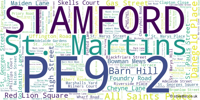
The largest settlements in the PE9 2 postal code are STAMFORD and St. Martins.
The PE9 2 Postcode shares a border with PE9 1 (STAMFORD), PE9 3 (Ketton, Easton On The Hill, Barnack) and PE9 4 (Tallington, Ryhall, Great Casterton).
The sector is within the post town of STAMFORD.
PE9 2 is a postcode sector within the PE9 postcode district which is within the PE Peterborough postcode area.
The Royal Mail delivery office for the PE9 2 postal sector is the Stamford Delivery Office.
The area of the PE9 2 postcode sector is 1.66 square miles which is 4.29 square kilometres or 1,060.81 square acres.
The PE9 2 postcode sector is crossed by the A1 Major A road.
Waterways within the PE9 2 postcode sector include the River Welland.

Map of the PE9 2 Postcode Sector
Explore the PE9 2 postcode sector by using our free interactive map.
| P | E | 9 | - | 2 | X | X |
| P | E | 9 | Space | 2 | Letter | Letter |
Official List of Streets
STAMFORD (203 Streets)
Unofficial Streets or Alternative Spellings
STAMFORD
BANKS CRESCENT BRAMBLE GROVE BURGESS ROAD COLLINS AVENUE EAST STREET IRONMONGER STREET LITTLE CASTERTON ROAD LONDON ROAD PRIMROSE WAY RADCLIFFE ROAD RED LION STREET STAMFORD WALK STAR LANE WAVERLEY GARDENS WELLINGTON LANEWothorpe
KETTERING ROADTinwell
EMPINGHAM ROADLittle Casterton
OLD GREAT NORTH ROADColsterworth
GREAT NORTH ROADWeather Forecast for PE9 2
Press Button to Show Forecast for Stamford
| Time Period | Icon | Description | Temperature | Rain Probability | Wind |
|---|---|---|---|---|---|
| 00:00 to 03:00 | Clear night | 5.0°C (feels like 2.0°C) | 0.00% | NNW 9 mph | |
| 03:00 to 06:00 | Cloudy | 4.0°C (feels like 1.0°C) | 3.00% | NW 9 mph | |
| 06:00 to 09:00 | Partly cloudy (day) | 5.0°C (feels like 1.0°C) | 1.00% | NNW 11 mph | |
| 09:00 to 12:00 | Cloudy | 7.0°C (feels like 4.0°C) | 8.00% | N 13 mph | |
| 12:00 to 15:00 | Overcast | 9.0°C (feels like 6.0°C) | 8.00% | N 11 mph | |
| 15:00 to 18:00 | Cloudy | 9.0°C (feels like 6.0°C) | 8.00% | N 11 mph | |
| 18:00 to 21:00 | Sunny day | 8.0°C (feels like 6.0°C) | 2.00% | NNE 7 mph | |
| 21:00 to 00:00 | Cloudy | 5.0°C (feels like 4.0°C) | 3.00% | ENE 4 mph |
Press Button to Show Forecast for Stamford
| Time Period | Icon | Description | Temperature | Rain Probability | Wind |
|---|---|---|---|---|---|
| 00:00 to 03:00 | Cloudy | 4.0°C (feels like 2.0°C) | 3.00% | WSW 7 mph | |
| 03:00 to 06:00 | Cloudy | 4.0°C (feels like 1.0°C) | 4.00% | WSW 7 mph | |
| 06:00 to 09:00 | Partly cloudy (day) | 5.0°C (feels like 2.0°C) | 2.00% | W 9 mph | |
| 09:00 to 12:00 | Cloudy | 8.0°C (feels like 5.0°C) | 8.00% | WNW 11 mph | |
| 12:00 to 15:00 | Cloudy | 10.0°C (feels like 8.0°C) | 9.00% | WNW 11 mph | |
| 15:00 to 18:00 | Cloudy | 10.0°C (feels like 8.0°C) | 8.00% | NNW 9 mph | |
| 18:00 to 21:00 | Cloudy | 8.0°C (feels like 6.0°C) | 8.00% | NNE 7 mph | |
| 21:00 to 00:00 | Partly cloudy (night) | 5.0°C (feels like 4.0°C) | 2.00% | NE 4 mph |
Press Button to Show Forecast for Stamford
| Time Period | Icon | Description | Temperature | Rain Probability | Wind |
|---|---|---|---|---|---|
| 00:00 to 03:00 | Partly cloudy (night) | 4.0°C (feels like 2.0°C) | 1.00% | NE 4 mph | |
| 03:00 to 06:00 | Partly cloudy (night) | 3.0°C (feels like 1.0°C) | 2.00% | NNE 4 mph | |
| 06:00 to 09:00 | Partly cloudy (day) | 4.0°C (feels like 2.0°C) | 2.00% | NE 4 mph | |
| 09:00 to 12:00 | Cloudy | 8.0°C (feels like 6.0°C) | 8.00% | E 7 mph | |
| 12:00 to 15:00 | Cloudy | 10.0°C (feels like 8.0°C) | 10.00% | E 7 mph | |
| 15:00 to 18:00 | Cloudy | 11.0°C (feels like 9.0°C) | 12.00% | E 9 mph | |
| 18:00 to 21:00 | Cloudy | 9.0°C (feels like 7.0°C) | 9.00% | E 9 mph | |
| 21:00 to 00:00 | Cloudy | 7.0°C (feels like 5.0°C) | 9.00% | E 9 mph |
Press Button to Show Forecast for Stamford
| Time Period | Icon | Description | Temperature | Rain Probability | Wind |
|---|---|---|---|---|---|
| 00:00 to 03:00 | Cloudy | 6.0°C (feels like 4.0°C) | 14.00% | E 7 mph | |
| 03:00 to 06:00 | Cloudy | 6.0°C (feels like 3.0°C) | 15.00% | E 7 mph | |
| 06:00 to 09:00 | Overcast | 6.0°C (feels like 4.0°C) | 17.00% | E 7 mph | |
| 09:00 to 12:00 | Cloudy | 9.0°C (feels like 7.0°C) | 15.00% | E 9 mph | |
| 12:00 to 15:00 | Cloudy | 12.0°C (feels like 10.0°C) | 14.00% | ESE 9 mph | |
| 15:00 to 18:00 | Light rain | 12.0°C (feels like 10.0°C) | 43.00% | E 11 mph | |
| 18:00 to 21:00 | Light rain shower (day) | 11.0°C (feels like 9.0°C) | 33.00% | NE 9 mph | |
| 21:00 to 00:00 | Cloudy | 9.0°C (feels like 7.0°C) | 15.00% | E 9 mph |
Schools and Places of Education Within the PE9 2 Postcode Sector
Malcolm Sargent Primary School
Academy converter
Empingham Road, Stamford, Lincolnshire, PE9 2SR
Head: Mr Tristan Revell
Ofsted Rating: Good
Inspection: 2019-10-30 (1638 days ago)
Website: Visit Malcolm Sargent Primary School Website
Phone: 01780756056
Number of Pupils: 656
Stamford St Gilberts Church of England Primary School
Academy converter
Foundry Road, Stamford, Lincolnshire, PE9 2PP
Head: Ms Frances Dicker
Ofsted Rating: Good
Inspection: 2021-07-08 (1021 days ago)
Website: Visit Stamford St Gilberts Church of England Primary School Website
Phone: 01780762400
Number of Pupils: 302

House Prices in the PE9 2 Postcode Sector
| Type of Property | 2018 Average | 2018 Sales | 2017 Average | 2017 Sales | 2016 Average | 2016 Sales | 2015 Average | 2015 Sales |
|---|---|---|---|---|---|---|---|---|
| Detached | £452,700 | 98 | £401,736 | 92 | £406,175 | 75 | £364,452 | 64 |
| Semi-Detached | £331,744 | 70 | £276,071 | 78 | £260,576 | 84 | £251,589 | 67 |
| Terraced | £415,236 | 79 | £406,086 | 85 | £351,139 | 75 | £267,065 | 75 |
| Flats | £235,634 | 22 | £195,543 | 40 | £218,530 | 55 | £181,000 | 26 |
Important Postcodes PE9 2 in the Postcode Sector
PE9 2BB is the postcode for Lincolnshire County Council, Stamford Library, High Street
PE9 2DB is the postcode for Jobcentre Plus, 13 St. Johns Street
PE9 2DL is the postcode for Stamford Arts Centre, 27 St Marys Street, and Tourist Information Centre, Stamford Arts Centre, 27 St. Marys Street
PE9 2EY is the postcode for Royal Mail Group Property, Post Office, All Saints Place
PE9 2PY is the postcode for St. Gilberts School, Foundry Road
PE9 2SR is the postcode for BLOCK 5, Malcolm Sargent Primary School, Empingham Road, and Malcolm Sargent Primary School, Empingham Road
| The PE9 2 Sector is within these Local Authorities |
|
|---|---|
| The PE9 2 Sector is within these Counties |
|
| The PE9 2 Sector is within these Water Company Areas |
|