RG42 3QZ is a postal code used within the United Kingdom for delivering mail.
Postcodes are made up of two parts. The part before the space (RG42) is called the outward code. The part after the space (3QZ) is called the inward code. The letters C, I, K, M, O and V are not allowed in the inward code. In addition to the inward and outward code, the postcode can be broken up into four parts:
- Postal Area. In our case RG which means Reading.
- Postal District. In our case RG42.
- Postal Sector. In our case RG42 3.
- Postcode Unit. The last two letters. In our case QZ.
The regional mail center for the post area RG is the South West Distribution Centre, which is located at Western Approach, Distribution Park, Severn Beach, BRISTOL, BS35 4GG.
The final port of call for any post addressed to the RG42 3QZ postcode is the local delivery office (DO) which is BRACKNELL DO. Here the post will be sorted ready for delivery.
The properties in the RG42 3QZ postcode have the street address of Westmorland Drive
A close-knit community! The 2021 Census indicates that only 19 individuals call the RG42 3QZ postcode their home.
It is situated within the post town of BRACKNELL within the old postal county of Berkshire.
RG42 3QZ is within the town of Bracknell.
The RG42 3QZ postcode area is composed of 100% residential properties, 0% commercial properties, and 0% public properties.
According to our data. Most dwellings in RG42 3QZ are houses. Of these houses, most are detached.
Most properties in RG42 3QZ are owned by the occupiers with the rest being unknown tenure.

Interactive Mapping Showing UPRNs within the RG42 3QZ Postcode Boundaries
Use the search box to search for other postcodes or places.
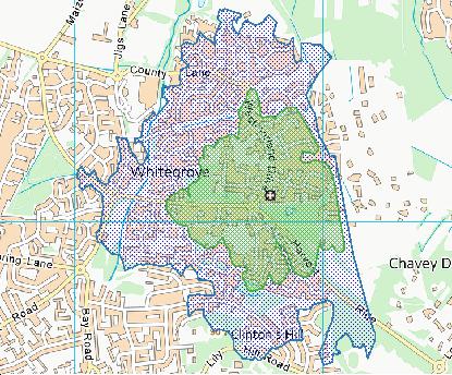
Map of the RG42 3QZ Postcode

| Property Type | Percentage |
|---|---|
| Residential | 100% |
| Commercial | 0% |
| Public | 0% |
Telephone Area Code for RG42 3QZ
The telephone area code for RG42 3QZ is 01344 Bracknell.
Map Coordinates for RG42 3QZ
| Latitude | 51.4230203394 |
|---|---|
| Longitude | -0.724407969975 |
Ordnance Survey Maps for RG42 3QZ
| Map Series | Amazon | Ordnance Survey |
| Explorer 1:25,000 160 Windsor, Weybridge & Bracknell | Check Price on Amazon | Buy Direct from the Ordnance Survey |
| Landranger 1:50,000 175 Reading & Windsor | Check Price on Amazon | Buy Direct from the Ordnance Survey |
How far is the RG42 3QZ Postcode from the Centre of London?
The RG42 3QZ postcode is 26.42 miles as the crow flies from the centre of London (Original Site of Charing Cross).
The distance by road is 30.86 miles. Taking the following route.
Harvest Ride (0.60 miles), B3017 (0.36 miles), A329 (4.96 miles), A30 (3.16 miles), A308 (0.05 miles), A30 (0.32 miles), M25 (4.06 miles), M4 (9.10 miles), A4 (4.46 miles).
Weather Forecast for RG42 3QZ
Tue 23rd Apr
Press Button to Show Forecast for Bracknell
| Time Period | Icon | Description | Temperature | Rain Probability | Wind |
|---|---|---|---|---|---|
| 06:00 to 09:00 | Light rain | 6.0°C (feels like 5.0°C) | 51.00% | NW 2 mph | |
| 09:00 to 12:00 | Light rain | 7.0°C (feels like 5.0°C) | 50.00% | NW 4 mph | |
| 12:00 to 15:00 | Overcast | 8.0°C (feels like 6.0°C) | 11.00% | NNW 7 mph | |
| 15:00 to 18:00 | Light rain | 10.0°C (feels like 8.0°C) | 44.00% | N 9 mph | |
| 18:00 to 21:00 | Partly cloudy (day) | 10.0°C (feels like 9.0°C) | 5.00% | N 7 mph | |
| 21:00 to 00:00 | Cloudy | 7.0°C (feels like 5.0°C) | 5.00% | NE 4 mph |
Wed 24th Apr
Press Button to Show Forecast for Bracknell
| Time Period | Icon | Description | Temperature | Rain Probability | Wind |
|---|---|---|---|---|---|
| 00:00 to 03:00 | Cloudy | 6.0°C (feels like 5.0°C) | 5.00% | NNW 4 mph | |
| 03:00 to 06:00 | Overcast | 5.0°C (feels like 3.0°C) | 8.00% | NNW 4 mph | |
| 06:00 to 09:00 | Overcast | 5.0°C (feels like 3.0°C) | 9.00% | NNW 7 mph | |
| 09:00 to 12:00 | Cloudy | 7.0°C (feels like 4.0°C) | 6.00% | NNW 9 mph | |
| 12:00 to 15:00 | Overcast | 9.0°C (feels like 6.0°C) | 8.00% | NNW 9 mph | |
| 15:00 to 18:00 | Overcast | 10.0°C (feels like 7.0°C) | 9.00% | NNW 11 mph | |
| 18:00 to 21:00 | Partly cloudy (day) | 8.0°C (feels like 6.0°C) | 4.00% | N 9 mph | |
| 21:00 to 00:00 | Clear night | 5.0°C (feels like 3.0°C) | 2.00% | N 7 mph |
Thu 25th Apr
Press Button to Show Forecast for Bracknell
| Time Period | Icon | Description | Temperature | Rain Probability | Wind |
|---|---|---|---|---|---|
| 00:00 to 03:00 | Partly cloudy (night) | 4.0°C (feels like 2.0°C) | 2.00% | N 7 mph | |
| 03:00 to 06:00 | Partly cloudy (night) | 3.0°C (feels like 1.0°C) | 1.00% | NW 7 mph | |
| 06:00 to 09:00 | Cloudy | 4.0°C (feels like 1.0°C) | 4.00% | NNW 7 mph | |
| 09:00 to 12:00 | Cloudy | 7.0°C (feels like 5.0°C) | 5.00% | NNW 9 mph | |
| 12:00 to 15:00 | Overcast | 10.0°C (feels like 8.0°C) | 11.00% | NNW 7 mph | |
| 15:00 to 18:00 | Cloudy | 10.0°C (feels like 9.0°C) | 8.00% | NW 7 mph | |
| 18:00 to 21:00 | Cloudy | 9.0°C (feels like 8.0°C) | 7.00% | NNW 7 mph | |
| 21:00 to 00:00 | Cloudy | 7.0°C (feels like 5.0°C) | 6.00% | N 4 mph |
Fri 26th Apr
Press Button to Show Forecast for Bracknell
| Time Period | Icon | Description | Temperature | Rain Probability | Wind |
|---|---|---|---|---|---|
| 00:00 to 03:00 | Partly cloudy (night) | 5.0°C (feels like 3.0°C) | 2.00% | NNE 4 mph | |
| 03:00 to 06:00 | Cloudy | 4.0°C (feels like 3.0°C) | 5.00% | WNW 4 mph | |
| 06:00 to 09:00 | Cloudy | 5.0°C (feels like 4.0°C) | 6.00% | WNW 4 mph | |
| 09:00 to 12:00 | Cloudy | 9.0°C (feels like 8.0°C) | 6.00% | N 4 mph | |
| 12:00 to 15:00 | Overcast | 11.0°C (feels like 9.0°C) | 12.00% | SSE 7 mph | |
| 15:00 to 18:00 | Overcast | 11.0°C (feels like 10.0°C) | 13.00% | WSW 7 mph | |
| 18:00 to 21:00 | Cloudy | 11.0°C (feels like 9.0°C) | 12.00% | SW 7 mph | |
| 21:00 to 00:00 | Cloudy | 8.0°C (feels like 6.0°C) | 7.00% | S 7 mph |
What are the Broadband Speeds like in the RG42 3QZ Postcode?
Download Speeds For RG42 3QZ

| Average Mbps | 265.900 |
|---|---|
| Median Mbps | 107.000 |
| Maximum Mbps | 1096.000 |
RG42 3QZ has an average download speed of 265.9 Megabits per second (Mbps).
18 other postcode units have the same broadband speed.
99% of postcodes (1,173,174) have slower broadband speeds.
1% of postcodes (11,449) have faster broadband speeds.
Upload Speeds For RG42 3QZ
| Average Mbps | 18.400 |
|---|---|
| Median Mbps | 10.000 |
| Maximum Mbps | 49.000 |
RG42 3QZ has an average upload speed of 18.4 Megabits per second (Mbps).
4,447 other postcode units have the same upload speed.
89% of postcodes (1,057,222) have slower upload speeds.
10% of postcodes (122,972) have faster upload speeds.
Schools within a five minute drive of RG42 3QZ Postcode
England Primary Schools
Winkfield St Mary's CofE Primary School
Address: Winkfield St Mary's CofE Primary School, Winkfield Row, Bracknell, Berkshire, RG42 6NH
Distance: 0.90 miles
Contact: 01344882422
Whitegrove Primary School
Address: Whitegrove Primary School, Westmorland Drive, Warfield, Bracknell, Berkshire, RG42 3QS
Distance: 0.12 miles
Contact: 01344861020
Harmans Water Primary School
Address: Harmans Water Primary School, Wellington Drive, Harmans Water, Bracknell, Berkshire, RG12 9NE
Distance: 1.46 miles
Contact: 01344422196
Holly Spring Primary School
Address: Holly Spring Primary School, Lily Hill Road, Bracknell, Berkshire, RG12 2SW
Distance: 0.61 miles
Contact: 01344483920
Holly Spring Junior School
Address: Holly Spring Junior School, Lily Hill Road, Bullbrook, Bracknell, Berkshire, RG12 2SW
Distance: 0.61 miles
Contact:
Sandy Lane Primary School
Address: Sandy Lane Primary School, Sandy Lane, Bracknell, Berkshire, RG12 2JG
Distance: 0.98 miles
Contact:
St Joseph's Catholic Primary School, Bracknell
Address: St Joseph's Catholic Primary School, Bracknell, Gipsy Lane, Bracknell Forest, Berkshire, RG12 9AP
Distance: 0.92 miles
Contact: 01344425246
Warfield Church of England Primary School
Address: Warfield Church of England Primary School, Sopwith Road, Bracknell, RG42 6BR
Distance: 1.33 miles
Contact: 01344862074
Meadow Vale Primary School
Address: Meadow Vale Primary School, Moordale Avenue, Bracknell, Berkshire, RG42 1SY
Distance: 1.90 miles
Contact: 01344421046
England Secondary Schools
The Brakenhale School
Address: The Brakenhale School, Rectory Lane, Bracknell, Berkshire, RG12 7BA
Distance: 1.61 miles
Contact:
Garth Hill College
Address: Garth Hill College, Bull Lane, Bracknell, Berkshire, RG42 2AD
Distance: 1.13 miles
Contact: 01344421122
The Brakenhale School
Address: The Brakenhale School, Rectory Lane, Bracknell, Berkshire, RG12 7BA
Distance: 1.61 miles
Contact: 01344423041
Ranelagh School
Address: Ranelagh School, Ranelagh Drive, Bracknell, Berkshire, RG12 9DA
Distance: 1.23 miles
Contact: 01344421233
Nearest Dentists
Dentists near RG42 3QZ
BLUEBERRY DENTAL SURGERY LIMITED
Address: 68 DEEPFIELD ROAD, BRACKNELL, RG12 2NX
Distance: 0.66 miles
Contact: :
PARK HOUSE DENTAL SURGERY
Address: 20 PARK ROAD, BRACKNELL, BERKSHIRE, RG12 2LU
Distance: 0.74 miles
Contact: :
DENTAL SURGERY
Address: 11-13 HIGH STREET, BRACKNELL, BERKSHIRE, RG12 1DL
Distance: 1.13 miles
Contact: :
COMMUNITY DENTAL CLINIC
Address: SKIMPED HILL HEALTH CENTRE, SKIMPED HILL LANE, BRACKNELL, BERKSHIRE, RG12 1LH
Distance: 1.29 miles
Contact: :
ALSTON HOUSE DENTAL SURGERY
Address: 5 ALSTON HOUSE, MARKET STREET, BRACKNELL, RG12 1FA
Distance: 1.33 miles
Contact: :
UNIT 6 ALSTON HOUSE
Address: MARKET STREET, BRACKNELL, BERKSHIRE, RG12 1JG
Distance: 1.33 miles
Contact: :
Nearest Chemists
Pharmacies near RG42 3QZ
TESCO INSTORE PHARMACY
Address: JIGS LANE, WARFIELD, BRACKNELL, BERKSHIRE, RG42 3JP
Distance: 0.37 miles
Contact: tel: 01344 658449
BULLBROOK PHARMACY
Address: 3 BULLBROOK ROW, BRACKNELL, BERKSHIRE, RG12 2NL
Distance: 0.60 miles
Contact: tel: 01344 454012
BOOTS
Address: THE LEXICON SHOPPING CTR, 19-23 BRACCAN WALK, BRACKNELL, BERKSHIRE, RG12 1BE
Distance: 1.16 miles
Contact: tel: 01344 303844
SUPERDRUG PHARMACY
Address: 13 CHARLES SQUARE, BRACKNELL, BERKSHIRE, RG12 1DF
Distance: 1.20 miles
Contact: :
BOOTS
Address: MOSS PHARMACY, 5 THE SQUARE, BRACKNELL, BERKSHIRE, RG12 9LP
Distance: 1.21 miles
Contact: tel: 01344 425599
PRIESTWOOD PHARMACY
Address: 7 PRIESTWOOD SQUARE, BRACKNELL, RG42 1UD
Distance: 1.73 miles
Contact: tel: 01344 306357
Nearest Opticians
Opticians near RG42 3QZ
BOOTS OPTICIANS - BRACKNELL
Address: 19-23 BRACCAN WALK, BRACKNELL, BERKSHIRE, RG12 1BE
Distance: 1.16 miles
Contact: :
BRACKNELL V.E LTD
Address: THE LEXICON CENTRE, 26 BRACCAN WALK, BRACKNELL, BERKSHIRE, RG12 1BE
Distance: 1.16 miles
Contact: :
INSIGHT OPTICIANS (BRACKNELL)
Address: 15B PRINCESS SQUARE, BRACKNELL, BERKSHIRE, RG12 1LS
Distance: 1.25 miles
Contact: :
SPECSAVERS (BRACKNELL)
Address: 18 PRINCESS SQUARE, BRACKNELL, BERKSHIRE, RG12 1LS
Distance: 1.25 miles
Contact: :
LONDON 4 DOMICILIARY SPECSAVERS LIMITED
Address: VENTURE HOUSE, 2 ARLINGTON SQUARE, DOWNSHIRE WAY, BRACKNELL, RG12 1WA
Distance: 1.53 miles
Contact: :
BOOTS OPTICIANS (ASCOT)
Address: 61 HIGH STREET, ASCOT, BERKSHIRE, SL5 7HP
Distance: 2.40 miles
Contact: :
Nearest GP Surgeries
Doctors near RG42 3QZ
THE GAINSBOROUGH PRACTICE
Address: 1 COUNTY LANE, WARFIELD, BRACKNELL, RG42 3JP
Distance: 0.37 miles
Contact: :
DR. MACHRAY
Address: THE WATERFIELD PRACTICE, 1 COUNTY LANE, WHITEGROVE, BRACKNELL, BERKSHIRE, RG42 3JP
Distance: 0.37 miles
Contact: tel: 01344 869771
THE GAINSBOROUGH PRACTICE
Address: 1 COUNTY LANE, WARFIELD, BRACKNELL, BERKSHIRE, RG42 3JP
Distance: 0.37 miles
Contact: tel: 01344 428742
THE WATERFIELD PRACTICE
Address: RALPHS RIDE, HARMANS WATER, BRACKNELL, BERKSHIRE, RG12 9LH
Distance: 1.04 miles
Contact: tel: 01344 454626
FOREST HEALTH GROUP
Address: BOUNDARY HOUSE SURGERY, BOUNDARY HOUSE, MOUNT LANE, BRACKNELL, BERKSHIRE, RG12 9PG
Distance: 1.12 miles
Contact: tel: 01344 421364
BALFRON PRACTICE
Address: SKIMPED HILL HEALTH CENTRE, SKIMPED HILL LANE, BRACKNELL, BERKSHIRE, RG12 1LH
Distance: 1.29 miles
Contact: :
Transport Links near RG42 3QZ
Train Stations
Nearest stations for postcode: RG42 3QZ
- Martins Heron
Martins Heron station, Whitton Road, Martins Heron, Berkshire, RG12 9TZDistance: 1.60 milesDriving Time: 2.74 minutes - Bracknell
Bracknell station, Market Street, Bracknell, Berkshire, RG12 1HXDistance: 1.60 milesDriving Time: 2.94 minutes - Ascot (Berks)
Ascot (Berkshire) station, Station Hill, Ascot, Berkshire, SL5 9EGDistance: 3.31 milesDriving Time: 5.54 minutes - Sunningdale
Sunningdale station, London Road, Sunningdale, Berkshire, SL5 0ELDistance: 5.82 milesDriving Time: 10.67 minutes - Bagshot
Bagshot station, Station Road, Bagshot, Surrey, GU19 5ASDistance: 6.14 milesDriving Time: 8.31 minutes
Distances represent the quickest route by car.
Motorway Junctions near RG42 3QZ
Train Stations
Motorway Junctions near RG42 3QZ
Distances represent the quickest route by car.
Who are my Elected Representatives in the RG42 3QZ Postcode?
| Westminster Constituency | Windsor Co Const |
|---|---|
| Member or Parliament |  |
| Contact Details | Contact Adam Afriyie |
| Political Party | Conservative |
What Council is the RG42 3QZ Postcode in?
The Council for this Postcode is Bracknell Forest Council, who are a Unitary authority. This means that they are responsible for providing education, libraries and maintaining highways as well as normal council duties such as council tax, rubbish collection, housing, environmental health and planning.
You can visit the website for Bracknell Forest at the following link Bracknell Forest.How much is the Council Tax?
Bracknell Forest Council is responsible for collecting council tax. This will vary depending on which council tax band the property falls within. You can check the council tax band at the gov.uk website.
Once you know the council tax band you can view how much Bracknell Forest charge for that band by visiting the The Council Tax section of their website.
Planning Applications
When moving house to a new post code it is worth checking out what will be built in the neighbourhood.
Few people want to live next door to a building site, have their garden overlooked or have the views from their property ruined.
Visit the local planning department and search for planning applications in this postcode granted within the last three years or still awaiting a decision. This will give an indication of what could still be built.
Where can I find out where the nearest Library to the RG42 3QZ Postcode is?
Libraries are the responsibility of Bracknell Forest council
Visit the link for more information. Please note that some councils outsource library services to private companies and community groups ran by volunteers.
Libraries | Bracknell Forest CouncilHouse Sales in RG42 3QZ
| Year | High | Low | Average | Sales |
|---|---|---|---|---|
| 2013 | £379,000 | £379,000 | £379,000 | 1 |
| 2017 | £560,000 | £615,000 | £587,500 | 2 |
| 2022 | £620,000 | £620,000 | £620,000 | 1 |
Contains HM Land Registry data © Crown copyright and database right 2024. This data is licensed under the Open Government Licence v3.0.
Postcodes near the RG42 3QZ Postcode
What Popular Supermarkets are near the RG42 3QZ Postcode?
| Supermarket | Distance | Directions |
|---|---|---|
| Tesco, County Lane, Warfield, BRACKNELL, RG42 3JP | 0.60 miles | Directions from RG42 3QZ to Tesco |
| Tesco, Whitton Road, BRACKNELL, RG12 9TZ | 1.56 miles | Directions from RG42 3QZ to Tesco |
| Waitrose, Bond Way, BRACKNELL, RG12 1RQ | 1.99 miles | Directions from RG42 3QZ to Waitrose |
| Morrisons, Skimped Hill Lane, BRACKNELL, RG12 1EN | 2.34 miles | Directions from RG42 3QZ to Morrisons |
| Sainsburys, Ringmead, BRACKNELL, RG12 7SS | 3.54 miles | Directions from RG42 3QZ to Sainsburys |
What Popular Restaurants are near the RG42 3QZ Postcode?
| Burger King | Distance | Directions |
|---|---|---|
| Carnival Field Leisure Park, Wokingham, RG40 2AT | 5.02 miles | Directions from RG42 3QZ to Carnival Field Leisure Park |
| 19 The Avenue, Runnymede Roundabout, Egham, TW20 9AB | 8.04 miles | Directions from RG42 3QZ to 19 The Avenue, Runnymede Roundabout |
| Princes Mead Shopping Centre, Farnborough, GU14 6YA | 9.16 miles | Directions from RG42 3QZ to Princes Mead Shopping Centre |
| C/o Leisure Sport Ltd, Staines Road, Chertsey, KT16 8PN | 9.16 miles | Directions from RG42 3QZ to C/o Leisure Sport Ltd, Staines Road |
| Mcdonald's | Distance | Directions |
|---|---|---|
| McDonald's, High Street, BRACKNELL, RG12 1EA | 1.20 miles | Directions from RG42 3QZ to McDonald's, High Street, BRACKNELL, RG12 1EA |
| McDonald's, Wildridings Road, BRACKNELL, RG12 7WT | 2.20 miles | Directions from RG42 3QZ to McDonald's, Wildridings Road, BRACKNELL, RG12 7WT |
| McDonald's, High Street, CAMBERLEY, GU15 3RB | 5.92 miles | Directions from RG42 3QZ to McDonald's, High Street, CAMBERLEY, GU15 3RB |
| McDonald's, London Road, CAMBERLEY, GU15 3JE | 6.47 miles | Directions from RG42 3QZ to McDonald's, London Road, CAMBERLEY, GU15 3JE |
| Restaurant | Distance | Directions |
|---|---|---|
| KFC, Bagshot Road, BRACKNELL, RG12 9SE | 1.61 miles | Directions from RG42 3QZ to KFC Bracknell - Bagshot Road |
| KFC, Dedworth Road, WINDSOR, SL4 5BD | 5.37 miles | Directions from RG42 3QZ to KFC Windsor - Dedworth Road |
| KFC, London Road, CAMBERLEY, GU15 3JE | 6.47 miles | Directions from RG42 3QZ to KFC Camberley - London Road |
| KFC, Bridge Avenue, MAIDENHEAD, SL6 1RS | 6.89 miles | Directions from RG42 3QZ to KFC Maidenhead - Bridge Avenue |
| KFC, Reading Road, YATELEY, GU46 7LR | 7.16 miles | Directions from RG42 3QZ to KFC Yateley - Reading Road |