The RH11 9 postcode sector is within the county of West Sussex.
Did you know? According to the 2021 Census, the RH11 9 postcode sector is home to a bustling 15,199 residents!
Given that each sector allows for 400 unique postcode combinations. Letters C, I, K, M, O and V are not allowed in the last two letters of a postcode. With 264 postcodes already in use, this leaves 136 units available.
The largest settlement in the RH11 9 postal code is CRAWLEY followed by Pease Pottage, and Broadfield.
The RH11 9 Postcode shares a border with RH10 5 (CRAWLEY, Pease Pottage), RH10 6 (CRAWLEY), RH11 6 (Bewbush, CRAWLEY), RH11 8 (CRAWLEY, Bewbush), RH12 4 (HORSHAM, Faygate, Rusper), RH13 6 (HORSHAM, Mannings Heath, Lower Beeding) and RH17 6 (Balcombe, Ardingly, Handcross).
The sector is within the post town of CRAWLEY.
RH11 9 is a postcode sector within the RH11 postcode district which is within the RH Redhill postcode area.
The Royal Mail delivery office for the RH11 9 postal sector is the Crawley Delivery Office.
The area of the RH11 9 postcode sector is 4.15 square miles which is 10.76 square kilometres or 2,659.18 square acres.
The RH11 9 postcode sector is crossed by the M23 motorway.
The RH11 9 postcode sector is crossed by the A23 Major A road.

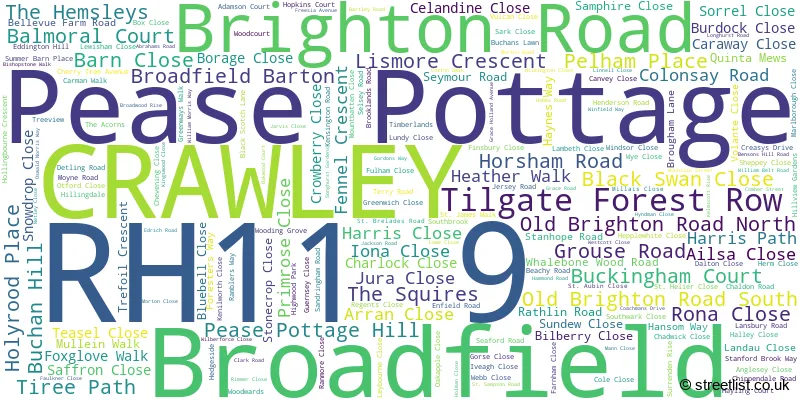
Map of the RH11 9 Postcode Sector
Explore the RH11 9 postcode sector by using our free interactive map.
| R | H | 1 | 1 | - | 9 | X | X |
| R | H | 1 | 1 | Space | 9 | Letter | Letter |
Official List of Streets
CRAWLEY (142 Streets)
Pease Pottage (45 Streets)
Unofficial Streets or Alternative Spellings
CRAWLEY
COACHMANS DRIVE CRAWLEY AVENUE TILGATE DRIVE ASPEN COURT ATTLEE HOUSE BREEZEHURST ROUNDABOUT BROADFIELD DRIVE BROADFIELD PARK BROADFIELD PLACE BROADFIELD ROUNDABOUT CHEALS ROUNDABOUT CHIVERTON WALK COPELAND HOUSE COTSFORD CRAWLEY GREENWAY CROSSMAN COURT DAMPIER WALK DAVIS CLOSE DYSON WALK FLAMSTEED HEIGHTS FOREST GATE FRY CLOSE FUCHSIA AVENUE GRADE HOLLAND AVENUE HAMPSTEAD WALK HARVEY CLOSE HERSCHEL WALK HIGHGATE COURT JEANS COURT LAMBETH WALK LASKI COURT LINDGREN WALK MARSH COURT MAXTON WALK MORRISON COURT MOTO PEASE POTTAGE SERVICES MURRAY COURT NORTH DRIVE OLD BRIGHTON ROAD (NORTH) OLD BRIGHTON ROAD (SOUTH) PANKHURST COURT PEASE POTTAGE INTERCHANGE PELHAM COURT PELHAM DRIVE PLANTAIN CRESCENT RICHARDSON COURT SAILYARD GARDENS SHINWELL WALK SILKIN WALK SOUTHGATE ROUNDABOUT ST CLEMENT ROAD STONEBRIDGE COURT TATHAM COURT THE AVENUE THE PAVILLIONS THOMPSON COURT TOLLGATE HILL WILKINSON COURT WOODMANS HILLPease Pottage
PARISH LANEHandcross
LONDON ROADColgate
FOREST ROAD GROUSE ROADWeather Forecast for RH11 9
Press Button to Show Forecast for Crawley
| Time Period | Icon | Description | Temperature | Rain Probability | Wind |
|---|---|---|---|---|---|
| 15:00 to 18:00 | Cloudy | 10.0°C (feels like 7.0°C) | 4.00% | NNW 11 mph | |
| 18:00 to 21:00 | Cloudy | 9.0°C (feels like 7.0°C) | 3.00% | N 7 mph | |
| 21:00 to 00:00 | Partly cloudy (night) | 6.0°C (feels like 5.0°C) | 1.00% | NNE 2 mph |
Press Button to Show Forecast for Crawley
| Time Period | Icon | Description | Temperature | Rain Probability | Wind |
|---|---|---|---|---|---|
| 00:00 to 03:00 | Cloudy | 5.0°C (feels like 4.0°C) | 4.00% | SSE 4 mph | |
| 03:00 to 06:00 | Cloudy | 5.0°C (feels like 3.0°C) | 4.00% | SSW 7 mph | |
| 06:00 to 09:00 | Cloudy | 7.0°C (feels like 5.0°C) | 48.00% | WSW 7 mph | |
| 09:00 to 12:00 | Partly cloudy (day) | 9.0°C (feels like 7.0°C) | 4.00% | W 9 mph | |
| 12:00 to 15:00 | Cloudy | 11.0°C (feels like 9.0°C) | 13.00% | WNW 11 mph | |
| 15:00 to 18:00 | Light rain | 10.0°C (feels like 8.0°C) | 50.00% | WSW 9 mph | |
| 18:00 to 21:00 | Cloudy | 9.0°C (feels like 7.0°C) | 50.00% | WNW 7 mph | |
| 21:00 to 00:00 | Light rain | 7.0°C (feels like 6.0°C) | 51.00% | N 7 mph |
Press Button to Show Forecast for Crawley
| Time Period | Icon | Description | Temperature | Rain Probability | Wind |
|---|---|---|---|---|---|
| 00:00 to 03:00 | Cloudy | 6.0°C (feels like 4.0°C) | 6.00% | ENE 7 mph | |
| 03:00 to 06:00 | Cloudy | 6.0°C (feels like 3.0°C) | 6.00% | ENE 7 mph | |
| 06:00 to 09:00 | Overcast | 5.0°C (feels like 3.0°C) | 10.00% | NE 7 mph | |
| 09:00 to 12:00 | Cloudy | 7.0°C (feels like 5.0°C) | 8.00% | ENE 9 mph | |
| 12:00 to 15:00 | Overcast | 9.0°C (feels like 8.0°C) | 15.00% | ENE 7 mph | |
| 15:00 to 18:00 | Overcast | 10.0°C (feels like 9.0°C) | 15.00% | ENE 7 mph | |
| 18:00 to 21:00 | Cloudy | 10.0°C (feels like 8.0°C) | 12.00% | E 7 mph | |
| 21:00 to 00:00 | Cloudy | 6.0°C (feels like 4.0°C) | 11.00% | E 7 mph |
Press Button to Show Forecast for Crawley
| Time Period | Icon | Description | Temperature | Rain Probability | Wind |
|---|---|---|---|---|---|
| 00:00 to 03:00 | Cloudy | 5.0°C (feels like 3.0°C) | 16.00% | ENE 7 mph | |
| 03:00 to 06:00 | Overcast | 5.0°C (feels like 2.0°C) | 22.00% | ENE 7 mph | |
| 06:00 to 09:00 | Cloudy | 6.0°C (feels like 4.0°C) | 18.00% | ENE 9 mph | |
| 09:00 to 12:00 | Overcast | 10.0°C (feels like 7.0°C) | 18.00% | E 11 mph | |
| 12:00 to 15:00 | Cloudy | 12.0°C (feels like 10.0°C) | 16.00% | E 11 mph | |
| 15:00 to 18:00 | Light rain | 12.0°C (feels like 9.0°C) | 49.00% | E 11 mph | |
| 18:00 to 21:00 | Light rain | 10.0°C (feels like 8.0°C) | 50.00% | ENE 11 mph | |
| 21:00 to 00:00 | Light rain | 9.0°C (feels like 7.0°C) | 51.00% | NE 11 mph |
Press Button to Show Forecast for Crawley
| Time Period | Icon | Description | Temperature | Rain Probability | Wind |
|---|---|---|---|---|---|
| 00:00 to 03:00 | Heavy rain | 9.0°C (feels like 7.0°C) | 73.00% | ENE 9 mph | |
| 03:00 to 06:00 | Heavy rain shower (night) | 9.0°C (feels like 7.0°C) | 59.00% | SE 11 mph | |
| 06:00 to 09:00 | Light rain | 9.0°C (feels like 7.0°C) | 48.00% | SE 9 mph | |
| 09:00 to 12:00 | Heavy rain shower (day) | 10.0°C (feels like 8.0°C) | 65.00% | SSE 11 mph | |
| 12:00 to 15:00 | Heavy rain shower (day) | 13.0°C (feels like 10.0°C) | 59.00% | SSW 13 mph | |
| 15:00 to 18:00 | Heavy rain shower (day) | 13.0°C (feels like 11.0°C) | 55.00% | SW 11 mph | |
| 18:00 to 21:00 | Light rain shower (day) | 11.0°C (feels like 9.0°C) | 33.00% | WSW 11 mph | |
| 21:00 to 00:00 | Cloudy | 9.0°C (feels like 8.0°C) | 10.00% | WSW 7 mph |
Schools and Places of Education Within the RH11 9 Postcode Sector
Atelier21 Future School
Other independent school
Broadfield Park, West Sussex, , RH11 9RZ
Head: Mrs Hayley Peacock
Ofsted Rating: Good
Inspection: 2022-06-16 (678 days ago)
Website: Visit Atelier21 Future School Website
Phone: 01293265417
Number of Pupils: 105
Broadfield Primary Academy
Academy sponsor led
Vulcan Close, Crawley, West Sussex, RH11 9PD
Head: Mrs Sian Markham
Ofsted Rating: Good
Inspection: 2019-05-02 (1819 days ago)
Website: Visit Broadfield Primary Academy Website
Phone: 01293406940
Number of Pupils: 532
Seymour Primary School
Academy converter
Seymour Road, Crawley, West Sussex, RH11 9ES
Head: Emma Eardley & Carol Collins
Ofsted Rating: Good
Inspection: 2018-12-06 (1966 days ago)
Website: Visit Seymour Primary School Website
Phone: 01293533198
Number of Pupils: 477

House Prices in the RH11 9 Postcode Sector
| Type of Property | 2018 Average | 2018 Sales | 2017 Average | 2017 Sales | 2016 Average | 2016 Sales | 2015 Average | 2015 Sales |
|---|---|---|---|---|---|---|---|---|
| Detached | £423,645 | 11 | £536,072 | 41 | £444,941 | 17 | £536,268 | 34 |
| Semi-Detached | £317,320 | 28 | £360,850 | 37 | £315,626 | 35 | £278,103 | 36 |
| Terraced | £256,338 | 114 | £260,860 | 101 | £233,567 | 110 | £212,046 | 140 |
| Flats | £179,765 | 26 | £184,567 | 39 | £161,302 | 43 | £149,343 | 34 |
Important Postcodes RH11 9 in the Postcode Sector
RH11 9AD is the postcode for CEDARS, Brighton Road
RH11 9BA is the postcode for West Sussex County Council, Broadfield Library, 46 Broadfield Barton
RH11 9BQ is the postcode for Crawley Leisure Centre, Pease Pottage Hill, Crawley K2 Leisure Centre, Pease Pottage Hill, and K2 Crawley, Pease Pottage Hill, Tilgate Drive
RH11 9ES is the postcode for Seymour Primary School, Seymour Road, and RECEPTION, Seymour Primary School, Seymour Road
RH11 9HJ is the postcode for Broadfield Children & Family Centre, Creasys Drive
RH11 9PD is the postcode for Broadfield Primary Academy, Vulcan Close, Broadfield East Junior School, Vulcan Close, and Broadfield East Infant School & Nursery, Vulcan Close
RH11 9YZ is the postcode for Broadfield Health Centre, Coachmans Drive
| The RH11 9 Sector is within these Local Authorities |
|
|---|---|
| The RH11 9 Sector is within these Counties |
|
| The RH11 9 Sector is within these Water Company Areas |
|