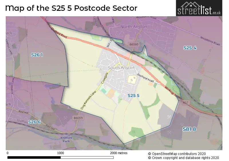
The S25 5 postcode sector is within the county of South Yorkshire.
Did you know? According to the 2021 Census, the S25 5 postcode sector is home to a bustling 2,546 residents!
Given that each sector allows for 400 unique postcode combinations. Letters C, I, K, M, O and V are not allowed in the last two letters of a postcode. With 57 postcodes already in use, this leaves 343 units available.
The S25 5 postal code covers the settlement of South Anston.
The S25 5 Postcode shares a border with S25 4 (North Anston), S26 1 (Todwick), S26 6 (Kiveton Park, Kiveton Park Station) and S81 8 (Shireoaks, Gateford, Blyth).
The sector is within the post town of SHEFFIELD.
S25 5 is a postcode sector within the S25 postcode district which is within the S Sheffield postcode area.
The Royal Mail delivery office for the S25 5 postal sector is the Dinnington Delivery Office.
The area of the S25 5 postcode sector is 1.23 square miles which is 3.20 square kilometres or 790.20 square acres.
Waterways within the S25 5 postcode sector include the Anston Brook.

Map of the S25 5 Postcode Sector
Explore the S25 5 postcode sector by using our free interactive map.
| S | 2 | 5 | - | 5 | X | X |
| S | 2 | 5 | Space | 5 | Letter | Letter |
Official List of Streets
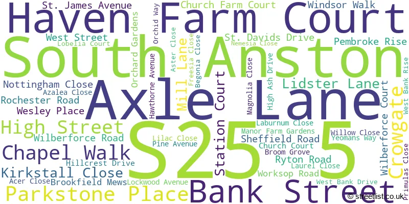
South Anston (52 Streets)
Unofficial Streets or Alternative Spellings
North Anston
RYTON ROADKiveton Park Station
DOG KENNEL HILLWeather Forecast for S25 5
Press Button to Show Forecast for Gildingwells
| Time Period | Icon | Description | Temperature | Rain Probability | Wind |
|---|---|---|---|---|---|
| 09:00 to 12:00 | Overcast | 7.0°C (feels like 5.0°C) | 19.00% | NW 9 mph | |
| 12:00 to 15:00 | Cloudy | 7.0°C (feels like 4.0°C) | 11.00% | N 9 mph | |
| 15:00 to 18:00 | Cloudy | 9.0°C (feels like 8.0°C) | 6.00% | N 4 mph | |
| 18:00 to 21:00 | Cloudy | 8.0°C (feels like 6.0°C) | 5.00% | NE 7 mph | |
| 21:00 to 00:00 | Cloudy | 5.0°C (feels like 3.0°C) | 5.00% | ENE 4 mph |
Press Button to Show Forecast for Gildingwells
| Time Period | Icon | Description | Temperature | Rain Probability | Wind |
|---|---|---|---|---|---|
| 00:00 to 03:00 | Partly cloudy (night) | 2.0°C (feels like 1.0°C) | 1.00% | NNE 4 mph | |
| 03:00 to 06:00 | Clear night | 1.0°C (feels like -1.0°C) | 1.00% | NNW 4 mph | |
| 06:00 to 09:00 | Sunny day | 2.0°C (feels like 0.0°C) | 1.00% | NNW 4 mph | |
| 09:00 to 12:00 | Cloudy | 7.0°C (feels like 5.0°C) | 5.00% | NE 4 mph | |
| 12:00 to 15:00 | Overcast | 8.0°C (feels like 7.0°C) | 9.00% | ENE 4 mph | |
| 15:00 to 18:00 | Cloudy | 9.0°C (feels like 8.0°C) | 7.00% | ENE 4 mph | |
| 18:00 to 21:00 | Cloudy | 7.0°C (feels like 6.0°C) | 8.00% | ENE 7 mph | |
| 21:00 to 00:00 | Cloudy | 5.0°C (feels like 4.0°C) | 10.00% | E 4 mph |
Press Button to Show Forecast for Gildingwells
| Time Period | Icon | Description | Temperature | Rain Probability | Wind |
|---|---|---|---|---|---|
| 00:00 to 03:00 | Cloudy | 4.0°C (feels like 3.0°C) | 8.00% | NNE 4 mph | |
| 03:00 to 06:00 | Cloudy | 3.0°C (feels like 1.0°C) | 12.00% | NNE 4 mph | |
| 06:00 to 09:00 | Partly cloudy (day) | 4.0°C (feels like 2.0°C) | 8.00% | NNE 4 mph | |
| 09:00 to 12:00 | Cloudy | 8.0°C (feels like 5.0°C) | 11.00% | ENE 9 mph | |
| 12:00 to 15:00 | Cloudy | 9.0°C (feels like 7.0°C) | 17.00% | E 9 mph | |
| 15:00 to 18:00 | Overcast | 10.0°C (feels like 8.0°C) | 21.00% | ENE 9 mph | |
| 18:00 to 21:00 | Cloudy | 9.0°C (feels like 7.0°C) | 20.00% | ENE 11 mph | |
| 21:00 to 00:00 | Cloudy | 7.0°C (feels like 4.0°C) | 17.00% | NE 9 mph |
Press Button to Show Forecast for Gildingwells
| Time Period | Icon | Description | Temperature | Rain Probability | Wind |
|---|---|---|---|---|---|
| 00:00 to 03:00 | Light rain | 6.0°C (feels like 3.0°C) | 50.00% | NE 11 mph | |
| 03:00 to 06:00 | Light rain | 6.0°C (feels like 3.0°C) | 50.00% | NNE 11 mph | |
| 06:00 to 09:00 | Heavy rain | 7.0°C (feels like 4.0°C) | 79.00% | NNE 13 mph | |
| 09:00 to 12:00 | Heavy rain | 8.0°C (feels like 5.0°C) | 79.00% | NNE 11 mph | |
| 12:00 to 15:00 | Heavy rain | 9.0°C (feels like 6.0°C) | 78.00% | N 11 mph | |
| 15:00 to 18:00 | Light rain | 10.0°C (feels like 7.0°C) | 54.00% | NNE 11 mph | |
| 18:00 to 21:00 | Overcast | 9.0°C (feels like 7.0°C) | 22.00% | N 9 mph | |
| 21:00 to 00:00 | Partly cloudy (night) | 8.0°C (feels like 6.0°C) | 10.00% | SSE 7 mph |
House Prices in the S25 5 Postcode Sector
| Type of Property | 2018 Average | 2018 Sales | 2017 Average | 2017 Sales | 2016 Average | 2016 Sales | 2015 Average | 2015 Sales |
|---|---|---|---|---|---|---|---|---|
| Detached | £360,153 | 25 | £248,475 | 22 | £266,550 | 27 | £297,641 | 16 |
| Semi-Detached | £144,191 | 22 | £144,458 | 13 | £139,686 | 15 | £125,900 | 12 |
| Terraced | £158,563 | 8 | £145,750 | 6 | £181,000 | 3 | £155,400 | 5 |
| Flats | £0 | 0 | £0 | 0 | £0 | 0 | £0 | 0 |
Important Postcodes S25 5 in the Postcode Sector
S25 5GR is the postcode for JUNIORS, Anston Hillcrest Primary School, Hawthorne Avenue, and INFANTS, Anston Hillcrest Primary School, Hawthorne Avenue
| The S25 5 Sector is within these Local Authorities |
|
|---|---|
| The S25 5 Sector is within these Counties |
|
| The S25 5 Sector is within these Water Company Areas |
|