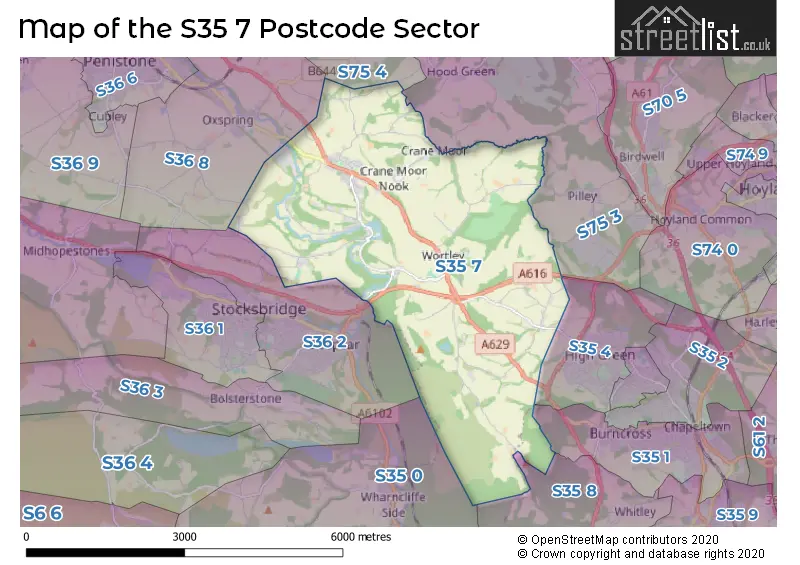
The S35 7 postcode sector is within the county of South Yorkshire.
Did you know? According to the 2021 Census, the S35 7 postcode sector is home to a bustling 2,814 residents!
Given that each sector allows for 400 unique postcode combinations. Letters C, I, K, M, O and V are not allowed in the last two letters of a postcode. With 88 postcodes already in use, this leaves 312 units available.
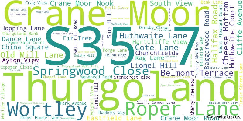
The largest settlement in the S35 7 postal code is Thurgoland followed by Wortley, and Crane Moor.
The S35 7 Postcode shares a border with S35 4 (High Green), S36 8 (Oxspring, Penistone, Hoylandswaine), S36 2 (Deepcar, Stocksbridge), S35 0 (Oughtibridge, Wharncliffe Side, Worrall), S35 1 (Chapeltown, Burncross), S35 8 (Grenoside), S75 3 (Dodworth, Tankersley, Hood Green) and S75 4 (Silkstone, Cawthorne, Silkstone Common).
The sector is within the post town of SHEFFIELD.
S35 7 is a postcode sector within the S35 postcode district which is within the S Sheffield postcode area.
The Royal Mail delivery office for the S35 7 postal sector is the Chapeltown Delivery Office.
The area of the S35 7 postcode sector is 10.27 square miles which is 26.59 square kilometres or 6,571.03 square acres.
The S35 7 postcode sector is crossed by the A616 Major A road.
Waterways within the S35 7 postcode sector include the River Don.

Map of the S35 7 Postcode Sector
Explore the S35 7 postcode sector by using our free interactive map.
| S | 3 | 5 | - | 7 | X | X |
| S | 3 | 5 | Space | 7 | Letter | Letter |
Official List of Streets
Thurgoland (35 Streets)
Wortley (30 Streets)
Unofficial Streets or Alternative Spellings
Grenoside
WOODHEAD ROADChapeltown
PENISTONE ROADOxspring
BIRD LANE COPSTER LANE POND COMMON LANESilkstone Common
PINFOLD LANEHood Green
BAGGER WOOD ROADDeepcar
WORTLEY ROADWeather Forecast for S35 7
Press Button to Show Forecast for Stocksbridge
| Time Period | Icon | Description | Temperature | Rain Probability | Wind |
|---|---|---|---|---|---|
| 21:00 to 00:00 | Cloudy | 4.0°C (feels like 2.0°C) | 11.00% | NNE 4 mph |
Press Button to Show Forecast for Stocksbridge
| Time Period | Icon | Description | Temperature | Rain Probability | Wind |
|---|---|---|---|---|---|
| 00:00 to 03:00 | Partly cloudy (night) | 2.0°C (feels like 0.0°C) | 1.00% | NNE 2 mph | |
| 03:00 to 06:00 | Clear night | 1.0°C (feels like -1.0°C) | 1.00% | NNW 4 mph | |
| 06:00 to 09:00 | Sunny day | 2.0°C (feels like 0.0°C) | 1.00% | NNW 4 mph | |
| 09:00 to 12:00 | Cloudy | 6.0°C (feels like 4.0°C) | 5.00% | ENE 4 mph | |
| 12:00 to 15:00 | Overcast | 7.0°C (feels like 6.0°C) | 10.00% | ENE 4 mph | |
| 15:00 to 18:00 | Cloudy | 8.0°C (feels like 7.0°C) | 7.00% | ENE 4 mph | |
| 18:00 to 21:00 | Cloudy | 7.0°C (feels like 5.0°C) | 9.00% | E 7 mph | |
| 21:00 to 00:00 | Cloudy | 4.0°C (feels like 2.0°C) | 7.00% | E 4 mph |
Press Button to Show Forecast for Stocksbridge
| Time Period | Icon | Description | Temperature | Rain Probability | Wind |
|---|---|---|---|---|---|
| 00:00 to 03:00 | Cloudy | 4.0°C (feels like 2.0°C) | 7.00% | ESE 2 mph | |
| 03:00 to 06:00 | Cloudy | 2.0°C (feels like 1.0°C) | 9.00% | NNE 4 mph | |
| 06:00 to 09:00 | Cloudy | 3.0°C (feels like 2.0°C) | 11.00% | NNE 4 mph | |
| 09:00 to 12:00 | Cloudy | 7.0°C (feels like 4.0°C) | 10.00% | ENE 7 mph | |
| 12:00 to 15:00 | Overcast | 8.0°C (feels like 6.0°C) | 17.00% | E 9 mph | |
| 15:00 to 18:00 | Cloudy | 9.0°C (feels like 7.0°C) | 21.00% | E 9 mph | |
| 18:00 to 21:00 | Cloudy | 8.0°C (feels like 6.0°C) | 17.00% | ENE 9 mph | |
| 21:00 to 00:00 | Cloudy | 6.0°C (feels like 3.0°C) | 17.00% | NE 9 mph |
Press Button to Show Forecast for Stocksbridge
| Time Period | Icon | Description | Temperature | Rain Probability | Wind |
|---|---|---|---|---|---|
| 00:00 to 03:00 | Light rain | 5.0°C (feels like 2.0°C) | 50.00% | NNE 9 mph | |
| 03:00 to 06:00 | Light rain | 5.0°C (feels like 2.0°C) | 51.00% | NNE 11 mph | |
| 06:00 to 09:00 | Heavy rain | 6.0°C (feels like 3.0°C) | 77.00% | NNE 11 mph | |
| 09:00 to 12:00 | Heavy rain | 7.0°C (feels like 4.0°C) | 79.00% | N 11 mph | |
| 12:00 to 15:00 | Heavy rain | 8.0°C (feels like 5.0°C) | 76.00% | N 11 mph | |
| 15:00 to 18:00 | Light rain | 9.0°C (feels like 6.0°C) | 56.00% | N 11 mph | |
| 18:00 to 21:00 | Light rain shower (day) | 8.0°C (feels like 6.0°C) | 35.00% | N 9 mph | |
| 21:00 to 00:00 | Partly cloudy (night) | 7.0°C (feels like 4.0°C) | 10.00% | NW 7 mph |
Schools and Places of Education Within the S35 7 Postcode Sector
Thurgoland Church of England (Voluntary Controlled) Primary School
Voluntary controlled school
Halifax Road, Sheffield, South Yorkshire, S35 7AL
Head: Mr D Jordan
Ofsted Rating: Good
Inspection: 2022-07-07 (658 days ago)
Website: Visit Thurgoland Church of England (Voluntary Controlled) Primary School Website
Phone: 01142883300
Number of Pupils: 213
House Prices in the S35 7 Postcode Sector
| Type of Property | 2018 Average | 2018 Sales | 2017 Average | 2017 Sales | 2016 Average | 2016 Sales | 2015 Average | 2015 Sales |
|---|---|---|---|---|---|---|---|---|
| Detached | £425,660 | 17 | £301,600 | 15 | £359,748 | 24 | £384,175 | 14 |
| Semi-Detached | £236,979 | 7 | £252,496 | 13 | £277,494 | 9 | £184,000 | 2 |
| Terraced | £180,064 | 7 | £157,038 | 13 | £167,767 | 12 | £146,615 | 10 |
| Flats | £0 | 0 | £168,000 | 1 | £162,500 | 1 | £0 | 0 |
Important Postcodes S35 7 in the Postcode Sector
S35 7AL is the postcode for Thurgoland C of E Primary School, Halifax Road, Thurgoland C of E Primary School, Halifax Road, Thurgoland, and THURGOLAND CHURCH OF ENGLAND PRIMARY SCHOOL, HALIFAX ROAD, THURGOLAND
| The S35 7 Sector is within these Local Authorities |
|
|---|---|
| The S35 7 Sector is within these Counties |
|
| The S35 7 Sector is within these Water Company Areas |
|