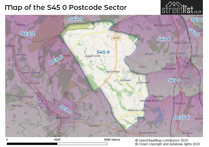
The S45 0 postcode sector is within the county of Derbyshire.
Did you know? According to the 2021 Census, the S45 0 postcode sector is home to a bustling 1,732 residents!
Given that each sector allows for 400 unique postcode combinations. Letters C, I, K, M, O and V are not allowed in the last two letters of a postcode. With 115 postcodes already in use, this leaves 285 units available.
The S45 0 postal code covers the settlement of Ashover.
The S45 0 Postcode shares a border with S45 9 (Clay Cross, Danesmoor), DE4 2 (Darley Dale, Winster, Bonsall), DE4 5 (Crich, Tansley, Whatstandwell), DE55 6 (Shirland, Stonebroom, Morton), S42 6 (Wingerworth, New Tupton, Old Tupton) and S42 7 (Holymoorside, Walton, Ashgate).
The sector is within the post town of CHESTERFIELD.
S45 0 is a postcode sector within the S45 postcode district which is within the S Sheffield postcode area.
The Royal Mail delivery office for the S45 0 postal sector is the Chesterfield Delivery Office.
The area of the S45 0 postcode sector is 12.56 square miles which is 32.53 square kilometres or 8,039.23 square acres.
Waterways within the S45 0 postcode sector include the River Hipper, Hodgelane Brook, Smalley Brook, River Amber.

Map of the S45 0 Postcode Sector
Explore the S45 0 postcode sector by using our free interactive map.
| S | 4 | 5 | - | 0 | X | X |
| S | 4 | 5 | Space | 0 | Letter | Letter |
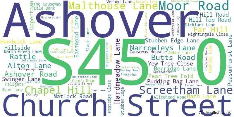
Official List of Streets
Ashover (68 Streets)
Unofficial Streets or Alternative Spellings
Brackenfield
COLDHARBOUR LANE WHITE CARR LANEAlton
LONG LANE TINKLEY LANEMatlock Moor
CHESTERFIELD ROADWoolley Moor
BADGER LANETansley
ALLEN LANE LANT LANEDarley Moor
JAGGERS LANERowsley
CHESTERFIELD ROADHolymoorside
HAREWOOD ROADWeather Forecast for S45 0
Press Button to Show Forecast for Ashover No 2
| Time Period | Icon | Description | Temperature | Rain Probability | Wind |
|---|---|---|---|---|---|
| 06:00 to 09:00 | Partly cloudy (day) | 4.0°C (feels like 1.0°C) | 1.00% | NNW 7 mph | |
| 09:00 to 12:00 | Cloudy | 7.0°C (feels like 4.0°C) | 4.00% | N 9 mph | |
| 12:00 to 15:00 | Overcast | 9.0°C (feels like 6.0°C) | 7.00% | N 9 mph | |
| 15:00 to 18:00 | Overcast | 10.0°C (feels like 8.0°C) | 7.00% | N 9 mph | |
| 18:00 to 21:00 | Overcast | 9.0°C (feels like 7.0°C) | 7.00% | NNE 4 mph | |
| 21:00 to 00:00 | Cloudy | 6.0°C (feels like 4.0°C) | 4.00% | NE 4 mph |
Press Button to Show Forecast for Ashover No 2
| Time Period | Icon | Description | Temperature | Rain Probability | Wind |
|---|---|---|---|---|---|
| 00:00 to 03:00 | Cloudy | 5.0°C (feels like 4.0°C) | 5.00% | N 4 mph | |
| 03:00 to 06:00 | Cloudy | 4.0°C (feels like 3.0°C) | 15.00% | N 4 mph | |
| 06:00 to 09:00 | Overcast | 5.0°C (feels like 3.0°C) | 45.00% | NNE 4 mph | |
| 09:00 to 12:00 | Cloudy | 6.0°C (feels like 4.0°C) | 13.00% | NE 7 mph | |
| 12:00 to 15:00 | Overcast | 8.0°C (feels like 6.0°C) | 12.00% | NE 7 mph | |
| 15:00 to 18:00 | Overcast | 9.0°C (feels like 7.0°C) | 14.00% | NE 7 mph | |
| 18:00 to 21:00 | Cloudy | 8.0°C (feels like 6.0°C) | 14.00% | NE 7 mph | |
| 21:00 to 00:00 | Overcast | 6.0°C (feels like 4.0°C) | 14.00% | NE 4 mph |
Press Button to Show Forecast for Ashover No 2
| Time Period | Icon | Description | Temperature | Rain Probability | Wind |
|---|---|---|---|---|---|
| 00:00 to 03:00 | Cloudy | 4.0°C (feels like 3.0°C) | 12.00% | NE 4 mph | |
| 03:00 to 06:00 | Cloudy | 3.0°C (feels like 2.0°C) | 14.00% | NE 2 mph | |
| 06:00 to 09:00 | Overcast | 4.0°C (feels like 3.0°C) | 22.00% | WSW 2 mph | |
| 09:00 to 12:00 | Cloudy | 6.0°C (feels like 5.0°C) | 19.00% | ESE 4 mph | |
| 12:00 to 15:00 | Light rain | 8.0°C (feels like 6.0°C) | 50.00% | SSE 4 mph | |
| 15:00 to 18:00 | Light rain | 9.0°C (feels like 7.0°C) | 52.00% | NE 7 mph | |
| 18:00 to 21:00 | Light rain | 8.0°C (feels like 7.0°C) | 47.00% | NNE 7 mph | |
| 21:00 to 00:00 | Cloudy | 7.0°C (feels like 5.0°C) | 12.00% | NNE 4 mph |
Press Button to Show Forecast for Ashover No 2
| Time Period | Icon | Description | Temperature | Rain Probability | Wind |
|---|---|---|---|---|---|
| 00:00 to 03:00 | Overcast | 6.0°C (feels like 5.0°C) | 11.00% | NE 4 mph | |
| 03:00 to 06:00 | Overcast | 5.0°C (feels like 4.0°C) | 10.00% | NNE 7 mph | |
| 06:00 to 09:00 | Overcast | 6.0°C (feels like 4.0°C) | 11.00% | N 7 mph | |
| 09:00 to 12:00 | Cloudy | 8.0°C (feels like 5.0°C) | 6.00% | NNE 9 mph | |
| 12:00 to 15:00 | Overcast | 10.0°C (feels like 7.0°C) | 11.00% | NNE 9 mph | |
| 15:00 to 18:00 | Cloudy | 10.0°C (feels like 8.0°C) | 12.00% | NNE 9 mph | |
| 18:00 to 21:00 | Cloudy | 9.0°C (feels like 7.0°C) | 9.00% | NNE 9 mph | |
| 21:00 to 00:00 | Clear night | 6.0°C (feels like 4.0°C) | 5.00% | N 7 mph |
Schools and Places of Education Within the S45 0 Postcode Sector
Ashover Primary School
Community school
Narrowleys Lane, Chesterfield, Derbyshire, S45 0AU
Head: Mrs Sue Myhill
Ofsted Rating: Good
Inspection: 2022-03-02 (780 days ago)
Website: Visit Ashover Primary School Website
Phone: 01246590207
Number of Pupils: 220
Eastwood Grange School
Other independent special school
Eastwood Grange, Chesterfield, Derbyshire, S45 0BA
Head: Mr Stuart Lees
Ofsted Rating: Requires improvement
Inspection: 2022-06-09 (681 days ago)
Website: Visit Eastwood Grange School Website
Phone: 01246590255
Number of Pupils: 41
House Prices in the S45 0 Postcode Sector
| Type of Property | 2018 Average | 2018 Sales | 2017 Average | 2017 Sales | 2016 Average | 2016 Sales | 2015 Average | 2015 Sales |
|---|---|---|---|---|---|---|---|---|
| Detached | £484,297 | 16 | £475,458 | 12 | £537,020 | 10 | £508,563 | 12 |
| Semi-Detached | £186,983 | 3 | £328,750 | 4 | £280,600 | 5 | £302,500 | 2 |
| Terraced | £288,333 | 3 | £0 | 0 | £314,100 | 5 | £293,600 | 5 |
| Flats | £0 | 0 | £0 | 0 | £0 | 0 | £0 | 0 |
Important Postcodes S45 0 in the Postcode Sector
S45 0AU is the postcode for MAIN BUILDING, Ashover Primary School, Narrowleys Lane, and Ashover Primary School, Narrowleys Lane
| The S45 0 Sector is within these Local Authorities |
|
|---|---|
| The S45 0 Sector is within these Counties |
|
| The S45 0 Sector is within these Water Company Areas |
|