The SA14 postcode district is a postal district located in the SA Swansea postcode area with a population of 35,356 residents according to the 2021 England and Wales Census.
The area of the SA14 postcode district is 40.74 square miles which is 105.52 square kilometres or 26,075.60 acres.
Currently, the SA14 district has about 868 postcode units spread across 4 geographic postcode sectors.
Given that each sector allows for 400 unique postcode combinations, the district has a capacity of 1,600 postcodes. With 868 postcodes already in use, this leaves 732 units available.
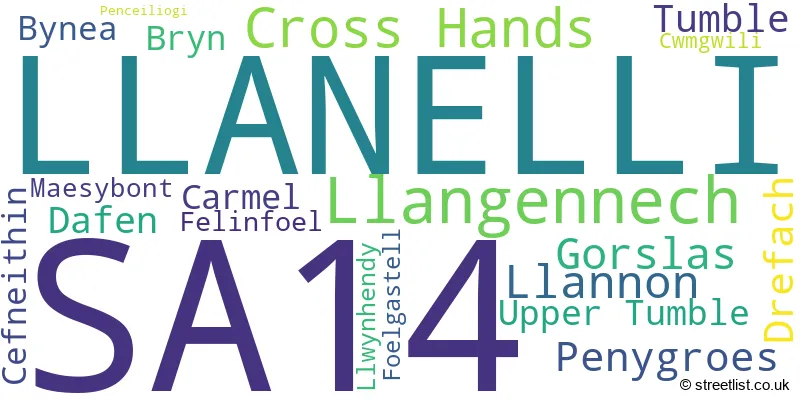
The largest settlement in the SA14 postal code is LLANELLI followed by LLANGENNECH, and CROSS HANDS.
The postcode area has a boundary with The Bristol Channel.
The SA14 Postcode shares a border with SA18 (AMMANFORD, LLANDYBIE, GLANAMAN), SA32 (NANTGAREDIG, LLANARTHNE, PENIEL), SA15 (LLANELLI, PONTYBEREM, PONTYATES) and SA4 (GORSEINON, PONTARDDULAIS, LOUGHOR).
The primary settlement in the SA14 postcode district is Cross Hands, located in the county of Dyfed, Wales. Other significant settlements in the district include Cwmgwili, Gorslas, Llannon, Tumble, and Upper Tumble. The most significant post town in the district is Llanelli, also in the county of Dyfed, Wales.
For the district SA14, we have data on 4 postcode sectors. Here's a breakdown: The sector SA14 6, covers Cross Hands and Tumble and Upper Tumble and Llannon in Dyfed. The sector SA14 7, covers Penygroes and Drefach and Carmel and Gorslas and Cefneithin in Dyfed. The sector SA14 8, covers Llanelli and Llangennech and Dafen in Dyfed. The sector SA14 9, covers Llanelli and Bynea and Bryn in Dyfed.

Map of the SA14 Postcode District
Explore the SA14 postcode district by using our free interactive map.

When it comes to local government, postal geography often disregards political borders. However, for a breakdown in the SA14 District: the district mostly encompasses the Sir Gaerfyrddin - Carmarthenshire area with a total of 876 postcodes.
Recent House Sales in SA14
| Date | Price | Address |
|---|---|---|
| 24/10/2023 | £210,000 | Talywern, Llangennech, Llanelli, SA14 8UQ |
| 23/10/2023 | £227,000 | Oaklands, Swiss Valley, Llanelli, SA14 8DA |
| 11/10/2023 | £45,000 | Tir Einon, Llanelli, SA14 9DT |
| 29/09/2023 | £120,000 | Lletty Road, Upper Tumble, Llanelli, SA14 6BN |
| 22/09/2023 | £295,000 | Pendderi Road, Llanelli, SA14 9PL |
| 22/09/2023 | £105,000 | Tir Capel, Llanelli, SA14 8SP |
| 21/09/2023 | £235,000 | Penllwyngwyn Road, Bryn, Llanelli, SA14 9UF |
| 15/09/2023 | £126,000 | Dan Yr Allt, Llanelli, SA14 8AT |
| 08/09/2023 | £123,000 | Bryngwyn Road, Llanelli, SA14 8LH |
| 07/09/2023 | £210,000 | Hendre Park, Llangennech, Llanelli, SA14 8UP |
Weather Forecast for SA14
Press Button to Show Forecast for Cross Hands
| Time Period | Icon | Description | Temperature | Rain Probability | Wind |
|---|---|---|---|---|---|
| 21:00 to 00:00 | Cloudy | 5.0°C (feels like 3.0°C) | 4.00% | NNW 4 mph |
Press Button to Show Forecast for Cross Hands
| Time Period | Icon | Description | Temperature | Rain Probability | Wind |
|---|---|---|---|---|---|
| 00:00 to 03:00 | Cloudy | 3.0°C (feels like 2.0°C) | 4.00% | NNE 2 mph | |
| 03:00 to 06:00 | Cloudy | 3.0°C (feels like 2.0°C) | 5.00% | NE 4 mph | |
| 06:00 to 09:00 | Cloudy | 4.0°C (feels like 2.0°C) | 7.00% | ENE 7 mph | |
| 09:00 to 12:00 | Cloudy | 8.0°C (feels like 6.0°C) | 9.00% | E 7 mph | |
| 12:00 to 15:00 | Overcast | 9.0°C (feels like 7.0°C) | 14.00% | ESE 7 mph | |
| 15:00 to 18:00 | Cloudy | 10.0°C (feels like 9.0°C) | 12.00% | E 4 mph | |
| 18:00 to 21:00 | Cloudy | 9.0°C (feels like 8.0°C) | 12.00% | ENE 7 mph | |
| 21:00 to 00:00 | Cloudy | 6.0°C (feels like 4.0°C) | 11.00% | NE 7 mph |
Press Button to Show Forecast for Cross Hands
| Time Period | Icon | Description | Temperature | Rain Probability | Wind |
|---|---|---|---|---|---|
| 00:00 to 03:00 | Cloudy | 5.0°C (feels like 3.0°C) | 12.00% | ENE 7 mph | |
| 03:00 to 06:00 | Cloudy | 4.0°C (feels like 1.0°C) | 11.00% | ENE 7 mph | |
| 06:00 to 09:00 | Partly cloudy (day) | 4.0°C (feels like 1.0°C) | 6.00% | NE 7 mph | |
| 09:00 to 12:00 | Cloudy | 8.0°C (feels like 6.0°C) | 7.00% | ENE 9 mph | |
| 12:00 to 15:00 | Cloudy | 10.0°C (feels like 8.0°C) | 12.00% | ENE 9 mph | |
| 15:00 to 18:00 | Overcast | 10.0°C (feels like 8.0°C) | 16.00% | NE 9 mph | |
| 18:00 to 21:00 | Cloudy | 10.0°C (feels like 7.0°C) | 12.00% | NE 9 mph | |
| 21:00 to 00:00 | Cloudy | 7.0°C (feels like 5.0°C) | 16.00% | NNE 9 mph |
Press Button to Show Forecast for Cross Hands
| Time Period | Icon | Description | Temperature | Rain Probability | Wind |
|---|---|---|---|---|---|
| 00:00 to 03:00 | Cloudy | 6.0°C (feels like 3.0°C) | 16.00% | N 11 mph | |
| 03:00 to 06:00 | Cloudy | 6.0°C (feels like 3.0°C) | 16.00% | N 11 mph | |
| 06:00 to 09:00 | Cloudy | 6.0°C (feels like 3.0°C) | 17.00% | N 11 mph | |
| 09:00 to 12:00 | Light rain shower (day) | 8.0°C (feels like 4.0°C) | 39.00% | N 13 mph | |
| 12:00 to 15:00 | Light rain | 10.0°C (feels like 7.0°C) | 47.00% | NNW 13 mph | |
| 15:00 to 18:00 | Partly cloudy (day) | 11.0°C (feels like 8.0°C) | 33.00% | NNW 13 mph | |
| 18:00 to 21:00 | Sunny day | 9.0°C (feels like 7.0°C) | 8.00% | NW 9 mph | |
| 21:00 to 00:00 | Clear night | 5.0°C (feels like 3.0°C) | 4.00% | WNW 7 mph |
Where is the SA14 Postcode District?
The postcode district SA14 is located in the town Llanelli. It is surrounded by several nearby towns, including Ammanford to the North East (5.46 miles away), Burry Port to the South West (7.77 miles away), Kidwelly to the West (8.01 miles away), Swansea to the South East (11.57 miles away), and Carmarthen to the North West (11.60 miles away). Additionally, the distance from SA14 to London is approximately 171.76 miles.
The district is within the post town of LLANELLI.
The sector has postcodes within the nation of Wales.
The SA14 Postcode District is in the South West Wales region of West Wales within the Wales.
| Postcode Sector | Delivery Office |
|---|---|
| SA14 6 | Llanelli Delivery Office |
| SA14 7 | Llanelli Delivery Office |
| SA14 8 | Llanelli Delivery Office |
| SA14 9 | Llanelli Delivery Office |
| S | A | 1 | 4 | - | X | X | X |
| S | A | 1 | 4 | Space | Numeric | Letter | Letter |
Tourist Attractions within the Postcode Area
We found 1 visitor attractions within the SA14 postcode area
| The Play King |
|---|
| View The Play King on Google Maps |
Current Monthly Rental Prices
| # Bedrooms | Min Price | Max Price | Avg Price |
|---|---|---|---|
| 3 | £675 | £675 | £675 |
| 4 | £1,500 | £1,500 | £1,500 |
Current House Prices
| # Bedrooms | Min Price | Max Price | Avg Price |
|---|---|---|---|
| £5,000 | £550,000 | £196,874 | |
| 1 | £50,000 | £50,000 | £50,000 |
| 2 | £82,000 | £425,000 | £174,523 |
| 3 | £80,000 | £550,000 | £218,984 |
| 4 | £149,950 | £1,100,000 | £386,962 |
| 5 | £334,995 | £399,500 | £367,248 |
| 6 | £500,000 | £500,000 | £500,000 |
| 28 | £300,000 | £300,000 | £300,000 |
Estate Agents who Operate in the SA14 District
| Logo | Name | Brand Name | Address | Contact Number | Total Properties |
|---|---|---|---|---|---|
 | Llanelli | John Francis | 27 Murray Street, Llanelli, SA15 1AQ | 01554 701037 | 20 |
 | Llanelli | West Wales Properties | 22 Murray Street, Llanelli, SA15 1DZ | 01554 701070 | 12 |
 | Ammanford | Anna Ashton Estate Agents | 3 College Street, Ammanford, SA18 3AB | 01269 508055 | 11 |
 | Ammanford | John Francis | 24 College Street, Ammanford, SA18 3AF | 01269 503844 | 8 |
 | South West | Yopa | Meridian House Wheatfield Way Hinckley LE10 1YG | 01202 145444 | 6 |
| Type of Property | 2018 Average | 2018 Sales | 2017 Average | 2017 Sales | 2016 Average | 2016 Sales | 2015 Average | 2015 Sales |
|---|---|---|---|---|---|---|---|---|
| Detached | £211,779 | 259 | £189,810 | 219 | £186,670 | 211 | £185,367 | 211 |
| Semi-Detached | £117,916 | 251 | £109,052 | 238 | £106,338 | 235 | £104,908 | 222 |
| Terraced | £99,918 | 119 | £95,332 | 107 | £93,442 | 89 | £90,502 | 83 |
| Flats | £62,167 | 3 | £90,000 | 1 | £59,063 | 4 | £60,000 | 1 |