The SA18 postcode district is a postal district located in the SA Swansea postcode area with a population of 30,428 residents according to the 2021 England and Wales Census.
The area of the SA18 postcode district is 53.43 square miles which is 138.38 square kilometres or 34,194.11 acres.
Currently, the SA18 district has about 766 postcode units spread across 3 geographic postcode sectors.
Given that each sector allows for 400 unique postcode combinations, the district has a capacity of 1,200 postcodes. With 766 postcodes already in use, this leaves 434 units available.
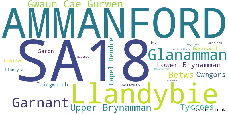
The largest settlement in the SA18 postal code is AMMANFORD followed by LLANDYBIE, and GLANAMAN.
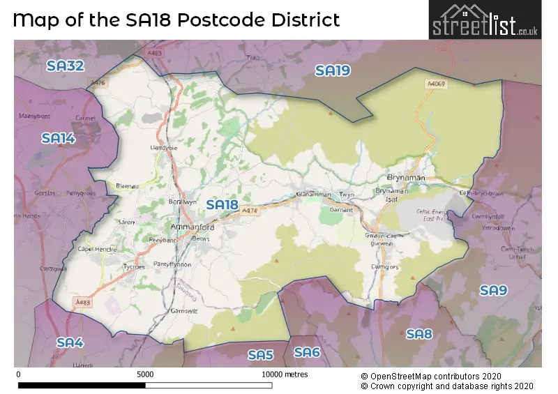
The SA18 Postcode shares a border with SA19 (LLANDEILO, LLANGADOG, FFAIRFACH), SA8 (PONTARDAWE, ALLTWEN, RHOS), SA9 (YSTRADGYNLAIS, Ystalyfera, LOWER CWMTWRCH), SA5 (PENLAN, FFORESTFACH, MANSELTON), SA14 (LLANELLI, LLANGENNECH, CROSS HANDS) and SA4 (GORSEINON, PONTARDDULAIS, LOUGHOR).
The primary settlement in the SA18 postcode district is Garnant, located in the county of Dyfed. Other significant settlements include Glanamman, Gwaun Cae Gurwen, and Lower Brynamman. The post town is Ammanford, situated in Dyfed.
For the district SA18, we have data on 4 postcode sectors. Here's a breakdown: The sector SA18 1, covers Upper Brynamman and Garnant and Glanamman in Dyfed. The sector SA18 1, covers Gwaun Cae Gurwen and Lower Brynamman and Cwmgors in West Glamorgan. The sector SA18 2, covers Ammanford and Glanamman and Betws in Dyfed. The sector SA18 3, covers Ammanford and Llandybie and Tycroes in Dyfed. The sector SA18 9 is non-geographic. It's often designated for PO Boxes, large organisations, or special services.

Map of the SA18 Postcode District
Explore the SA18 postcode district by using our free interactive map.
When it comes to local government, postal geography often disregards political borders. However, for a breakdown in the SA18 District: the district mostly encompasses the Sir Gaerfyrddin - Carmarthenshire (651 postcodes), followed by the Castell-nedd Port Talbot - Neath Port Talbot area (103 postcodes), and finally, the Abertawe - Swansea area (16 postcodes).
Recent House Sales in SA18
| Date | Price | Address |
|---|---|---|
| 12/10/2023 | £200,000 | Gwaun Henllan, Ammanford, SA18 2FD |
| 06/10/2023 | £100,000 | Llandybie Road, Ammanford, SA18 2DW |
| 02/10/2023 | £330,000 | Maes Yr Helyg, Llandybie, Ammanford, SA18 2SX |
| 02/10/2023 | £273,000 | Mountain Road, Upper Brynamman, Ammanford, SA18 1AE |
| 02/10/2023 | £134,500 | Fforest Fach, Tycroes, Ammanford, SA18 3PR |
| 27/09/2023 | £310,000 | Heol Y Gors, Cwmgors, Ammanford, SA18 1RW |
| 22/09/2023 | £242,500 | Delfryn, Capel Hendre, Ammanford, SA18 3TT |
| 15/09/2023 | £72,000 | Cwmamman Road, Glanamman, Ammanford, SA18 1DQ |
| 15/09/2023 | £100,000 | Banc Y Ddraenen, Capel Hendre, Ammanford, SA18 3SR |
| 08/09/2023 | £220,000 | Caeffynnon Road, Llandybie, Ammanford, SA18 2TH |
Weather Forecast for SA18
Press Button to Show Forecast for Glanaman
| Time Period | Icon | Description | Temperature | Rain Probability | Wind |
|---|---|---|---|---|---|
| 09:00 to 12:00 | Cloudy | 10.0°C (feels like 8.0°C) | 4.00% | NNW 7 mph | |
| 12:00 to 15:00 | Cloudy | 12.0°C (feels like 11.0°C) | 3.00% | NNW 7 mph | |
| 15:00 to 18:00 | Partly cloudy (day) | 13.0°C (feels like 11.0°C) | 1.00% | NNW 9 mph | |
| 18:00 to 21:00 | Sunny day | 11.0°C (feels like 9.0°C) | 0.00% | NNW 9 mph | |
| 21:00 to 00:00 | Clear night | 6.0°C (feels like 4.0°C) | 0.00% | N 7 mph |
Press Button to Show Forecast for Glanaman
| Time Period | Icon | Description | Temperature | Rain Probability | Wind |
|---|---|---|---|---|---|
| 00:00 to 03:00 | Clear night | 5.0°C (feels like 3.0°C) | 0.00% | NNW 4 mph | |
| 03:00 to 06:00 | Clear night | 4.0°C (feels like 2.0°C) | 1.00% | NNW 4 mph | |
| 06:00 to 09:00 | Cloudy | 6.0°C (feels like 4.0°C) | 5.00% | N 4 mph | |
| 09:00 to 12:00 | Partly cloudy (day) | 9.0°C (feels like 7.0°C) | 1.00% | WNW 9 mph | |
| 12:00 to 15:00 | Partly cloudy (day) | 11.0°C (feels like 9.0°C) | 2.00% | WNW 11 mph | |
| 15:00 to 18:00 | Partly cloudy (day) | 11.0°C (feels like 9.0°C) | 5.00% | WNW 11 mph | |
| 18:00 to 21:00 | Partly cloudy (day) | 10.0°C (feels like 8.0°C) | 3.00% | NW 9 mph | |
| 21:00 to 00:00 | Cloudy | 8.0°C (feels like 6.0°C) | 7.00% | NW 7 mph |
Press Button to Show Forecast for Glanaman
| Time Period | Icon | Description | Temperature | Rain Probability | Wind |
|---|---|---|---|---|---|
| 00:00 to 03:00 | Cloudy | 7.0°C (feels like 5.0°C) | 10.00% | NW 4 mph | |
| 03:00 to 06:00 | Cloudy | 6.0°C (feels like 4.0°C) | 13.00% | N 7 mph | |
| 06:00 to 09:00 | Cloudy | 7.0°C (feels like 5.0°C) | 14.00% | NE 7 mph | |
| 09:00 to 12:00 | Cloudy | 9.0°C (feels like 6.0°C) | 14.00% | SE 9 mph | |
| 12:00 to 15:00 | Cloudy | 10.0°C (feels like 8.0°C) | 16.00% | SSE 9 mph | |
| 15:00 to 18:00 | Cloudy | 10.0°C (feels like 8.0°C) | 15.00% | WSW 9 mph | |
| 18:00 to 21:00 | Cloudy | 10.0°C (feels like 8.0°C) | 15.00% | ENE 9 mph | |
| 21:00 to 00:00 | Cloudy | 8.0°C (feels like 6.0°C) | 11.00% | NE 9 mph |
Press Button to Show Forecast for Glanaman
| Time Period | Icon | Description | Temperature | Rain Probability | Wind |
|---|---|---|---|---|---|
| 00:00 to 03:00 | Cloudy | 7.0°C (feels like 5.0°C) | 11.00% | NNE 9 mph | |
| 03:00 to 06:00 | Cloudy | 7.0°C (feels like 4.0°C) | 14.00% | N 9 mph | |
| 06:00 to 09:00 | Cloudy | 7.0°C (feels like 4.0°C) | 12.00% | ENE 9 mph | |
| 09:00 to 12:00 | Cloudy | 9.0°C (feels like 7.0°C) | 12.00% | ENE 11 mph | |
| 12:00 to 15:00 | Cloudy | 11.0°C (feels like 9.0°C) | 18.00% | NNE 11 mph | |
| 15:00 to 18:00 | Cloudy | 11.0°C (feels like 9.0°C) | 19.00% | NNE 11 mph | |
| 18:00 to 21:00 | Cloudy | 11.0°C (feels like 9.0°C) | 21.00% | NNE 9 mph | |
| 21:00 to 00:00 | Light rain | 9.0°C (feels like 7.0°C) | 46.00% | NW 9 mph |
Where is the SA18 Postcode District?
The postcode district SA18 is located in the town of Ammanford, which is in close proximity to several nearby towns. To the north, there is Llandeilo, approximately 7.1 miles away. Neath is situated to the southeast, around 11 miles away. Llanelli is located to the southwest, approximately 12.1 miles away. Swansea is to the south, about 12.4 miles away. Carmarthen is situated to the northwest, around 14.4 miles away. Kidwelly is located to the west, approximately 15.1 miles away. Moreover, the distance from Ammanford to the center of London is approximately 165.3 miles.
The district is within the post town of AMMANFORD.
The sector has postcodes within the nation of Wales.
The SA18 Postcode District is covers the following regions.
- South West Wales - West Wales - Wales
- Bridgend and Neath Port Talbot - West Wales - Wales
- Swansea - West Wales - Wales
| Postcode Sector | Delivery Office |
|---|---|
| SA18 1 | Ammanford Delivery Office |
| SA18 2 | Ammanford Delivery Office |
| SA18 3 | Ammanford Delivery Office |
| S | A | 1 | 8 | - | X | X | X |
| S | A | 1 | 8 | Space | Numeric | Letter | Letter |
Current Monthly Rental Prices
| # Bedrooms | Min Price | Max Price | Avg Price |
|---|---|---|---|
| 2 | £550 | £750 | £655 |
| 3 | £525 | £695 | £610 |
Current House Prices
| # Bedrooms | Min Price | Max Price | Avg Price |
|---|---|---|---|
| £5,000 | £575,000 | £137,765 | |
| 1 | £115,000 | £115,000 | £115,000 |
| 2 | £89,950 | £455,000 | £181,389 |
| 3 | £92,000 | £695,000 | £230,124 |
| 4 | £125,000 | £625,000 | £328,701 |
| 5 | £380,000 | £725,000 | £504,167 |
| 6 | £460,000 | £600,000 | £536,667 |
| 14 | £2,600,000 | £2,600,000 | £2,600,000 |
Estate Agents who Operate in the SA18 District
| Logo | Name | Brand Name | Address | Contact Number | Total Properties |
|---|---|---|---|---|---|
 | Ammanford | Anna Ashton Estate Agents | 3 College Street, Ammanford, SA18 3AB | 01269 508055 | 66 |
 | Ammanford | Clee Tompkinson & Francis | 8 High Street, Ammanford, SA18 2LY | 01269 503910 | 39 |
 | Ammanford | John Francis | 24 College Street, Ammanford, SA18 3AF | 01269 503844 | 34 |
 | Llandeilo | BJP Residential Limited | 50 Rhosmaen Street, Llandeilo, SA19 6HA | 01558 821358 | 11 |
 | covering Swansea | Purplebricks | Suite 7 First Floor Cranmore Drive Shirley Solihull B90 4RZ | 020 3889 9181 | 10 |
| Type of Property | 2018 Average | 2018 Sales | 2017 Average | 2017 Sales | 2016 Average | 2016 Sales | 2015 Average | 2015 Sales |
|---|---|---|---|---|---|---|---|---|
| Detached | £187,603 | 181 | £179,368 | 193 | £174,324 | 200 | £164,128 | 190 |
| Semi-Detached | £109,912 | 203 | £107,758 | 194 | £100,796 | 175 | £93,649 | 135 |
| Terraced | £94,655 | 107 | £90,021 | 99 | £85,117 | 86 | £81,416 | 64 |
| Flats | £110,224 | 6 | £51,500 | 2 | £64,992 | 6 | £84,375 | 4 |