The SA34 0 postcode sector is within the county of Dyfed.
Did you know? According to the 2021 Census, the SA34 0 postcode sector is home to a bustling 5,108 residents!
Given that each sector allows for 400 unique postcode combinations. Letters C, I, K, M, O and V are not allowed in the last two letters of a postcode. With 230 postcodes already in use, this leaves 170 units available.
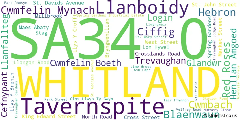
The largest settlement in the SA34 0 postal code is WHITLAND followed by LLANBOIDY, and HEBRON.
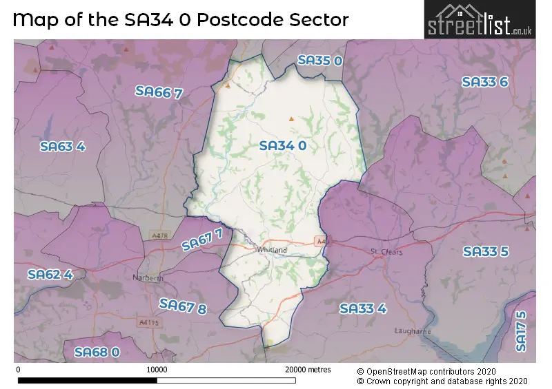
The SA34 0 Postcode shares a border with SA33 6 (CYNWYL ELFED, BRONWYDD, LLANPUMSAINT), SA35 0 (TEGRYN, LLANFYRNACH, CILRHEDYN), SA36 0 (HERMON, GLOGUE), SA41 3 (CRYMYCH, EGLWYSWRW, FELINDRE FARCHOG), SA67 7 (NARBERTH, LLANDDEWI VELFREY, COXHILL), SA67 8 (TEMPLETON, STEPASIDE, NARBERTH), SA33 4 (ST CLEARS, Laugharne, PENDINE), SA33 5 (LLANGAIN, LLANSTEFFAN, MEIDRIM) and SA66 7 (CLUNDERWEN, LLANDISSILIO, MAENCLOCHOG).
The sector is within the post town of WHITLAND.
SA34 0 is a postcode sector within the SA34 postcode district which is within the SA Swansea postcode area.
The Royal Mail delivery office for the SA34 0 postal sector is the Whitland Delivery Office.
The area of the SA34 0 postcode sector is 63.42 square miles which is 164.26 square kilometres or 40,588.28 square acres.

Map of the SA34 0 Postcode Sector
Explore the SA34 0 postcode sector by using our free interactive map.
| S | A | 3 | 4 | - | 0 | X | X |
| S | A | 3 | 4 | Space | 0 | Letter | Letter |
Official List of Streets
Tavernspite (5 Streets)
WHITLAND (27 Streets)
Red Roses (2 Streets)
Unofficial Streets or Alternative Spellings
Weather Forecast for SA34 0
Press Button to Show Forecast for Whitland
| Time Period | Icon | Description | Temperature | Rain Probability | Wind |
|---|---|---|---|---|---|
| 12:00 to 15:00 | Cloudy | 11.0°C (feels like 9.0°C) | 9.00% | NNW 11 mph | |
| 15:00 to 18:00 | Sunny day | 13.0°C (feels like 11.0°C) | 1.00% | N 13 mph | |
| 18:00 to 21:00 | Sunny day | 10.0°C (feels like 8.0°C) | 0.00% | N 11 mph | |
| 21:00 to 00:00 | Clear night | 7.0°C (feels like 4.0°C) | 0.00% | NNW 9 mph |
Press Button to Show Forecast for Whitland
| Time Period | Icon | Description | Temperature | Rain Probability | Wind |
|---|---|---|---|---|---|
| 00:00 to 03:00 | Clear night | 5.0°C (feels like 3.0°C) | 0.00% | NNW 4 mph | |
| 03:00 to 06:00 | Clear night | 4.0°C (feels like 3.0°C) | 0.00% | NW 4 mph | |
| 06:00 to 09:00 | Sunny day | 6.0°C (feels like 4.0°C) | 1.00% | NW 4 mph | |
| 09:00 to 12:00 | Partly cloudy (day) | 11.0°C (feels like 9.0°C) | 1.00% | NNW 9 mph | |
| 12:00 to 15:00 | Partly cloudy (day) | 12.0°C (feels like 10.0°C) | 1.00% | NNW 9 mph | |
| 15:00 to 18:00 | Sunny day | 13.0°C (feels like 10.0°C) | 0.00% | NNW 11 mph | |
| 18:00 to 21:00 | Sunny day | 10.0°C (feels like 8.0°C) | 0.00% | N 9 mph | |
| 21:00 to 00:00 | Clear night | 4.0°C (feels like 2.0°C) | 0.00% | NW 4 mph |
Press Button to Show Forecast for Whitland
| Time Period | Icon | Description | Temperature | Rain Probability | Wind |
|---|---|---|---|---|---|
| 00:00 to 03:00 | Clear night | 3.0°C (feels like 2.0°C) | 2.00% | WNW 4 mph | |
| 03:00 to 06:00 | Cloudy | 3.0°C (feels like 1.0°C) | 3.00% | WNW 4 mph | |
| 06:00 to 09:00 | Cloudy | 6.0°C (feels like 5.0°C) | 4.00% | NW 4 mph | |
| 09:00 to 12:00 | Partly cloudy (day) | 10.0°C (feels like 8.0°C) | 2.00% | WNW 9 mph | |
| 12:00 to 15:00 | Partly cloudy (day) | 11.0°C (feels like 9.0°C) | 2.00% | NW 11 mph | |
| 15:00 to 18:00 | Partly cloudy (day) | 11.0°C (feels like 9.0°C) | 5.00% | NW 11 mph | |
| 18:00 to 21:00 | Partly cloudy (day) | 10.0°C (feels like 8.0°C) | 3.00% | NW 9 mph | |
| 21:00 to 00:00 | Cloudy | 7.0°C (feels like 5.0°C) | 9.00% | WNW 4 mph |
Press Button to Show Forecast for Whitland
| Time Period | Icon | Description | Temperature | Rain Probability | Wind |
|---|---|---|---|---|---|
| 00:00 to 03:00 | Cloudy | 6.0°C (feels like 5.0°C) | 11.00% | NNW 4 mph | |
| 03:00 to 06:00 | Cloudy | 6.0°C (feels like 4.0°C) | 13.00% | NNE 4 mph | |
| 06:00 to 09:00 | Cloudy | 7.0°C (feels like 5.0°C) | 15.00% | ENE 7 mph | |
| 09:00 to 12:00 | Cloudy | 9.0°C (feels like 7.0°C) | 16.00% | S 9 mph | |
| 12:00 to 15:00 | Light rain shower (day) | 10.0°C (feels like 8.0°C) | 36.00% | SSE 9 mph | |
| 15:00 to 18:00 | Cloudy | 10.0°C (feels like 9.0°C) | 21.00% | WSW 9 mph | |
| 18:00 to 21:00 | Cloudy | 10.0°C (feels like 8.0°C) | 15.00% | NNE 7 mph | |
| 21:00 to 00:00 | Cloudy | 7.0°C (feels like 6.0°C) | 9.00% | ENE 7 mph |
Press Button to Show Forecast for Whitland
| Time Period | Icon | Description | Temperature | Rain Probability | Wind |
|---|---|---|---|---|---|
| 00:00 to 03:00 | Cloudy | 7.0°C (feels like 5.0°C) | 10.00% | ENE 9 mph | |
| 03:00 to 06:00 | Cloudy | 7.0°C (feels like 4.0°C) | 12.00% | ENE 9 mph | |
| 06:00 to 09:00 | Cloudy | 7.0°C (feels like 5.0°C) | 13.00% | ENE 9 mph | |
| 09:00 to 12:00 | Cloudy | 10.0°C (feels like 7.0°C) | 11.00% | ENE 11 mph | |
| 12:00 to 15:00 | Overcast | 11.0°C (feels like 9.0°C) | 19.00% | ENE 11 mph | |
| 15:00 to 18:00 | Cloudy | 12.0°C (feels like 9.0°C) | 19.00% | ENE 11 mph | |
| 18:00 to 21:00 | Cloudy | 10.0°C (feels like 8.0°C) | 17.00% | N 11 mph | |
| 21:00 to 00:00 | Light rain | 8.0°C (feels like 6.0°C) | 45.00% | NNW 9 mph |
House Prices in the SA34 0 Postcode Sector
| Type of Property | 2018 Average | 2018 Sales | 2017 Average | 2017 Sales | 2016 Average | 2016 Sales | 2015 Average | 2015 Sales |
|---|---|---|---|---|---|---|---|---|
| Detached | £233,904 | 38 | £221,032 | 47 | £212,600 | 40 | £211,434 | 35 |
| Semi-Detached | £131,962 | 13 | £139,571 | 21 | £121,500 | 13 | £135,150 | 10 |
| Terraced | £124,333 | 15 | £115,660 | 15 | £111,346 | 13 | £111,625 | 12 |
| Flats | £0 | 0 | £75,000 | 1 | £0 | 0 | £0 | 0 |
Important Postcodes SA34 0 in the Postcode Sector
SA34 0BD is the postcode for LANGUAGE BUILDING, Ysgol Dyffryn Taf, North Road, MAIN SCHOOL BUILDING, Ysgol Dyffryn Taf, North Road, Dyffryn Taf Sports Hall, North Road, SPORTS HALL, Ysgol Dyffryn Taf, North Road, Ysgol Dyffryn Taf, North Road, and MATHS BUILDING, Ysgol Dyffryn Taf, North Road
SA34 0EL is the postcode for Ysgol Bro Brynach, C3201 From Llanboidy To Llangynin, Llanboidy
SA34 0NL is the postcode for Tavernspite Community Primary School, Tavernspite, and Tavernspite Cp School, Tavernspite
SA34 0QB is the postcode for BLOCK 1, Whitland County Primary School, Market Street
| The SA34 0 Sector is within these Local Authorities |
|
|---|---|
| The SA34 0 Sector is within these Counties |
|
| The SA34 0 Sector is within these Water Company Areas |
|