The SG9 postcode district is a postal district located in the SG Stevenage postcode area with a population of 12,524 residents according to the 2021 England and Wales Census.
The area of the SG9 postcode district is 47.08 square miles which is 121.93 square kilometres or 30,128.92 acres.
Currently, the SG9 district has about 502 postcode units spread across 2 geographic postcode sectors.
Given that each sector allows for 400 unique postcode combinations, the district has a capacity of 800 postcodes. With 502 postcodes already in use, this leaves 298 units available.
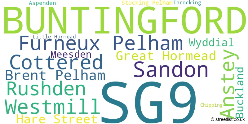
The largest settlement in the SG9 postal code is BUNTINGFORD followed by Sandon, and Cottered.
The SG9 Postcode shares a border with CB11 (SAFFRON WALDEN, Newport, Clavering), CM23 (BISHOP'S STORTFORD, Birchanger, Manuden), SG7 (BALDOCK, Ashwell, Hinxworth), SG8 (ROYSTON, Melbourn, Bassingbourn) and SG11 (Puckeridge, Standon, Little Hadham).
In the SG9 postcode district, the primary settlement is Buntingford, located in the county of Hertfordshire in England. Other significant settlements in this district include Anstey, Brent Pelham, Buckland, Chipping, Furneux Pelham, Great Hormead, Hare Street, Little Hormead, Meesden, Rushden, Sandon, Stocking Pelham, and Wyddial. The most significant post town in this district is Buntingford.
For the district SG9, we have data on 2 postcode sectors. Here's a breakdown: The sector SG9 0, covers Sandon and Anstey and Furneux Pelham and Rushden and Brent Pelham in Hertfordshire. The sector SG9 9, covers Buntingford in Hertfordshire.

Map of the SG9 Postcode District
Explore the SG9 postcode district by using our free interactive map.

When it comes to local government, postal geography often disregards political borders. However, for a breakdown in the SG9 District: the district mostly encompasses the East Hertfordshire District (455 postcodes), and finally, the North Hertfordshire District area (59 postcodes).
Recent House Sales in SG9
| Date | Price | Address |
|---|---|---|
| 23/10/2023 | £440,000 | Hummerston Close, Buntingford, SG9 9SX |
| 12/10/2023 | £875,000 | Southern Green, Rushden, Buntingford, SG9 0SY |
| 08/09/2023 | £407,500 | Mill Close, Buntingford, SG9 9SZ |
| 24/08/2023 | £595,000 | Daws End Cottages, Anstey, Buntingford, SG9 0DA |
| 24/08/2023 | £515,000 | Fairfield, Buntingford, SG9 9NU |
| 24/08/2023 | £480,000 | Hamels Park, Buntingford, SG9 9NA |
| 18/08/2023 | £750,000 | Bowling Green Lane, Buntingford, SG9 9TA |
| 18/08/2023 | £360,000 | Monks Walk, Buntingford, SG9 9DZ |
| 31/07/2023 | £705,000 | The Causeway, Brent Pelham, Buntingford, SG9 0HW |
| 31/07/2023 | £580,000 | Freman Drive, Buntingford, SG9 9TD |
Weather Forecast for SG9
Press Button to Show Forecast for Buntingford
| Time Period | Icon | Description | Temperature | Rain Probability | Wind |
|---|---|---|---|---|---|
| 21:00 to 00:00 | Cloudy | 5.0°C (feels like 3.0°C) | 7.00% | NNW 7 mph |
Press Button to Show Forecast for Buntingford
| Time Period | Icon | Description | Temperature | Rain Probability | Wind |
|---|---|---|---|---|---|
| 00:00 to 03:00 | Partly cloudy (night) | 4.0°C (feels like 0.0°C) | 1.00% | NW 9 mph | |
| 03:00 to 06:00 | Partly cloudy (night) | 3.0°C (feels like -1.0°C) | 1.00% | NNW 9 mph | |
| 06:00 to 09:00 | Partly cloudy (day) | 4.0°C (feels like 0.0°C) | 1.00% | NW 9 mph | |
| 09:00 to 12:00 | Cloudy | 7.0°C (feels like 4.0°C) | 4.00% | NNW 13 mph | |
| 12:00 to 15:00 | Cloudy | 9.0°C (feels like 5.0°C) | 6.00% | NNW 13 mph | |
| 15:00 to 18:00 | Cloudy | 9.0°C (feels like 6.0°C) | 6.00% | N 11 mph | |
| 18:00 to 21:00 | Cloudy | 8.0°C (feels like 6.0°C) | 3.00% | N 7 mph | |
| 21:00 to 00:00 | Partly cloudy (night) | 3.0°C (feels like 2.0°C) | 1.00% | NE 4 mph |
Press Button to Show Forecast for Buntingford
| Time Period | Icon | Description | Temperature | Rain Probability | Wind |
|---|---|---|---|---|---|
| 00:00 to 03:00 | Cloudy | 3.0°C (feels like 1.0°C) | 5.00% | SW 4 mph | |
| 03:00 to 06:00 | Cloudy | 3.0°C (feels like 1.0°C) | 4.00% | WSW 7 mph | |
| 06:00 to 09:00 | Cloudy | 4.0°C (feels like 2.0°C) | 5.00% | WSW 7 mph | |
| 09:00 to 12:00 | Cloudy | 8.0°C (feels like 5.0°C) | 7.00% | WNW 11 mph | |
| 12:00 to 15:00 | Overcast | 10.0°C (feels like 7.0°C) | 14.00% | WNW 11 mph | |
| 15:00 to 18:00 | Light rain shower (day) | 10.0°C (feels like 8.0°C) | 32.00% | NW 9 mph | |
| 18:00 to 21:00 | Cloudy | 8.0°C (feels like 7.0°C) | 11.00% | N 7 mph | |
| 21:00 to 00:00 | Partly cloudy (night) | 5.0°C (feels like 3.0°C) | 1.00% | NNE 4 mph |
Press Button to Show Forecast for Buntingford
| Time Period | Icon | Description | Temperature | Rain Probability | Wind |
|---|---|---|---|---|---|
| 00:00 to 03:00 | Cloudy | 3.0°C (feels like 1.0°C) | 5.00% | ENE 4 mph | |
| 03:00 to 06:00 | Cloudy | 3.0°C (feels like 1.0°C) | 6.00% | NE 4 mph | |
| 06:00 to 09:00 | Cloudy | 4.0°C (feels like 2.0°C) | 8.00% | ENE 4 mph | |
| 09:00 to 12:00 | Cloudy | 8.0°C (feels like 6.0°C) | 10.00% | E 7 mph | |
| 12:00 to 15:00 | Overcast | 10.0°C (feels like 8.0°C) | 15.00% | ESE 7 mph | |
| 15:00 to 18:00 | Overcast | 10.0°C (feels like 8.0°C) | 16.00% | SE 9 mph | |
| 18:00 to 21:00 | Cloudy | 9.0°C (feels like 7.0°C) | 15.00% | SE 9 mph | |
| 21:00 to 00:00 | Cloudy | 7.0°C (feels like 4.0°C) | 12.00% | ESE 9 mph |
Press Button to Show Forecast for Buntingford
| Time Period | Icon | Description | Temperature | Rain Probability | Wind |
|---|---|---|---|---|---|
| 00:00 to 03:00 | Cloudy | 6.0°C (feels like 4.0°C) | 15.00% | ESE 7 mph | |
| 03:00 to 06:00 | Cloudy | 6.0°C (feels like 4.0°C) | 17.00% | E 7 mph | |
| 06:00 to 09:00 | Cloudy | 7.0°C (feels like 4.0°C) | 19.00% | E 7 mph | |
| 09:00 to 12:00 | Overcast | 10.0°C (feels like 7.0°C) | 18.00% | ESE 9 mph | |
| 12:00 to 15:00 | Cloudy | 11.0°C (feels like 9.0°C) | 21.00% | SE 9 mph | |
| 15:00 to 18:00 | Light rain shower (day) | 12.0°C (feels like 10.0°C) | 35.00% | ESE 11 mph | |
| 18:00 to 21:00 | Cloudy | 11.0°C (feels like 9.0°C) | 14.00% | ESE 9 mph | |
| 21:00 to 00:00 | Cloudy | 9.0°C (feels like 7.0°C) | 14.00% | ESE 9 mph |
Where is the SG9 Postcode District?
The data shows that the postcode district SG9 is located in the town of Buntingford. Buntingford is situated in close proximity to several nearby towns. To the north of Buntingford is Royston, which is approximately 6.22 miles away. Baldock is located to the northwest, about 7.32 miles away. Much Hadham is to the southeast, around 8.11 miles away. Stevenage is situated to the southwest, approximately 8.56 miles away. Ware is located to the south, about 9.10 miles away. Lastly, Stansted and Letchworth Garden City are to the east and west respectively, both at a distance of around 9.53 miles. Additionally, Buntingford is approximately 31.43 miles away from the center of London.
The district is within the post town of BUNTINGFORD.
The sector has postcodes within the nation of England.
The SG9 Postcode District is in the Hertfordshire region of Bedfordshire and Hertfordshire within the East of England.
| Postcode Sector | Delivery Office |
|---|---|
| SG9 0 | Ware Delivery Office |
| SG9 0 | Buntingford Scale Payment Delivery Office |
| SG9 9 | Ware Delivery Office |
| SG9 9 | Buntingford Scale Payment Delivery Office |
| S | G | 9 | - | X | X | X |
| S | G | 9 | Space | Numeric | Letter | Letter |
Current Monthly Rental Prices
| # Bedrooms | Min Price | Max Price | Avg Price |
|---|---|---|---|
| 1 | £750 | £1,650 | £1,350 |
| 2 | £1,095 | £2,625 | £2,105 |
| 4 | £2,100 | £2,100 | £2,100 |
| 5 | £3,500 | £3,500 | £3,500 |
Current House Prices
| # Bedrooms | Min Price | Max Price | Avg Price |
|---|---|---|---|
| £135,000 | £1,995,000 | £836,000 | |
| 1 | £95,000 | £395,000 | £241,833 |
| 2 | £182,250 | £1,120,000 | £431,793 |
| 3 | £359,950 | £765,000 | £512,167 |
| 4 | £395,000 | £1,395,000 | £731,342 |
| 5 | £700,000 | £1,995,000 | £1,222,708 |
| 6 | £1,625,000 | £2,350,000 | £2,065,000 |
| 7 | £1,250,000 | £3,350,000 | £2,300,000 |
Estate Agents who Operate in the SG9 District
| Logo | Name | Brand Name | Address | Contact Number | Total Properties |
|---|---|---|---|---|---|
 | Buntingford | Hunters | 34 High Street, Buntingford, SG9 9AQ | 01763 290698 | 31 |
 | Buntingford | Jonathan Hunt Estate Agency | 8 High Street, Buntingford, SG9 9AG | 01760 308690 | 24 |
 | Buntingford | Chris Dellar Properties | 58A High Street, Buntingford, SG9 9AH | 01763 290692 | 17 |
 | Buntingford | Keith Ian | 42 High Street Buntingford Hertfordshire, SG9 9AH | 01763 295178 | 15 |
 | Bishops Stortford | Savills | Chequers, 19 North Street, Bishop's Stortford, CM23 2LD | 01279 967996 | 10 |
- Anstey
- Aspenden
- Barkway
- Barleycroft End
- Braughing
- Brent Pelham
- Buckland
- Buntingford
- Chipping
- Cottered
- Dassels
- Furneux Pelham
- Great Hormead
- Green End
- Hare Street
- Hare Street
- Little Hormead
- Meesden
- Moor Green
- Nasty
- Nuthampstead
- Puckeridge
- Redhill
- Roe Green
- Rushden
- Sandon
- Snow End
- Southern Green
- Starling's Green
- Stocking Pelham
- The Willows
- Throcking
- Wallington
- Ware
- Westmill
- Wyddial
| Type of Property | 2018 Average | 2018 Sales | 2017 Average | 2017 Sales | 2016 Average | 2016 Sales | 2015 Average | 2015 Sales |
|---|---|---|---|---|---|---|---|---|
| Detached | £624,322 | 124 | £561,160 | 114 | £602,043 | 115 | £512,949 | 89 |
| Semi-Detached | £392,727 | 84 | £385,032 | 105 | £388,407 | 76 | £371,613 | 44 |
| Terraced | £343,707 | 61 | £332,315 | 71 | £316,907 | 57 | £305,018 | 55 |
| Flats | £299,113 | 20 | £220,091 | 22 | £194,615 | 13 | £166,219 | 16 |